Mount Velyka Sivulya


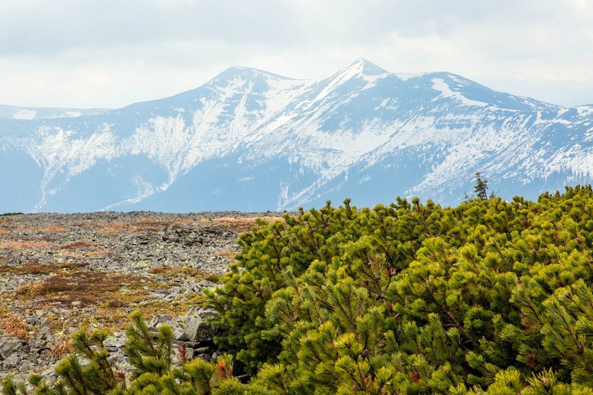
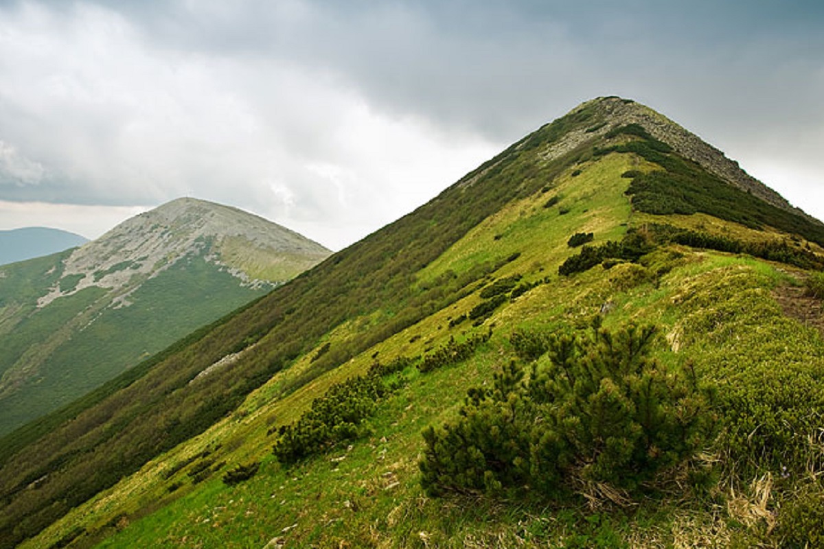
Velyka Sivulya (1836 m) is the highest peak of the Gorgany, on the ridge between the valleys of the Limnytsia and the Bystrytsia Solotvynska; its top is covered with huge boulder fields. The climb from Stara Huta via the Vodospadnyi pass is 20 km with 1170 m of ascent; waymarked paths also lead here from Osmoloda and Bystrytsia.
Nature
Like Grofa, Ihrovets and Vysoka, Sivulya is covered with fields of greenish-yellow stones overgrown with moss and lichen. Lower down grow dense spruce and beech-spruce forests, in places with traces of snow avalanches — fallen trees.
Where to start
There are three main approaches to Velyka Sivulya: from Osmoloda, Bystrytsia and Huta (Stara Huta). The paths are waymarked, with information boards at junctions showing distances to neighbouring peaks and villages. An example route is Stara Huta – Vodospadnyi pass – Velyka Sivulya – Rushchyna meadow.
The routes here are long and the boulder fields slow you down, so plan the start, finish and overnight stop in advance.
The summit at a glance
- Elevation: 1836 m above sea level
- Range: Gorgany
- Nearest settlement: Osmoloda
- Routes over the summit on Karpaty.rocks: 25
- Best time: June–September; in winter only with experience and gear (avalanche danger is possible)
Routes to the summit
The routes over the summit most viewed by Karpaty.rocks readers. Length and ascent come from our track and a digital elevation model, time from Naismith's rule (without stops).
- Stara Huta village, via Mount Borevka, Mount Lopushna, Mount Syvulia and Rushchyna polonyna to Stara Huta village — 27.4 km, ascent 1,257 m, ≈9 h of walking, loop
- Osmoloda, via Mount Vysoka, Mount Ihrovets and Mount Syvulia to Stara Huta village — 33.4 km, ascent 1,987 m, ≈11.5 h of walking
- Stara Huta village, via the Vodospadnyi Pass and Mount Velyka Syvulia to Rushchyna polonyna — 20 km, ascent 1,170 m, ≈7 h of walking
- Stara Huta village, via Mount Vysoka, Mount Ihrovets and Mount Syvulia to Bystrytsia village — 39.9 km, ascent 1,918 m, ≈13 h of walking
- Stara Huta village, via Mount Vysoka, Mount Borevka, Mount Syvulia and Rushchyna polonyna to Stara Huta village — 36.8 km, ascent 1,714 m, ≈12 h of walking, loop
- Mount Velyka Syvulia, via Mount Borevka, Mount Ihrovets, Mount Vysoka and Mount Serednia to Osmoloda village — 27.8 km, ascent 1,080 m, ≈8.5 h of walking
All routes over the summit (25)
Weather and safety
The summit is above the tree line: fog, strong wind and thunderstorms are possible even in summer, and the weather can change within hours. Check the forecast before you set off, take water, a rain jacket and a warm layer, and plan to reach the top before midday. Summit weather forecast.
In an emergency call 101 or 112. Carpathian mountain rescue contacts.
FAQ — Velyka Sivulya
Velyka Sivulya: how high is the summit?
It rises to 1836 m above sea level and belongs to the Gorgany range.
Velyka Sivulya: how long does it take to reach the summit?
The shortest of the popular routes is “Stara Huta village, via the Vodospadnyi Pass and Mount Velyka Syvulia to Rushchyna polonyna”: 20 km with 1,170 m of ascent, about 7 h of walking without stops. Allow extra time for rests, photos and the weather.
Velyka Sivulya: when is the best time to go?
June to September, when the paths are free of snow. In winter the ascent is only for experienced hikers with avalanche gear and after checking the forecast.
Velyka Sivulya: where to stay nearby?
The nearest settlement in our data is Osmoloda. Places to stay nearby: hotels, guesthouses and cottages.
Comments
Travellers’ experience: reports, tips, questions.
No one has reported on this trail yet. Been here lately? Tell others what it is like now.
Video
 Україна, Карпати, г. Велика Сивуля (1836 м)Andrij M
Location on the map
Water and shelter nearby
- Spring below Mount Velyka Syvulia620 m · Not verified · 1 498 m
- Spring on Polonyna Rushchyna1.2 km · Not verified · 1 443 m
- Spring on Polonyna Rushchyna (2)1.3 km · Not verified · 1 436 m
- Spring on Polonyna Rushchyna (3)1.4 km · Not verified · 1 440 m
- Spring on Polonyna Rushchyna (4)1.4 km · Not verified · 1 437 m
- Spring on Polonyna Rushchyna (5)1.9 km · Not verified · 1 402 m
- Spring on Polonyna Rushchyna (6)1.9 km · Not verified · 1 400 m
- Source of the Bystrytsia Solotvynska (spring)1.9 km · Not verified · 1 405 m
- Spring on Polonyna Rushchyna (7)1.9 km · Not verified · 1 396 m
- Spring below Mount Lopushna2.5 km · Not verified · 1 471 m
- Spring below Mount Borevka (6)2.6 km · Not verified · 1 418 m
- Hut on Polonyna Negrova2.8 km · Standing · 1 432 m
- Spring below Mount Kinets Horhanu (3)2.9 km · Not verified · 1 371 m
- Drinking water below Mount Borevka2.9 km · Not verified · 1 342 m
- Hut below Mount Nehrova2.9 km · Not verified · 1 404 m
Places to stay nearby
All stays HotelSinihirskaBohorodchany11 km from Mount Velyka SivulyaParkingTransferNearby: Residence Synihora 900 mManyavsky Waterfall 6.8 km19 trailsfrom 5 880 UAH per night
 SadybaMykhailova SadybaKuzmynets16 km from Mount Velyka SivulyaSaunaFireplaceKitchenNearby: Sokil tract 3.0 kmPlast camp - Sokol museum 3.2 km14 trailsfrom 2 800 UAH whole place / night
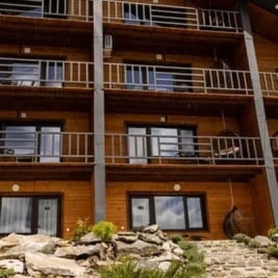 HotelManyava ResortIvano-Frankivsk18 km from Mount Velyka SivulyaHot tubPoolSaunaNearby: Manyavsky Waterfall 2.2 kmManyavskyi Skit 3.4 km5 trailsfrom 4 200 UAH per night
Trails via Mount Velyka Sivulya
All 25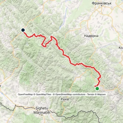 HardMulti-dayMarkedEast Carpathian Tourist TrailElevation profile643–1 836 m278.1 kmascent 8 455 m
 HardOne-dayMarkedStara Huta village loopvia Mount Borevka, Mount Lopushna +2Elevation profile768–1 836 m27.4 kmascent 1 257 m≈ 9 h walking
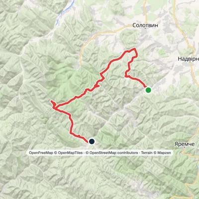 HardMulti-dayPasichna village to Bystrytsia villagevia Maniava village, Maniava Waterfall +1Elevation profile495–1 836 m69.7 kmascent 2 898 m
Nearby attractions
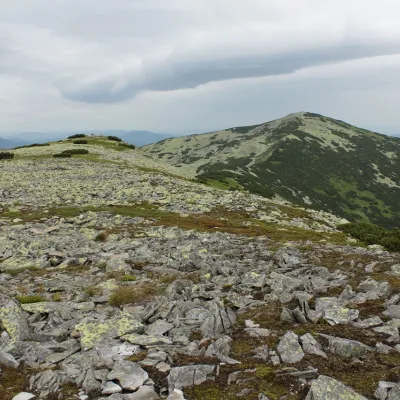 PeakMount Mala SivulyaBystrytsiaaltitude 1 815 m · Gorgany rangeunder 1 km from Mount Velyka Sivulya26 trails to the topMount Mala Syvulya, 1815 meters high, is located next to the Velyka Syvulya on the Syvulyansky ridge. It is the second highest mountain in the Gorgan mountain range.
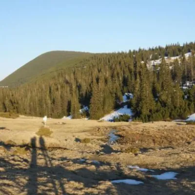 Mountain meadowPolonyna RuschynaOsmolodaaltitude 1 409 m1.9 km from Mount Velyka SivulyaRuschyna meadow is famous for its panoramic views of the mountains that surround it from all sides and the diversity of flora and fauna.
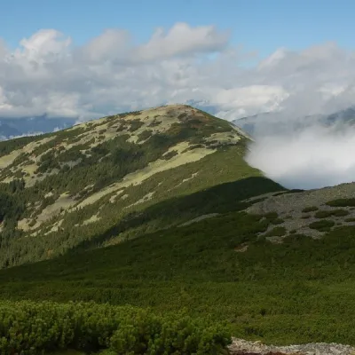 PeakMount LopushnaOsmolodaaltitude 1 694 m · Gorgany range1.9 km from Mount Velyka Sivulya24 trails to the topMount Lopushna is a 1,694-meter peak in the Ukrainian Carpathians. It is located within the Gorgany mountain range on the border of two districts of Ivano-Frankivsk...
Craft nearby
All craft places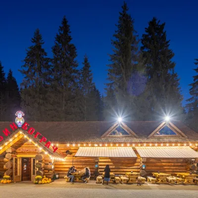 Koliby & Hutsul cuisineBabyn Bograch Tavern, Polianytsia (Bukovel)Polianytsia (Bukovel)29 km from Mount Velyka SivulyaBabyn Bograch tavern ("Grandma's Bograch") is located inside the Hutsul Land ethno park in Polianytsia, at the Bukovel resort, behind the Lake of Youth.
 Water parks & thermal poolsMAVKA water park, BukovelPolianytsia (Bukovel)29 km from Mount Velyka SivulyaMAVKA water park is Bukovel's largest indoor water park and one of the most modern in Ukraine. It opened in early 2025 in the Shchyvky area, near Lake Molodosti and...
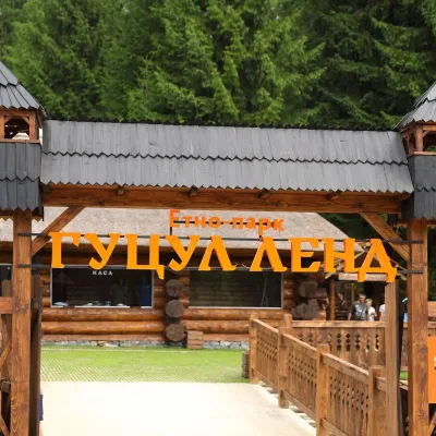 Ethno parks & homesteadsHutsul Land Ethno Park, PolianytsiaPolianytsia (Bukovel)29 km from Mount Velyka SivulyaHutsul Land Ethno Park is a space at the Bukovel resort where the old ways of the Hutsuls, Boikos and Lemkos are shown not behind glass but in living form.
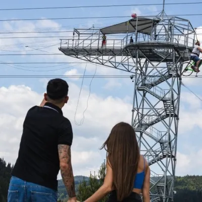 Adventures & attractionsAdrenaline Tower (rope jump), BukovelPolianytsia (Bukovel)29 km from Mount Velyka SivulyaThe Adrenaline Tower is a steel tower on the shore of Lake Molodosti in Bukovel from which people take a free-fall rope jump, and the hub of several high-altitude...
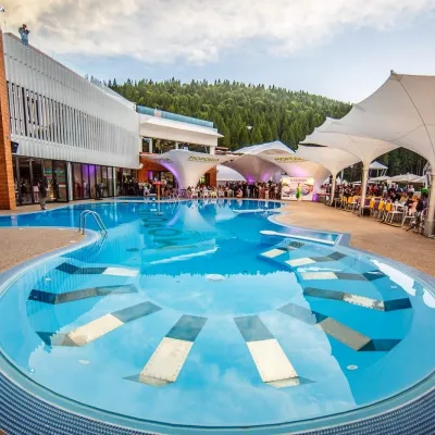 Water parks & thermal poolsVODA club spa and beach club, BukovelPolianytsia (Bukovel)29 km from Mount Velyka SivulyaVODA club is a large all-season pool, spa and beach club complex on the shore of Lake Molodosti in Bukovel (Polianytsia village).
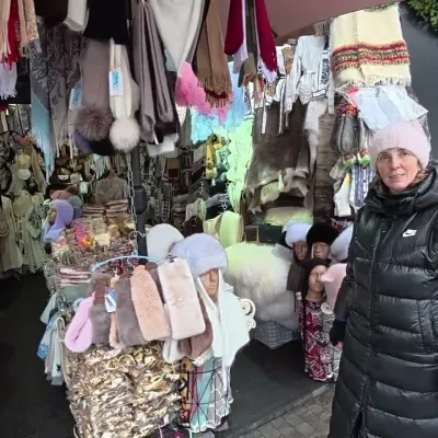 Markets & fairsBukovel Souvenir Market, PolianytsiaPolianytsia (Bukovel)30 km from Mount Velyka SivulyaBukovel's souvenir market is a row of shops and stalls right in the centre of Ukraine's largest ski resort, on the territory of Polianytsia village.
