Pasichna village — to Bystrytsia village, via Maniava village, Maniava Waterfall, Mount Velyka Syvulia
Unmarked trailmore
It may be partly marked. Unmarked trails have no information boards, signposts or auxiliary signs (water, campsite, etc.). The decision to walk the trail is entirely your own responsibility.
Trail map
Where to stay nearby
About the trail
Route Pasichna village, via Maniava village, Maniava Waterfall and Mount Velyka Syvulia to Bystrytsia village. Along the route you will see: Bukhtivetsky waterfall, Bukovo, Maniava Blessed Stone, Museum of the brown bear, Wooden Church of the Intercession in Manyava, Manyavskyi Skit, Manyavsky Waterfall and 5 more.
At a glance
A multi-day route of 69.7 km with 3,340 m of ascent from Pasichna village to Bystrytsia village. Estimated time: 3 days of 5–10 h of walking (about 23 h in total, not counting stops). Difficulty: hard. Waymarking is missing or partial.
Route stages
- 0–25 kmGentle ups and downs at 500–950 m
- 25–30 kmClimb of 630 m (up to 1,255 m)
- 30–42 kmGentle ups and downs at 860–1,260 m
- 42–51 kmClimb of 950 m to Mount Velyka Sivulya (1,836 m)
- 51–70 kmDescent of 1,070 m to Bystrytsia village
Steepest kilometre: km 49–50, a climb of 290 m (≈28%), near Mount Mala Sivulya.
Water and overnight stays
Springs near the trail: at km 4, 6, 14, 15, 20, 23, 25, 29, 31 and 37 etc.. Some springs run low or dry up in late summer.
Huts and shelters near the trail: Forester's hut by the Maniavka river (km 26), Cabin on Polonyna Ripna (km 31), Hut “Kovalskyi” (km 35), Hut (Stara Huta, 2) (km 42), Hut on Polonyna Negrova (km 55), Hut below Mount Nehrova (km 55), Mountain shelter on Polonyna Boiaryn (km 59), Hut (Bystrytsia) (km 63) etc..
A possible split into days:
- Day 1: km 0–26, ≈8 h — overnight: Forester's hut by the Maniavka river (hut)
- Day 2: km 26–42, ≈6 h — overnight: Hut (Stara Huta, 2) (hut)
- Day 3: km 42–70, ≈9 h — finish
When to go
Best time: June to September. In winter only for experienced hikers with proper gear: avalanche danger is possible. About 4 km of the route runs above 1,500 m, where the weather changes quickly — check the forecast.
Getting there
Start: Pasichna village. This is a one-way route: the finish is 18 km from the start in a straight line, so plan your way back in advance.
FAQ
- How long does the route take?
- Estimated time: 3 days of 5–10 h of walking (about 23 h in total, not counting stops).
- Is there water on the route?
- Springs near the trail: at km 4, 6, 14, 15, 20, 23, 25, 29, 31 and 37 etc.. Some springs run low or dry up in late summer.
- Where can I stay overnight?
- Huts and shelters near the trail: Forester's hut by the Maniavka river (km 26), Cabin on Polonyna Ripna (km 31), Hut “Kovalskyi” (km 35), Hut (Stara Huta, 2) (km 42), Hut on Polonyna Negrova (km 55), Hut below Mount Nehrova (km 55), Mountain shelter on Polonyna Boiaryn (km 59), Hut (Bystrytsia) (km 63) etc.. Possible overnight stops: Forester's hut by the Maniavka river (km 26), Hut (Stara Huta, 2) (km 42).
Water and shelter on the route
- Spring (Pasichna, 2)km 3.5 from the start · Not verified · 576 m
- Spring (Bukove, 4)km 5.6 from the start · Not verified · 628 m
- Spring (Bukove, 2)km 6 from the start · Not verified · 662 m
- Spring (Maniava, 4)km 13 from the start · Not verified · 723 m
- Spring (Maniava, 5)km 14.5 from the start · 250 m off the path · Not verified · 599 m
- Spring (Maniava, 3)km 18.8 from the start · Not verified · 549 m
- Spring (Maniava, 2)km 21.3 from the start · Not verified · 648 m
- Stream water (Bukove)km 23.8 from the start · Not verified · 675 m
- Forester's hut by the Maniavka riverkm 24.6 from the start · Standing · 735 m
- Spring (Stara Huta, 11)km 27.3 from the start · 50 m off the path · Not verified · 1 211 m
- Cabin on Polonyna Ripnakm 29.2 from the start · Not verified · 1 157 m
- Spring (Stara Huta, 10)km 29.5 from the start · 220 m off the path · Not verified · 1 143 m
- Hut “Kovalskyi”km 33.4 from the start · Not verified · 992 m
- Spring (Stara Huta, 6)km 35.2 from the start · Not verified · 1 220 m
- Hut (Stara Huta, 2)km 39.8 from the start · Not verified · 869 m
- Spring below Mount Boiaryn (2)km 42 from the start · Not verified · 996 m
- Stream water below Mount Nehrovakm 42.5 from the start · Not verified · 1 037 m
- Spring on Polonyna Rushchyna (7)km 45.5 from the start · Not verified · 1 396 m
- Spring on Polonyna Rushchyna (4)km 46.2 from the start · 70 m off the path · Not verified · 1 437 m
- Source of the Bystrytsia Solotvynska (spring)km 50.5 from the start · 90 m off the path · Not verified · 1 405 m
- Hut on Polonyna Negrovakm 51.8 from the start · Standing · 1 432 m
- Hut below Mount Nehrovakm 51.9 from the start · Not verified · 1 404 m
- Spring below Mount Nehrovakm 52.1 from the start · Weak flow · 1 428 m
- Spring below Mount Boiarynkm 53.7 from the start · Not verified · 1 368 m
- Mountain shelter on Polonyna Boiarynkm 55.7 from the start · 130 m off the path · Not verified · 1 201 m
- Stream water (Bystrytsia, 2)km 56.8 from the start · Not verified · 966 m
- Hut (Bystrytsia)km 59.2 from the start · Not verified · 851 m
- Stream water (Bystrytsia)km 59.3 from the start · 70 m off the path · Not verified · 849 m
- Hut (Bystrytsia, 2)km 59.5 from the start · Not verified · 850 m
- Hut (Bystrytsia, 3)km 59.6 from the start · Not verified · 842 m
- Stream water (Bystrytsia, 4)km 60.4 from the start · Not verified · 836 m
- Spring (Bystrytsia, 13)km 61.7 from the start · Not verified · 854 m
- Stream water (Bystrytsia, 5)km 63.8 from the start · Not verified · 767 m
Comments
What to see on the trail
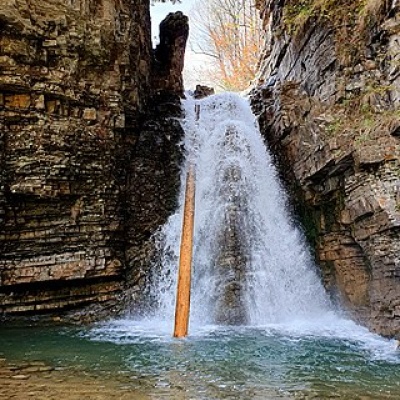 Bukhtivetsky waterfall, Bukovoaltitude 544 mBukhtivetskyi waterfall (Vodopad Bukhtivets ) is a waterfall in the Ukrainian Carpathians, in the Gorgany massif; a hydrological natural monument...
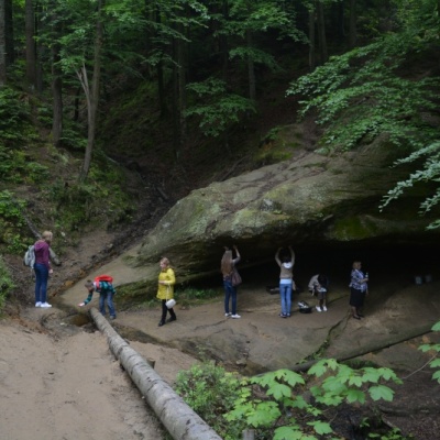 Maniava Blessed Stonealtitude 558 mThe blessed stone is a huge boulder from under which healing water flows. It is the same water that saved the monks from thirst.
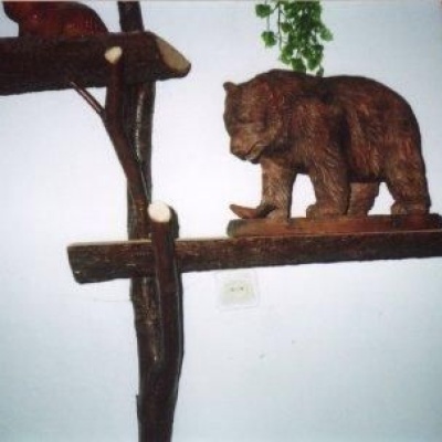 Museum of the brown bearaltitude 558 mThe initiator of this unusual museum in the village of Manyava was an ecologist Mykola Skidaniuk, who is concerned about the threat of the brown...
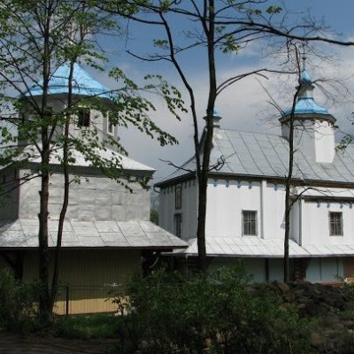 Wooden Church of the Intercession in Manyavaaltitude 558 mMany of us who hear the name "Manyava" immediately associate this village with the famous Manyava Skete and the equally famous Manyava Waterfall.
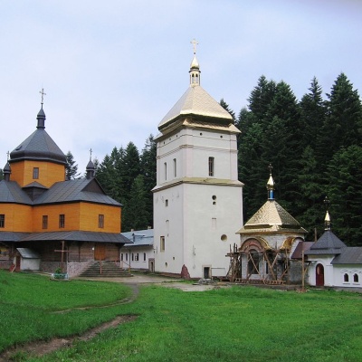 Manyavskyi Skitaltitude 558 mThe oldest Orthodox monastery in the Carpathians, Manyavskyi Skit, is located just behind the village and has earned the nickname of the Ukrainian...
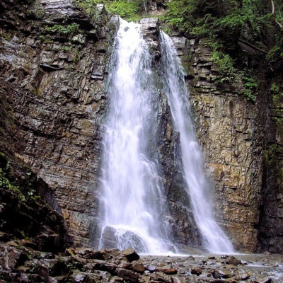 Manyavsky Waterfallaltitude 558 mManyavsky Waterfall is a true wonder that deserves the attention of every traveler, one of the highest in the Carpathians and even in Ukraine (the...
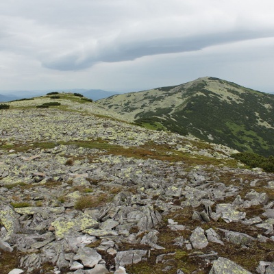 Mount Mala Sivulyaaltitude 1 815 mMount Mala Syvulya, 1815 meters high, is located next to the Velyka Syvulya on the Syvulyansky ridge.
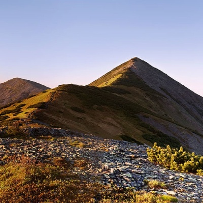 Mount Velyka Sivulyaaltitude 1 836 mMount Velyka Syvulia (or simply - Syvulia) is the highest peak of the Horhan massif. Syvulya is located on the ridge of the same name, which...
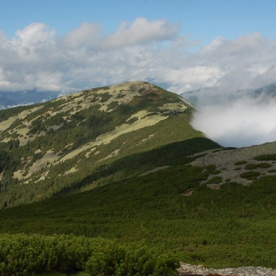 Mount Lopushnaaltitude 1 694 mMount Lopushna is a 1,694-meter peak in the Ukrainian Carpathians. It is located within the Gorgany mountain range on the border of two districts...
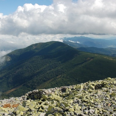 Mount Negrovaaltitude 1 604 mNegrova is a peak in the central part of the Gorgan mountain range(Ukrainian Carpathians). ...
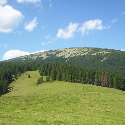 Mount Boyarin (Korotkan)altitude 1 675 mBoyarin (there is another name - Korotkan) is a massive oval-shaped mountain in the central part of the Gorgan mountain range of the Ukrainian...
Trails nearby
All trails HardMulti-dayMarkedEast Carpathian Tourist TrailElevation profile635–1 819 m278.1 kmascent 14 105 m
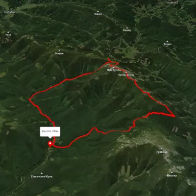 HardMulti-dayUnmarkedStara Huta village loopvia Mount Borevka, Mount Lopushna +2Elevation profile768–1 798 m27.4 kmascent 1 402 m≈ 9.5 h walking
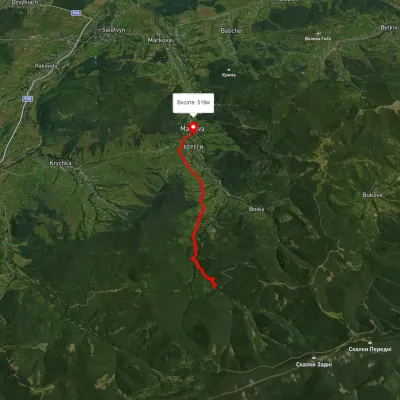 EasyOne-dayMarkedManiava village Maniava WaterfallElevation profile515–740 m7 kmascent 170 m≈ 2 h walking