Mount Hoverla
Remember: Mount Hoverla has a difficult route and you need to prepare for the climb in advance. You need an experienced friend, company, or guide to go hiking on Hoverla, and it's best to make an appointment in advance.
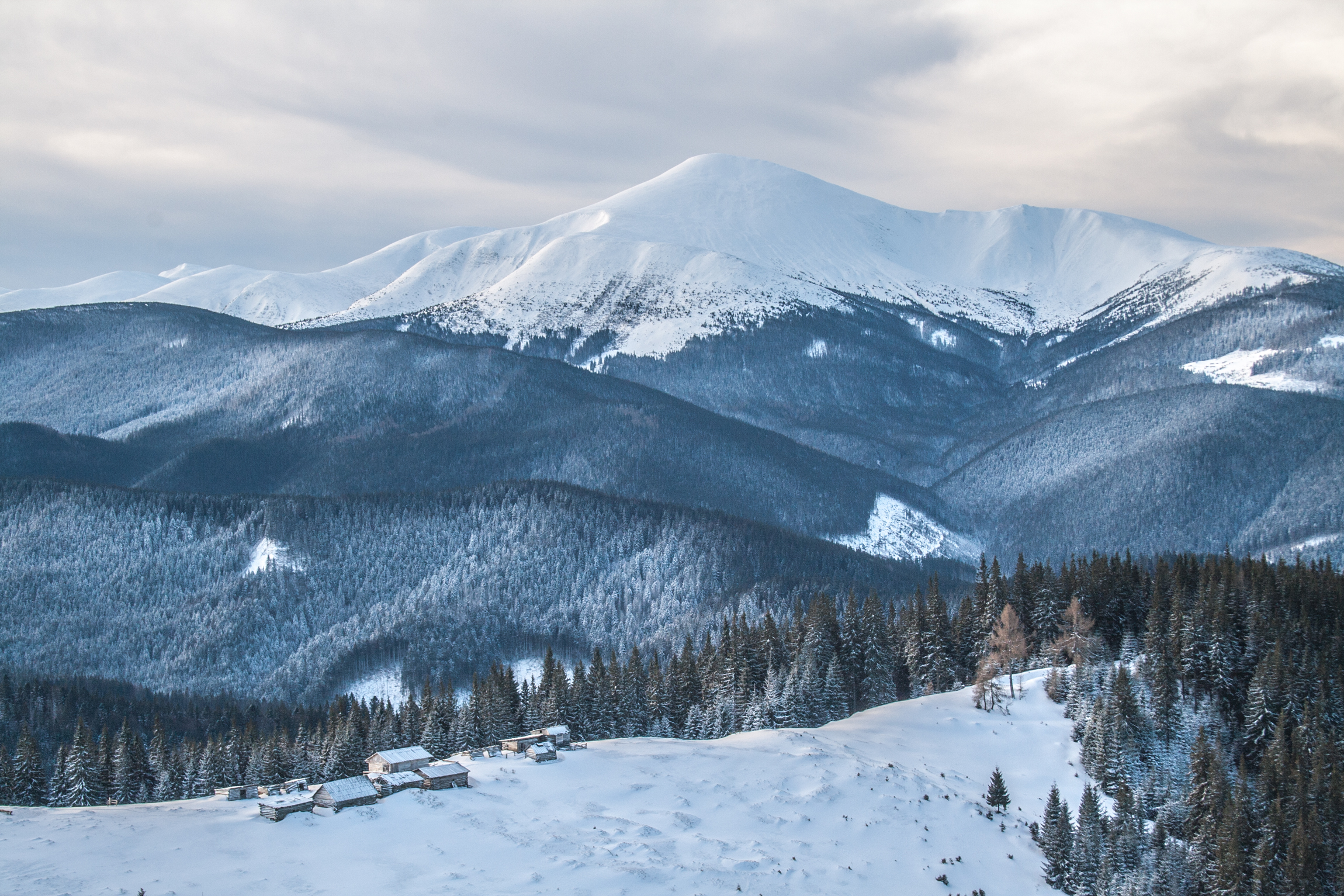
This is the main and largest mountain of our native Carpathians, which is believed to be the highest point in Ukraine (2061 meters). Mount Hoverla is geographically part of the Chornohora massif, located on the border of Ivano-Frankivsk and Zakarpattia regions.
The shape of the mountain is conical, and there are rockfalls and avalanches. It has incredible nature: alpine meadows, shrubs and rocky slopes. On the eastern side of the mountain, the Hoverla source of the Prut River and the Prut Waterfall begin (the total height is almost 80 m). Hoverla is located within the Carpathian Biosphere Reserve and the Carpathian National Nature Park. The slopes are covered with beech and spruce forests, and the meadow begins at an altitude of 1500 m.
It is the most popular natural tourist attraction. Back in 1880, the route to Hoverla was first opened (assigned category 1B for winter mountaineering).
Please note: Bring garbage bags to pick up your own and partially other people's garbage. Share this idea in social networks to keep the summit area of Hoverla clean.
- from Mount Breskul (about 1 hour, downhill also almost 1 hour);
- from the base "Zaroslyak" (first to the village of Vorokhta and the route will take about 3 hours up and 2 hours down);
- from the base "Zaroslyak" (first to the village of Vorokhta, then through the Kozmeska valley and the mountain Mala Hoverla, the route will take about 3 hours up and 2 hours down);
- from the village of Lazeshchyna to the Kozmeschyk tract, then along the route, then to the Kozmeska valley, then through the Mala Hoverla mountain (the route takes about 7 hours up and about 6 hours down);
- from the village of Lazeshchyna to the Kozmeschyk tract, then along the route through the Gropa meadow (the route will take 6.45 hours up and 5.45 hours down);
- from Mount Petros through the Holovcheska meadow, the Skopeska meadow and the Vysokohiria Karpat shelter (the route takes 4 hours up and 4 hours down).

Accommodation around Mount Hoverla:


Nearby hiking trails near Mount Hoverla:
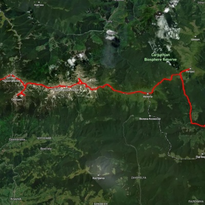
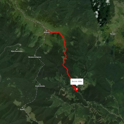
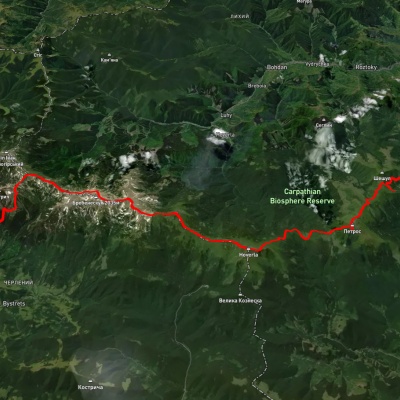
Which trails pass by Mount Hoverla?
We suggest these hiking trails through or near Mount Hoverla: Lazeshchyna village, Mount Petros, Mount Hoverla, Mount Dzembronia, Mount Smotrych and Mount Pip Ivan Chornohirskyi to Shybene village, Kozmeshchyk – Mount Hoverla – Kozmeshchyk, Kvasy village, via Mount Petros, Mount Hoverla, Mount Rebra and Mount Dzembronia to Topolche village, Yasinia, via Mount Petros, Mount Hoverla and Mount Kukul to Vorokhta, Mount Hoverla – Kozmeshchyk, Mount Petros, via Mount Hoverla to Zaroslyak base