Malé Borové
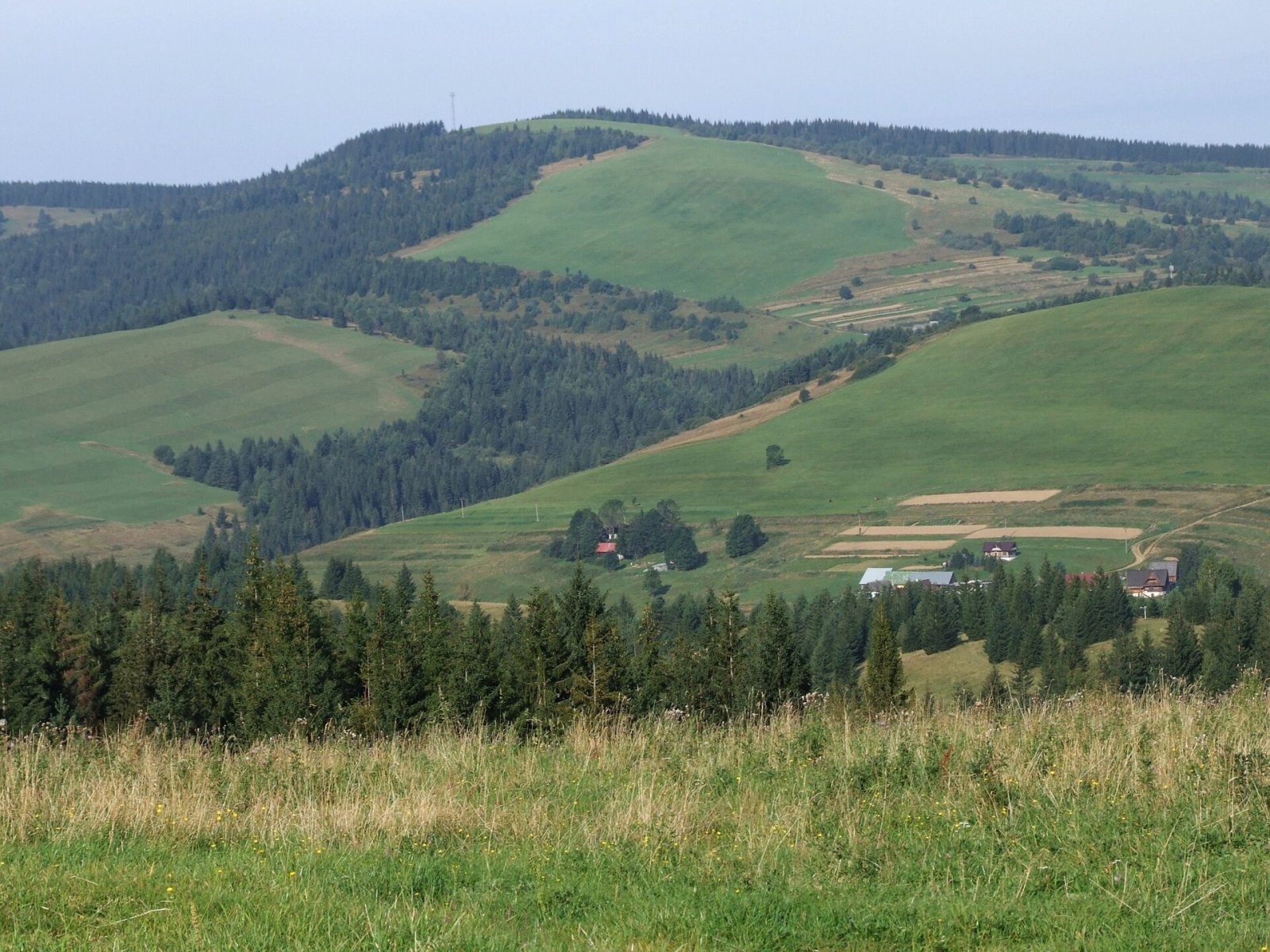
Photos: Polianky
Malé Borové is a village in Slovakia.
Elevation: about 904 m above sea level. Population: 112 (2025).
Here and nearby on the site: 1 peak.
Facts: Wikidata, OpenStreetMap. More on Wikipedia
What's nearby
Trails nearby
All trails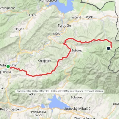 HardMulti-dayMarkedDolný Kubín Junction under UmrláElevation profile476–1 314 m56.6 kmascent 2 149 munder 1 km from the centre
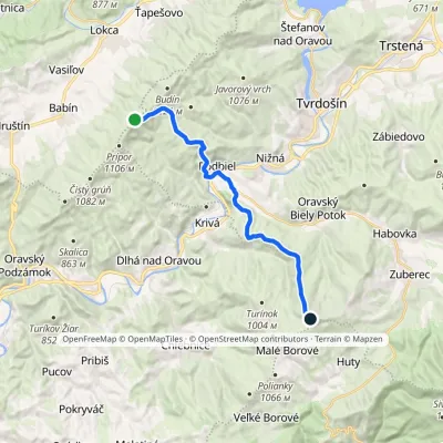 ModerateTwo-dayMarkedKopec ŠubovkaElevation profile549–1 252 m17.3 kmascent 738 m≈ 6 h walking2.1 km from the centre
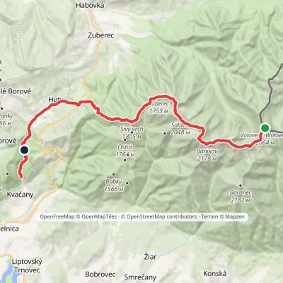 HardMulti-dayMarkedÚstie Kvačianskej doliny Pyšné sedlovia VolovecElevation profile644–2 178 m27.6 kmascent 1 566 m≈ 10 h walking2.2 km from the centre
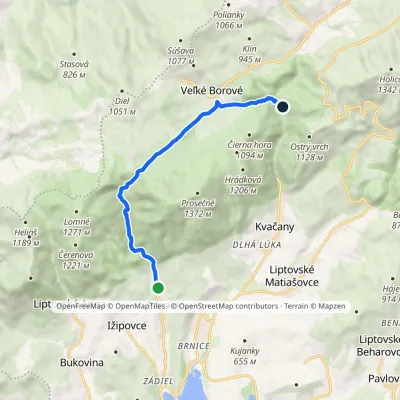 EasyOne-dayMarkedProsiek Oblazy, junctionElevation profile618–942 m8.8 kmascent 391 m≈ 3 h walking3.3 km from the centre
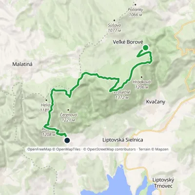 ModerateTwo-dayMarkedLiptovská Anna Dolina Borovianky, junctionElevation profile662–1 372 m17 kmascent 1 132 m≈ 6.5 h walking3.4 km from the centre
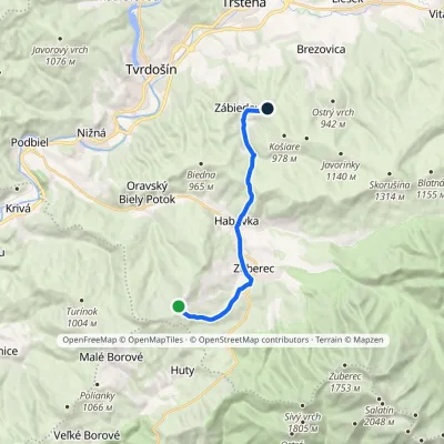 ModerateOne-dayMarkedPrieková ZábiedovoElevation profile679–1 170 m12.8 kmascent 355 m≈ 4 h walking3.6 km from the centre
Peaks nearby
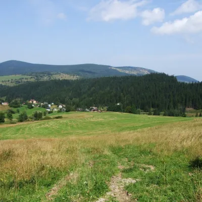
All peaks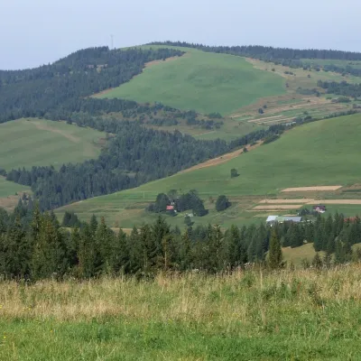 PeakPoliankyMalé Borovéaltitude 1 066 m1.1 km from the centrePolianky is a 1066 m summit in the Skorušinské vrchy in Slovakia (Polish geographers call the range the Orava or Skoruszyna Foothills).
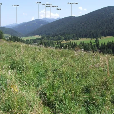
 PeakKopecOravský Biely Potokaltitude 1 251 m2.2 km from the centreKopec (Slovak for “mound”; formerly Polish Kopiec) is a 1,251 m summit, the second highest in the Skorušinské vrchy of northern Slovakia.
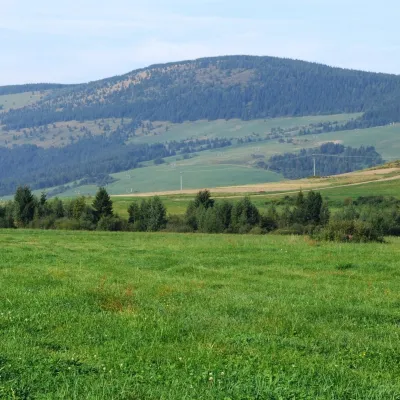
 PeakČierna horaKvačanyaltitude 1 094 m4.3 km from the centreČierna hora ("Black Mountain") is a 1094 m summit in the Choč Mountains (Chočské vrchy) in northern Slovakia.
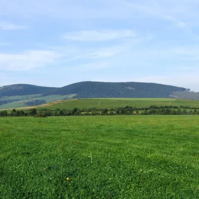
 PeakMachyOravský Biely Potokaltitude 1 202 m4.3 km from the centreMachy is a 1202 m summit in the Skorušina Mountains in Orava, northern Slovakia. It rises above the village of Zuberec, about 8 km south of Tvrdošín, in the central...
 PeakMníchZuberecaltitude 1 110 m5.7 km from the centreMních is a summit 1110 m high in the Skorušina Mountains (Skorušinské vrchy) in Orava, Slovakia, in their Kopec subunit.
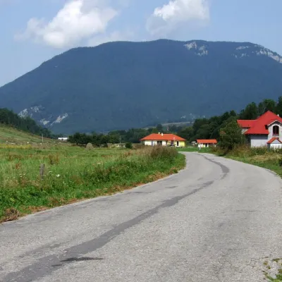 PeakProsečnéVeľké Borovéaltitude 1 372 m5.9 km from the centreProsečné (local forms Prosečnô, Prosečná; Polish Prosieczne) is a prominent 1372 m peak in the Choč Mountains of northern Slovakia.
What to visit
All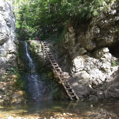 WaterfallRáztocký waterfall and the Oblazy mills (Kvačianska valley)Kvačany3.3 km from the centreThe Ráztocký waterfall (Ráztocký vodopád) is an eight-metre waterfall on the Ráztoka stream in the Chočské vrchy of northern Slovakia, just above the locality of...
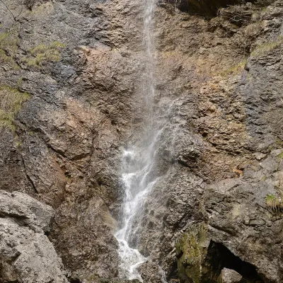 WaterfallČervené piesky waterfall in the Prosiecka valleyProsiek6.4 km from the centreČervené piesky is a 15-metre waterfall in a side valley of the Prosiecka dolina in the Chočské vrchy of northern Slovakia, above the village of Prosiek in the Liptov...
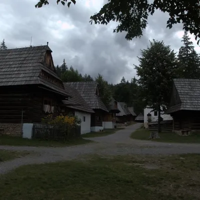 MuseumMuseum of the Orava Village (Zuberec open-air museum)Zuberec10 km from the centreThe Museum of the Orava Village (Múzeum oravskej dediny) is an open-air museum on the Brestová meadow at about 830 m, at the foot of the Western Tatras — the Roháče.
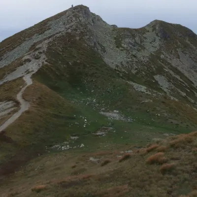 Mountain meadowThe grassy hole of Salatín and Brestová in the Western TatrasZuberecaltitude 2 048 m11 km from the centreSalatín (2,048 m) is a massive grassy mountain on the main ridge of the Western Tatras (Západné Tatry) in Slovakia, above the Bobrovecká and Jalovecká valleys on the...
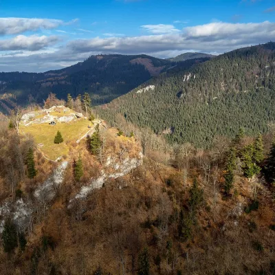 CastleLiptov Castle (ruins)Liptovská Sielnica12 km from the centreLiptov Castle (Liptovský hrad), also known as Liptov Old Castle or Sielnica Castle, is the ruin of a medieval fortress on the summit of Sestrč (999.9 m) in the Choč...
 LakeLiptovská MaraLiptovský Trnovec13 km from the centreLiptovská Mara is a large reservoir on the Váh river in central Liptov, by the town of Liptovský Mikuláš, with views of the Western and Low Tatras.
Craft nearby
All craft places Water parks & thermal poolsAquapark TatralandiaLiptovský Mikuláš14 km from the centreAquapark Tatralandia is a large year-round water leisure complex near Liptovský Mikuláš, on the northern shore of the Liptovská Mara reservoir.
 Water parks & thermal poolsLúčky Spa and AQUA-VITAL ParkLúčky14 km from the centreLúčky Spa (Kúpele Lúčky) lies in a quiet valley beneath the Choč Mountains, in the village of Lúčky near Ružomberok.
 Koliby & Hutsul cuisineSalaš Dechtáre above Liptovská MaraGalovany15 km from the centreSalaš Dechtáre is a wooden koliba above the Liptovská Mara reservoir that is described as one of Slovakia’s first commercial salaš restaurants.
 Water parks & thermal poolsBešeňová Water ParkBešeňová15 km from the centreBešeňová — the "thermal heart of Liptov" Bešeňová Water Park (Vodný park Bešeňová) lies on the edge of the village of the same name in the western part of the Liptov...
 Craft beer & breweriesLiptovar brewery, Liptovský Mikuláš: craft beer and brewpubLiptovský Mikuláš17 km from the centreLiptovský Mikuláš is the main town of the Liptov region, a short drive from the Low and Western Tatras, the Demänovská Valley and the Liptovská Mara reservoir.
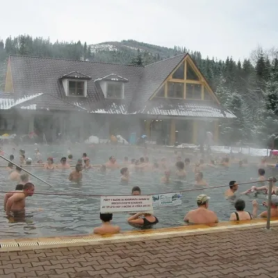 Water parks & thermal poolsOravice thermal poolsVitanová18 km from the centreThe Oravice thermal pools (Termálne kúpalisko Oravice) are the municipal thermal baths in the mountain settlement of Oravice at the foot of the Western Tatras.
Spas and thermal pools nearby
Water parks & thermal poolsAquapark TatralandiaLiptovský Mikuláš14 km from the centreAquapark Tatralandia is a large year-round water leisure complex near Liptovský Mikuláš, on the northern shore of the Liptovská Mara reservoir.Water parks & thermal poolsLúčky Spa and AQUA-VITAL ParkLúčky14 km from the centreLúčky Spa (Kúpele Lúčky) lies in a quiet valley beneath the Choč Mountains, in the village of Lúčky near Ružomberok.Water parks & thermal poolsBešeňová Water ParkBešeňová15 km from the centreBešeňová — the "thermal heart of Liptov" Bešeňová Water Park (Vodný park Bešeňová) lies on the edge of the village of the same name in the western part of the Liptov...Huts, shelters and springs nearby
Getting there from Ukraine
Border crossings
- Uzhhorod – Vyšné Nemecké — road, 24/7
- Malyi Bereznyi – Ubľa — road, 24/7 For cars and buses; pedestrians not confirmed by the Ukrainian border service, lorries up to 3.5 t.
- Mali Selmentsi – Veľké Slemence (pedestrian) — pedestrian, 09:00–21:00 Kyiv time Pedestrians and cyclists only; inconvenient for the Tatras without onward transport.
- Chop – Čierna nad Tisou (rail) — rail, 24/7
By car
From Uzhhorod ≈275 km, ≈3 h 35 min without queues: Uzhhorod – Vyšné Nemecké → I/19 to Košice → D1 motorway via Prešov, Poprad and Liptovský Mikuláš to Ružomberok (≈270 km, ≈3 h 25 min from the border). From Lviv it is faster through Poland: M-10 → Krakovets – Korczowa → A4 to Kraków → S7/DK7 to the Chyżne – Trstená border → R3 and I/59 via Dolný Kubín to Ružomberok: ≈482 km, ≈6 h 15 min (via Uzhok and Ubľa ≈500 km, ≈7 h 30 min). The D1 requires an e-vignette (eznamka.sk).
Checked 23.10.2026; border crossing hours and timetables change — check before you travel.
