Polianky
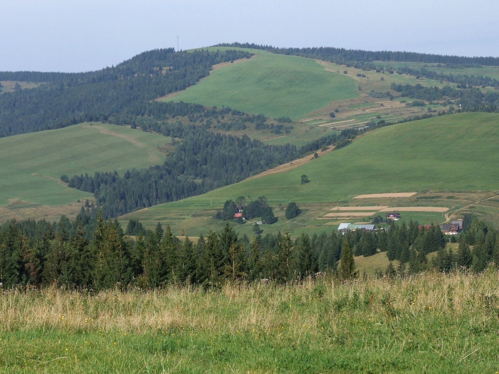
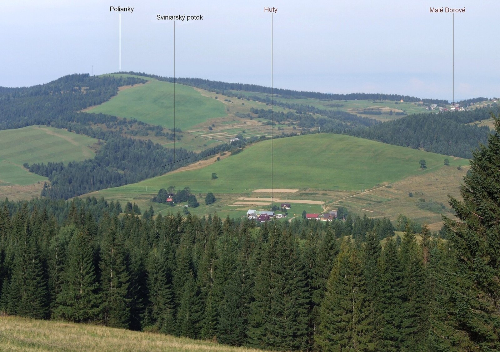
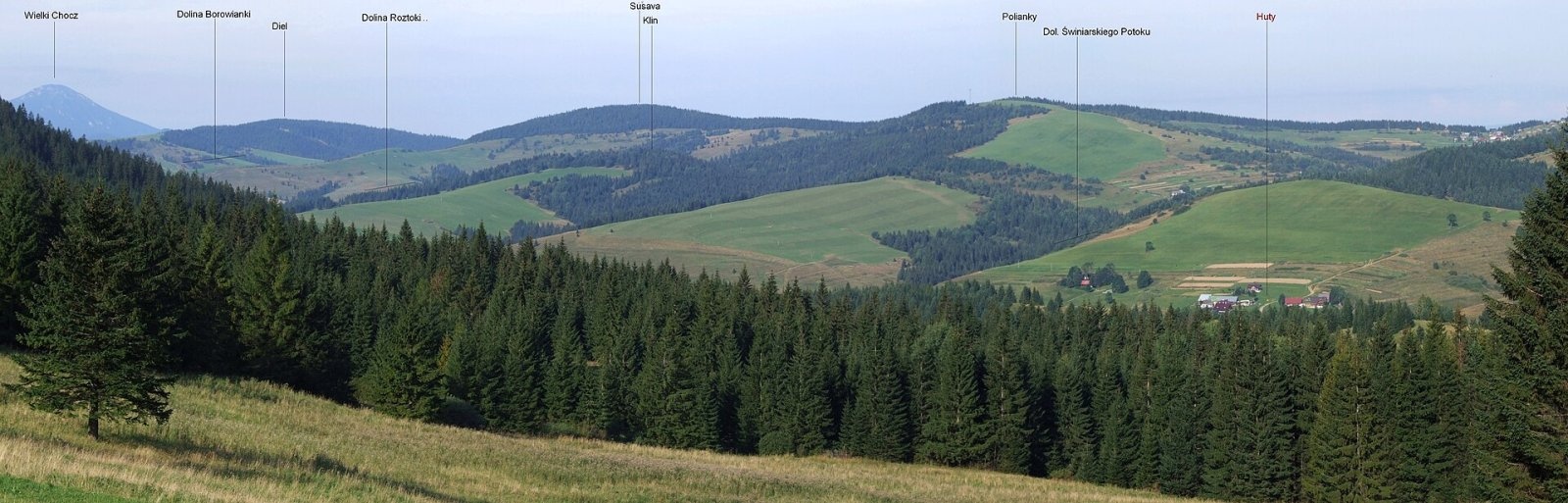
Polianky is a 1066 m summit in the Skorušinské vrchy in Slovakia (Polish geographers call the range the Orava or Skoruszyna Foothills). It rises directly above the village of Malé Borové, about 13 km south of Tvrdošín, in Liptovský Mikuláš District, Žilina Region, within the municipality of Malé Borové. The nearest villages are Malé Borové at its north-eastern foot (about 1 km), Veľké Borové to the south-west (2.4 km), Huty (3.6 km) and Chlebnice to the north-west (4.5 km). A few kilometres to the east rise the Western Tatras.
Polianky lies in the south-western part of the Skorušinské vrchy, in the Kopec subunit, on the ridge running from Diel (1051 m) north-east to the dominant Kopec (1251 m). According to Polish sources it stands on the main ridge between Blato and Súšava; two spurs run south-east from it towards the Huty valley, separating the valleys of the Sviniarsky potok and Roztoka. Around it rise Lysec (945 m) and Blato (1138 m) to the north, Kraviarska (770 m) and Súšava (1077 m) to the west, Prosečné (1372 m) and Ostrý vrch (1128 m) to the south, and Prípor (1003 m) and Kopec to the east. The hill sits on a watershed: the north-western slopes drain via tributaries of the Chlebnický potok to the Orava, the southern and eastern ones via tributaries of the Kvačianka to the Váh.
How to get there / routes
The red ridge trail crosses the summit area – a long route Oravský Biely Potok – Mních – Machy – Prieková – Kopec – Malé Borové – Polianky – Súšava – Veľké Borové – Diel – Malatiná.
- From the north-east – from Kopec via Malé Borové.
- From the south-west – from Malatiná via Súšava.
The shortest ascent is from Malé Borové, right below the summit. The sources give no walking times.
What you can see from the top
The summit is covered by broken woodland that gives way to large mountain meadows, so the view is unobstructed. You see the surrounding peaks of the Skorušinské vrchy and the Choč Mountains and, in good weather, the Western and Low Tatras, the Lesser Fatra and Oravská Magura.
Nature and history
The summit and much of the slopes are treeless, taken up by the meadows and fields of Malé Borové, giving the hill the mosaic landscape of arable strips, hay meadows and spruce woods typical of the Skorušinské vrchy. A telecommunications relay tower stands below the summit.
Safety, season and rules
Polianky is a low, safe meadow ridge accessible all year, but it is exposed to wind, so it is unpleasant on the meadows in a thunderstorm; in winter the snow lies deep. Keep to the marked path and do not trample hay meadows. Slovak Mountain Rescue Service (HZS): 18 300 (+421 18 300) or 112.
Interesting facts
- Malé Borové lies so close that the summit is only about a kilometre from the last houses.
- Water from the slopes of Polianky flows into two different rivers, the Orava and the Váh.
Photos: Jerzy Opioła, CC BY-SA 4.0; Jerzy Opioła, CC BY-SA 4.0; Jerzy Opioła, CC BY-SA 4.0 — Wikimedia Commons.
Getting there from Ukraine
Border crossings
- Uzhhorod – Vyšné Nemecké — road, 24/7
- Malyi Bereznyi – Ubľa — road, 24/7 For cars and buses; pedestrians not confirmed by the Ukrainian border service, lorries up to 3.5 t.
- Mali Selmentsi – Veľké Slemence (pedestrian) — pedestrian, 09:00–21:00 Kyiv time Pedestrians and cyclists only; inconvenient for the Tatras without onward transport.
- Chop – Čierna nad Tisou (rail) — rail, 24/7
By car
From Uzhhorod ≈275 km, ≈3 h 35 min without queues: Uzhhorod – Vyšné Nemecké → I/19 to Košice → D1 motorway via Prešov, Poprad and Liptovský Mikuláš to Ružomberok (≈270 km, ≈3 h 25 min from the border). From Lviv it is faster through Poland: M-10 → Krakovets – Korczowa → A4 to Kraków → S7/DK7 to the Chyżne – Trstená border → R3 and I/59 via Dolný Kubín to Ružomberok: ≈482 km, ≈6 h 15 min (via Uzhok and Ubľa ≈500 km, ≈7 h 30 min). The D1 requires an e-vignette (eznamka.sk).
Checked 23.10.2026; border crossing hours and timetables change — check before you travel.
Location on the map
Water and shelter nearby
- Vyvieračka Spring, 780 m2.6 km · Not verified · 780 m
- Spring below Savoš (north-west slope)2.7 km · Not verified · 800 m
- Spring below Háj (south-west slope), 809 m2.8 km · Not verified · 809 m
- Spring below Háj (south-east slope)2.9 km · Not verified · 739 m
- Spring below Ostrý Vrch (north-west slope), 851 m3 km · Not verified · 851 m
Comments
Trails nearby
All trails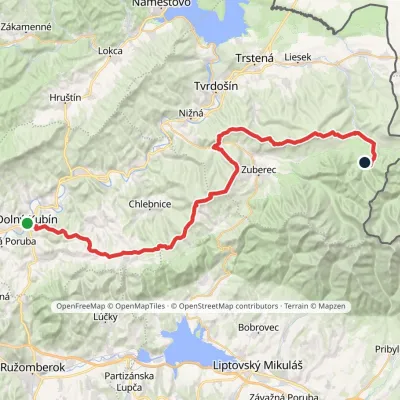 HardMulti-dayMarkedDolný Kubín Junction under UmrláElevation profile476–1 314 m56.6 kmascent 2 149 munder 1 km from Polianky
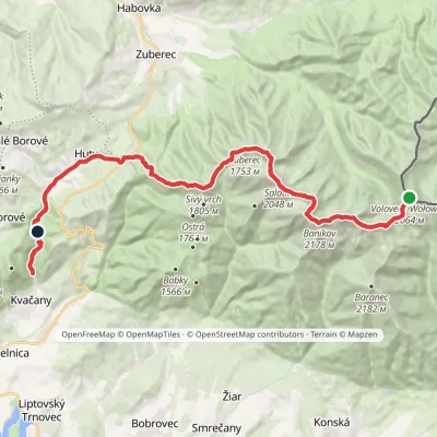 HardMulti-dayMarkedÚstie Kvačianskej doliny Pyšné sedlovia VolovecElevation profile644–2 178 m27.6 kmascent 1 566 m≈ 10 h walking2.1 km from Polianky
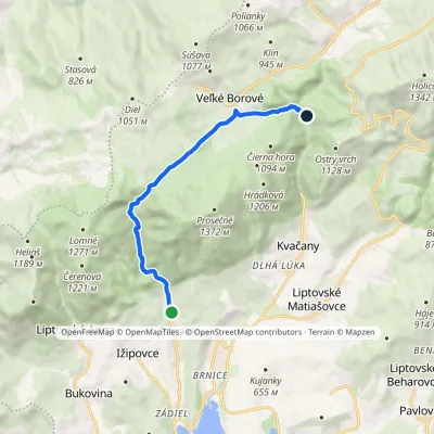 EasyOne-dayMarkedProsiek Oblazy, junctionElevation profile618–942 m8.8 kmascent 391 m≈ 3 h walking2.5 km from Polianky
Nearby attractions
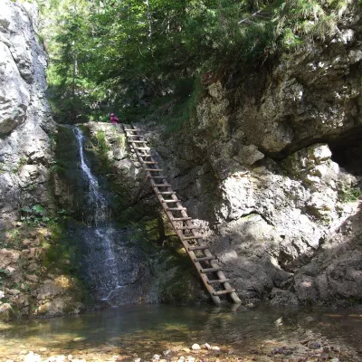 WaterfallRáztocký waterfall and the Oblazy mills (Kvačianska valley)Kvačany2.6 km from PoliankyThe Ráztocký waterfall (Ráztocký vodopád) is an eight-metre waterfall on the Ráztoka stream in the Chočské vrchy of northern Slovakia, just above the locality of...
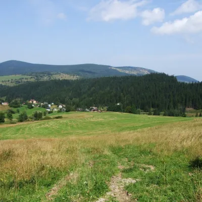 PeakKopecOravský Biely Potokaltitude 1 251 m3.2 km from PoliankyKopec (Slovak for “mound”; formerly Polish Kopiec) is a 1,251 m summit, the second highest in the Skorušinské vrchy of northern Slovakia.
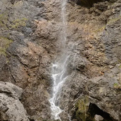 WaterfallČervené piesky waterfall in the Prosiecka valleyProsiek5.3 km from PoliankyČervené piesky is a 15-metre waterfall in a side valley of the Prosiecka dolina in the Chočské vrchy of northern Slovakia, above the village of Prosiek in the Liptov...
Craft nearby
All craft places Water parks & thermal poolsAquapark TatralandiaLiptovský Mikuláš13 km from PoliankyAquapark Tatralandia is a large year-round water leisure complex near Liptovský Mikuláš, on the northern shore of the Liptovská Mara reservoir.
 Water parks & thermal poolsLúčky Spa and AQUA-VITAL ParkLúčky13 km from PoliankyLúčky Spa (Kúpele Lúčky) lies in a quiet valley beneath the Choč Mountains, in the village of Lúčky near Ružomberok.
 Koliby & Hutsul cuisineSalaš Dechtáre above Liptovská MaraGalovany14 km from PoliankySalaš Dechtáre is a wooden koliba above the Liptovská Mara reservoir that is described as one of Slovakia’s first commercial salaš restaurants.
 Water parks & thermal poolsBešeňová Water ParkBešeňová14 km from PoliankyBešeňová — the "thermal heart of Liptov" Bešeňová Water Park (Vodný park Bešeňová) lies on the edge of the village of the same name in the western part of the Liptov...
 Craft beer & breweriesLiptovar brewery, Liptovský Mikuláš: craft beer and brewpubLiptovský Mikuláš17 km from PoliankyLiptovský Mikuláš is the main town of the Liptov region, a short drive from the Low and Western Tatras, the Demänovská Valley and the Liptovská Mara reservoir.
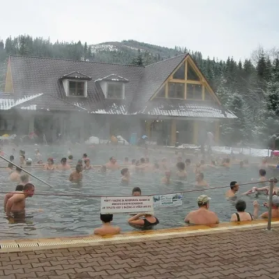 Water parks & thermal poolsOravice thermal poolsVitanová18 km from PoliankyThe Oravice thermal pools (Termálne kúpalisko Oravice) are the municipal thermal baths in the mountain settlement of Oravice at the foot of the Western Tatras.
