Čierna hora
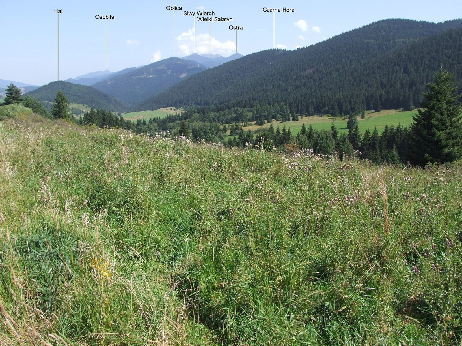
Čierna hora ("Black Mountain") is a 1094 m summit in the Choč Mountains (Chočské vrchy) in northern Slovakia. It lies above the village of Veľké Borové, about 11 km north-west of Liptovský Mikuláš, in the north-eastern part of the range – the Prosečné sub-unit. It belongs to the Liptovský Mikuláš District of the Žilina Region and extends into the cadastres of Veľké Borové and Kvačany. The nearest villages are Veľké Borové at the north-western foot (about 1.4 km), Kvačany (2.6 km), Liptovské Matiašovce and Malé Borové (over 4 km); further away lie Huty, Liptovská Sielnica, Prosiek and Malatiná.
Čierna hora is the eastern end of the Prosečné group: it stands on a ridge running north-east from Prosečné (1372 m), from which it is separated by the Ostruhy (Ostruky, about 1085 m) saddle. Together with Hrádková (1206 m) it forms the western slopes of the Kvačianska valley, while its northern and north-western slopes frame the Borovianka valley. Its farthest north-eastern slopes fall to the Oblazy meadow with historic water mills that still work. Around it lie Machy, Kopec, Polianky and Súšava to the north, Diel and Heliaš to the west, Prosečné and Hrádková to the south, and Babky (1566 m), Ostrý vrch and Holica to the east. The Kvačianka drains the east and its tributary the Borovianka the north, both in the Váh basin.
How to get there / routes
A green-marked trail traverses the summit:
- from the north – from Veľké Borové via the Dolina Borovianky junction;
- from the west – from the Svorad junction in the Prosiecka valley via Prosečné (1372 m).
The whole section from the Borovianka valley junction over Čierna hora and Prosečné to Svorad takes about 3 h (2:50 h back).
What you can see from the top
Sparse forest covers the summit, so views are limited. From open spots you can see the neighbouring Choč peaks, the Western Tatras, the Skorušina Mountains, the Orava Highlands, the Orava Magura, the Lesser Fatra and the Low Tatras.
Nature and history
The mountain is completely forested, but the Kvačianka and Borovianka streams have steeply undercut the lower slopes, creating outcrops, crags and rock towers; a large rock tower also stands on the ridge. Much of the slopes belongs to the Kvačianska dolina nature reserve, whose boundary runs along the ridge. This national nature reserve in a karst valley was declared in 1967 (last amended in 1993); it covers 462 ha and protects the Kvačianka gorge. The two wooden mills at Oblazy, where the Kvačianka meets the Borovianka and the Ráztocký stream, are technical monuments.
Safety, season and rules
The trail runs through forest; the crags above the valleys have steep drops – do not leave the marked path. In the reserve stay on marked trails. In winter snowshoes are needed. Slovak Mountain Rescue Service (HZS): 18 300 (+421 18 300); general emergency number 112.
Interesting facts
- Below the mountain, on the Oblazy meadow, old water mills are still at work.
- The boundary of the Kvačianska dolina reserve runs along the ridge of Čierna hora.
Photos: Jerzy Opioła, CC BY-SA 4.0 — Wikimedia Commons.
Getting there from Ukraine
Border crossings
- Uzhhorod – Vyšné Nemecké — road, 24/7
- Malyi Bereznyi – Ubľa — road, 24/7 For cars and buses; pedestrians not confirmed by the Ukrainian border service, lorries up to 3.5 t.
- Mali Selmentsi – Veľké Slemence (pedestrian) — pedestrian, 09:00–21:00 Kyiv time Pedestrians and cyclists only; inconvenient for the Tatras without onward transport.
- Chop – Čierna nad Tisou (rail) — rail, 24/7
By car
From Uzhhorod ≈275 km, ≈3 h 35 min without queues: Uzhhorod – Vyšné Nemecké → I/19 to Košice → D1 motorway via Prešov, Poprad and Liptovský Mikuláš to Ružomberok (≈270 km, ≈3 h 25 min from the border). From Lviv it is faster through Poland: M-10 → Krakovets – Korczowa → A4 to Kraków → S7/DK7 to the Chyżne – Trstená border → R3 and I/59 via Dolný Kubín to Ružomberok: ≈482 km, ≈6 h 15 min (via Uzhok and Ubľa ≈500 km, ≈7 h 30 min). The D1 requires an e-vignette (eznamka.sk).
Checked 23.10.2026; border crossing hours and timetables change — check before you travel.
Location on the map
Water and shelter nearby
- Spring below Háj (south-west slope), 809 m810 m · Not verified · 809 m
- Spring below Háj (south-east slope)1 km · Not verified · 739 m
- Vyvieračka Spring, 780 m1.1 km · Not verified · 780 m
- Drinking water below Ostrý Vrch (north-west slope)1.1 km · Not verified · 833 m
- Spring below Ostrý Vrch (west slope)1.1 km · Not verified · 855 m
- Spring below Ostrý Vrch (south-west slope), 893 m1.2 km · Not verified · 893 m
- Spring below Ostrý Vrch (north-west slope), 831 m1.2 km · Not verified · 831 m
- Spring below Ostrý Vrch (north-west slope), 851 m1.3 km · Not verified · 851 m
- Spring below Ostrý Vrch (north-west slope), 924 m1.3 km · Not verified · 924 m
- Spring below Hoľa (north-west slope)1.6 km · Not verified · 667 m
- Krasová Spring1.7 km · Not verified · 640 m
- Spring below Savoš (north-west slope)1.8 km · Not verified · 800 m
- Spring below Prosečné2 km · Not verified · 1 085 m
- Spring below Sokol Pass (north-east slope)2.2 km · Not verified · 998 m
- Captured Spring Suchý jarok, 955 m2.2 km · Not verified · 955 m
- Spring below Savoš (north slope), 1 145 m2.5 km · Not verified · 1 145 m
Comments
Trails nearby
All trails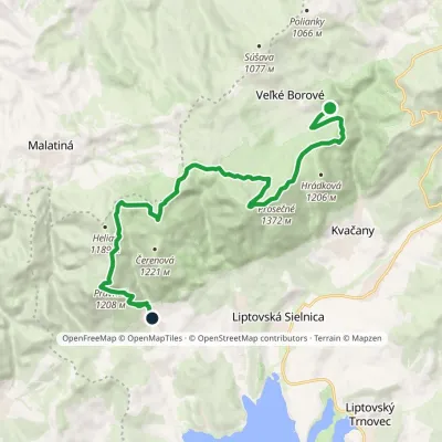 ModerateTwo-dayMarkedLiptovská Anna Dolina Borovianky, junctionElevation profile662–1 372 m17 kmascent 1 132 m≈ 6.5 h walkingunder 1 km from Čierna hora
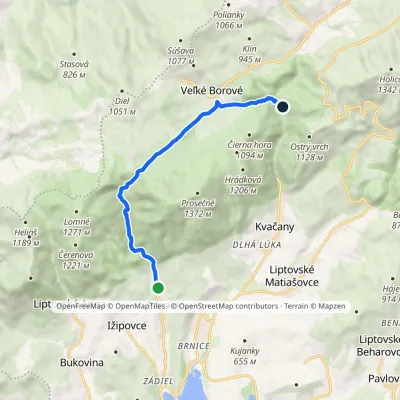 EasyOne-dayMarkedProsiek Oblazy, junctionElevation profile618–942 m8.8 kmascent 391 m≈ 3 h walkingunder 1 km from Čierna hora
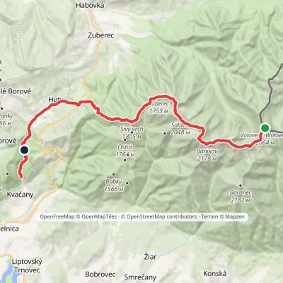 HardMulti-dayMarkedÚstie Kvačianskej doliny Pyšné sedlovia VolovecElevation profile644–2 178 m27.6 kmascent 1 566 m≈ 10 h walkingunder 1 km from Čierna hora
Nearby attractions
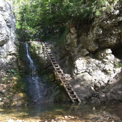 WaterfallRáztocký waterfall and the Oblazy mills (Kvačianska valley)Kvačany1.1 km from Čierna horaThe Ráztocký waterfall (Ráztocký vodopád) is an eight-metre waterfall on the Ráztoka stream in the Chočské vrchy of northern Slovakia, just above the locality of...
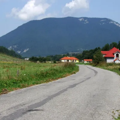 PeakProsečnéVeľké Borovéaltitude 1 372 m2 km from Čierna horaProsečné (local forms Prosečnô, Prosečná; Polish Prosieczne) is a prominent 1372 m peak in the Choč Mountains of northern Slovakia.
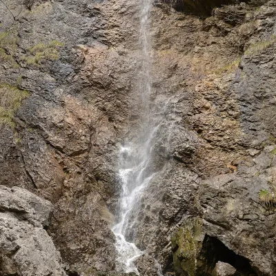 WaterfallČervené piesky waterfall in the Prosiecka valleyProsiek3.5 km from Čierna horaČervené piesky is a 15-metre waterfall in a side valley of the Prosiecka dolina in the Chočské vrchy of northern Slovakia, above the village of Prosiek in the Liptov...
Craft nearby
All craft places Water parks & thermal poolsAquapark TatralandiaLiptovský Mikuláš9.6 km from Čierna horaAquapark Tatralandia is a large year-round water leisure complex near Liptovský Mikuláš, on the northern shore of the Liptovská Mara reservoir.
 Koliby & Hutsul cuisineSalaš Dechtáre above Liptovská MaraGalovany11 km from Čierna horaSalaš Dechtáre is a wooden koliba above the Liptovská Mara reservoir that is described as one of Slovakia’s first commercial salaš restaurants.
 Water parks & thermal poolsLúčky Spa and AQUA-VITAL ParkLúčky11 km from Čierna horaLúčky Spa (Kúpele Lúčky) lies in a quiet valley beneath the Choč Mountains, in the village of Lúčky near Ružomberok.
 Water parks & thermal poolsBešeňová Water ParkBešeňová12 km from Čierna horaBešeňová — the "thermal heart of Liptov" Bešeňová Water Park (Vodný park Bešeňová) lies on the edge of the village of the same name in the western part of the Liptov...
 Craft beer & breweriesLiptovar brewery, Liptovský Mikuláš: craft beer and brewpubLiptovský Mikuláš14 km from Čierna horaLiptovský Mikuláš is the main town of the Liptov region, a short drive from the Low and Western Tatras, the Demänovská Valley and the Liptovská Mara reservoir.
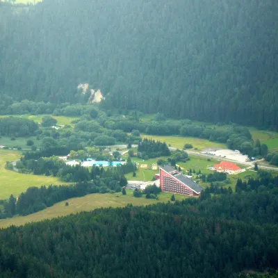 Water parks & thermal poolsTERMAL raj thermal bath, Liptovský JánLiptovský Ján20 km from Čierna horaLiptovský Ján: thermal water at the entrance to Jánska dolina Liptovský Ján is an old village in southern Liptov, about 10 km from Liptovský Mikuláš, at the entrance...
