Zakopane

Photos: Maksym Kozlenko, CC BY-SA 4.0 (Wikimedia Commons); Maksym Kozlenko, CC BY-SA 4.0 (Wikimedia Commons); Aldis Dzenovskis, CC BY-SA 3.0 (Wikimedia Commons); OrlandoFax, CC BY 3.0 (Wikimedia Commons); enonim, CC BY-SA 3.0 (Wikimedia Commons); FraKtus, CC BY-SA 3.0 (Wikimedia Commons)
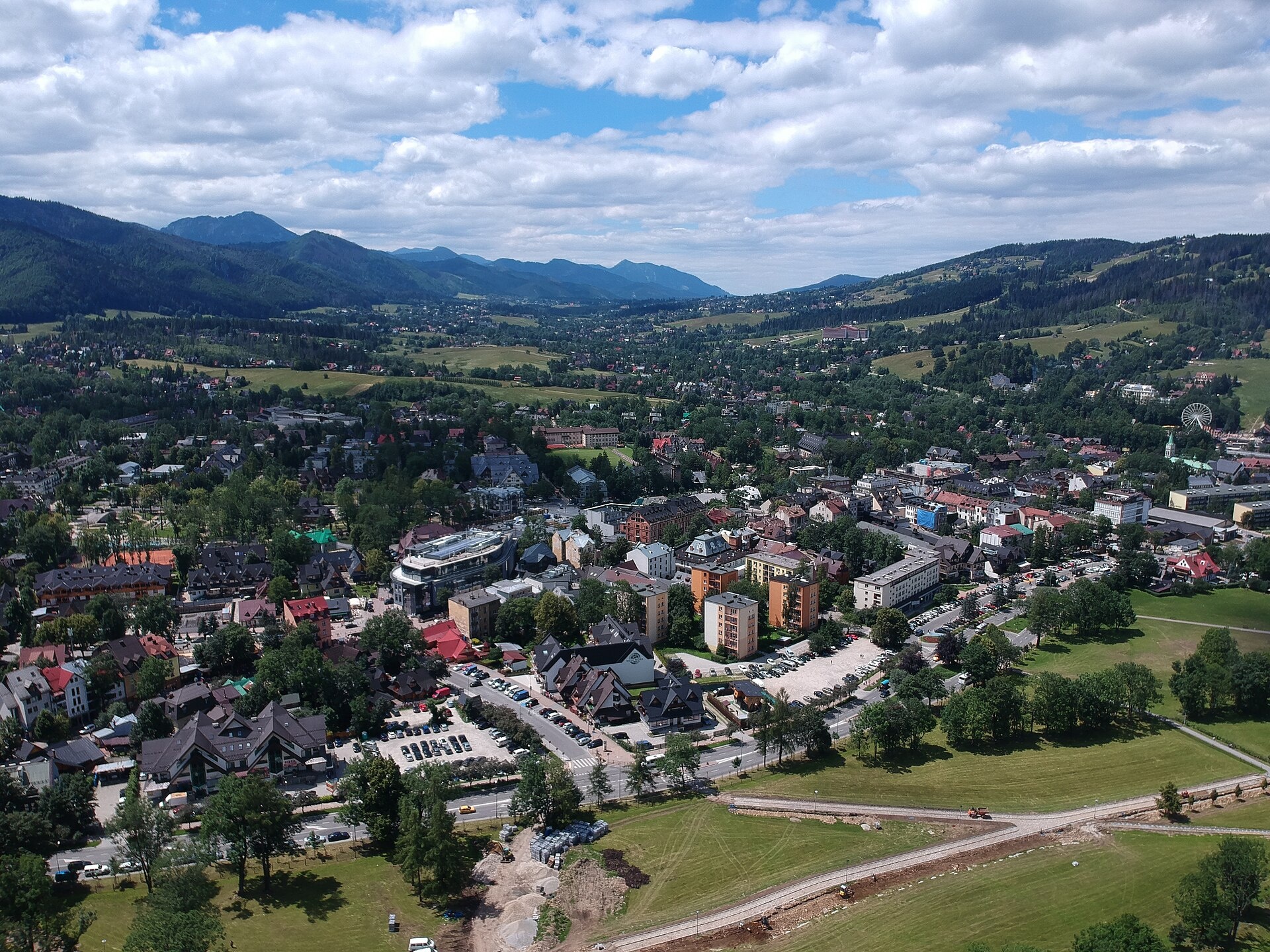
Zakopane is a town in Poland. Administrative area: Tatra County, Lesser Poland Voivodeship.
Elevation: about 837 m above sea level. Population: 25,770 (2021). Mountains nearby: Western Tatras.
Here and nearby on the site: 34 trails, 7 peaks, 25 sights, 8 craft places, 1 spa or thermal pool, 3 mountain huts and shelters.
Facts: Wikidata, OpenStreetMap. More on Wikipedia
Trails nearby
All trails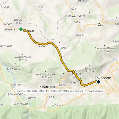 EasyOne-dayMarkedZakopane DzianiszElevation profile822–1 132 m9.2 kmascent 277 m≈ 3 h walkingunder 1 km from the centre
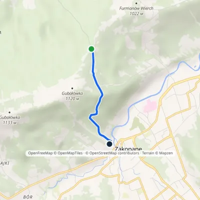 EasyOne-dayMarkedMichny ZakopaneElevation profile821–1 070 m2.2 km≈ 30 min walkingunder 1 km from the centre
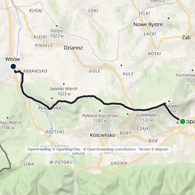 ModerateOne-dayMarkedZakopane WitówElevation profile820–1 179 m11.5 kmascent 405 m≈ 3.5 h walkingunder 1 km from the centre
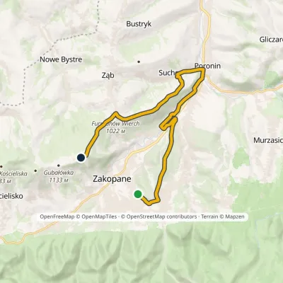 ModerateOne-dayMarkedAntałówka Gubałówka, upper funicular stationElevation profile729–1 123 m16.4 kmascent 443 m≈ 5 h walking1.2 km from the centre
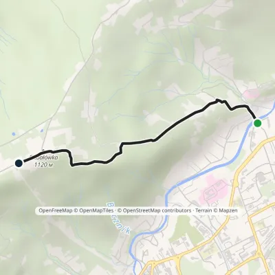 EasyOne-dayMarkedZakopane Gubałówkavia KotelnicaElevation profile789–1 125 m2.5 kmascent 334 m≈ 1.5 h walking1.2 km from the centre
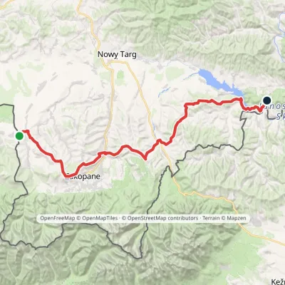 HardMulti-dayMarkedChochołów Trzy Kopce PassElevation profile469–1 132 m65.7 kmascent 1 966 m1.6 km from the centre
Peaks nearby
All peaks PeakGubałówkaZakopanealtitude 1 126 m1.6 km from the centreGubałówka is a long, gentle hill above the north-western part of Zakopane and the best-known summit of the Gubałówka Foothills in Podhale.
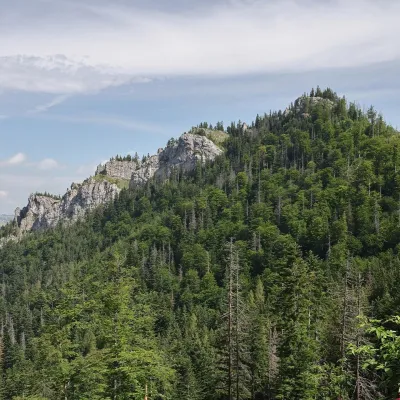 PeakNosalZakopanealtitude 1 206 m3.6 km from the centre1 trail to the topNosal is a low, wooded 1,206 m summit in the Western Tatras, right above Kuźnice on the south-eastern edge of Zakopane.
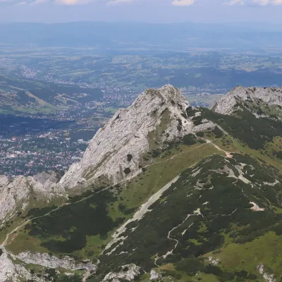 PeakGiewontZakopanealtitude 1 895 m5.2 km from the centre1 trail to the topGiewont is a 1,895 m mountain massif in the Western Tatras, towering over Zakopane. Its main summit, Wielki Giewont, is usually regarded as the highest peak of the...
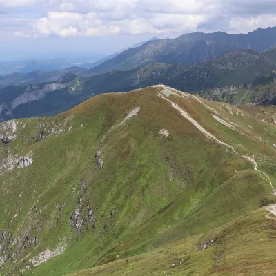 PeakKopa KondrackaZakopanealtitude 2 005 m6.8 km from the centreKopa Kondracka (Slovak: Kondratova kopa) is a 2,005 m peak on the main ridge of the Tatras, on the border between Poland and Slovakia.
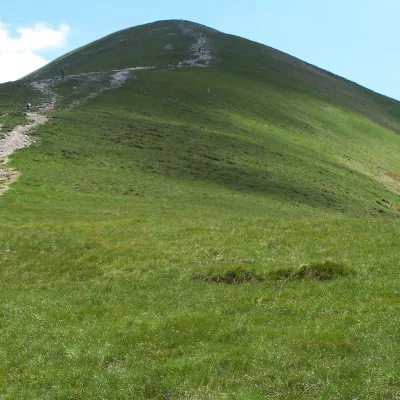 PeakMałołączniakKościeliskoaltitude 2 096 m7.2 km from the centreMałołączniak (Slovak Malolúčniak) is a 2,096 m summit of the Western Tatras on the main Tatra ridge along the Polish–Slovak border.
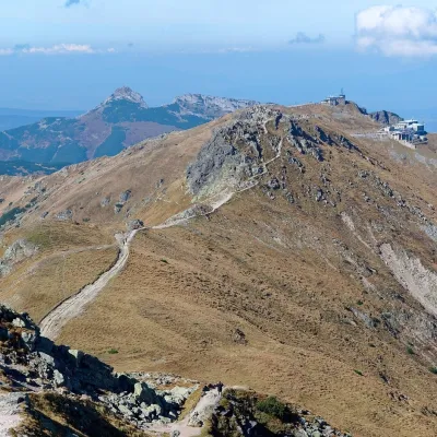 PeakKasprowy WierchZakopanealtitude 1 987 m7.6 km from the centre1 trail to the topKasprowy Wierch (Slovak: Kasprov vrch) is a 1,987 m summit on the main ridge of the Western Tatras, on the Polish–Slovak border.
What to visit
All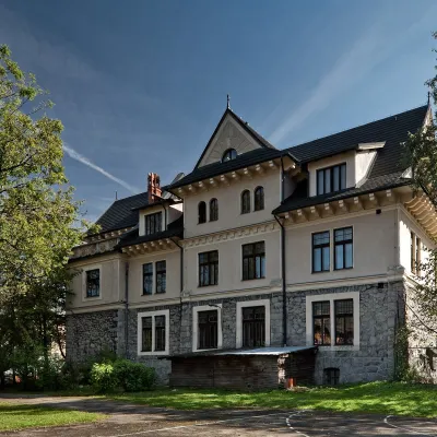 MuseumTatra Museum in ZakopaneZakopaneunder 1 km from the centreThe Dr Tytus Chałubiński Tatra Museum (Muzeum Tatrzańskie) is one of the oldest museums in Poland and the best place to understand Zakopane, the Tatras and the Podhale...
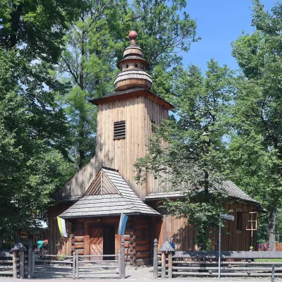 ChurchOld Church and Pęksowy Brzyzek CemeteryZakopaneunder 1 km from the centreOn Kościeliska Street, a few minutes from Krupówki, stands a small larch-wood church, and behind it Zakopane's oldest cemetery.
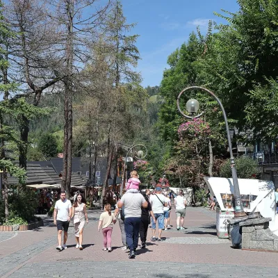 Historic siteKrupówki Street, ZakopaneZakopaneunder 1 km from the centreKrupówki is Zakopane's main street and the town's central axis. The name comes from the old Krupówki clearing.
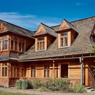 MuseumVilla Atma — Karol Szymanowski MuseumZakopaneunder 1 km from the centreVilla Atma is a small timber house on Kasprusie Street in Zakopane, home of one of the greatest Polish composers of the 20th century, Karol Szymanowski.
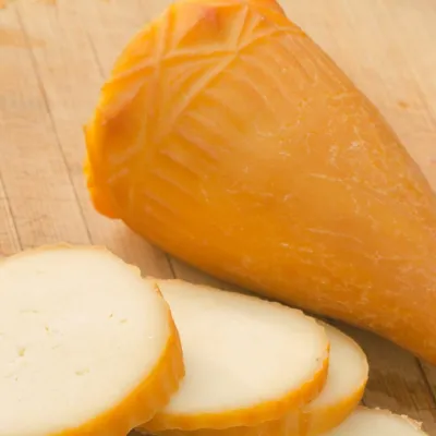 Cheese dairies & pasturesDom Oscypka, Krupówki, Zakopane: cheese-making workshop with a bacaZakopaneunder 1 km from the centreDom Oscypka ("House of Oscypek") is a workshop studio on Krupówki in the very centre of Zakopane, where you can see how highland cheese is made from milk and make some...
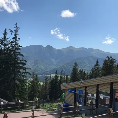 NatureGubałówka — viewpoint ridge above ZakopaneZakopane1.6 km from the centreGubałówka is an elongated ridge on the north-western edge of Zakopane, part of the Gubałówka Range. It rises from 1,120 m at its eastern end to 1,129 m at its western...
Craft nearby
All craft places Markets & fairsMarket under GubałówkaZakopaneunder 1 km from the centreThe market under Gubałówka (Targ pod Gubałówką) is Zakopane's best-known bazaar and probably the most photographed row of stalls in the Polish Tatras.
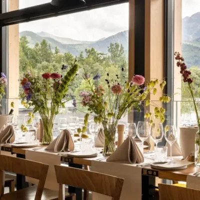 Craft beer & breweriesGwarno Restaurant & Brewery, ZakopaneZakopaneunder 1 km from the centreGwarno is a restaurant with its own small brewery at the foot of Gubałówka in Zakopane. It stands on Na Gubałówkę street right next to the lower station of the...
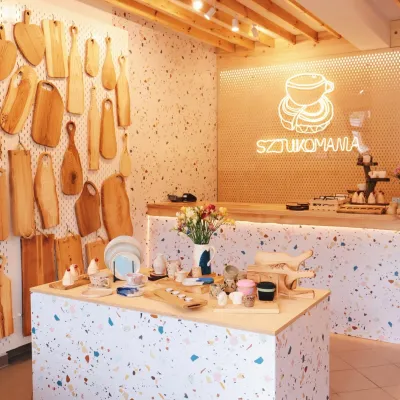 Crafts & workshopsSztukomania Studio, Zakopane: handmade ceramics and pottery workshopsZakopaneunder 1 km from the centreSztukomania is a small ceramics and woodwork studio on Staszica street in Zakopane, a few minutes' walk from Krupówki.
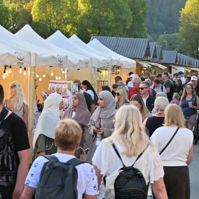 Markets & fairsEuropean Fair of Regional Products, Zakopane (every August)Zakopaneunder 1 km from the centreThe European Fair of Regional Products (Europejskie Targi Produktów Regionalnych) is a five-day festival of food, crafts and music held every August on Górna Równia...
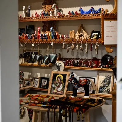 Craft shopsGazduś gallery, Zakopane: Podhale folk art and handicraft shopZakopaneunder 1 km from the centreGazduś is a small folk-art gallery and shop in Zakopane run by the Zakopane Cultural Centre (Zakopiańskie Centrum Kultury).
 Water parks & thermal poolsTermy Zakopiańskie (Aqua Park Zakopane)Zakopane1.1 km from the centreTermy Zakopiańskie is a thermal water park right in Zakopane, on Jagiellońska Street, only a kilometre from Krupówki.
Spas and thermal pools nearby
Water parks & thermal poolsTermy Zakopiańskie (Aqua Park Zakopane)Zakopane1.1 km from the centreTermy Zakopiańskie is a thermal water park right in Zakopane, on Jagiellońska Street, only a kilometre from Krupówki.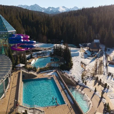 Water parks & thermal poolsTermy BukovinaBukowina Tatrzańska11 km from the centreTermy Bukovina is a modern thermal pool complex in Bukowina Tatrzańska, a village lying about a thousand metres above sea level on the edge of the Tatra National Park.
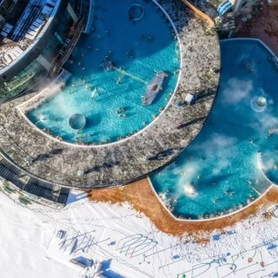 Water parks & thermal poolsChochołowskie TermyChochołów11 km from the centreChochołowskie Termy stand in the village of Chochołów in the Podhale region, north-west of Zakopane and not far from the Slovak border.
Huts, shelters and springs nearby
- Kalatówki Mountain Hotel4.3 km · Standing · 1 198 m
- Hala Kondratowa Hut5.2 km · Standing · 1 333 m
- Murowaniec Hut7.2 km · Standing · 1 500 m
- Murań Youth Shelter2.2 km · Standing · 871 m
- Drinking water below Gronik2.3 km · Not verified · 922 m
- Spring below Samkowa Czuba3.1 km · Not verified · 965 m
- Drinking water below Boczań (north-west slope), 1 024 m3.6 km · Not verified · 1 024 m
- Drinking water below Boczań (north-west slope), 1 010 m3.8 km · Not verified · 1 010 m
Getting there from Ukraine
Border crossings
- Krakovets – Korczowa — road, 24/7
- Shehyni – Medyka — road, 24/7 Pedestrian crossing is not confirmed by the Ukrainian border service — check dpsu.gov.ua before the trip.
- Smilnytsia – Krościenko — road, 24/7
- Hrushiv – Budomierz — road, 24/7
- Mostyska – Przemyśl (rail) — rail, 24/7
By car
Lviv – Zakopane ≈421 km, ≈5 h 10 min without border queues. Route: M-10 Lviv – Krakovets → Krakovets – Korczowa checkpoint → A4 motorway (Rzeszów – Tarnów – Kraków) → Kraków southern bypass → S7/DK7 → DK47 ('Zakopianka') via Nowy Targ → Zakopane. The A4 Katowice – Kraków section (Balice and Mysłowice toll plazas) is tolled, but this route does not use it. In summer and at weekends the DK47 near Zakopane is often congested.
Checked 23.10.2026; border crossing hours and timetables change — check before you travel.
