Kasprowy Wierch
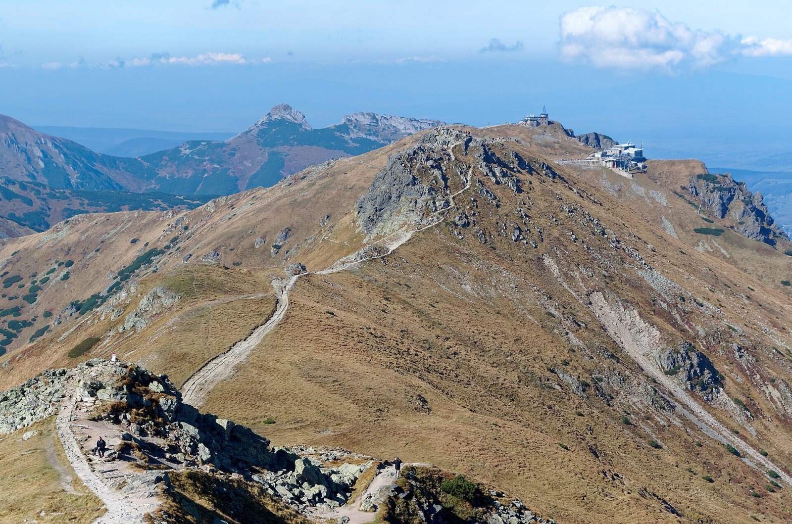
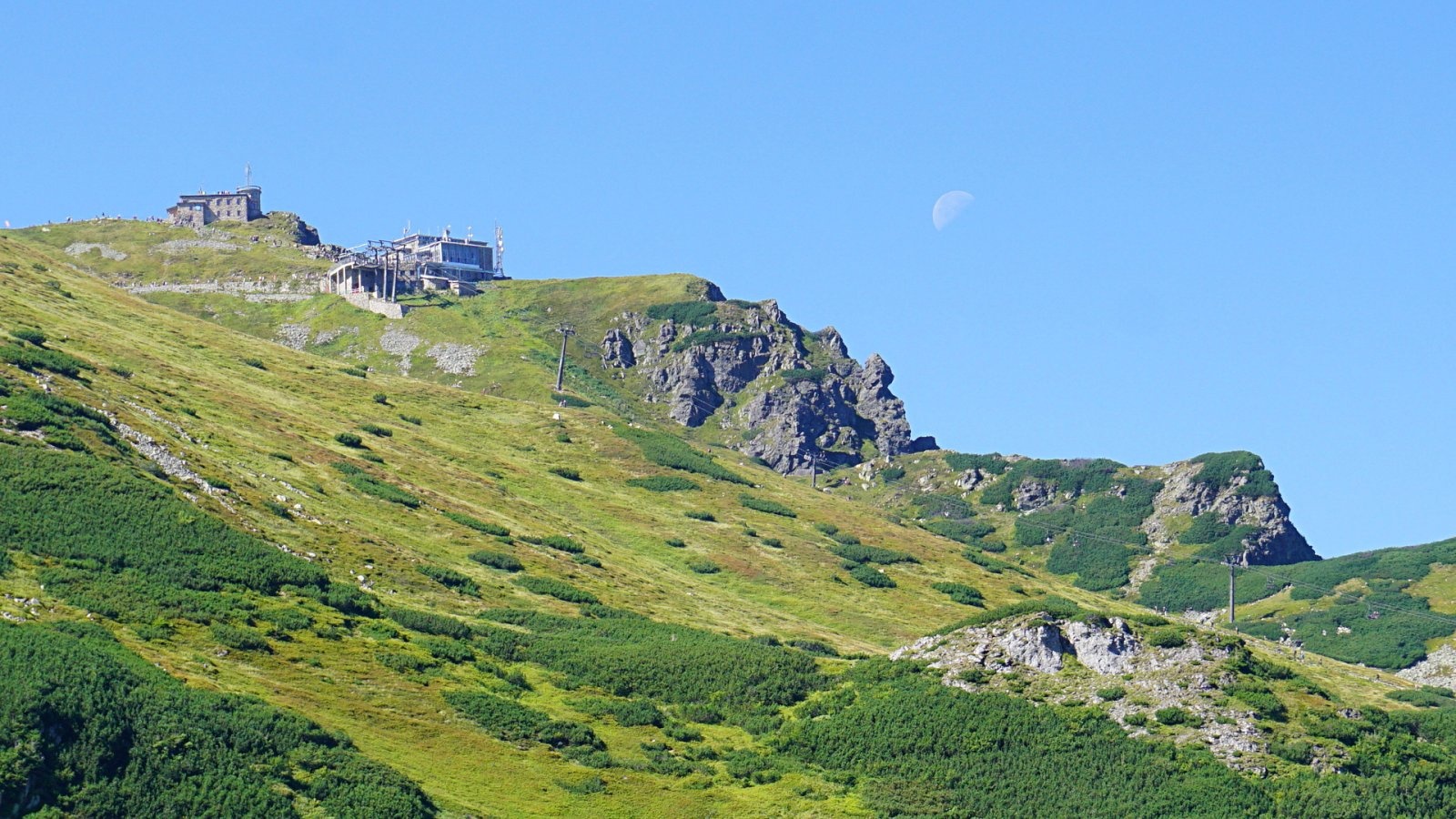
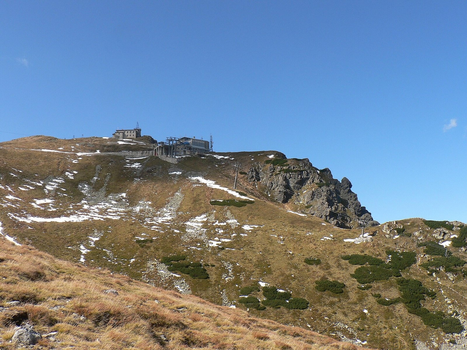
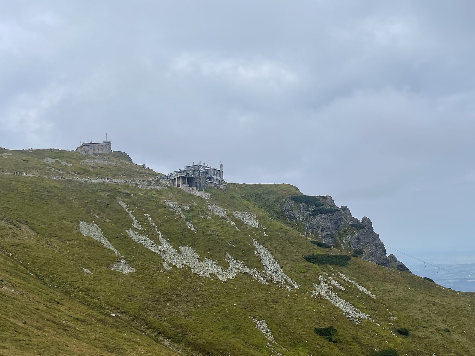
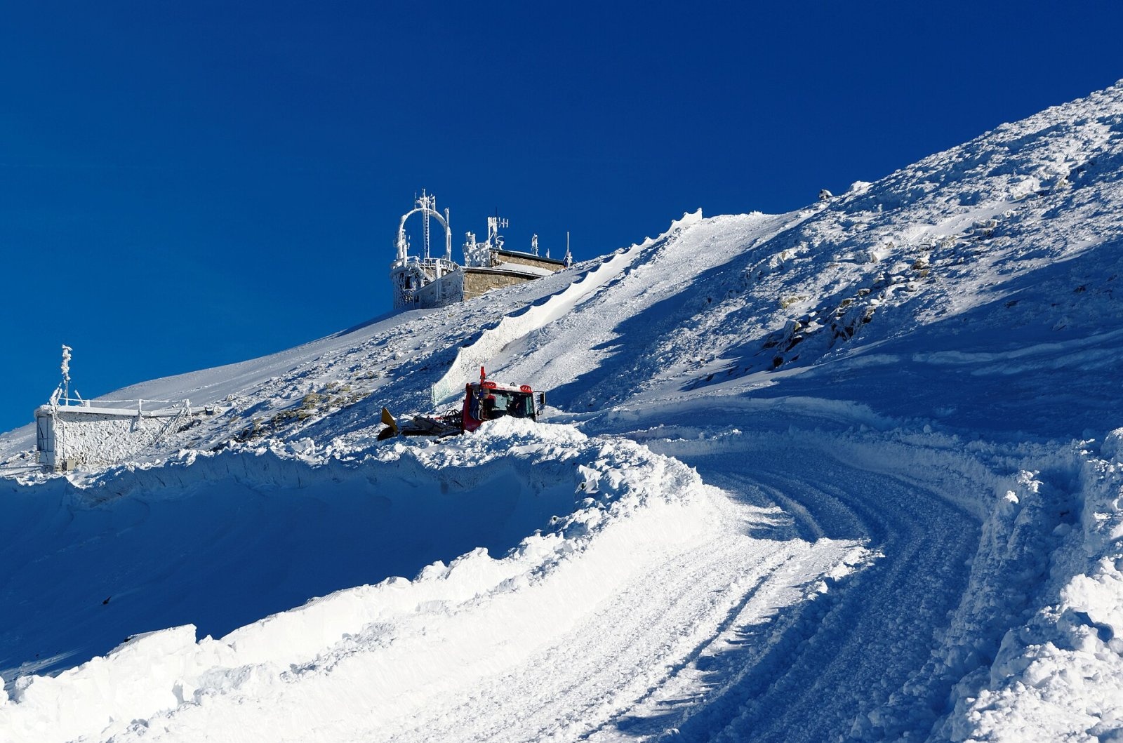
Kasprowy Wierch (Slovak: Kasprov vrch) is a 1,987 m summit on the main ridge of the Western Tatras, on the Polish–Slovak border. It is a junction of four ridges rising above three large valleys — Bystra and Sucha Woda Gąsienicowa on the Polish side and Tichá dolina on the Slovak side. Kasprowy Wierch is the most visited peak in the Tatras, with up to 4,000 people a day in season, because a cable car runs from Kuźnice almost to the top. Kuźnice lies about 4.2 km to the north in a straight line, central Zakopane about 7.8 km. In winter it is one of Poland's main ski areas.
How to get there / routes
The cable car from Kuźnice (run by Polskie Koleje Linowe) is about 4.3 km long and climbs 936 m, with a change at Myślenickie Turnie; each cabin carries up to 60 people. The top station stands at 1,959 m, 26 m below the summit, and a paved path leads from it to the top and to Sucha Przełęcz. The line closes every year for inspections in May and November and does not run in winds above 20 m/s, icing or temperatures below −28 °C. It is worth buying tickets online in advance. Private cars cannot drive to Kuźnice — take a bus, a taxi or walk.
Hiking routes (times from Polish Wikipedia):
- Green from Kuźnice via Myślenickie Turnie — about 3 h up, 2 h 15 min down.
- Yellow from the Murowaniec hut in Dolina Gąsienicowa to Sucha Przełęcz — about 1 h 25 min up, 1 h 05 min down.
- Red along the main ridge: westward over the Goryczkowe peaks to Kopa Kondracka and the Czerwone Wierchy (about 1 h 55 min from Kopa Kondracka); eastward via Beskid and Liliowe to Świnica (about 1 h 40 min; beyond Liliowe the route turns harder, with chains).
- Yellow from Slovakia — from Tichá dolina up to Sucha Przełęcz (about 2 h 20 min up from the red valley trail). The approach from Podbanské is long — some 17 km up a remote valley — so far fewer people come from the Slovak side.
The view from the summit
The open summit gives a full panorama: to the west the grassy Western Tatras with the Czerwone Wierchy and Giewont, to the east the rocky High Tatras with Świnica in the foreground, to the south Tichá dolina and to the north Zakopane and the Podhale basin. In good visibility, according to Slovak sources, parts of the Low Tatras and the Orava Beskids can be seen.
Nature and history
The name comes from Hala Kasprowa, a pasture at the foot of the peak, said to be named after its owner, a highlander called Kasper. Although the summit lies in the Western Tatras, which are made mostly of sedimentary rock, it is built of crystalline granodiorite and pegmatite belonging to the so-called Goryczkowa crystalline island. Steep, almost wall-like slopes drop only into Dolina Kasprowa. Botanists have found several very rare plants here that in Poland grow only in the Tatras, including alpine bent grass and Tatra meadow grass.
Paths to the summit existed by about 1850, and from the 1910s Kasprowy became a favourite with skiers. The cable car was built in eight months in 1935–1936, making it one of the oldest in Europe; after a complete rebuild it reopened at the end of 2007. In 1938 a high-mountain meteorological observatory was built on the summit (designed by Aleksander and Anna Kodelski) — since 1945 the highest building in Poland, now also home to a greenhouse-gas measurement laboratory. In 1961 the astronomer Kazimierz Kordylewski first photographed from Kasprowy the faint dust clouds at the Earth–Moon Lagrange points. On 6 June 1997 Pope John Paul II visited the summit, as a plaque at the top station records.
Safety, season and rules
Easy access can be deceptive: the weather at 2,000 m changes quickly, and the climate here is classed as tundra. In winter the slopes are avalanche-prone, crampons are needed on the ridge, and walking on the Goryczkowa and Gąsienicowa ski runs is forbidden. For ski touring, the Myślenickie Turnie – Kasprowy Wierch and Dolina Gąsienicowa – Liliowe trails are open for ascent only. If the cable car stops because of wind, you will have to walk down — build that into your plan.
- Entry to Tatra National Park is paid (since 2025: 11 PLN, reduced 5.50 PLN); the cable car ticket is bought separately.
- From 1 March to 30 November all TPN trails are closed from dusk to dawn; from 1 December to the end of February, from 22:00 to 05:00.
- Dogs, drones and camping are not allowed; stay on marked trails.
- The Slovak side belongs to TANAP, where many high-mountain trails are closed seasonally (1 November – 31 May) — check the rules at tanap.sk.
- Emergency numbers: TOPR 985 or +48 601 100 300, and 112 (in Slovakia HZS 18 300). Current conditions are in the daily TPN bulletin.
Interesting facts
- In winter TOPR rescuers are on duty at the top station of the cable car.
- In 2018 the play "Pan Tadeusz z M3" was staged in the top-station restaurant — the highest theatre performance ever held in Poland.
- From 1967 to 1995 a transmitter on the summit broadcast Polish Television's Channel 1.
Photos: Jakub Hałun, CC BY-SA 4.0; Faxe, CC BY-SA 4.0; Krzysztof Dudzik-Górnicki (User:ToSter), CC BY-SA 4.0; Emperor12345PL, CC BY-SA 4.0; Jakub Hałun, CC BY-SA 4.0; Opioła Jerzy, CC BY 2.5 — Wikimedia Commons.
Getting there from Ukraine
Border crossings
- Krakovets – Korczowa — road, 24/7
- Shehyni – Medyka — road, 24/7 Pedestrian crossing is not confirmed by the Ukrainian border service — check dpsu.gov.ua before the trip.
- Smilnytsia – Krościenko — road, 24/7
- Hrushiv – Budomierz — road, 24/7
- Mostyska – Przemyśl (rail) — rail, 24/7
By car
Lviv – Zakopane ≈421 km, ≈5 h 10 min without border queues. Route: M-10 Lviv – Krakovets → Krakovets – Korczowa checkpoint → A4 motorway (Rzeszów – Tarnów – Kraków) → Kraków southern bypass → S7/DK7 → DK47 ('Zakopianka') via Nowy Targ → Zakopane. The A4 Katowice – Kraków section (Balice and Mysłowice toll plazas) is tolled, but this route does not use it. In summer and at weekends the DK47 near Zakopane is often congested.
Checked 23.10.2026; border crossing hours and timetables change — check before you travel.
Location on the map
Comments
Trails nearby
All trails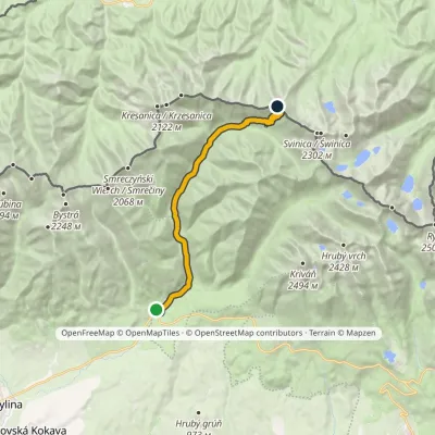 ModerateTwo-dayMarkedPodbanské Suché SaddleElevation profile928–1 946 m16.2 kmascent 1 013 m≈ 6 h walkingunder 1 km from Kasprowy Wierch
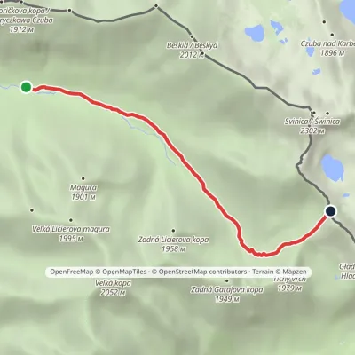 EasyOne-dayMarkedLiptovský košiar Hladké sedloElevation profile1 275–1 988 m5.3 kmascent 694 m≈ 2.5 h walking1.4 km from Kasprowy Wierch
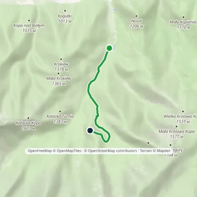 EasyOne-dayMarkedKuźnice Myślenickie TurnieElevation profile1 018–1 363 m3.3 kmascent 332 m≈ 1.5 h walking2 km from Kasprowy Wierch
Nearby attractions
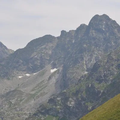 PeakŚwinicaaltitude 2 302 m2.4 km from Kasprowy WierchŚwinica (Slovak: Svinica) is a 2,302 m summit on the main ridge of the Tatra Mountains, right on the Polish–Slovak border.
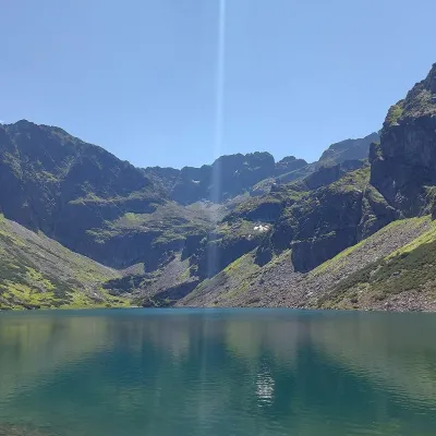 LakeCzarny Staw Gąsienicowy2.7 km from Kasprowy WierchCzarny Staw Gąsienicowy lies in the High Tatras, in a glacial cirque in the eastern part of the Gąsienicowa Valley, at 1,624 m.
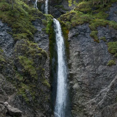 WaterfallSiklawica Waterfall4.8 km from Kasprowy WierchSiklawica (also Siklawica Strążyska) is a waterfall in the Western Tatras, in the upper part of the Strążyska Valley (strictly speaking in its branch called Mała...
Craft nearby
All craft places Cheese dairies & pasturesFurtek's Shepherd's Huts, Kuźnice and Kalatówki4.8 km from Kasprowy WierchAbove Kuźnice — the southern edge of Zakopane where most hikes into the Western and High Tatras begin — the flocks are tended by baca Andrzej Staszel, nicknamed "Furtek".
 Koliby & Hutsul cuisineBąkowo Zohylina Wyźnio Highland Tavern6.1 km from Kasprowy WierchBąkowo Zohylina Wyźnio is a regional highland tavern in Zakopane housed in a wooden "szałas" (shepherd-hut-style building) with a view of the Tatras.
 Water parks & thermal poolsTermy Zakopiańskie (Aqua Park Zakopane)7.1 km from Kasprowy WierchTermy Zakopiańskie is a thermal water park right in Zakopane, on Jagiellońska Street, only a kilometre from Krupówki.
 Markets & fairsMarket under Gubałówka7.8 km from Kasprowy WierchThe market under Gubałówka (Targ pod Gubałówką) is Zakopane's best-known bazaar and probably the most photographed row of stalls in the Polish Tatras.
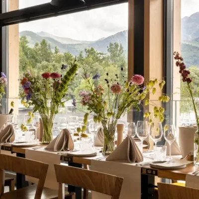 Craft beer & breweriesGwarno Restaurant & Brewery, Zakopane7.9 km from Kasprowy WierchGwarno is a restaurant with its own small brewery at the foot of Gubałówka in Zakopane. It stands on Na Gubałówkę street right next to the lower station of the...
 Cheese dairies & pasturesShepherd's Hut on Rusinowa Polana8.6 km from Kasprowy WierchRusinowa Polana is one of the most beautiful mountain glades in the Polish Tatras, and from May to October it is home to the bacówka (shepherd's hut) of baca Stanisław...
