Stara Huta village, via Mount Vysoka, Mount Syvulia, Mount Durnia, Mount Bratkivska, Mount Tataruka and Mount Blyznytsia to Bilyn village
About the route:
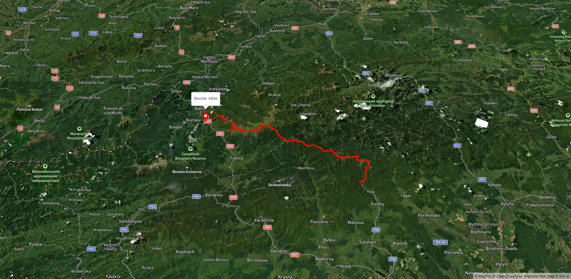
Route Stara Huta village, via Mount Vysoka, Mount Syvulia, Mount Durnia, Mount Bratkivska, Mount Tataruka and Mount Blyznytsia to Bilyn village. Warning! This route is unmarked (it may be partially marked)! Unmarked routes are not equipped with: information boards; signposts; auxiliary signs (water, campsite, etc.). The decision to take the route is entirely your own responsibility! Trail length 95850m. Lowest point - 481m., highest point - 1850m. Total elevation gain 5130m. Along the route you will see: Srednya Mountain, Gora Vysoka, Mount Igrovets, Mount Borevka, Mount Lopushnaya, Mount Velyka Sivulya, Mount Mala Sivulya, Mount Durnia, Mount Grope, Mount Bratkivska, Mount Tataruka, Mount Trojaska, Lake Gereshaska (Dogyaska), Mount Dogyaska, Lake Vorozheskaya, Mount Bolshoi Kotel, Mount Stig (Dragobrat), Mount Bliznytsia.
What to see along the route:
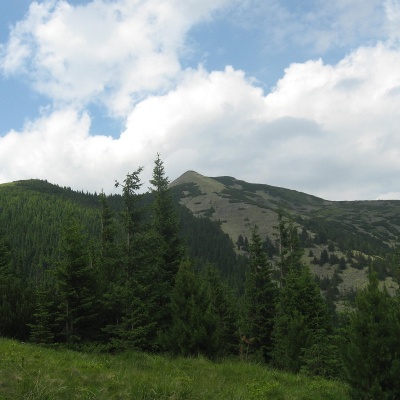 Serednya is a 1,639-meter peak of the Ukrainian Carpathians, which is located within the Gorgan mountain range. The mountain is located southeast of the village of Osmoloda and west of the village of Stara Huta on the border of two districts of Ivano-Frankivsk region - Bohorodchany and Rozhnyativ.
... More...
Serednya is a 1,639-meter peak of the Ukrainian Carpathians, which is located within the Gorgan mountain range. The mountain is located southeast of the village of Osmoloda and west of the village of Stara Huta on the border of two districts of Ivano-Frankivsk region - Bohorodchany and Rozhnyativ.
... More...
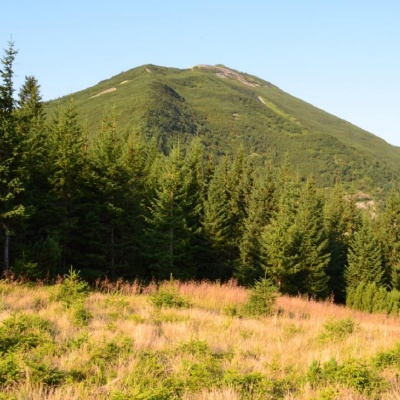 Mount Vysoka (1803.6 m) is one of the peaks of the Ukrainian Carpathians, located in the Gorgan mountain range. It is located in Ivano-Frankivsk region on the border of Bohorodchany and Rozhniativ districts, southeast of the village of Osmoloda.
... More...
Mount Vysoka (1803.6 m) is one of the peaks of the Ukrainian Carpathians, located in the Gorgan mountain range. It is located in Ivano-Frankivsk region on the border of Bohorodchany and Rozhniativ districts, southeast of the village of Osmoloda.
... More...
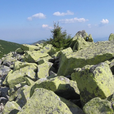 Mount Igrovets is located on the Igrovyshche ridge and is the third highest peak in the Horhan mountain range (after Velyka and Mala Syvul) at 1804.3 meters. It is here, to the meadows near Igrovets, that the local population from the village of Osmoloda goes to pick blueberries.
... More...
Mount Igrovets is located on the Igrovyshche ridge and is the third highest peak in the Horhan mountain range (after Velyka and Mala Syvul) at 1804.3 meters. It is here, to the meadows near Igrovets, that the local population from the village of Osmoloda goes to pick blueberries.
... More...
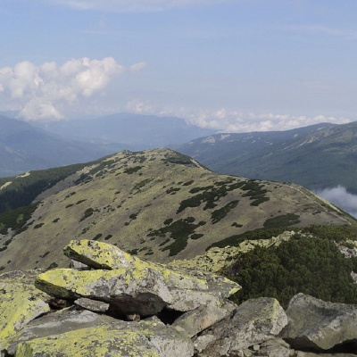 Mount Borevka is a 1,596-meter peak of the Ukrainian Carpathians, located in the northeastern part of the Syvulianskyi ridge of the Horhanskyi mountain range on the border of two districts of Ivano-Frankivsk Oblast - Bohorodchany and Rozhniativ.
... More...
Mount Borevka is a 1,596-meter peak of the Ukrainian Carpathians, located in the northeastern part of the Syvulianskyi ridge of the Horhanskyi mountain range on the border of two districts of Ivano-Frankivsk Oblast - Bohorodchany and Rozhniativ.
... More...
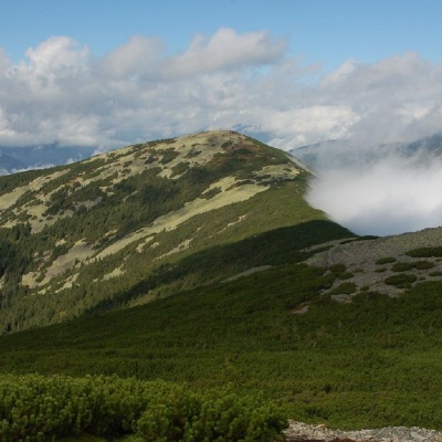 Mount Lopushna is a 1,694-meter peak in the Ukrainian Carpathians. It is located within the Gorgany mountain range on the border of two districts of Ivano-Frankivsk region - Bohorodchany and Rozhnyativ.
... More...
Mount Lopushna is a 1,694-meter peak in the Ukrainian Carpathians. It is located within the Gorgany mountain range on the border of two districts of Ivano-Frankivsk region - Bohorodchany and Rozhnyativ.
... More...
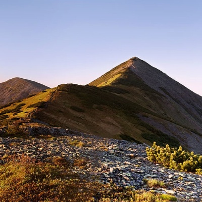 Mount Velyka Syvulia (or simply - Syvulia) is the highest peak of the Horhan massif. Its height is 1836 meters. Syvulya is located on the ridge of the same name, which separates the valleys of the Limnytsia and Bystrytsia Solotvynska rivers.
... More...
Mount Velyka Syvulia (or simply - Syvulia) is the highest peak of the Horhan massif. Its height is 1836 meters. Syvulya is located on the ridge of the same name, which separates the valleys of the Limnytsia and Bystrytsia Solotvynska rivers.
... More...
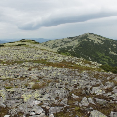 Mount Mala Syvulya, 1815 meters high, is located next to the Velyka Syvulya on the Syvulyansky ridge. It is the second highest mountain in the Gorgan mountain range. It is located on the border of two districts of Ivano-Frankivsk region(Bohorodchany and Rozhnyativ) in the watershed of the upper reaches of the Bystrytsia Solotvynska and Limnytsia rivers.
... More...
Mount Mala Syvulya, 1815 meters high, is located next to the Velyka Syvulya on the Syvulyansky ridge. It is the second highest mountain in the Gorgan mountain range. It is located on the border of two districts of Ivano-Frankivsk region(Bohorodchany and Rozhnyativ) in the watershed of the upper reaches of the Bystrytsia Solotvynska and Limnytsia rivers.
... More...
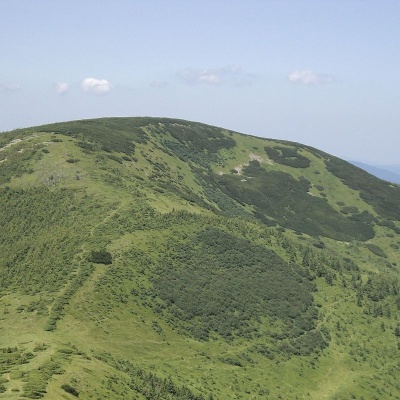 Mount Durnia is a 1704-meter (according to other sources, 1709-meter) peak of the Ukrainian Carpathians of the Horhan mountain range, located on the Bratkivsky ridge. It is located on the border of two regions - Ivano-Frankivsk and Zakarpattia.
... More...
Mount Durnia is a 1704-meter (according to other sources, 1709-meter) peak of the Ukrainian Carpathians of the Horhan mountain range, located on the Bratkivsky ridge. It is located on the border of two regions - Ivano-Frankivsk and Zakarpattia.
... More...
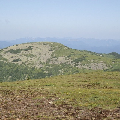 Mount Gropa (height - 1759 m (according to other sources - 1763 m)) is a peak in the Ukrainian Carpathians, located on the Bratkivsky ridge of the Horhan mountain range. It lies on the border of Tyachiv district of Zakarpattia region and Nadvirna district of Ivano-Frankivsk region.
... More...
Mount Gropa (height - 1759 m (according to other sources - 1763 m)) is a peak in the Ukrainian Carpathians, located on the Bratkivsky ridge of the Horhan mountain range. It lies on the border of Tyachiv district of Zakarpattia region and Nadvirna district of Ivano-Frankivsk region.
... More...
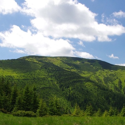 Mount Bratkivska is a peak in the Ukrainian Carpathians, 1788 m high (some sources give other data - 1792 m). The mountain is located on the eponymous ridge of the Gorgan mountain range on the border of two regions: Ivano-Frankivsk and Zakarpattia.
... More...
Mount Bratkivska is a peak in the Ukrainian Carpathians, 1788 m high (some sources give other data - 1792 m). The mountain is located on the eponymous ridge of the Gorgan mountain range on the border of two regions: Ivano-Frankivsk and Zakarpattia.
... More...
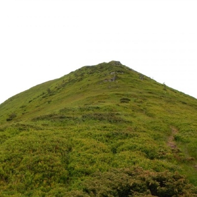 Mount Tataruka is the peak of the Ukrainian Carpathians, located in the northern part of the Svydovets mountain range. It is located on the border of two districts of Zakarpattia region - Tyachiv and Rakhiv.
... More...
Mount Tataruka is the peak of the Ukrainian Carpathians, located in the northern part of the Svydovets mountain range. It is located on the border of two districts of Zakarpattia region - Tyachiv and Rakhiv.
... More...
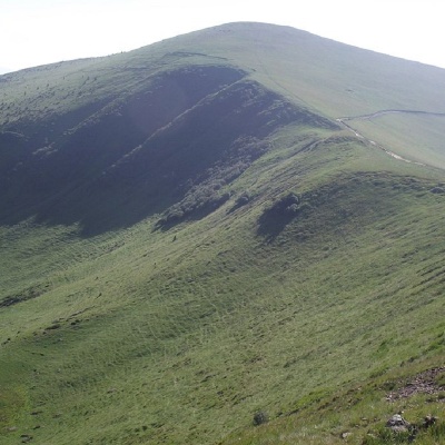 Troiaska is a 1702-meter peak of the Ukrainian Carpathians. The mountain is located in Rakhiv district of Zakarpattia region within the central part of the Svydovets mountain range.
... More...
Troiaska is a 1702-meter peak of the Ukrainian Carpathians. The mountain is located in Rakhiv district of Zakarpattia region within the central part of the Svydovets mountain range.
... More...
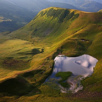 Gerashaska (another name - Dogyaska ) is a high-mountain lake in the Ukrainian Carpathians, within the Rakhiv district of Zakarpattia region. It is a hydrological natural monument of local significance (according to the decision of the Transcarpathian Regional Executive Committee of 23.10.1984, No. 253), with an area of 1.35 hectares, where it is referred to as "Lake Gereshavske". The organization responsible for its protection is the Kosiv-Polyanske Village Council.
... More...
Gerashaska (another name - Dogyaska ) is a high-mountain lake in the Ukrainian Carpathians, within the Rakhiv district of Zakarpattia region. It is a hydrological natural monument of local significance (according to the decision of the Transcarpathian Regional Executive Committee of 23.10.1984, No. 253), with an area of 1.35 hectares, where it is referred to as "Lake Gereshavske". The organization responsible for its protection is the Kosiv-Polyanske Village Council.
... More...
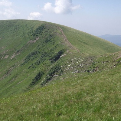 Dogyaska is a peak in the Ukrainian Carpathians, located in the central part of the Svydovets mountain range. The mountain is located in Rakhiv district of Zakarpattia region.
... More...
Dogyaska is a peak in the Ukrainian Carpathians, located in the central part of the Svydovets mountain range. The mountain is located in Rakhiv district of Zakarpattia region.
... More...
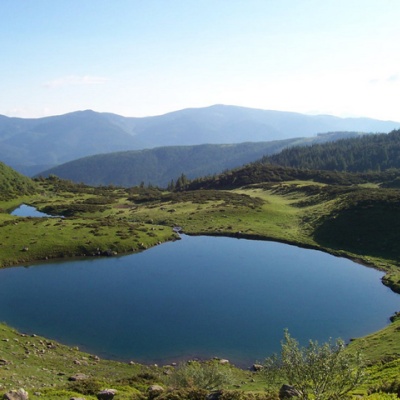 The real pearl of the Carpathians - Lake Vorozheska (other names - Vorozheska, Triton ) - is a hydrological natural monument of local importance, a high-mountain lake of glacial origin in the Ukrainian Carpathians at an altitude of 1460 m. It is located within the Rakhiv district of the Zakarpattia region, in the Carpathian Biosphere Reserve on the Svydovets massif. The NGO "Carpathian Trails" has installed a protective sign near the lake.
... More...
The real pearl of the Carpathians - Lake Vorozheska (other names - Vorozheska, Triton ) - is a hydrological natural monument of local importance, a high-mountain lake of glacial origin in the Ukrainian Carpathians at an altitude of 1460 m. It is located within the Rakhiv district of the Zakarpattia region, in the Carpathian Biosphere Reserve on the Svydovets massif. The NGO "Carpathian Trails" has installed a protective sign near the lake.
... More...
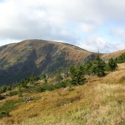 Mount Velykyi Kotel is the peak of the Ukrainian Carpathians, which lies within the Svydovets mountain range. It is located in Rakhiv district of Zakarpattia region. The height of the mountain is 1771 m (other data - 1774 m).
... More...
Mount Velykyi Kotel is the peak of the Ukrainian Carpathians, which lies within the Svydovets mountain range. It is located in Rakhiv district of Zakarpattia region. The height of the mountain is 1771 m (other data - 1774 m).
... More...
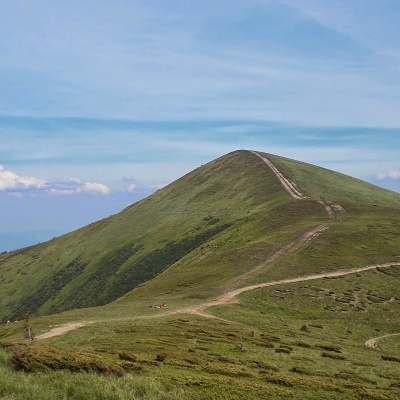 Stig (locally known as Stug) is a peak of the Ukrainian Carpathians, located in the Rakhiv district of Zakarpattia region in the northeastern part of the Svydovets mountain range.
... More...
Stig (locally known as Stug) is a peak of the Ukrainian Carpathians, located in the Rakhiv district of Zakarpattia region in the northeastern part of the Svydovets mountain range.
... More...
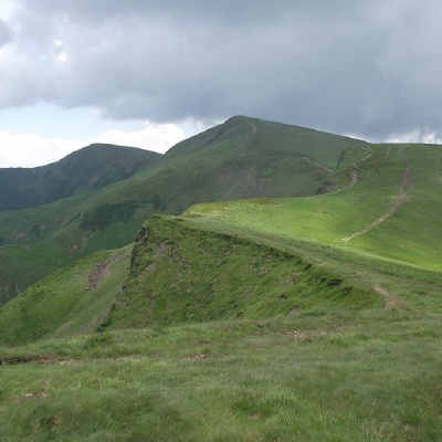 Blyznytsia (also called Bliznytsia, Blyzhnytsia) are two mountains of the Ukrainian Carpathians, located in the eastern part of the Svydovets mountain range. The peaks are located in Rakhiv district of Zakarpattia regionbetween the valleys of the Chorna Tysa and Kosivska rivers.
... More...
Blyznytsia (also called Bliznytsia, Blyzhnytsia) are two mountains of the Ukrainian Carpathians, located in the eastern part of the Svydovets mountain range. The peaks are located in Rakhiv district of Zakarpattia regionbetween the valleys of the Chorna Tysa and Kosivska rivers.
... More...


