Black Kleva Mountain
Mount Chorna Kleva (also called Chorna Klyva on some tourist maps) is a peak of the Ukrainian Carpathians, located on the Bratkivsky ridge of the Horhan mountain range. It lies on the border of Zakarpattia and Ivano-Frankivsk regions.
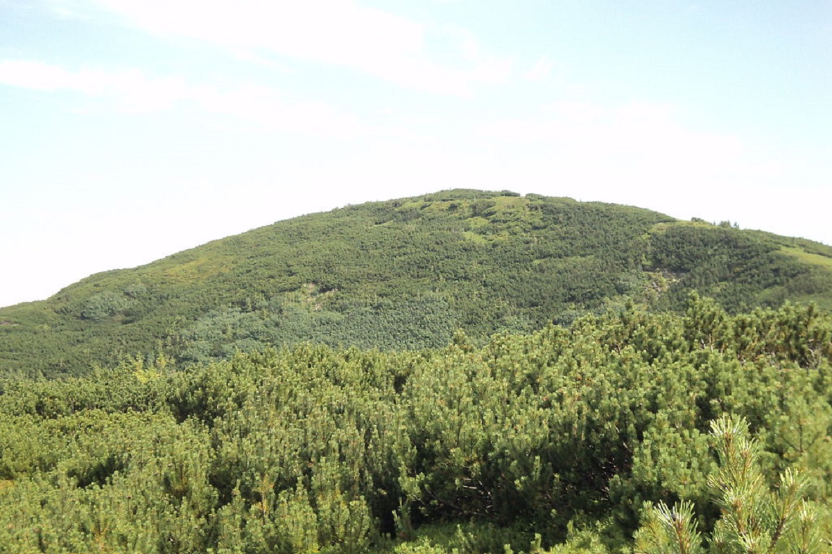
The height of Chorna Kleva is 1719 meters (according to other information - 1723 meters). Up to an altitude of 1400-1500 meters, the slopes of the peak are covered with spruce forests, above this line - with alpine pine forests and stone scree and placers.
To the west of Chorna Kleva Mountain is Ruska Mountain, to the northeast is the Kryvyi Hrun ridge, and beyond it is Ploska Mountain. On the northern slopes of the peak are the sources of the Bystrytsia Nadvirnianska River.
The most convenient way to climb Chorna Kleva is from the village of Chorna Tysa. However, the mountain itself is not very popular among tourists, and there are several reasons for this: firstly, the relatively long distance to "civilization", secondly, the great aridity of the Bratkivsky mountain. Bratkivskyi, and thirdly, the thickets of fir trees that make it difficult to move along the ridge.
The nearest settlement is the village of Chorna Tysa in Rakhiv district, Zakarpattia region.

Accommodation around Black Kleva Mountain:


Nearby hiking trails near Black Kleva Mountain:
Які маршрути проходять повз Black Kleva Mountain?
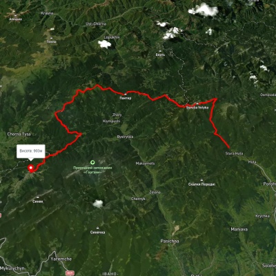
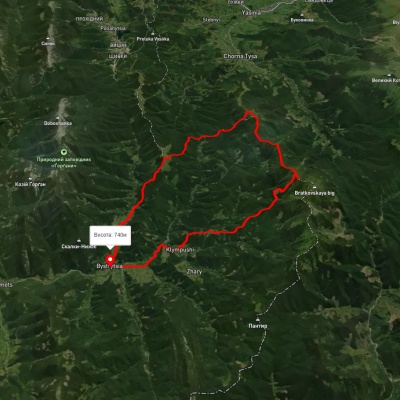
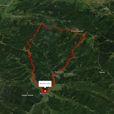
Пропонуємо пройти такі туристичні (пішохідні) маршрути через/біля Black Kleva Mountain: с. Стара Гута, через г. Сивуля, пер. Легіонів, г. Братківська, г. Чорна Клева, г. Плоска, г. Довга до с. Поляниця, с. Бистриця, через с. Климпуші, г. Руська, г. Чорна Клева до с. Бистриця, с. Бистриця, через с. Климпуші, г. Гропа, г. Братківська, г. Руська, г. Чорна Клева до с. Бистриця, с. Кваси, через г. Близниця, г. Братківська, г. Чорна Клева, с. Чорна Тиса до смт. Ясіня, с. Бистриця, через г. Гропа, г. Братківська, г. Чорна Клева до с. Поляниця, с. Бистриця, через г. Чорна Клева, г. Руська, г. Братківська до с. Бистриця