Ždiar
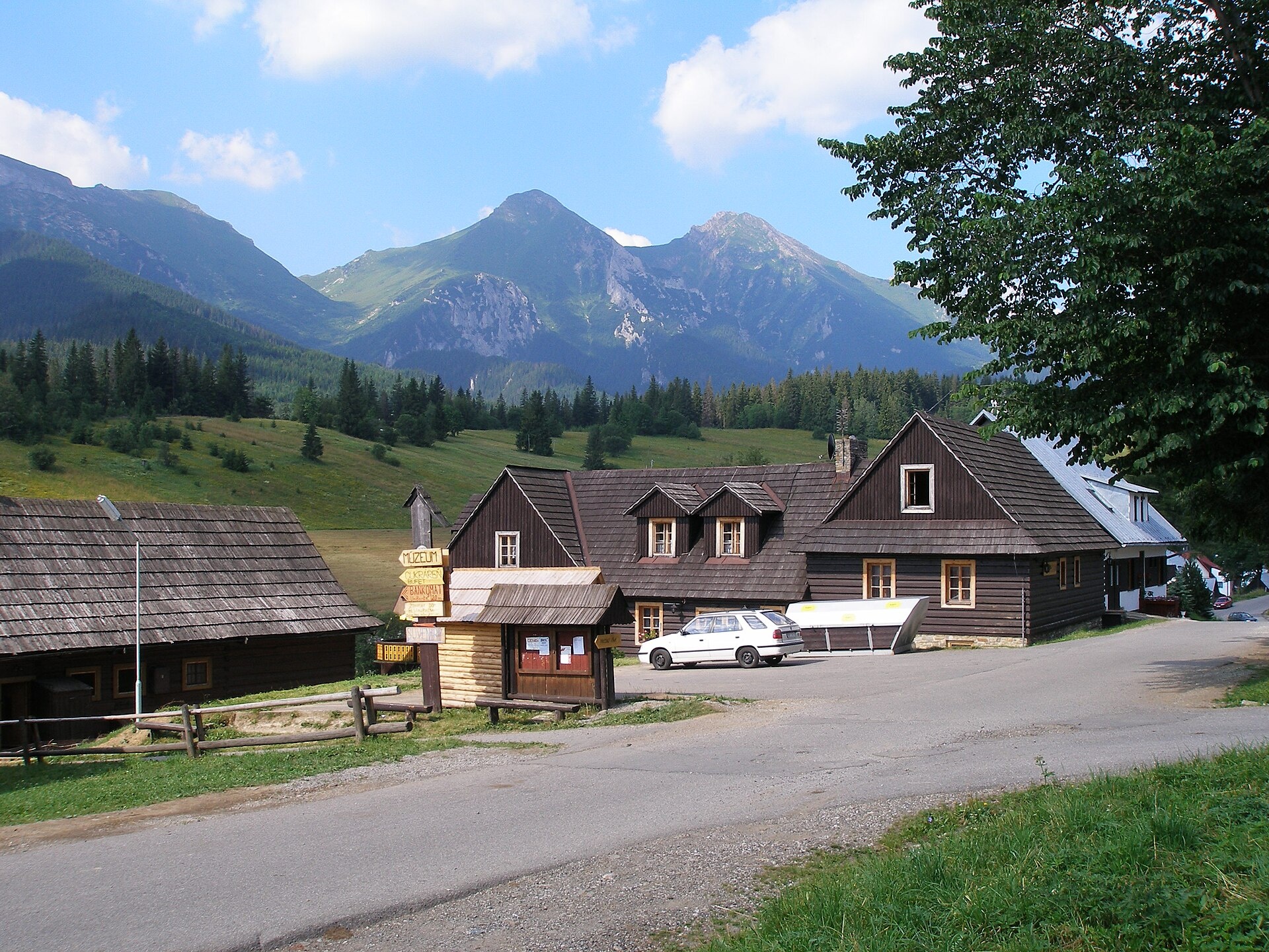
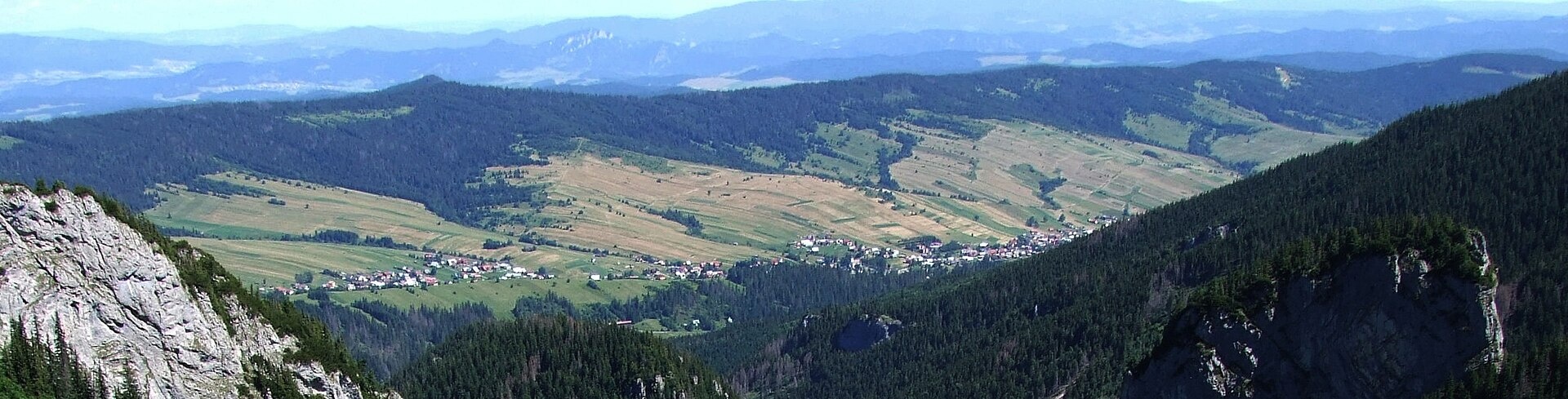
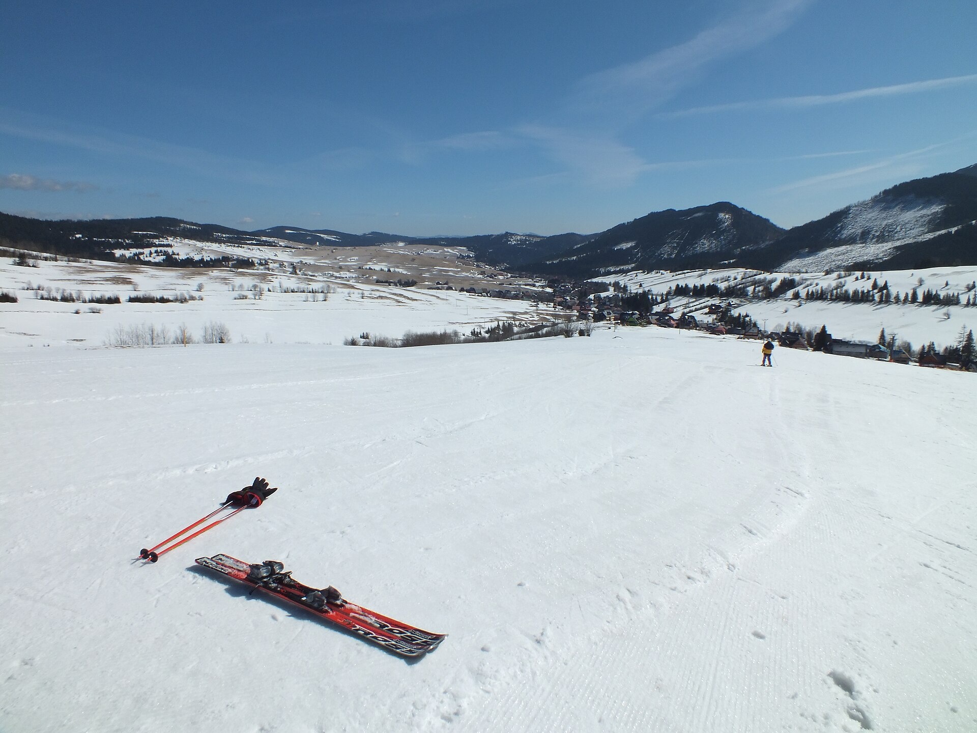
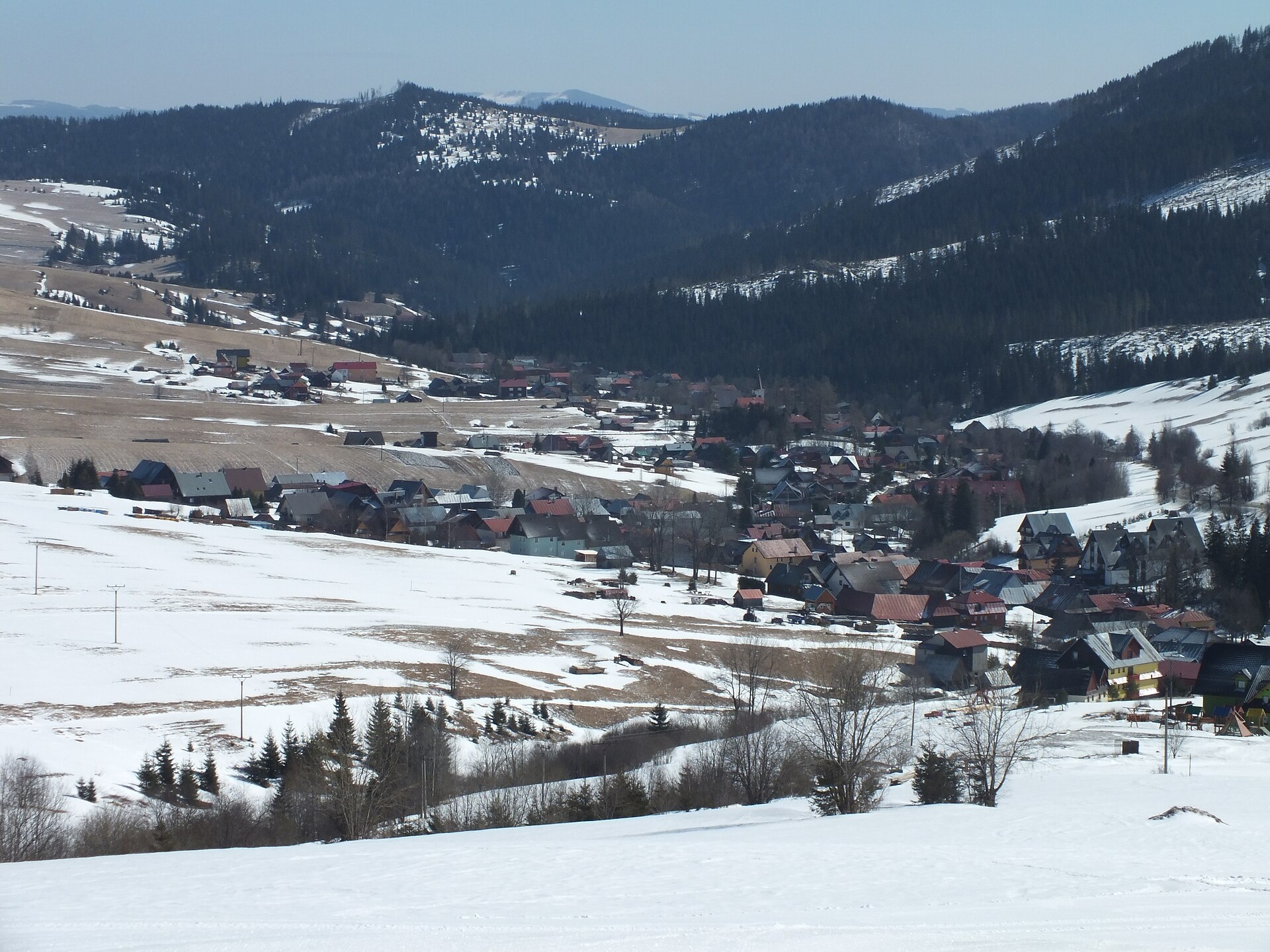
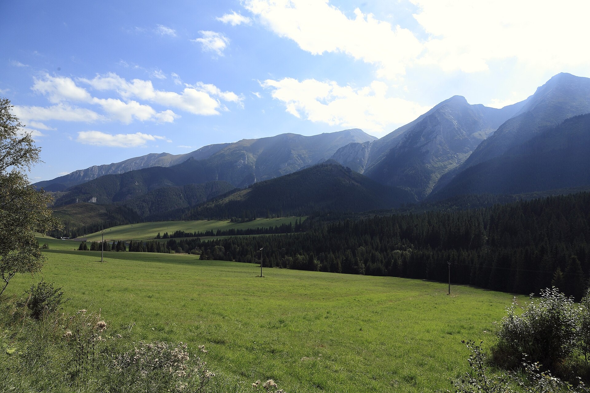
Photos: Ing.Mgr.Jozef Kotulič, CC BY-SA 3.0 (Wikimedia Commons); Jerzy Opioła, CC BY-SA 4.0 (Wikimedia Commons); Steve Priest, CC BY 3.0 (Wikimedia Commons); Steve Priest, CC BY 3.0 (Wikimedia Commons); Falk2, CC BY-SA 4.0 (Wikimedia Commons); Falk2, CC BY-SA 4.0 (Wikimedia Commons)
Ždiar is a village in the Poprad District of the Prešov Region, northern Slovakia, situated in the Belianska Valley at the border of the Belianske Tatras and Spišská Magura. The village stands at an elevation of 896 metres and is a traditional Goral settlement at the foot of the Belianske Tatras.
The first historical mention of Ždiar dates back to 1409, originally named Stragan. Locals were engaged in agriculture, pasturage, and charcoal production, and from the late 19th century, tourism became an important occupation. The village has a Roman Catholic church built in 1831.
Ždiar is known for its scenic location near the Belianske Tatras, rich Goral culture, and traditional architecture. The village preserves local dialects and folklore, and is a popular resort, especially for winter sports thanks to ski areas in the Bachledova and Strednica valleys.
Visitors to Ždiar have access to numerous hiking trails, including the Tatranská Magistrála: Podbanské – Veľké Biele pleso, Tatranská Lomnica – Lysá Poľana, and peaks such as Jahňací štít, Lomnický štít, and Ždiarska vidla. Notable sights include the Belianska Cave, Bachledka Treetop Walk, and the TANAP Museum in Tatranská Lomnica. Mountain huts such as the hut at Zelené pleso, Skalnatá chata, and Plesnivec hut offer shelter for hikers.
Getting there from Ukraine
Uzhhorod – Poprad ≈195 km, ≈2 h 55 min without queues: Uzhhorod – Vyšné Nemecké checkpoint → I/19 via Sobrance and Michalovce → Košice → D1 motorway via Prešov → Poprad (Liptovský Mikuláš is ≈56 km further on the D1, total ≈249 km). Košice – Poprad ≈112 km. The D1 requires an e-vignette (eznamka.sk). Note: from Lviv the fastest way to Poprad is through Poland — Krakovets – A4 – Kraków – Zakopane – Łysa Polana ≈468 km (≈5 h 50 min); via Uzhok and Malyi Bereznyi ≈419 km but slower (≈6 h 40 min). Zakopane – Poprad ≈69 km, Zakopane – Liptovský Mikuláš ≈80 km.
Sources: Wikipedia, Wikidata, OpenStreetMap, Karpaty.rocks data. More on Wikipedia
Trails nearby
All trails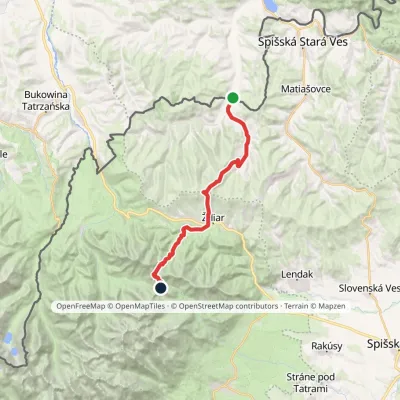 HardTwo-dayMarkedTatranská magistrála (Tatra Highway)Elevation profile613–1 933 m21.2 kmascent 1 744 m≈ 9 h walkingunder 1 km from the centre
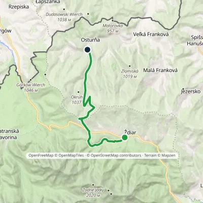 ModerateOne-dayMarkedŽdiar, Tatra Osturňa, Pod Bystrou ValleyElevation profile738–1 135 m13.5 kmascent 261 m≈ 4 h walkingunder 1 km from the centre
 ModerateOne-dayMarkedŽdiar, chapel KeheľElevation profile663–1 167 m12.8 kmascent 674 m≈ 4.5 h walking1.1 km from the centre
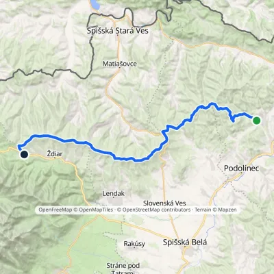 HardMulti-dayMarkedVyšné Ružbachy, spa Strednica, ski areaElevation profile637–1 198 m34.1 kmascent 1 105 m≈ 10.5 h walking1.9 km from the centre
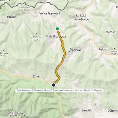 EasyOne-dayMarkedŽdiar, Bachledova dolina Malá Franková, junctionElevation profile715–1 135 m7.9 kmascent 420 m≈ 3 h walking2.2 km from the centre
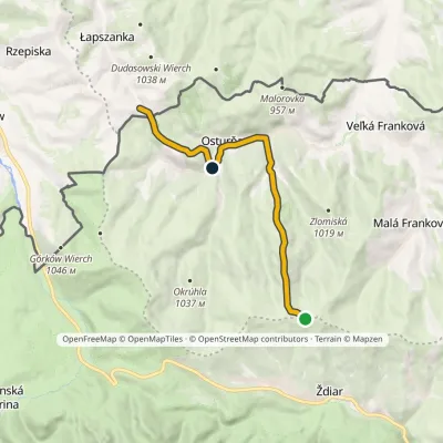 EasyOne-dayMarkedMagurka Łapszanka, chapelElevation profile694–1 179 m10.6 kmascent 272 m≈ 3 h walking2.3 km from the centre
Peaks nearby
All peaks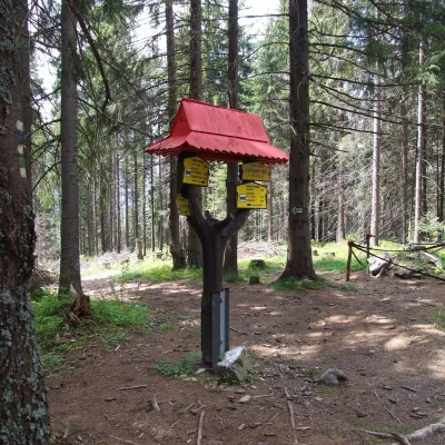 PeakSlodičovský vrchMalá Frankováaltitude 1 167 m2.1 km from the centreSlodičovský vrch (Polish Słodyczowski Wierch) is a 1167 m summit on the main ridge of the Spišská Magura in northern Slovakia.
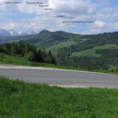 PeakMagurkaOsturňaaltitude 1 193 m2.3 km from the centreMagurka is a 1193 m summit in the central part of the Spišská Magura in northern Slovakia. It rises above the village of Ždiar, about 17 km north-west of the town of...
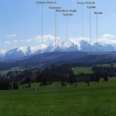 PeakPriehrštieOsturňaaltitude 1 209 m3.2 km from the centrePriehrštie (also Javorinka or Penčákova hora; Polish Prehrštie) is a 1209 m summit in the Spišská Magura in northern Slovakia.
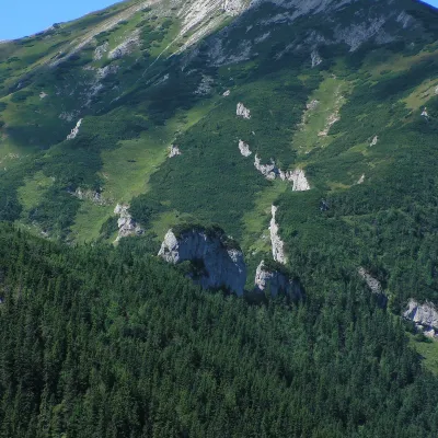 PeakBujačí vrchKežmarské Žľabyaltitude 1 947 m4.6 km from the centreBujačí vrch (Polish Bujaczy Wierch, German Stirnberg) is a 1,947 m summit on the main ridge of the Belianske Tatras in Slovakia and the last high mountain at the...
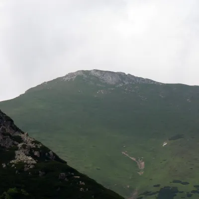 PeakHlúpyKežmarské Žľabyaltitude 2 061 m5.3 km from the centreHlúpy (also Šialený vrch, "Crazy Peak"; Polish Szalony Wierch; German Törichter Gern) is a 2061 m summit in the Slovak Belianske Tatras and the third highest of this...
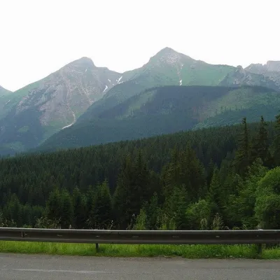 PeakŽdiarska vidlaKežmarské Žľabyaltitude 2 142 m5.5 km from the centreŽdiarska vidla (Polish Płaczliwa Skała, German Greiner) is a 2,142 m summit, the second highest in the Belianske Tatras after neighbouring Havran (2,152 m).
What to visit
All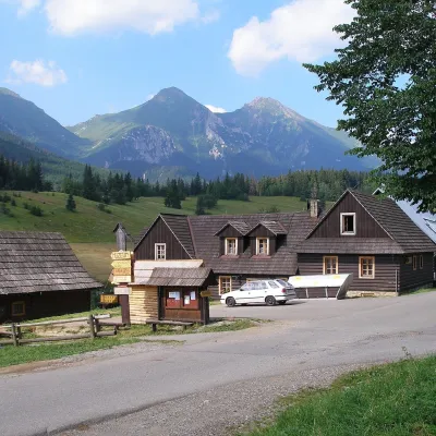 Historic siteŽdiar — Goral village below the Belianske TatrasŽdiarunder 1 km from the centreŽdiar is a Goral village in the valley between the Belianske Tatras and the Spišská Magura hills, about 34 km from Poprad.
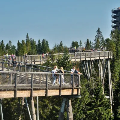 ArchitectureBachledka Treetop WalkMalá Franková3.5 km from the centreThe Bachledka Treetop Walk (Chodník korunami stromov Bachledka) is a wooden footbridge above the forest on a ridge of the Spišská Magura hills, over the Bachledova...
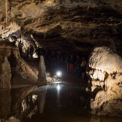 NatureBelianska CaveKežmarské Žľaby5.5 km from the centreBelianska Cave (Belianska jaskyňa) is the only show cave in the High Tatras and one of the most visited in Slovakia.
 LakeBiele plesá (White Tarns)Kežmarské Žľaby6.2 km from the centreBiele plesá (the White Tarns) are a group of nine small lakes in Dolina Bielych plies in the north-east of the High Tatras, in the Tatra National Park (TANAP).
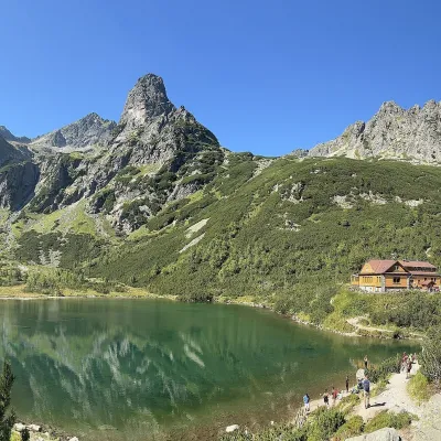 LakeZelené pleso (Kežmarské)Kežmarské Žľaby7.8 km from the centreZelené pleso, often called Kežmarské Zelené pleso, is a moraine lake in the Dolina Zeleného plesa valley in the north-east of the High Tatras, at 1,545 m.
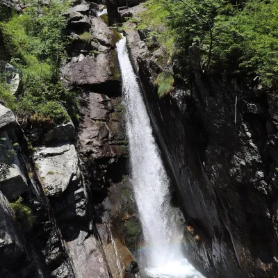 WaterfallObrovský vodopád (Giant Waterfall)Starý Smokovec12 km from the centreObrovský vodopád (Polish Wodospad Olbrzymi, German Riesenwasserfall – the "Giant Waterfall") is one of the most powerful and photogenic waterfalls of the Slovak High...
Craft nearby
All craft places Water parks & thermal poolsClimatic spas of the High Tatras: Nový Smokovec, Polianka, KotlinaVysoké Tatry15 km from the centreNový Smokovec is the best known of the climatic spas of the High Tatras. It grew up in a spruce forest at about 1010 m, south-west of Starý Smokovec, with which it...
 Ethno tours & guidesGoral raftsmen of Červený Kláštor: wooden-raft trip on the DunajecČervený Kláštor17 km from the centreBetween Červený Kláštor and Lesnica the Dunajec cuts a deep, winding gorge through the limestone Pieniny, and here the river becomes the border between Slovakia and...
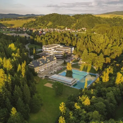 Water parks & thermal poolsVyšné Ružbachy Spa: Izabela Mountain Pools and Indoor Thermal PoolVyšné Ružbachy21 km from the centreVyšné Ružbachy is one of Slovakia’s oldest spas. It lies on the south-eastern slope of the Spišská Magura at about 617 m, surrounded by coniferous forest that merges...
 Water parks & thermal poolsAquaCity Poprad water parkPoprad24 km from the centreAquaCity Poprad is a large year-round water park and wellness complex in the town of Poprad, a few minutes from the centre; according to the complex, the High Tatras...
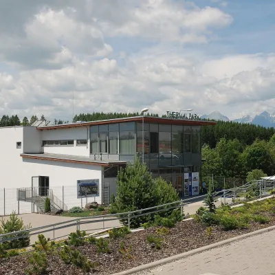 Water parks & thermal poolsThermal Park VrbovVrbov24 km from the centreThermal Park Vrbov is one of the best-known thermal baths in the Spiš region, on the southern edge of the village of Vrbov, about 6 km (as the crow flies) from...
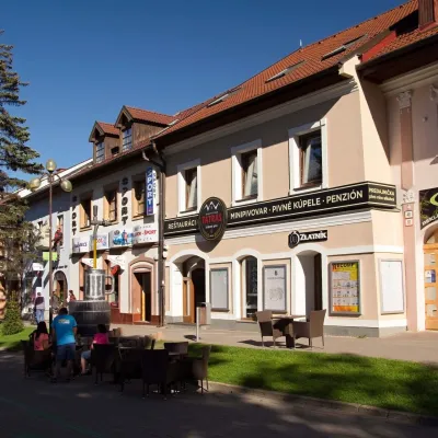 Craft beer & breweriesMinipivovar TATRAS, PopradPoprad24 km from the centreMinipivovar TATRAS is a brewpub on Poprad’s main square, Námestie sv. Egídia, housed in a building with a long brewing history.
Spas and thermal pools nearby
Water parks & thermal poolsClimatic spas of the High Tatras: Nový Smokovec, Polianka, KotlinaVysoké Tatry15 km from the centreNový Smokovec is the best known of the climatic spas of the High Tatras. It grew up in a spruce forest at about 1010 m, south-west of Starý Smokovec, with which it...Water parks & thermal poolsVyšné Ružbachy Spa: Izabela Mountain Pools and Indoor Thermal PoolVyšné Ružbachy21 km from the centreVyšné Ružbachy is one of Slovakia’s oldest spas. It lies on the south-eastern slope of the Spišská Magura at about 617 m, surrounded by coniferous forest that merges...Water parks & thermal poolsAquaCity Poprad water parkPoprad24 km from the centreAquaCity Poprad is a large year-round water park and wellness complex in the town of Poprad, a few minutes from the centre; according to the complex, the High Tatras...Huts, shelters and springs nearby
 1 290 mMountain shelterPlesnivec HutBelianske Tatras · SlovakiaStandingOn a trailSleeps up to 20Meals served
 1 550 mMountain shelterGreen Tarn HutHigh Tatras · SlovakiaStandingOn a trailSleeps up to 56Meals served
Getting there from Ukraine
Border crossings
- Uzhhorod – Vyšné Nemecké — road, 24/7
- Malyi Bereznyi – Ubľa — road, 24/7 For cars and buses; pedestrians not confirmed by the Ukrainian border service, lorries up to 3.5 t.
- Mali Selmentsi – Veľké Slemence (pedestrian) — pedestrian, 09:00–21:00 Kyiv time Pedestrians and cyclists only; inconvenient for the Tatras without onward transport.
- Chop – Čierna nad Tisou (rail) — rail, 24/7
By car
Uzhhorod – Poprad ≈195 km, ≈2 h 55 min without queues: Uzhhorod – Vyšné Nemecké checkpoint → I/19 via Sobrance and Michalovce → Košice → D1 motorway via Prešov → Poprad (Liptovský Mikuláš is ≈56 km further on the D1, total ≈249 km). Košice – Poprad ≈112 km. The D1 requires an e-vignette (eznamka.sk). Note: from Lviv the fastest way to Poprad is through Poland — Krakovets – A4 – Kraków – Zakopane – Łysa Polana ≈468 km (≈5 h 50 min); via Uzhok and Malyi Bereznyi ≈419 km but slower (≈6 h 40 min). Zakopane – Poprad ≈69 km, Zakopane – Liptovský Mikuláš ≈80 km.
Checked 23.10.2026; border crossing hours and timetables change — check before you travel.
