Ostredok
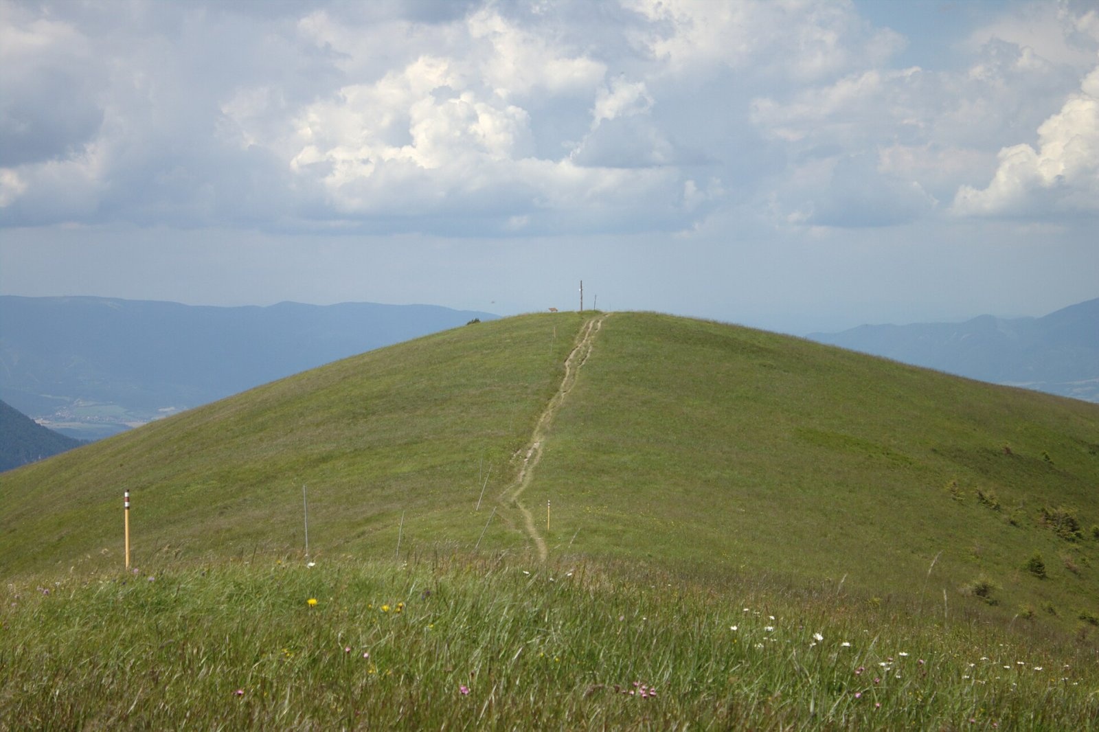

Ostredok is the highest peak of the Greater Fatra (Veľká Fatra) at 1,596 m. It lies in the central part of the range, in the Hôľna Fatra, above the village of Liptovské Revúce, about 16 km east of Turčianske Teplice, on the boundary of the Ružomberok and Martin districts of the Žilina Region. The whole mountain lies in the Veľká Fatra National Park. Curiously, Slovakia has as many as six summits called Ostredok.
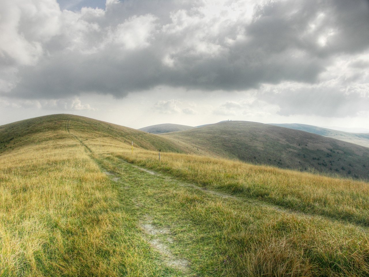
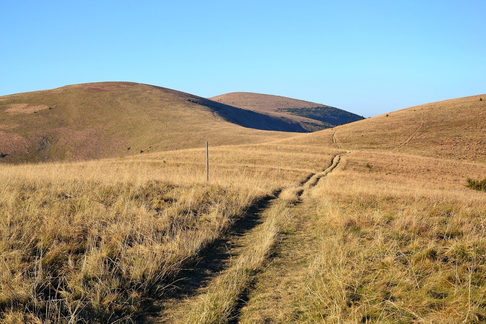
Ostredok has two tops on the main ridge: the main southern one (1,596 m) and the slightly lower northern one (1,593 m) 350–400 m away, joined by an almost level rounded crest. The tops are indistinct but completely treeless, so nothing blocks the panorama. To the south, beyond a shallow saddle, stands Frčkov (1,586 m) and then the nodal Krížna (1,574 m); to the north Suchý vrch and Ploská. The slopes are smoothly shaped and steep; in winter avalanches threaten in many places. Ostredok's prominence is 672 m, 14th among Slovak summits. The eastern slopes feed the Revúca river (its source lies less than a kilometre from the summit) and its tributary Lopušná, the western ones the Gaderský potok flowing to the Turiec.
The height story
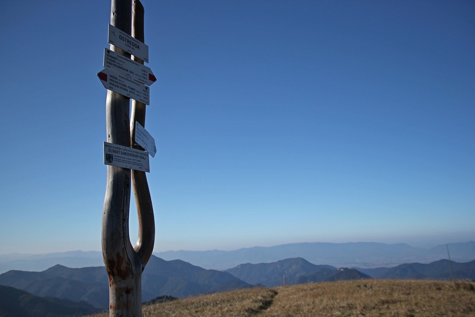
Until 2015 maps showed the northern top (1,592 m) as the highest point of the Greater Fatra. In summer 2015 the Slovak Hiking Club placed a sign on the southern top reading «Pustolovčia / 1595 m / highest point of the Veľká Fatra». Measurements by the Geodetic and Cartographic Institute in Bratislava confirmed that the southern point is higher, and in 2016 the names commission moved the name Ostredok to it, with a height of 1,595.58 m (rounded 1,596 m). The name «Pustolovčia» stayed with the meadow on the slope, and the old spot now carries the signpost «Ostredok – rázcestie».
Getting there / trails
- Red markings — the 49 km Veľkofatranská magistrála along the main ridge, passing over the summit. The section from the hut below Borišov via Ploská, Chyžky and Suchý vrch to Krížna is 9.9 km, about 3 h 30 min (2 h 40 min in reverse).
- Green markings from the Dedošová valley (Drobkov) via the saddle behind Štrochy to the «Ostredok» junction — 3.7 km and 740 m of ascent, about 2 h 20 min up and 1 h 25 min down.
- The shortest approaches are from the east, from Vyšná Revúca (the upper part of Liptovské Revúce) or from Staré Hory.
Ostredok lies far from roads, so it is much quieter here than on the popular summits of the Tatras or the Lesser Fatra.
The view
The all-round panorama takes in almost the whole Greater Fatra, the Lesser Fatra, Oravská Magura and the Beskids, the Western, High and Low Tatras, the Veporské vrchy, Poľana, Javorie, Vtáčnik, the Strážov Mountains and the Moravian-Silesian Beskids. Occasionally, in perfect visibility, you can see mountains in four neighbouring countries: Kékes in Hungary, Schneeberg in Austria, Lysá hora in the Czech Republic and Babia Góra in Poland.
Nature
The smooth grassy relief of the summit is due to soft rocks: here the ridge is built of marls of the so-called Krížna nappe, while the rocky Štrochy on the western shoulder are harder limestones. Because of past human activity the tree line has been lowered to 1,260–1,350 m, and the dwarf-pine belt has disappeared completely on Ostredok. In the heads of the surrounding valleys, at 1,000–1,200 m, fragments of primeval fir-beech forest survive.
Safety and rules
In the Veľká Fatra National Park you may walk only on marked trails. The broad treeless ridge is exposed to wind and storms, in fog it is easy to lose your bearings, and in winter the steep slopes are avalanche-prone. Slovak Mountain Rescue Service (HZS): 18 300 (from a foreign phone +421 18 300) or 112.
Photos: I would appreciate being notified if you use my work outside Wikimedia. More of my work can be found in my personal gallery., CC BY-SA 4.0; Pe3kZA, CC BY-SA 3.0; Michal Klajban, CC BY-SA 4.0; David Paloch (Caroig), CC BY-SA 2.5; Pudelek, CC BY-SA 4.0 — Wikimedia Commons.
Getting there from Ukraine
Border crossings
- Uzhhorod – Vyšné Nemecké — road, 24/7
- Malyi Bereznyi – Ubľa — road, 24/7 For cars and buses; pedestrians not confirmed by the Ukrainian border service, lorries up to 3.5 t.
- Mali Selmentsi – Veľké Slemence (pedestrian) — pedestrian, 09:00–21:00 Kyiv time Pedestrians and cyclists only; inconvenient for the Tatras without onward transport.
- Chop – Čierna nad Tisou (rail) — rail, 24/7
By car
From Uzhhorod ≈275 km, ≈3 h 35 min without queues: Uzhhorod – Vyšné Nemecké → I/19 to Košice → D1 motorway via Prešov, Poprad and Liptovský Mikuláš to Ružomberok (≈270 km, ≈3 h 25 min from the border). From Lviv it is faster through Poland: M-10 → Krakovets – Korczowa → A4 to Kraków → S7/DK7 to the Chyżne – Trstená border → R3 and I/59 via Dolný Kubín to Ružomberok: ≈482 km, ≈6 h 15 min (via Uzhok and Ubľa ≈500 km, ≈7 h 30 min). The D1 requires an e-vignette (eznamka.sk).
Checked 23.10.2026; border crossing hours and timetables change — check before you travel.
Location on the map
Water and shelter nearby
- Revúca River Spring690 m · Not verified · 1 321 m
- Lopušná Spring, 1 303 m710 m · Not verified · 1 303 m
- Lopušná Spring, 1 412 m820 m · Not verified · 1 412 m
- Spring below Suchý vrch (south-west slope), 1 459 m840 m · Not verified · 1 459 m
- Spring below Suchý vrch (south-west slope), 1 476 m850 m · Not verified · 1 476 m
- Spring below Suchý vrch (south-west slope), 1 497 m870 m · Not verified · 1 497 m
- Spring below Suchý vrch (south-west slope), 1 494 m880 m · Not verified · 1 494 m
- Spring below Frčkov (east slope), 1 312 m890 m · Not verified · 1 312 m
- Spring below Frčkov (east slope), 1 318 m920 m · Not verified · 1 318 m
- Spring below Suchý vrch (west slope)1.2 km · Not verified · 1 440 m
- Spring below Ostré brdo (north-west slope), 1 211 m1.2 km · Not verified · 1 211 m
- Spring below Ostré brdo (north-west slope), 1 194 m1.3 km · Not verified · 1 194 m
- Captured spring below Suchý vrch1.6 km · Not verified · 1 368 m
- Captured spring below Biela skala (south slope), 1 248 m1.6 km · Not verified · 1 248 m
- Captured spring below Biela skala (south slope), 1 252 m1.7 km · Not verified · 1 252 m
- Captured spring below Dlhý grúň1.7 km · Not verified · 1 323 m
Comments
Trails nearby
All trails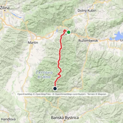 HardMulti-dayMarkedVeľkofatranská magistrálaElevation profile439–1 595 m42 kmascent 3 071 munder 1 km from Ostredok
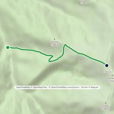 EasyOne-dayMarkedDrobkov OstredokElevation profile862–1 593 m3.4 kmascent 732 m≈ 2.5 h walkingunder 1 km from Ostredok
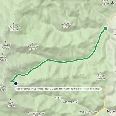 ModerateOne-dayMarkedVyšná Revúca Rybovské SaddleElevation profile708–1 322 m8 kmascent 614 m≈ 3 h walking2.1 km from Ostredok
Nearby attractions
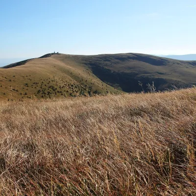 Mountain meadowKrížna and the hole meadows of Veľká FatraTureckáaltitude 1 574 m2.6 km from OstredokKrížna (1,574 m) is a broad grassy massif in the central part of Veľká Fatra in Slovakia, the third-highest summit of these mountains after Ostredok and Frčkov.
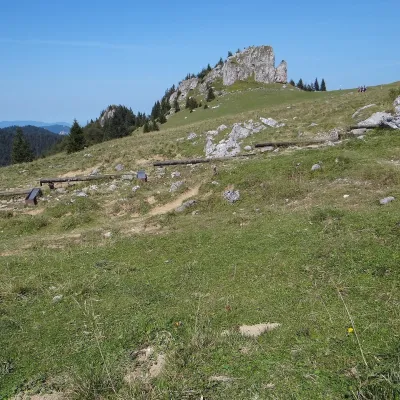 Mountain meadowKráľova studňa: meadow plateau and springs in Veľká FatraDolný Harmanecaltitude 1 365 m3.1 km from OstredokKráľova studňa (literally the «King's Well») is a broad grassy plateau on the main ridge of Veľká Fatra, at the western edge of the Krížna massif.
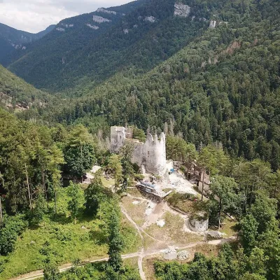 CastleBlatnica Castle and the Gader ValleyBlatnica11 km from OstredokBlatnica Castle (Blatnický hrad) is a medieval ruin on the low but sharp limestone ridge of Plešovica (658 m), which separates the Gader valley (Gaderská dolina) from...
Craft nearby
All craft places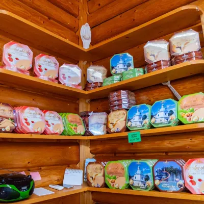 Cheese dairies & pasturesTuriec bryndza dairy, Turčianske Teplice: bryndza since 1917Turčianske Teplice17 km from OstredokMore than a hundred years of Turiec bryndza Turiec is a wide basin between the ridges of the Veľká and Malá Fatra, a land of pastures and old sheep farming.
 Water parks & thermal poolsSpa & Aquapark Turčianske TepliceTurčianske Teplice17 km from OstredokTurčianske Teplice is one of Slovakia’s oldest spa towns. Its warm springs were first mentioned in 1281 in a deed of gift by King Ladislaus IV, and from 1533 they...
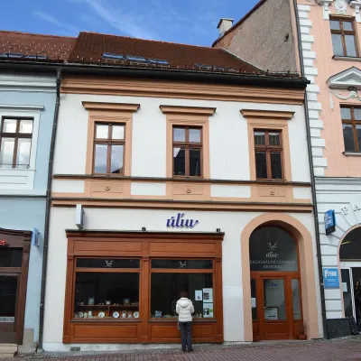 Craft shopsÚĽUV Banská Bystrica: folk-craft shop and craft schoolBanská Bystrica19 km from OstredokÚĽUV (Ústredie ľudovej umeleckej výroby, the Centre for Folk Art Production) is a state institution that has looked after Slovak folk crafts since 1945: it keeps a...
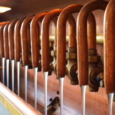 Craft beer & breweriesUrpiner brewery in Banská Bystrica: tour and beer from the tankBanská Bystrica22 km from OstredokBanská Bystrica is the centre of Central Slovakia and grew rich on copper mining in the 14th–16th centuries.
 Craft beer & breweriesURSUS craft brewery, Čutkovská valleyRužomberok24 km from OstredokURSUS craft brewery (Remeselný pivovar URSUS) is the first brewery of the town of Ružomberok, tucked away in the picturesque Čutkovská valley in lower Liptov.
 Craft producersKremnica gingerbread: the Haurík family bakery since 1922Kremnica25 km from OstredokKremnica is an old mining town in the Kremnica Mountains where coins have been struck for more than six centuries.
