Demänovská jaskyňa Slobody, loop — Demänovská jaskyňa Slobody
Trail map
Route, springs and shelters: © OpenStreetMap contributors (ODbL) · elevation: Copernicus DEM © DLR e.V., © Airbus DS · Data & licences
About the trail
Route Demänovská jaskyňa Slobody, loop – Demänovská jaskyňa Slobody. Has yellow marking (regional route №8619, KST). Waymarking data: OpenStreetMap (© OpenStreetMap contributors, ODbL).
Officially marked regional tourist route No. 8619. The marking is yellow, the sign is a horizontal stripe on a white background. Marked and maintained by: KST. The length of the route is 17.6 km, the route is circular. Location: mountain range – Low Tatras, Slovakia.
At a glance
A one-day loop route of 17.6 km with 1,265 m of ascent, starting and finishing at Demänovská jaskyňa Slobody, loop. Estimated walking time: about 6.5 h, not counting stops. Difficulty: hard. Waymarking: yellow.
Route stages
- 0–3 kmAlong the ridge at 1,840–1,900 m, past Poľana, Zákľuky, Bôr
- 3–9 kmDescent of 1,010 m (down to 857 m)
- 9–10 kmClimb of 340 m to Stodôlky (1,213 m)
- 10–12 kmGentle ups and downs at 1,100–1,210 m, past Ostredok
- 12–18 kmClimb of 720 m (up to 1,830 m)
Steepest kilometre: km 7–8, a descent of 280 m (≈28%).
Water and overnight stays
Springs near the trail: at km 2, 4, 5, 6 and 7. There are no springs between km 8 and 18 — carry at least 2.5 l of water.
When to go
Best time: June to September. In winter only for experienced hikers with proper gear: avalanche danger is possible. About 6 km of the route runs above 1,500 m, where the weather changes quickly — check the forecast.
Getting there
Start: Demänovská jaskyňa Slobody, loop. This is a loop: it brings you back to the start.
FAQ
- How long does the route take?
- Estimated walking time: about 6.5 h, not counting stops.
- Is there water on the route?
- Springs near the trail: at km 2, 4, 5, 6 and 7. There are no springs between km 8 and 18 — carry at least 2.5 l of water.
Water and shelter on the route
- Zákluky Springkm 1.7 from the start · 190 m off the path · Not verified · 1 752 m
- Kliny Spring, 1 698 mkm 2.3 from the start · 280 m off the path · Not verified · 1 698 m
- Mošnica Spring, 1 489 mkm 4 from the start · 280 m off the path · Not verified · 1 489 m
- Spring below Havrany (south-east slope), 1 425 mkm 4.6 from the start · 130 m off the path · Not verified · 1 425 m
- Spring below Havrany (north-east slope)km 5.2 from the start · 210 m off the path · Not verified · 1 344 m
- Spring below Repiská (south slope), 1 341 mkm 5.8 from the start · 120 m off the path · Not verified · 1 341 m
- Spring below Repiská (south-west slope), 1 197 mkm 6.3 from the start · 210 m off the path · Not verified · 1 197 m
- Spring below Repiská (east slope), 1 159 mkm 6.9 from the start · 280 m off the path · Not verified · 1 159 m
- Spring below Repiská (east slope), 1 092 mkm 7.3 from the start · 90 m off the path · Not verified · 1 092 m
- Spring below Repiská (east slope), 984 mkm 7.8 from the start · 40 m off the path · Not verified · 984 m
Comments
Trails nearby
All trails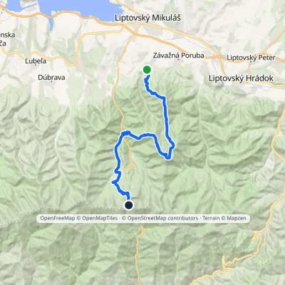 HardMulti-dayMarkedIľanovo ChopokElevation profile652–2 003 m26.7 kmascent 2 715 m≈ 12 h walking
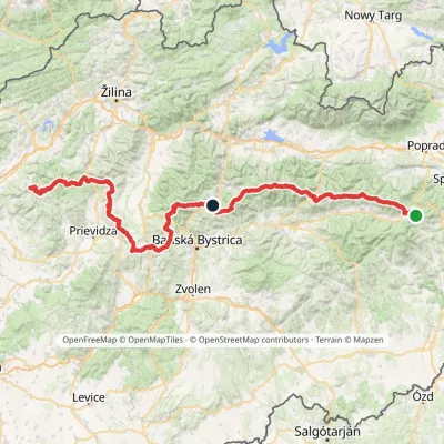 HardMulti-dayMarkedHorná Poruba, U Brdárov Pred ČuntavouElevation profile309–2 004 m241.6 kmascent 15 694 m
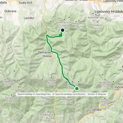 ModerateTwo-dayMarkedChata generála M. R. Štefánika Za VrátamiElevation profile802–1 919 m17.5 kmascent 623 m≈ 5.5 h walking
Craft nearby
All craft places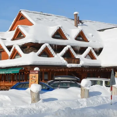 Koliby & Hutsul cuisineKoliba Strachanovka, Jánska valleyLiptovský Ján14 km from the trailKoliba Strachanovka (Jánska koliba) is a large wooden koliba at the entrance to the Jánska valley in the village of Liptovský Ján, which locals consider one of the...
 Water parks & thermal poolsTERMAL raj thermal bath, Liptovský JánLiptovský Ján14 km from the trailLiptovský Ján: thermal water at the entrance to Jánska dolina Liptovský Ján is an old village in southern Liptov, about 10 km from Liptovský Mikuláš, at the entrance...
 Craft beer & breweriesLiptovar brewery, Liptovský Mikuláš: craft beer and brewpubLiptovský Mikuláš16 km from the trailLiptovský Mikuláš is the main town of the Liptov region, a short drive from the Low and Western Tatras, the Demänovská Valley and the Liptovská Mara reservoir.
 Koliby & Hutsul cuisineSalaš Dechtáre above Liptovská MaraGalovany17 km from the trailSalaš Dechtáre is a wooden koliba above the Liptovská Mara reservoir that is described as one of Slovakia’s first commercial salaš restaurants.
 Water parks & thermal poolsAquapark TatralandiaLiptovský Mikuláš18 km from the trailAquapark Tatralandia is a large year-round water leisure complex near Liptovský Mikuláš, on the northern shore of the Liptovská Mara reservoir.
 Water parks & thermal poolsBešeňová Water ParkBešeňová19 km from the trailBešeňová — the "thermal heart of Liptov" Bešeňová Water Park (Vodný park Bešeňová) lies on the edge of the village of the same name in the western part of the Liptov...
