Horná Poruba, U Brdárov – Pred Čuntavou
Trail map
Route, springs and shelters: © OpenStreetMap contributors (ODbL) · elevation: Copernicus DEM © DLR e.V., © Airbus DS · Data & licences
About the trail
Route Horná Poruba, U Brdárov – Pred Čuntavou. Has red marking (national route №0801, KST). Waymarking data: OpenStreetMap (© OpenStreetMap contributors, ODbL).
Officially marked national tourist route No. 0801. The marking is red, the sign is a horizontal stripe on a white background. Marked and maintained by: KST. Length of the route — 241.6 km. Location: mountain range — Low Tatras, Slovakia.
Attention: part of the route has not yet been mapped in OpenStreetMap, so the line on the map has gaps. On the ground, orient yourself by the marking signs.
At a glance
A multi-day route of 241.6 km with 15,694 m of ascent from Horná Poruba, U Brdárov to Pred Čuntavou. Estimated time: 12 days of 5–9 h of walking (about 86.5 h in total, not counting stops). Difficulty: hard. Waymarking: red.
Route stages
- 0–6 kmGentle ups and downs at 880–1,180 m
- 6–10 kmClimb of 1,040 m to Kráľova hoľa — mountain meadows of the Low Tatras
- 10–22 kmDescent of 720 m to Priehyba Pass
- 22–87 kmGentle ups and downs at 950–1,990 m, past Krúpova hoľa, Dereše, Kotliská, Chabenec
- 87–97 kmDescent of 650 m to Malý Šturec Pass
- 97–242 kmGentle ups and downs at 440–1,320 m, past Tabla Pass, Kordícky štít, Vyhnatová, Zadné diely
Steepest kilometre: km 21–22, a descent of 300 m (≈39%), near Priehyba Pass.
Water and overnight stays
Springs near the trail: at km 3, 9, 14, 15, 17, 21, 23, 29, 31 and 32 etc.. There are no springs between km 212 and 242 — carry at least 4 l of water. Some springs run low or dry up in late summer.
Huts and shelters near the trail: Hut below Buchvald (km 0), Andrejcová Hut (km 17), Hut below Andrejcová (km 18), Ramža Shelter (km 32), Terezka Hut (km 36), M. R. Štefánik Hut (km 43), Kamenná Hut under Chopok (km 47), Hiadeľské Pass (km 68) etc..
A possible split into days:
- Day 1: km 0–17, ≈7 h — overnight: Andrejcová Hut (hut)
- Day 2: km 17–36, ≈7.5 h — overnight: Terezka Hut (hut)
- Day 3: km 36–47, ≈5.5 h — overnight: Kamenná Hut under Chopok (hut)
- Day 4: km 47–71, ≈9 h — overnight: Hut below Kečka (hut)
- Day 5: km 71–87, ≈7 h — overnight: no shelter nearby on the map, bring a tent
- Day 6: km 87–105, ≈6.5 h — overnight: Cabanka Hut (hut)
- Day 7: km 105–126, ≈7 h — overnight: SNP Sklené Hut (hut)
- Day 8: km 126–149, ≈8.5 h — overnight: no shelter nearby on the map, bring a tent
- Day 9: km 149–166, ≈7 h — overnight: no shelter nearby on the map, bring a tent
- Day 10: km 166–188, ≈7 h — overnight: no shelter nearby on the map, bring a tent
- Day 11: km 188–212, ≈6.5 h — overnight: Hut below Horeňovo (hut)
- Day 12: km 212–242, ≈7.5 h — finish
When to go
Best time: June to September. In winter only for experienced hikers with proper gear: avalanche danger is possible. About 42 km of the route runs above 1,500 m, where the weather changes quickly — check the forecast.
Getting there
Start: Horná Poruba, U Brdárov. This is a one-way route: the finish is 75 km from the start in a straight line, so plan your way back in advance.
FAQ
- How long does the route take?
- Estimated time: 12 days of 5–9 h of walking (about 86.5 h in total, not counting stops).
- Is there water on the route?
- Springs near the trail: at km 3, 9, 14, 15, 17, 21, 23, 29, 31 and 32 etc.. There are no springs between km 212 and 242 — carry at least 4 l of water. Some springs run low or dry up in late summer.
- Where can I stay overnight?
- Huts and shelters near the trail: Hut below Buchvald (km 0), Andrejcová Hut (km 17), Hut below Andrejcová (km 18), Ramža Shelter (km 32), Terezka Hut (km 36), M. R. Štefánik Hut (km 43), Kamenná Hut under Chopok (km 47), Hiadeľské Pass (km 68) etc.. Possible overnight stops: Andrejcová Hut (km 17), Terezka Hut (km 36), Kamenná Hut under Chopok (km 47), Hut below Kečka (km 71), Cabanka Hut (km 105), SNP Sklené Hut (km 126), Hut below Horeňovo (km 212).
Water and shelter on the route
- Hut below Buchvaldkm 0 from the start · Not verified · 1 170 m
- Grain-Springkm 4.5 from the start · 50 m off the path · Not verified · 937 m
- Zubrovice Springkm 11.3 from the start · Not verified · 1 663 m
- Spring below Bartkovákm 17.8 from the start · 130 m off the path · Not verified · 1 698 m
- Spring below Andrejcová (3)km 20.3 from the start · 80 m off the path · Not verified · 1 444 m
- Andrejcová Hutkm 22.4 from the start · 110 m off the path · Standing · 1 410 m
- Spring below Andrejcová (2)km 22.4 from the start · 100 m off the path · Not verified · 1 400 m
- Spring below Andrejcovákm 23 from the start · 100 m off the path · Not verified · 1 400 m
- Hut below Andrejcovákm 23 from the start · 70 m off the path · Not verified · 1 401 m
- Spring below Čelo (2)km 28.1 from the start · 100 m off the path · Not verified · 1 198 m
- Spring below Kolesárová (2)km 30 from the start · 190 m off the path · Not verified · 1 405 m
- Spring below Babinákm 38.1 from the start · Not verified · 1 365 m
- Spring below Vrbovica (2)km 40.3 from the start · Not verified · 1 279 m
- Ramža Shelterkm 41.9 from the start · 70 m off the path · Not verified · 1 260 m
- Spring below Fišiarkakm 42.1 from the start · 90 m off the path · Not verified · 1 314 m
- Terezka Hutkm 46.9 from the start · Not verified · 1 370 m
- Spring below Besná (3)km 55.6 from the start · 120 m off the path · Not verified · 1 720 m
- Drinking water below Kozie chrbtykm 56.8 from the start · Not verified · 1 714 m
- M. R. Štefánik Hutkm 56.8 from the start · Standing · 1 740 m
- Kamenná Hut under Chopokkm 62.1 from the start · Standing · 1 985 m
- Spring below Poľana (3)km 67.2 from the start · 180 m off the path · Not verified · 1 737 m
- Širková Springkm 72.9 from the start · 210 m off the path · Not verified · 1 596 m
- Viedenka Springkm 74.4 from the start · 170 m off the path · Not verified · 1 524 m
- Klinček Springkm 75.9 from the start · 210 m off the path · Not verified · 1 503 m
- Spring below Veľká hoľa (4)km 78.8 from the start · 100 m off the path · Not verified · 1 518 m
- Spring below Skalka (21)km 81.6 from the start · 160 m off the path · Not verified · 1 451 m
- Spring below Košarisko (7)km 83.9 from the start · 180 m off the path · Not verified · 1 549 m
- Spring below Malá Chochuľa (14)km 85.9 from the start · 180 m off the path · Not verified · 1 590 m
- Spring below Malá Chochuľa (8)km 86.5 from the start · 200 m off the path · Not verified · 1 488 m
- Spring below Holica (4)km 88.3 from the start · 140 m off the path · Not verified · 1 371 m
- Spring below Holicakm 89.1 from the start · 50 m off the path · Not verified · 1 245 m
- Hiadeľské Passkm 89.7 from the start · 40 m off the path · Not verified · 1 099 m
- Spring in Hiadeľské sedlokm 89.8 from the start · 120 m off the path · Not verified · 1 096 m
- Spring in Úplazkm 91.5 from the start · 190 m off the path · Not verified · 1 111 m
- Hut below Kečkakm 93.6 from the start · 150 m off the path · Not verified · 1 213 m
- Hut under Kečkakm 94.4 from the start · 70 m off the path · Not verified · 1 134 m
- Captured spring under Kečkakm 94.5 from the start · 100 m off the path · Not verified · 1 125 m
- Drinking water below Baníkkm 97 from the start · Not verified · 1 046 m
- Spring below Nová hoľakm 100.1 from the start · Not verified · 1 127 m
- Spring below Motyčianska hoľakm 102.4 from the start · 90 m off the path · Not verified · 1 192 m
- Spring below Šturec (2)km 107.2 from the start · 200 m off the path · Not verified · 935 m
- Zadkykm 107.7 from the start · 160 m off the path · Not verified · 939 m
- Spring below Krížna (5)km 112.5 from the start · 120 m off the path · Not verified · 1 278 m
- Bystrice Springkm 116.1 from the start · 60 m off the path · Not verified · 1 344 m
- Spring below Smrekovkm 117.9 from the start · Has water · 1 257 m
- Cabanka Hutkm 138.1 from the start · 220 m off the path · Not verified · 1 143 m
- Spring below Kordícky štít (2)km 138.1 from the start · 220 m off the path · Not verified · 1 143 m
- Kapucínka Hutkm 148.8 from the start · 160 m off the path · Not verified · 852 m
- Európa Springkm 148.8 from the start · 60 m off the path · Not verified · 833 m
- Medvedí Springkm 156.8 from the start · Not verified · 892 m
- SNP Sklené Hutkm 165.4 from the start · Not verified · 820 m
- Spring below Horeňovo (2)km 166 from the start · Has water · 858 m
- Spring below Opálený vrchkm 175.7 from the start · 110 m off the path · Has water · 717 m
- Spring below Malý Vyšehradkm 179.9 from the start · Not verified · 693 m
- Spring below Vyšehradkm 181.4 from the start · Not verified · 698 m
- Spring below Vysoká (2)km 189.2 from the start · Not verified · 756 m
- Spring below Vrania skalakm 197.9 from the start · Has water · 912 m
- Spring below Reváňkm 201.5 from the start · Has water · 876 m
- Mountain hut below Homôľkakm 203 from the start · Standing · 859 m
- Spring below Javorinka Pass (2)km 211.2 from the start · Has water · 782 m
- Captured spring below Paškov vŕšokkm 213.8 from the start · 180 m off the path · Not verified · 695 m
- Spring below Úbočkakm 215.5 from the start · Not verified · 710 m
- Spring below Kudľajov vrch (2)km 216.4 from the start · Not verified · 801 m
- Captured spring below Strážov (3)km 218.7 from the start · Not verified · 1 024 m
- Captured spring below Strážovkm 219.3 from the start · Not verified · 876 m
- Spring below Strážovkm 219.7 from the start · Not verified · 749 m
- Drinking water below Javorina Passkm 221 from the start · 50 m off the path · Not verified · 633 m
- Spring below Skalka (3)km 227.7 from the start · 170 m off the path · Not verified · 568 m
- Spring below Suchá horakm 233.5 from the start · 60 m off the path · Not verified · 695 m
- Spring below Vápeč (6)km 236.3 from the start · Not verified · 798 m
- Spring below Vápeč (7)km 237.1 from the start · 80 m off the path · Not verified · 627 m
- Spring below Vápeč (2)km 237.7 from the start · 50 m off the path · Not verified · 531 m
- Spring below Jedľovinakm 238.5 from the start · 170 m off the path · Not verified · 446 m
- Spring below Vápečkm 239 from the start · Not verified · 489 m
- Spring below Suchý vrch (2)km 249 from the start · 80 m off the path · Not verified · 453 m
- Spring below Mačací zámokkm 271.9 from the start · 170 m off the path · Not verified · 510 m
- Spring below Nemcovokm 273.8 from the start · Not verified · 767 m
- Na Hrobľach Springkm 275.6 from the start · Not verified · 821 m
- Spring below Horeňovokm 277.7 from the start · Not verified · 763 m
- Hut below Horeňovokm 277.8 from the start · 60 m off the path · Not verified · 779 m
Comments
Trails nearby
All trails EasyOne-dayMarkedDonovaly, Recreation Center Turnoff to KorytnicaElevation profile728–1 015 m4.6 kmascent 27 m≈ 1 h walking
 HardMulti-dayMarkedPred Čuntavou Dukliansky PassElevation profile227–1 293 m280.7 kmascent 8 346 m
 HardTwo-dayMarkedDemänovská jaskyňa Slobody, loop Demänovská jaskyňa SlobodyElevation profile837–1 915 m17.6 kmascent 1 265 m≈ 7 h walking
Craft nearby
All craft places Horse ridingRanč u Trapera, Podlesok: Horse Rides in the Slovak Paradise16 km from the trailA little away from the main tourist bustle, below the forest, stands the family-run Ranč u Trapera, run by the Salaj family.
 Craft beer & breweriesMinipivovar TATRAS, Poprad24 km from the trailMinipivovar TATRAS is a brewpub on Poprad’s main square, Námestie sv. Egídia, housed in a building with a long brewing history.
 Water parks & thermal poolsAquaCity Poprad water park24 km from the trailAquaCity Poprad is a large year-round water park and wellness complex in the town of Poprad, a few minutes from the centre; according to the complex, the High Tatras...
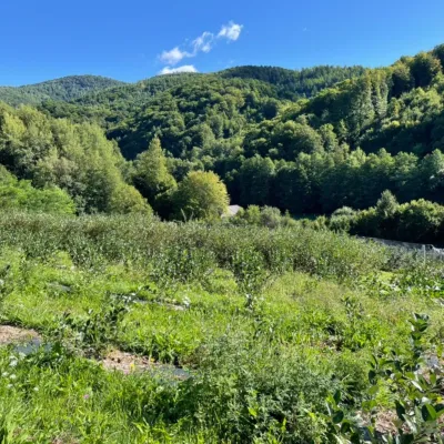 Eco farmsČučoriedková záhrada: pick-your-own blueberries and aronia juice26 km from the trailHere in 2010 the owners’ family planted the first Canadian blueberry bushes on a small plot — and gradually grew them into the Čučoriedková záhrada (Blueberry Garden).
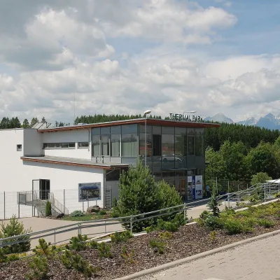 Water parks & thermal poolsThermal Park Vrbov30 km from the trailThermal Park Vrbov is one of the best-known thermal baths in the Spiš region, on the southern edge of the village of Vrbov, about 6 km (as the crow flies) from...
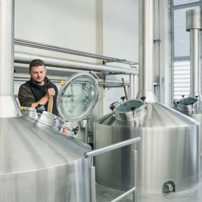 Craft beer & breweriesKaltenecker Brewery, Rožňava: Gemer craft beer from the source31 km from the trailThe modern Kaltenecker brewery was founded in 1997, and from the start it took a different path from the big breweries of the day: instead of one-size-fits-all beer, a...
