Pred Čuntavou – Dukliansky Pass
Trail map
Route, springs and shelters: © OpenStreetMap contributors (ODbL) · elevation: Copernicus DEM © DLR e.V., © Airbus DS · Data & licences
About the trail
Route Pred Čuntavou – Dukliansky Pass. Has red marking (national route №0901, KST). Waymarking data: OpenStreetMap (© OpenStreetMap contributors, ODbL).
Officially marked national tourist route No. 0901. The marking is red, the sign is a horizontal stripe on a white background. Marked and maintained by: KST. Length of the route — 280.7 km. Location: mountain range — Slovak Rudohorie, Slovakia.
At a glance
A multi-day route of 280.7 km with 8,346 m of ascent from Pred Čuntavou to Dukliansky Pass. Estimated time: 12 days of 4–10 h of walking (about 84 h in total, not counting stops). Difficulty: hard. Waymarking: red.
Route stages
- 0–115 kmGentle ups and downs at 260–1,280 m, past Honzovské, Skalisko, Zbojnícka Skala, Kloptaň
- 115–127 kmClimb of 560 m to Biela skala (812 m)
- 127–210 kmGentle ups and downs at 240–1,050 m, past Čergov Hut, Priehybky, Bukový Vrch
- 210–220 kmClimb of 620 m to Stebnícka Magura (900 m)
- 220–225 kmDescent of 570 m (down to 320 m)
- 225–281 kmGentle ups and downs at 220–660 m, past Kohútov, Čierna Hora, Ostrý Vrch, Hrabníky
Steepest kilometre: km 220–221, a descent of 210 m (≈21%), near Stebnícka Magura.
Water and overnight stays
Springs near the trail: at km 2, 7, 10, 19, 39, 51, 54, 57, 64 and 66 etc.. There are no springs between km 189 and 209 — carry at least 3 l of water. Some springs run low or dry up in late summer.
Huts and shelters near the trail: Hut below Buchvald (km 0), Hut below Strmá prť (km 2), Lookout Tower Suchý vrch (km 19), Stromíš Cabin (km 24), Gálová Hut (km 25), Hut from Avia (km 46), SNP Úhorná Hut (km 51), Ján Krutek Shelter (km 78) etc..
A possible split into days:
- Day 1: km 0–24, ≈7.5 h — overnight: Stromíš Cabin (hut)
- Day 2: km 24–46, ≈6.5 h — overnight: Hut from Avia (hut)
- Day 3: km 46–70, ≈7 h — overnight: no shelter nearby on the map, bring a tent
- Day 4: km 70–91, ≈7 h — overnight: Erika Hut, 1 137 m (hut)
- Day 5: km 91–121, ≈8.5 h — overnight: Hrešná Hut (hut)
- Day 6: km 121–138, ≈5 h — overnight: Skalka Hut (hut)
- Day 7: km 138–166, ≈8 h — overnight: no shelter nearby on the map, bring a tent
- Day 8: km 166–187, ≈6.5 h — overnight: Čergov Hut (hut)
- Day 9: km 187–212, ≈7.5 h — overnight: no shelter nearby on the map, bring a tent
- Day 10: km 212–234, ≈7 h — overnight: no shelter nearby on the map, bring a tent
- Day 11: km 234–249, ≈5 h — overnight: Čierna Hora Hut (hut)
- Day 12: km 249–281, ≈9 h — finish
When to go
Best time: May to October. In winter deep snow is possible, so experience and winter gear are needed.
Getting there
Start: Pred Čuntavou. This is a one-way route: the finish is 123 km from the start in a straight line, so plan your way back in advance.
FAQ
- How long does the route take?
- Estimated time: 12 days of 4–10 h of walking (about 84 h in total, not counting stops).
- Is there water on the route?
- Springs near the trail: at km 2, 7, 10, 19, 39, 51, 54, 57, 64 and 66 etc.. There are no springs between km 189 and 209 — carry at least 3 l of water. Some springs run low or dry up in late summer.
- Where can I stay overnight?
- Huts and shelters near the trail: Hut below Buchvald (km 0), Hut below Strmá prť (km 2), Lookout Tower Suchý vrch (km 19), Stromíš Cabin (km 24), Gálová Hut (km 25), Hut from Avia (km 46), SNP Úhorná Hut (km 51), Ján Krutek Shelter (km 78) etc.. Possible overnight stops: Stromíš Cabin (km 24), Hut from Avia (km 46), Erika Hut, 1 137 m (km 91), Hrešná Hut (km 121), Skalka Hut (km 138), Čergov Hut (km 187), Čierna Hora Hut (km 249).
Water and shelter on the route
- Hut below Buchvaldkm 0 from the start · Not verified · 1 170 m
- Spring below Ondrejiskokm 1.8 from the start · 80 m off the path · Not verified · 1 091 m
- Hut below Strmá prťkm 1.9 from the start · 150 m off the path · Not verified · 1 067 m
- Spring below Strmá prťkm 2.3 from the start · Not verified · 1 167 m
- Spring under Hanesová 1km 6.6 from the start · 120 m off the path · Not verified · 912 m
- Spring below Gápeľkm 9.5 from the start · Not verified · 941 m
- Lookout Tower Suchý vrchkm 19 from the start
- Spring on Muzikantský chodníkkm 19.2 from the start · 170 m off the path · Not verified · 935 m
- Stromíš Cabinkm 23.9 from the start · 200 m off the path · Not verified · 1 043 m
- Gálová Hutkm 24.5 from the start · Not verified · 1 123 m
- Spring below Volovec (east slope)km 38 from the start · Not verified · 1 134 m
- Hut from Aviakm 45.4 from the start · Not verified · 1 144 m
- Smolníka Springkm 50.3 from the start · Not verified · 1 009 m
- SNP Úhorná Hutkm 50.5 from the start · Not verified · 1 021 m
- Pipitka Springkm 53.7 from the start · 120 m off the path · Not verified · 1 163 m
- Zimná voda Spring, 1 025 mkm 56.6 from the start · 160 m off the path · Not verified · 1 025 m
- Spring under Skorušinakm 62.7 from the start · Not verified · 1 012 m
- Spring below Tupý vrch (south-west slope)km 63.3 from the start · 40 m off the path · Not verified · 969 m
- Drinking water below Kotlineckm 65.3 from the start · Not verified · 881 m
- Navštívenia panny márie Springkm 67.4 from the start · 100 m off the path · Not verified · 775 m
- Spring below Ostrý Vrch (south-east slope)km 68.1 from the start · 70 m off the path · Not verified · 760 m
- Spring below Štósky vrch (south slope), 689 mkm 69.1 from the start · Not verified · 689 m
- Spring Prepad zvyšnej pitnej vody z rezervoára v Kúpeloch Štóskm 69.8 from the start · 70 m off the path · Not verified · 668 m
- Juhozapadny Kamenný Spring of Lastovičieho vrchukm 72.9 from the start · 170 m off the path · Not verified · 939 m
- Spring under Lastovičím Vrchomkm 73.9 from the start · Not verified · 954 m
- Ján Krutek Shelterkm 76.8 from the start · Not verified · 852 m
- Spring below Jedľovec Pass (north slope), 869 mkm 77.2 from the start · Not verified · 869 m
- Spring below Zbojnícka Skalakm 79 from the start · 100 m off the path · Not verified · 1 078 m
- Tri studnekm 85.5 from the start · Not verified · 947 m
- Jožkova Hutkm 89.4 from the start · Not verified · 1 138 m
- Erika Hut, 1 137 mkm 90.1 from the start · Standing · 1 137 m
- Drinking water below Zlatoidská horakm 91 from the start · Not verified · 1 160 m
- Jankova studňa Springkm 93.7 from the start · Not verified · 1 009 m
- Spring below Holý vrch (south-west slope), 963 mkm 96.2 from the start · 150 m off the path · Not verified · 963 m
- Lajoška Hutkm 99.4 from the start · Standing · 908 m
- Jahodná Hutkm 104.2 from the start · 70 m off the path · Standing · 579 m
- Spring below Kamenný Hrb (east slope)km 108.6 from the start · 160 m off the path · Not verified · 498 m
- Víl Springkm 109.9 from the start · 190 m off the path · Not verified · 472 m
- Drinking water (Košice)km 111.2 from the start · Not verified · 403 m
- Drinking water below Hradovákm 113.5 from the start · 60 m off the path · Not verified · 267 m
- Hrešná Hutkm 119 from the start · Standing · 593 m
- Göndör Gábor Springkm 121.5 from the start · 160 m off the path · Not verified · 647 m
- Spring below Hradkm 130.8 from the start · Not verified · 341 m
- Margita Springkm 131.8 from the start · Not verified · 313 m
- Spring below Stráž (south slope), 266 mkm 134.5 from the start · Not verified · 266 m
- Skalka Hutkm 135.8 from the start · 180 m off the path · Not verified · 399 m
- Lackova Shelterkm 145.7 from the start · Not verified · 314 m
- Kadlubek Springkm 152.1 from the start · Not verified · 356 m
- Kvašna voda Springkm 152.9 from the start · 50 m off the path · Not verified · 343 m
- Kvašná voda Hutkm 153 from the start · 50 m off the path · Not verified · 360 m
- Spring below Borsučia horakm 155.7 from the start · Not verified · 373 m
- Papučová studnička Springkm 157.3 from the start · Not verified · 386 m
- Zimná studňa Well, 454 mkm 171.3 from the start · Not verified · 454 m
- Well at Lazoríkkm 174.4 from the start · 90 m off the path · Not verified · 377 m
- Well below Bukoveckm 178.7 from the start · Not verified · 573 m
- Spring below Kalisko Passkm 184.5 from the start · 190 m off the path · Not verified · 861 m
- Čergov Hutkm 184.6 from the start · 60 m off the path · Standing · 927 m
- Drina Hutkm 186 from the start · 160 m off the path · Not verified · 1 013 m
- Spring below Čergov Hutkm 186 from the start · 180 m off the path · Not verified · 1 003 m
- Žobrák Hut, 890 m (2)km 193 from the start · Not verified · 890 m
- Žobrák Hut, 890 mkm 193 from the start · Not verified · 890 m
- Drinking water below Kopytovkakm 206.3 from the start · Not verified · 275 m
- Klárka Springkm 210.6 from the start · Not verified · 403 m
- Anna Spring, 334 mkm 211.2 from the start · 60 m off the path · Not verified · 334 m
- Klára Spring, 395 mkm 211.8 from the start · 50 m off the path · Not verified · 395 m
- Spring below Kamenná Hora (south-east slope), 514 mkm 213.2 from the start · 90 m off the path · Not verified · 514 m
- Tri studničky, 633 mkm 215 from the start · 90 m off the path · Not verified · 633 m
- Spring below Kamenná Hora (north-east slope), 704 mkm 215.5 from the start · Not verified · 704 m
- Spring below Kohútovkm 228.4 from the start · Not verified · 358 m
- Spring under Makovicakm 240.5 from the start · 130 m off the path · Not verified · 495 m
- Hut by the Well under Makovicakm 240.5 from the start · 100 m off the path · Not verified · 497 m
- Čierna studňa Springkm 241.7 from the start · Not verified · 600 m
- Čierna Hora Hutkm 245.9 from the start · Not verified · 664 m
- Spring below Krížovkm 255.7 from the start · Not verified · 283 m
- Spring below Timofejkakm 260.8 from the start · 40 m off the path · Not verified · 283 m
- Spring (Nižná Pisaná)km 262.1 from the start · 140 m off the path · Not verified · 302 m
- Spring below Ščobkm 263.8 from the start · Not verified · 328 m
- Spring under Ščobkm 265.4 from the start · 110 m off the path · Not verified · 368 m
- Hut under Ščobkm 265.4 from the start · 80 m off the path · Not verified · 362 m
- Vajcovka Spring, 433 mkm 272.7 from the start · Not verified · 433 m
- Spring below Kiczurkikm 276.3 from the start · 110 m off the path · Not verified · 467 m
Comments
Trails nearby
All trails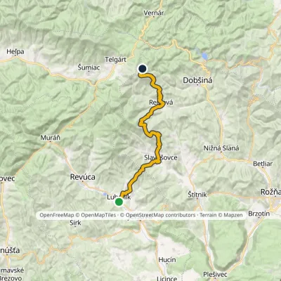 HardMulti-dayMarkedLubeník, station Stará ČuntavaElevation profile274–1 229 m37.3 kmascent 1 922 m≈ 13 h walking
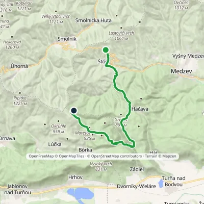 HardTwo-dayMarkedŠtós, spa Pod OsadníkomElevation profile417–1 042 m21.7 kmascent 1 058 m≈ 7.5 h walking
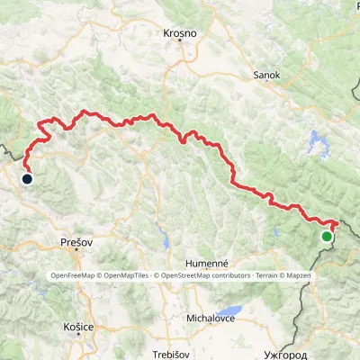 HardMulti-dayMarkedVýchodokarpatská magistrálaElevation profile390–1 209 m213.5 kmascent 7 991 m
Craft nearby
All craft places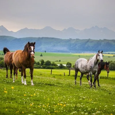 Horse ridingRanč u Trapera, Podlesok: Horse Rides in the Slovak Paradise16 km from the trailA little away from the main tourist bustle, below the forest, stands the family-run Ranč u Trapera, run by the Salaj family.
 Craft beer & breweriesMinipivovar TATRAS, Poprad24 km from the trailMinipivovar TATRAS is a brewpub on Poprad’s main square, Námestie sv. Egídia, housed in a building with a long brewing history.
 Water parks & thermal poolsAquaCity Poprad water park24 km from the trailAquaCity Poprad is a large year-round water park and wellness complex in the town of Poprad, a few minutes from the centre; according to the complex, the High Tatras...
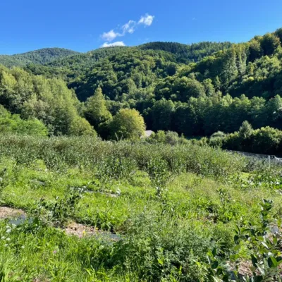 Eco farmsČučoriedková záhrada: pick-your-own blueberries and aronia juice26 km from the trailHere in 2010 the owners’ family planted the first Canadian blueberry bushes on a small plot — and gradually grew them into the Čučoriedková záhrada (Blueberry Garden).
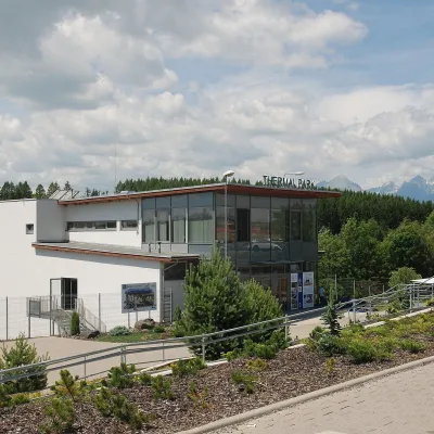 Water parks & thermal poolsThermal Park Vrbov30 km from the trailThermal Park Vrbov is one of the best-known thermal baths in the Spiš region, on the southern edge of the village of Vrbov, about 6 km (as the crow flies) from...
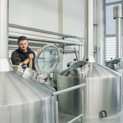 Craft beer & breweriesKaltenecker Brewery, Rožňava: Gemer craft beer from the source31 km from the trailThe modern Kaltenecker brewery was founded in 1997, and from the start it took a different path from the big breweries of the day: instead of one-size-fits-all beer, a...
