Baranec
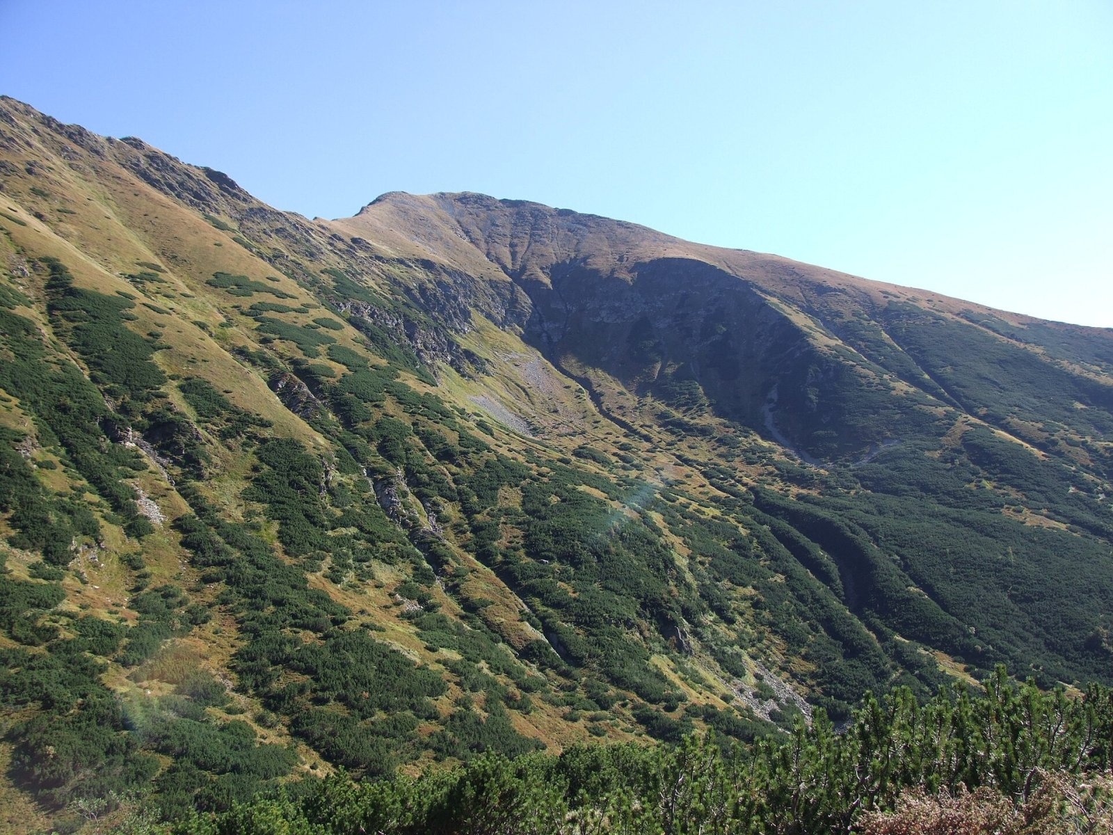
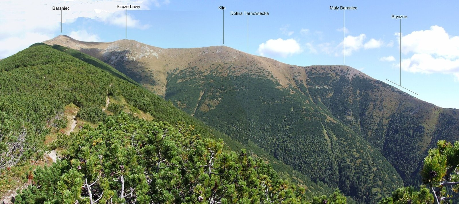
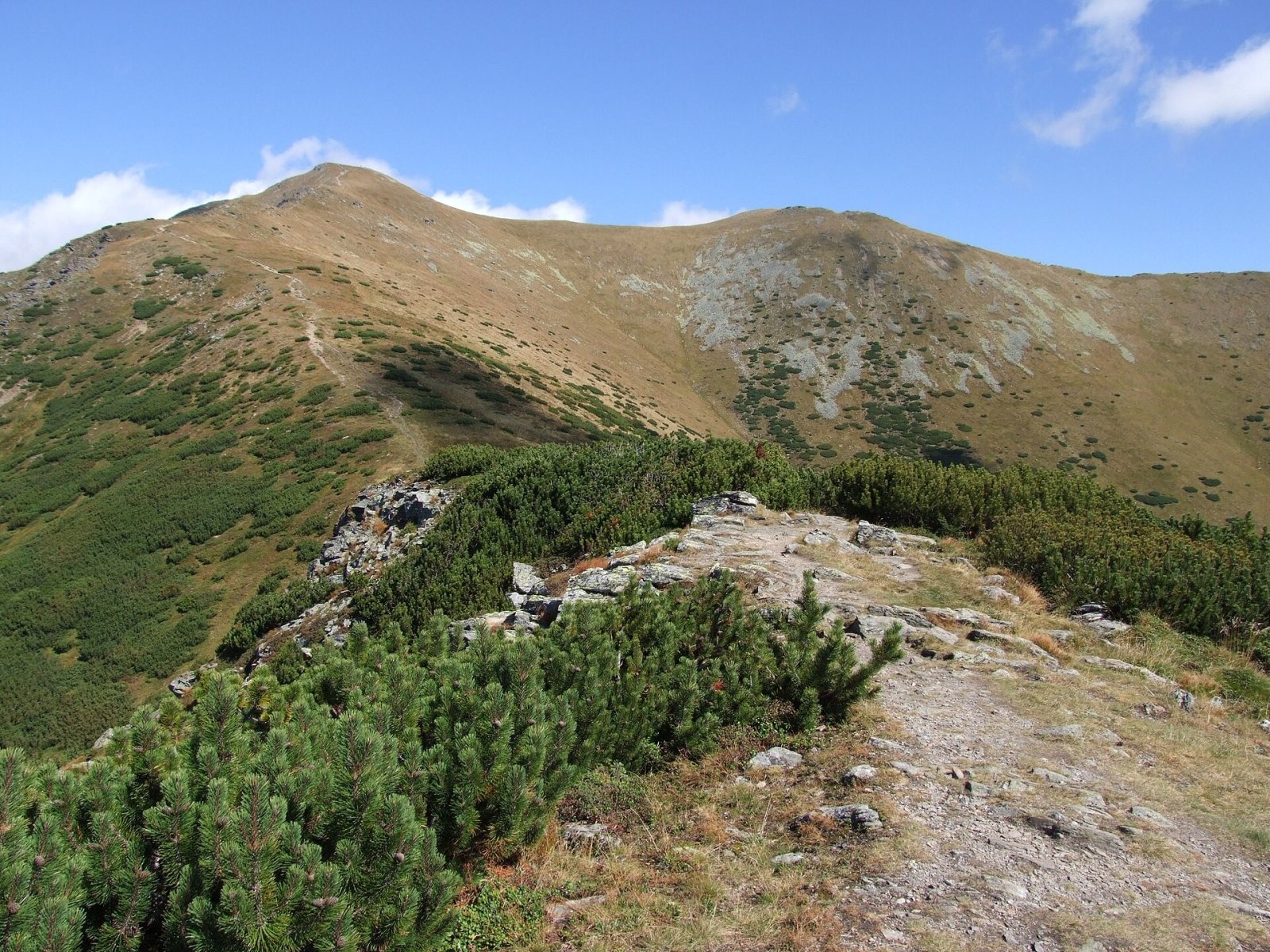
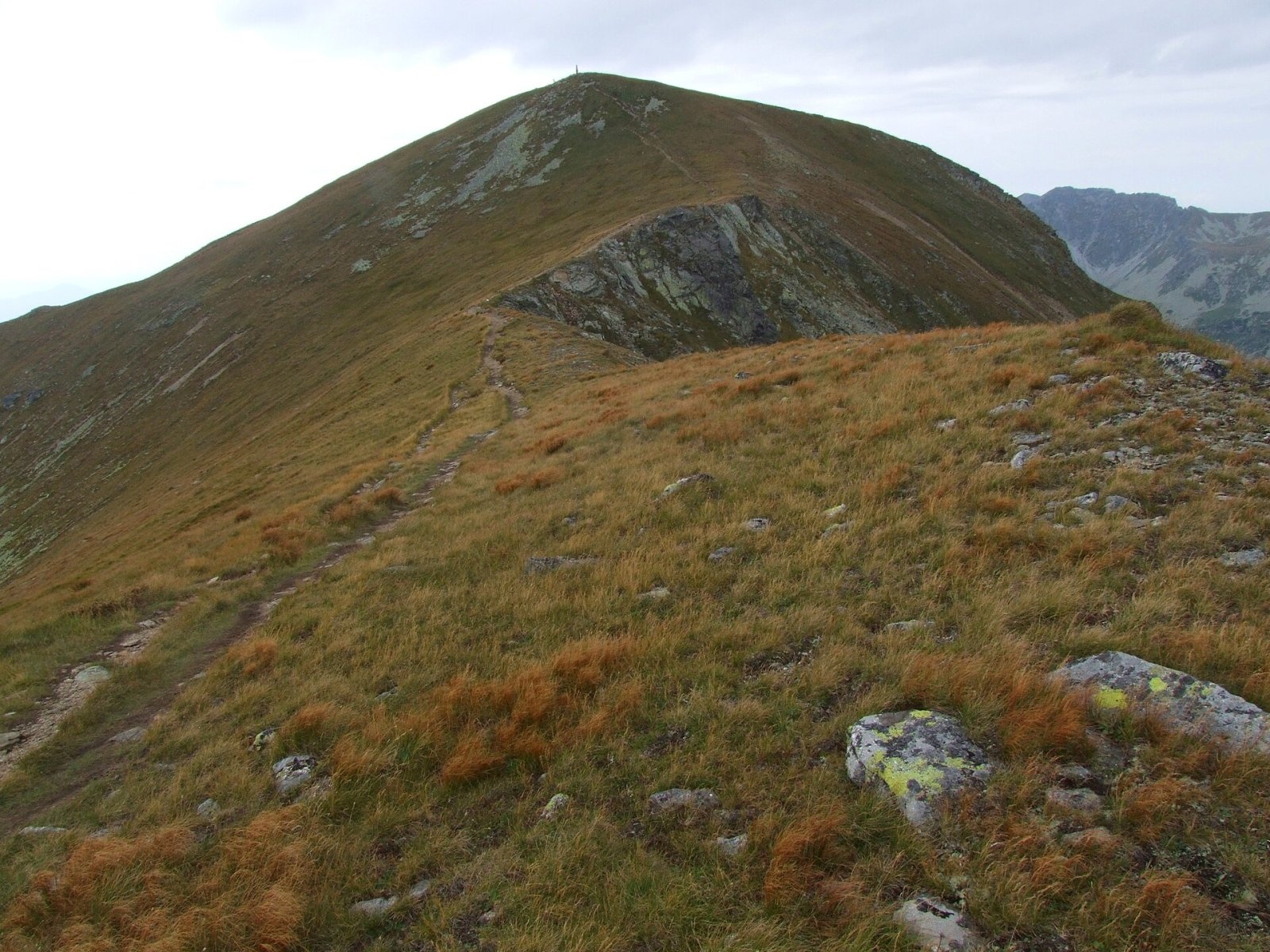
Baranec (Polish: Baraniec) is a 2,185 m peak in the Slovak part of the Western Tatras, the third highest in the range after Bystrá and Jakubina. It stands about 2.5 km south of the main ridge and is the highest point of the Barance side ridge, which branches off from Plačlivé. The mountain towers over the Liptov basin; because of this dominance it was once considered the highest summit of Liptov and is still nicknamed the "Peak of Liptov" (Štít Liptova). Baranec is the junction of four ridges, between which lie the Žiarska, Jamnícka and Trnovecká valleys and the valley of the Bystrý potok. The nearest villages are Jalovec (about 5 km to the west), Konská (about 6 km to the south-west), Žiar and Jakubovany (about 8 km to the south); the Žiarska chata hut stands at the north-western foot in the Žiarska valley. The peak lies in the Tatra National Park (TANAP).
How to get there: routes
Three marked trails lead to Baranec, all from the Slovak Liptov side:
- Green — from the car camp in the Račkova valley (junction at the mouth of the Úzka valley) over the Klinovaté ridge, Malý Baranec and Mládky: about 4 hours up, 3 hours down.
- Yellow — from the mouth of the Žiarska valley over Holý vrch to the summit: about 4 hours up, 2 h 40 min down. The yellow trail then continues along the ridge over Smrek and Žiarske sedlo to Plačlivé (about another 2 h 05 min).
- Blue — from the village of Jakubovany via the Pod Holým vrchom junction to Holý vrch (about 2 hours), then on the yellow trail.
Every option is a serious outing: at least 1,200 m of ascent, and loop hikes returning through another valley take 8–10 hours. Czech sources warn that dense dwarf pine on the south slope makes the climb awkward in places.
What you can see from the summit
Baranec offers an all-round panorama. The main ridge from the Roháče to Baníkov, the Otargance ridge and almost the whole of Liptov are clearly visible; above the Otargance rise the Bystrá massif, Kriváň and other High Tatra peaks. The Roháče and Jakubina are particularly striking, as is the view over the Sub-Tatra basin. Slovak sources add that in good visibility you can see Oravská Magura, the Chočské vrchy, Malá and Veľká Fatra, the Low Tatras, the Spiš-Gemer Karst, Kozie chrbty and the Volovec Mountains.
Nature and history
Baranec is built of crystalline schists with inclusions of amphibolite and garnet-bearing graphite schist. The summit is stony and the upper slopes are grassy. The north side drops steeply into the Žiarska valley, where a small glacial cirque called Kotlina lies below the summit. On the Jamnícka side there are two-stage cirques, and the slopes rise more than 1,000 m above the valley floor. They are cut by deep gullies that carry huge avalanches in winter; the largest runs south into the Trnovecká valley. Tatra chamois are frequently seen here and marmots have their burrows. A sad episode is remembered from New Year's Eve 1971/72, when chamois frightened by hikers fled across the icy slopes and twelve of them were killed.
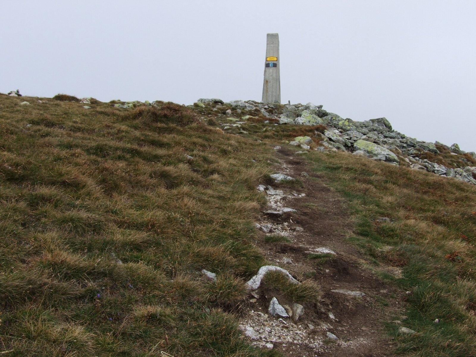
The slopes of Baranec were once grazed. The mountain was one of the five main triangulation points of the Tatras: in 1820 a wooden tower was built on the summit and the height was measured precisely at 2,185 m. The tower was later replaced by a concrete pillar with a metal box, which still stands on the summit. The first winter ascent was made by J. Przyborowski and Wacław Majewski on 23 February 1914.
Safety, season and rules
The routes to Baranec lie in TANAP's high-mountain zone, where under the current visitor rules trails above the tree line are closed from 1 November to 31 May (formerly until 15 June). However, according to the Slovak news agency TASR (October 2025), the yellow trail to Baranec and on to Plačlivé is among the exceptions that may be used in winter. Check the current list on the TANAP website before you go; a winter ascent requires avalanche equipment and experience.
There is no shelter at all from thunderstorms on the open ridge of Baranec, so start early and watch the forecast. The long climb and descent call for good fitness, plenty of water and warm clothing. Do not approach or disturb the chamois — on steep slopes it can cost the animals their lives.
Emergency numbers: the Slovak Mountain Rescue Service (HZS) 18 300 (+421 18 300 from a foreign phone) and 112. Rescue operations in Slovakia may be charged, so it is worth having insurance that covers mountain hiking.
Interesting facts
- Because of its dominant position over Liptov, Baranec was long thought to be the region's highest peak and was nicknamed the "Peak of Liptov".
- Its height was measured precisely back in 1820, when a wooden triangulation tower stood on the summit.
- The yellow trail to Baranec is one of the few high-mountain trails in TANAP that stay open in winter.
Photos: Jerzy Opioła, CC BY-SA 4.0; Jerzy Opioła, CC BY-SA 4.0; Jerzy Opioła, CC BY-SA 4.0; Jerzy Opioła, CC BY-SA 4.0; Jerzy Opioła, CC BY 3.0; Jerzy Opioła, CC BY-SA 4.0; pepanos, CC BY 3.0 — Wikimedia Commons.
Getting there from Ukraine
Border crossings
- Uzhhorod – Vyšné Nemecké — road, 24/7
- Malyi Bereznyi – Ubľa — road, 24/7 For cars and buses; pedestrians not confirmed by the Ukrainian border service, lorries up to 3.5 t.
- Mali Selmentsi – Veľké Slemence (pedestrian) — pedestrian, 09:00–21:00 Kyiv time Pedestrians and cyclists only; inconvenient for the Tatras without onward transport.
- Chop – Čierna nad Tisou (rail) — rail, 24/7
By car
From Uzhhorod ≈275 km, ≈3 h 35 min without queues: Uzhhorod – Vyšné Nemecké → I/19 to Košice → D1 motorway via Prešov, Poprad and Liptovský Mikuláš to Ružomberok (≈270 km, ≈3 h 25 min from the border). From Lviv it is faster through Poland: M-10 → Krakovets – Korczowa → A4 to Kraków → S7/DK7 to the Chyżne – Trstená border → R3 and I/59 via Dolný Kubín to Ružomberok: ≈482 km, ≈6 h 15 min (via Uzhok and Ubľa ≈500 km, ≈7 h 30 min). The D1 requires an e-vignette (eznamka.sk).
Checked 23.10.2026; border crossing hours and timetables change — check before you travel.
Location on the map
Comments
Trails nearby
All trails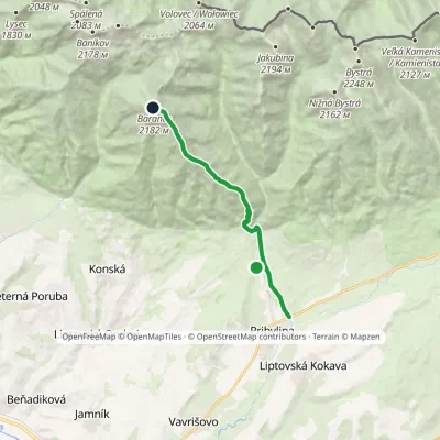 ModerateOne-dayMarkedPribylina, Hotel Esperanto BaranecElevation profile780–2 174 m11.3 kmascent 1 389 m≈ 5.5 h walkingunder 1 km from Baranec
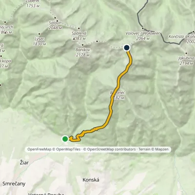 ModerateOne-dayMarkedMouth of Žiarska Valley PlačlivéElevation profile882–2 174 m9.7 kmascent 1 492 m≈ 5.5 h walkingunder 1 km from Baranec
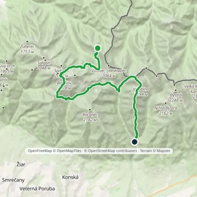 HardMulti-dayMarkedSedlo Zábrať Junction of Jamnická and Račková ValleysElevation profile962–2 176 m26.6 kmascent 2 450 m≈ 11.5 h walking1.5 km from Baranec
Nearby attractions
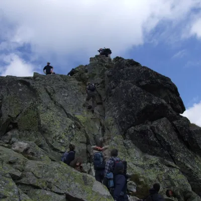 PeakOstrý Roháčaltitude 2 088 m3.2 km from BaranecOstrý Roháč (Polish: Rohacz Ostry) is a rocky, twin-summited 2,088 m mountain on the main ridge of the Western Tatras in Slovakia.
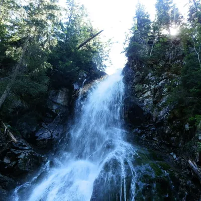 WaterfallRoháčsky Waterfall4.7 km from BaranecRoháčsky waterfall (Roháčsky vodopád) is the best-known waterfall of the Western Tatras, in the Roháče massif about 12 km east of the village of Zuberec in Orava.
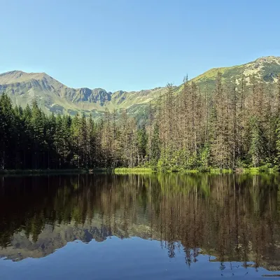 LakeSmreczyński Staw Lake10 km from BaranecSmreczyński Staw is a small glacial lake in the upper part of the Kościeliska Valley, at the mouth of the Pyszniańska Valley, at 1,226 m.
Craft nearby
All craft places Cheese dairies & pasturesShepherds' Huts on Polana Chochołowska7.9 km from BaranecPolana Chochołowska is the largest glade in the Polish Tatras and one of the largest in the whole range.
 Cheese dairies & pasturesShepherd's Hut in the Kościeliska Valley14 km from BaranecJózef Słodyczka's bacówka (shepherd's hut) on the Wyżnia Kira Miętusia glade is probably the most easily reached shepherds' hut in the Polish Tatras.
 Water parks & thermal poolsOravice thermal pools14 km from BaranecThe Oravice thermal pools (Termálne kúpalisko Oravice) are the municipal thermal baths in the mountain settlement of Oravice at the foot of the Western Tatras.
 Water parks & thermal poolsMeander Thermal Resort, Oravice14 km from BaranecMeander Thermal & Ski Resort (formerly Meander Park) is a thermal water park and ski centre in the mountain settlement of Oravice in northern Slovakia, at the foot of...
 Water parks & thermal poolsAquapark Tatralandia14 km from BaranecAquapark Tatralandia is a large year-round water leisure complex near Liptovský Mikuláš, on the northern shore of the Liptovská Mara reservoir.
 Water parks & thermal poolsTERMAL raj thermal bath, Liptovský Ján16 km from BaranecLiptovský Ján: thermal water at the entrance to Jánska dolina Liptovský Ján is an old village in southern Liptov, about 10 km from Liptovský Mikuláš, at the entrance...
