Voronenko village, via Mount Kukul, Mount Hoverla and Mount Pip Ivan Chornohirskyi to Iltsi village
About the route:
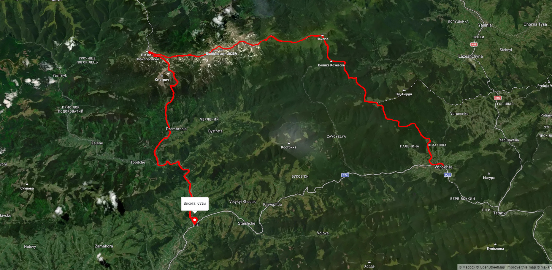
Route Voronenko village, via Mount Kukul, Mount Hoverla and Mount Pip Ivan Chornohirskyi to Iltsi village. Warning! This route is unmarked (it may be partially marked)! Unmarked routes are not equipped with: information boards; signposts; auxiliary signs (water, campsite, etc.). The decision to take the route is entirely your own responsibility! Trail length 63274m. Lowest point - 635m., highest point - 2015m. Total elevation gain 3028m. Along the route you will see: Museum of History and Local Lore, Vorokhta, Church of the Nativity of the Virgin Mary XVII-XVIII, Vorokhta, Austrian viaduct bridge, Vorokhta, Polonyna Kukul (Kukul), Voronenko, Mount Kukul, Mount Hoverla, Mount Breskul, Mount Pozhyzhevska, Mount Danzig, Mount Turkul, High-mountainous Lake Nesamovite (1750 m.a.s.l., Chornohora ridge), Mount Rebra, Polonyna Gadzhina, Lake Brebeneskul, Mount Gutin Tomnatik, Mount Brebeneskul, Mount Menchul, Mount Dzembronya, Mount Pip Ivan of Chornohora (Pip Ivan, Black Mountain), The White Elephant Observatory on Mount Pip Ivan Chornohirsky, Mount Smotrych, Museum of Hutsul life, Krasnyk, Museum of mushrooms, Iltsi.
What to see along the route:
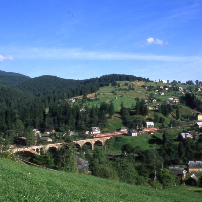 The museum was inaugurated on January 21, 2007. The museum reveals the processes of the settlement's emergence, the Oprishka movement in the Vorokhta neighborhood, and religious life. One of the sections of the permanent exhibition is dedicated to the life and work of the forgotten minister of the ZUNR and UPR, father-in-law of E. Konovalets and A. Melnyk, philanthropist, prominent public figure Stepan Fedak (1861-1937) and his family, and highlights their connection with Vorokhta. There are... More...
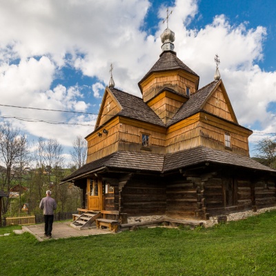 The Church of the Nativity of the Virgin Mary in Vorokhta of the seventeenth and eighteenth centuries is a traditional Hutsul church built without a single nail. The building is shaped like a cross. In the background, if you look closely, you can see an arched railroad bridge - a viaduct.
Inside there are wall paintings of the 19th century. The bell tower houses the church museum. Coordinates: 48°17'2 "N, 24°34'13 "E.Read more on the blog >> More...
The Church of the Nativity of the Virgin Mary in Vorokhta of the seventeenth and eighteenth centuries is a traditional Hutsul church built without a single nail. The building is shaped like a cross. In the background, if you look closely, you can see an arched railroad bridge - a viaduct.
Inside there are wall paintings of the 19th century. The bell tower houses the church museum. Coordinates: 48°17'2 "N, 24°34'13 "E.Read more on the blog >> More...
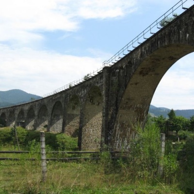 The Austrian Viaduct Bridge in Vorokhta is an engineering marvel that connects the two banks of the Prut River. Today, the bridge is a kind of open-air museum, a place for fabulous photo shoots and an observation deck with an incredible view.
... More...
The Austrian Viaduct Bridge in Vorokhta is an engineering marvel that connects the two banks of the Prut River. Today, the bridge is a kind of open-air museum, a place for fabulous photo shoots and an observation deck with an incredible view.
... More...
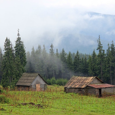 Polonyna Kukul is a mountain meadow in the Ukrainian Carpathians, within the Kukul ridge (Kukul mountain - 1539 m), administratively located within the Zakarpattia region. The approximate height above sea level is 1440 m.
... More...
Polonyna Kukul is a mountain meadow in the Ukrainian Carpathians, within the Kukul ridge (Kukul mountain - 1539 m), administratively located within the Zakarpattia region. The approximate height above sea level is 1440 m.
... More...
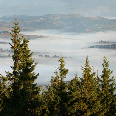 Kukul (another name - Kukul) is a 1539-meter peak in the Ukrainian Carpathians, which is located in the northern direction of the Chornohora mountain range. The mountain is located in Nadvirna district of Ivano-Frankivsk region and Rakhiv district of Zakarpattia region.
... More...
Kukul (another name - Kukul) is a 1539-meter peak in the Ukrainian Carpathians, which is located in the northern direction of the Chornohora mountain range. The mountain is located in Nadvirna district of Ivano-Frankivsk region and Rakhiv district of Zakarpattia region.
... More...
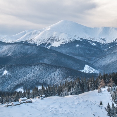 Remember: Mount Hoverla has a difficult route and you need to prepare for the climb in advance. You need an experienced friend, company, or guide to go hiking on Hoverla, and it's best to make an appointment in advance.
... More...
Remember: Mount Hoverla has a difficult route and you need to prepare for the climb in advance. You need an experienced friend, company, or guide to go hiking on Hoverla, and it's best to make an appointment in advance.
... More...
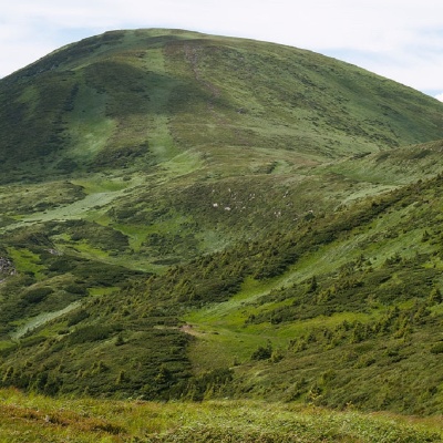 Breskul (another name for the mountain is Bretskul), 1911 meters high, is a famous mountain peak in the Ukrainian Carpathians, located in the Chornohora mountain range on the border of Zakarpattia and Ivano-Frankivsk regions.
... More...
Breskul (another name for the mountain is Bretskul), 1911 meters high, is a famous mountain peak in the Ukrainian Carpathians, located in the Chornohora mountain range on the border of Zakarpattia and Ivano-Frankivsk regions.
... More...
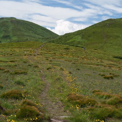 Mount Pozhyzhevska (or Pozhezhevska) is one of the peaks of the Ukrainian Carpathians. It is located in the northwestern part of the Chornohora mountain range on the border of Zakarpattia and Ivano-Frankivsk regions.
... More...
Mount Pozhyzhevska (or Pozhezhevska) is one of the peaks of the Ukrainian Carpathians. It is located in the northwestern part of the Chornohora mountain range on the border of Zakarpattia and Ivano-Frankivsk regions.
... More...
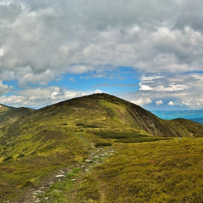 Dantsizh (also known as Danzer) is a peak of the Ukrainian Carpathians, 1850 meters high. The mountain is located on the Chornohora mountain range (in its northwestern part) on the border of two regions - Zakarpattia and Ivano-Frankivsk.
... More...
Dantsizh (also known as Danzer) is a peak of the Ukrainian Carpathians, 1850 meters high. The mountain is located on the Chornohora mountain range (in its northwestern part) on the border of two regions - Zakarpattia and Ivano-Frankivsk.
... More...
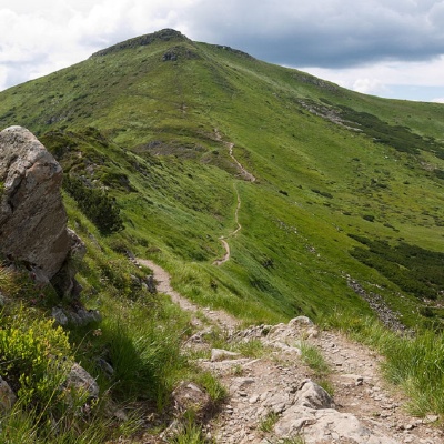 Turkul, 1933 meters high, is one of the peaks of the Ukrainian Carpathians, located in the Chornohora mountain range. The mountain is located on the border of two regions - Zakarpattia and Ivano-Frankivsk.
... More...
Turkul, 1933 meters high, is one of the peaks of the Ukrainian Carpathians, located in the Chornohora mountain range. The mountain is located on the border of two regions - Zakarpattia and Ivano-Frankivsk.
... More...
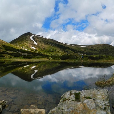 Nesamovyte is one of the highest lakes in the Ukrainian Carpathians (1750 m above sea level). It is located within the Nadvirna district of Ivano-Frankivsk region. It lies within the Carpathian National Park, in a glacial kar (depression) on the eastern slopes of Mount Turkul (Chornohora massif).
... More...
Nesamovyte is one of the highest lakes in the Ukrainian Carpathians (1750 m above sea level). It is located within the Nadvirna district of Ivano-Frankivsk region. It lies within the Carpathian National Park, in a glacial kar (depression) on the eastern slopes of Mount Turkul (Chornohora massif).
... More...
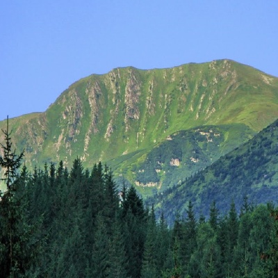 Mount Rebra, with a height of 2001 meters, is located in the central part of the Chornohora ridge. It is one of the highest peaks in Ukraine and closes the six so-called "two-thousanders" of the Ukrainian Carpathians, which includes Hoverla, Brebeneskul, Pip Ivan Chornohirsky, Petros , and Hutyn Tomnatyk.
... More...
Mount Rebra, with a height of 2001 meters, is located in the central part of the Chornohora ridge. It is one of the highest peaks in Ukraine and closes the six so-called "two-thousanders" of the Ukrainian Carpathians, which includes Hoverla, Brebeneskul, Pip Ivan Chornohirsky, Petros , and Hutyn Tomnatyk.
... More...
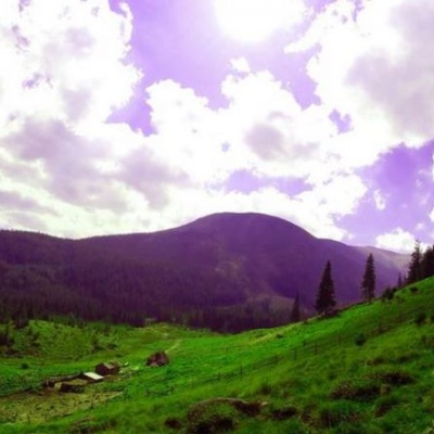 It seemed that the Chornohora massif was literally crowded with people, but sometimes you can come across places that either locals or tourists who have eaten the dog on hikes know about. We are talking about the Hajyna meadow.
... More...
It seemed that the Chornohora massif was literally crowded with people, but sometimes you can come across places that either locals or tourists who have eaten the dog on hikes know about. We are talking about the Hajyna meadow.
... More...
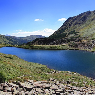 Brebeneskul is the highest mountain lake in the Ukrainian Carpathians (1801 m above sea level), a hydrological natural monument of local importance (registered as Lake Berbenyaskul), and a tourist attraction. It is located in the Chornohora massif and is part of the Carpathian Biosphere Reserve. The length is 147 m, width is 67 m, and the maximum depth is 3.2 m. The lake is incredibly picturesque and popular among tourists. A particularly beautiful view can be seen from the slopes and isthmus... More...
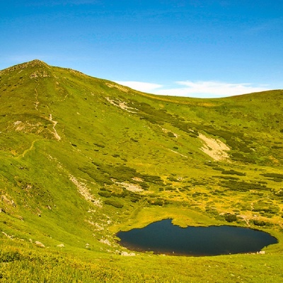 Hutyn Tomnatyk is one of the highest and most beautiful peaks of the Ukrainian Carpathians. The mountain is located on the southwestern spur of the Chornohora mountain range. The height is 2016 meters.
... More...
Hutyn Tomnatyk is one of the highest and most beautiful peaks of the Ukrainian Carpathians. The mountain is located on the southwestern spur of the Chornohora mountain range. The height is 2016 meters.
... More...
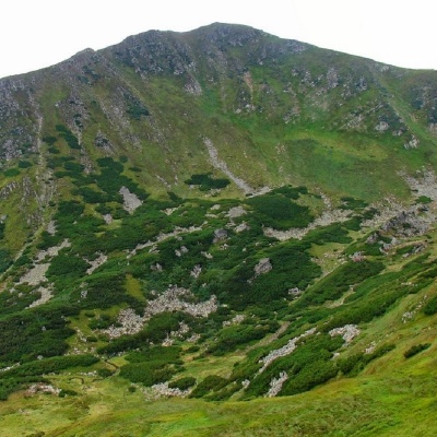 Mount Brebeneskul is the second highest peak in the Ukrainian Carpathians after Hoverla (2061 m), located in the middle of the Chornohora ridge on the border of two regions: Zakarpattia and Ivano-Frankivsk.
... More...
Mount Brebeneskul is the second highest peak in the Ukrainian Carpathians after Hoverla (2061 m), located in the middle of the Chornohora ridge on the border of two regions: Zakarpattia and Ivano-Frankivsk.
... More...
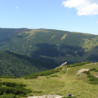 Menchul (also known as Munchel, which comes from the Romanian "munteul" meaning "mountain"), with a height of 1998 meters, is the seventh largest peak in the Ukrainian Carpathians. It is located on the border of Zakarpattia and Ivano-Frankivsk regions in the southeastern part of the Chornohora mountain range.
... More...
Menchul (also known as Munchel, which comes from the Romanian "munteul" meaning "mountain"), with a height of 1998 meters, is the seventh largest peak in the Ukrainian Carpathians. It is located on the border of Zakarpattia and Ivano-Frankivsk regions in the southeastern part of the Chornohora mountain range.
... More...
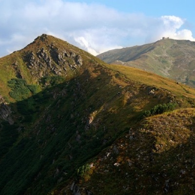 Mount Dzembronia, with a height of 1877 meters, is one of the most famous peaks of the Ukrainian Carpathians, located in the Carpathian National Nature Park on the border of Zakarpattia and Ivano-Frankivsk regions.
... More...
Mount Dzembronia, with a height of 1877 meters, is one of the most famous peaks of the Ukrainian Carpathians, located in the Carpathian National Nature Park on the border of Zakarpattia and Ivano-Frankivsk regions.
... More...
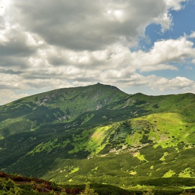 Pip Ivan Chornohirsky (also known as "Pip Ivan" and "Black Mountain") is the third highest mountain (2028 m) after Hoverla (2061 m) and Brebeneskul (2035 m) in the Chornohora mountain range of the Ukrainian Carpathians.
... More...
Pip Ivan Chornohirsky (also known as "Pip Ivan" and "Black Mountain") is the third highest mountain (2028 m) after Hoverla (2061 m) and Brebeneskul (2035 m) in the Chornohora mountain range of the Ukrainian Carpathians.
... More...
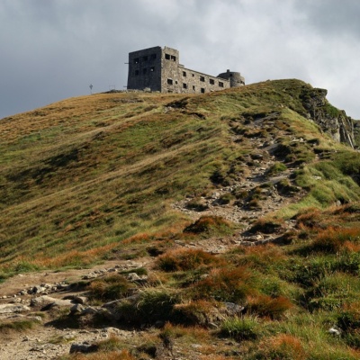 The construction of the White Elephant Observatory on Mount Pip-Ivan Chornohirsky(the route along the Chornohirsky ridge starts from this two-thousand meter high peak) began in the summer of 1936, designed by architects K. Marczewski and J. Pogoski (who were recognized as the best in a closed competition), and was completed by the Polish Ministry of Air Defense in July 1938.
... More...
The construction of the White Elephant Observatory on Mount Pip-Ivan Chornohirsky(the route along the Chornohirsky ridge starts from this two-thousand meter high peak) began in the summer of 1936, designed by architects K. Marczewski and J. Pogoski (who were recognized as the best in a closed competition), and was completed by the Polish Ministry of Air Defense in July 1938.
... More...
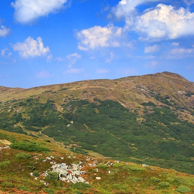 Mount Smotrych (also known as Smotrets) is an 1898-meter peak of the Ukrainian Carpathians. It is located in the Carpathian National Nature Park on the Chornohora mountain range in the Verkhovyna district of Ivano-Frankivsk region.
... More...
Mount Smotrych (also known as Smotrets) is an 1898-meter peak of the Ukrainian Carpathians. It is located in the Carpathian National Nature Park on the Chornohora mountain range in the Verkhovyna district of Ivano-Frankivsk region.
... More...
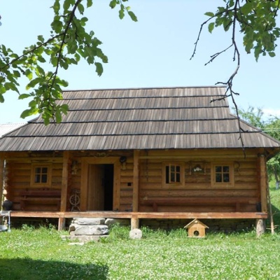 The museum has been open since 2011. It is housed in a Hutsul house, which was built in 2009 on the model of the eighteenth century.
... More...
The museum has been open since 2011. It is housed in a Hutsul house, which was built in 2009 on the model of the eighteenth century.
... More...
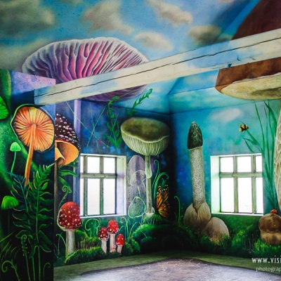 The Mushroom Museum opens its doors to the fabulous and amazing world of mushrooms and forests. They know everything about mushrooms here!
... More...
The Mushroom Museum opens its doors to the fabulous and amazing world of mushrooms and forests. They know everything about mushrooms here!
... More...


