Polonyna Kukul (Kukul), Voronenko
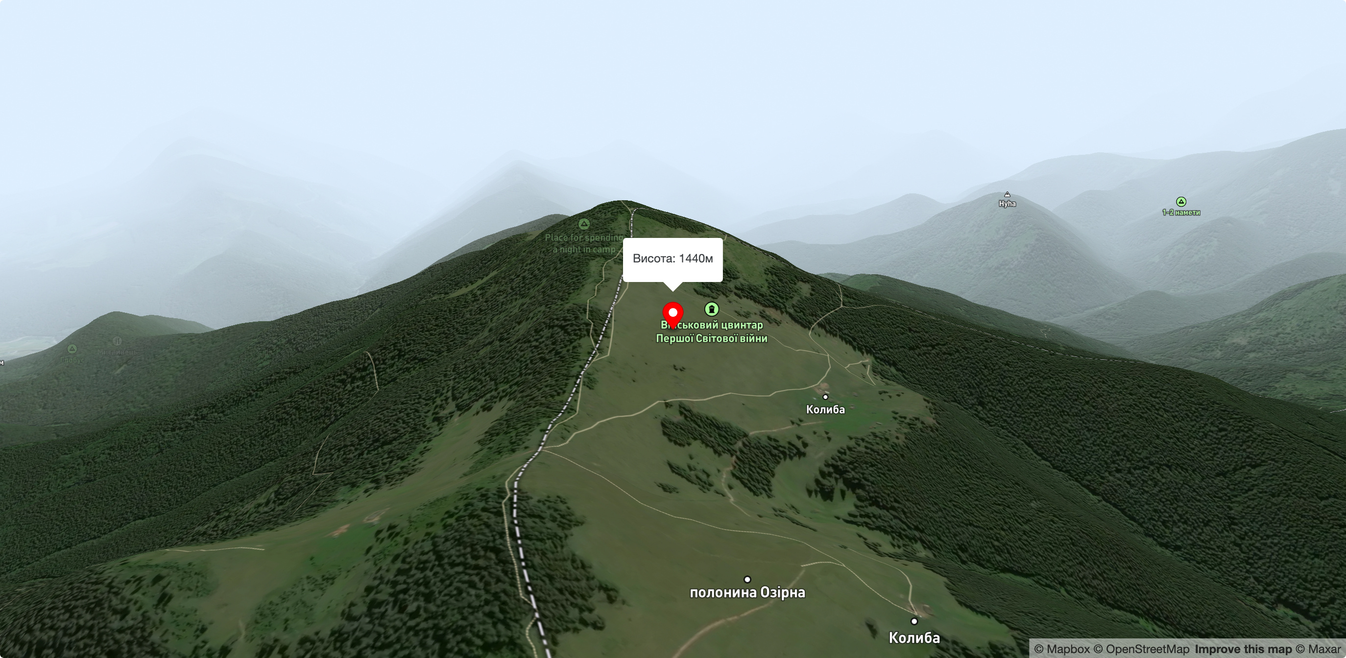
Polonyna Kukul is a mountain meadow in the Ukrainian Carpathians, within the Kukul ridge (Kukul mountain - 1539 m), administratively located within the Zakarpattia region. The approximate height above sea level is 1440 m.
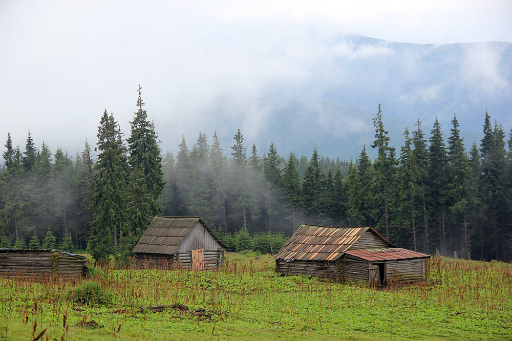
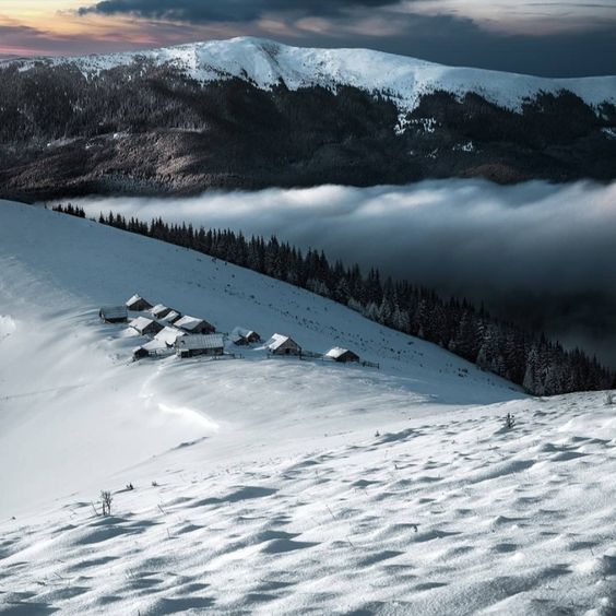
The distance to the village of Zavoila is 5 km. The distance to the road Zaroslyak Sports Center - Vorokhta is 4 km. The meadow can be divided into two parts, one of which lies higher, and the other is called the "back field". There are 7 buildings on the meadow.
On the Kukul meadow, we run a traditional highland farm. Here I graze cows, which are about 50 heads. Traditional Hutsul cheeses such as budz, brynza, and vurda are produced in the meadow.
Kukul is a mountain in the Ukrainian Carpathians, north of the Chornohora massif. It is located within Nadvirna district of Ivano-Frankivsk region and (partially) Rakhiv district of Zakarpattia region. The height of the mountain is 1539 meters above sea level. The western and northeastern slopes of the mountain are very steep. The top of the mountain is covered with spruce trees. Near the mountain there are Kukul, Zakukul and Labeska meadows of the same name. To the north of the mountain are the town of Vorokhta and the village of Voronenko, to the northwest are the village of Lazeshchyna and the town of Yasinia. To the southwest of the mountain, the Foreshchanka River, a left tributary of the Prut, originates. On the mountain there is an old cemetery of German soldiers who died during the First World War. Near Kukul, there are concrete structures from the First World War, as well, because there were battles there. There are also the remains of a Hungarian battery from the First World War.
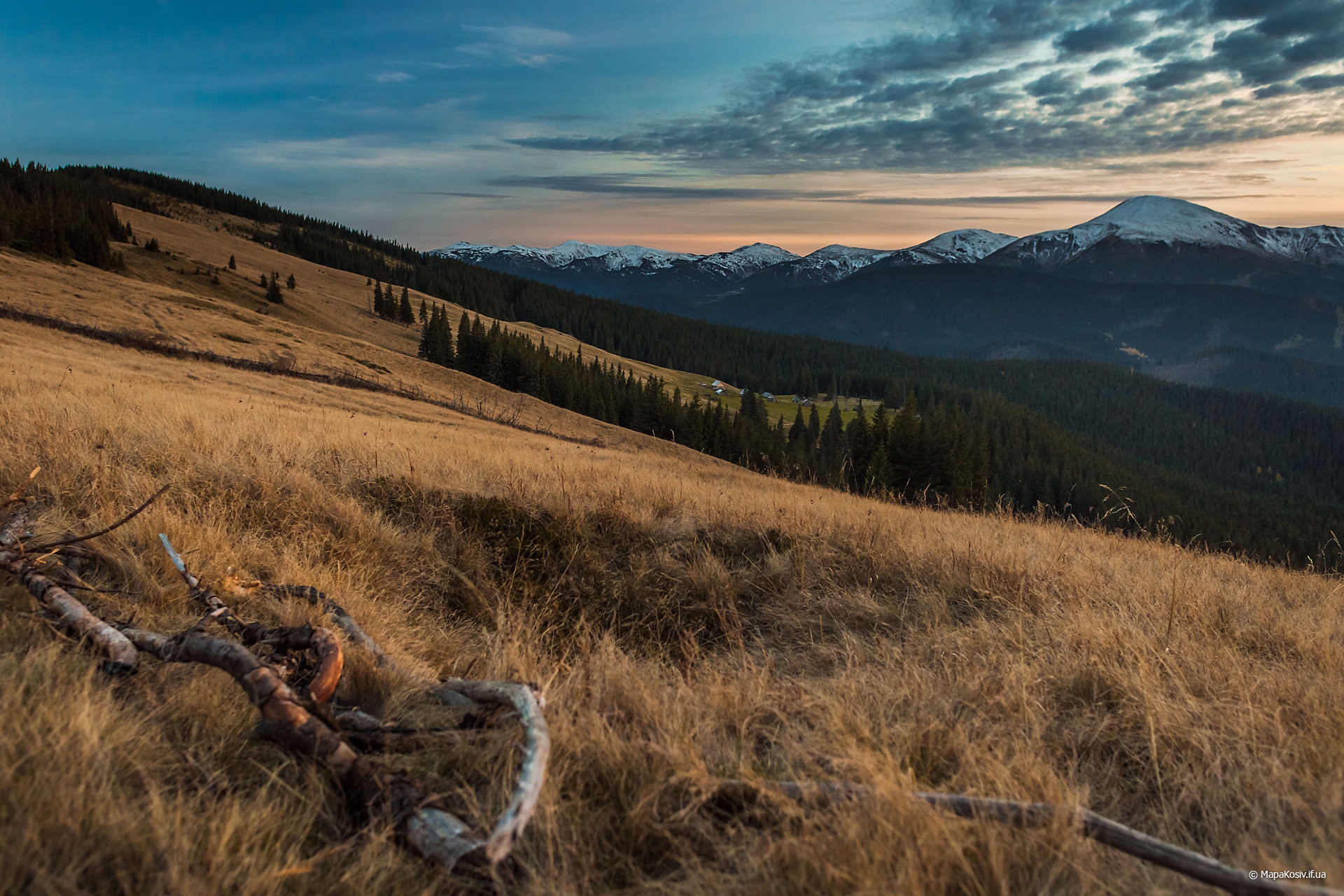
It should be noted right away that Kukul is quite a popular place among tourists throughout the year, given its accessibility, breathtaking views of Chornohora and a large number of kolybas. However, although six kolybas are available to travelers, there are also a lot of people, especially during holidays or weekends. Therefore, I advise you to go off-season or take a tent for insurance. In addition to Chornohora, the Horgan massifs are also clearly visible from Kukul.
There are three marked hiking routes to Mount Kukul.
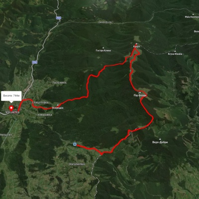
Voronenko - Kukul (via Pid-Berdya), 13 km long, 720 m elevation difference. This is the standard and most popular route to the ridge, given the proximity to the railroad and the magnificent views along the route. It is worth seeing the majestic Petros and the Gorgany from the Voronenka side. There are also several kolybas where you can stay, and run up to the ridge without a heavy backpack and equipment.
To get to the route from Kosiv, you should leave the city in the morning at 6-7 a.m. to catch the diesel train "Rakhovoz" that departs from Kolomyia at 8-15. At 10:30-10:40 you will be at the station in the village of Voronenko, where the ascent begins. It is worth walking another 2 kilometers towards Zakarpattia to the tunnel and, later, you will see a yellow stand and marker, following which you will get to the top of Kukul in 4-5 hours. This road is often used by tourists from big cities on their way back, but since we need to return to Kosiv, we can take two other routes towards Vorokhta.
Vorokhta - Kukul (via Oseredok), length 12 km, altitude difference 800 m. I would not recommend this route option to people, except for those who have settled or live in Vorokhta. You will see almost nothing but a long road through the forest. The descent is very long and boring, and since it's on the north side, it's often knee-deep in mud. In addition, this is the longest option for going up and down Kukul. In short, the route is for "amateurs". The only positive thing is the panorama of Vorokhta at the end of the descent.
Checkpoint "Chornohora" (Zavoyela) - Kukul, 7 km long, 580 m altitude difference. In my opinion, for Kosiv residents and tourists in general, this is the fastest and best way down. Firstly, you can see Chornohora in some places, especially on the Zakukul meadow, and secondly, it is close to civilization. After all, a lot of transport goes from the checkpoint to the Hoverla area and back to the Bukovel-Vorokhta-Verkhovyna highway. So we were driven to the road, although we walked 4-5 km on a flat road from the checkpoint.
Accommodation around Polonyna Kukul (Kukul), Voronenko:


Nearby hiking trails near Polonyna Kukul (Kukul), Voronenko:


Which trails pass by Polonyna Kukul (Kukul), Voronenko?
We suggest these hiking trails through or near Polonyna Kukul (Kukul), Voronenko: Voronenko village, via Mount Kukul to Vorokhta, Voronenko village, via Mount Kukul to Kryvopillia village, Vorokhta, via Mount Kukul to Yasinia, Voronenko village, via Mount Kukul to Staishche village, Voronenko village – Mount Kukul, Mount Kukul – Vorokhta