Niżnie Rysy
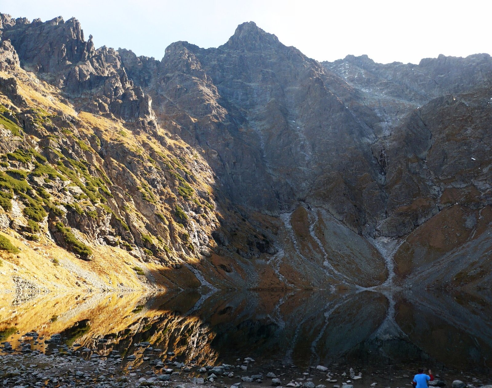
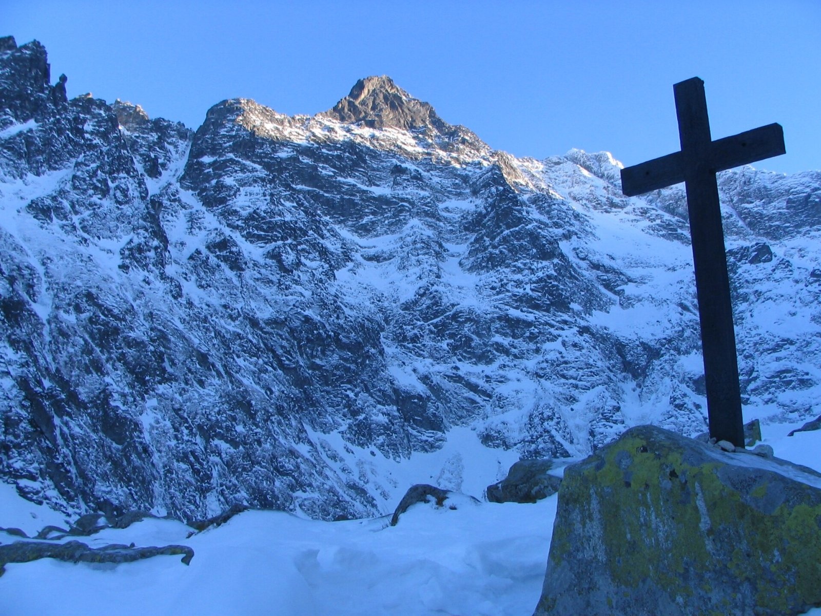
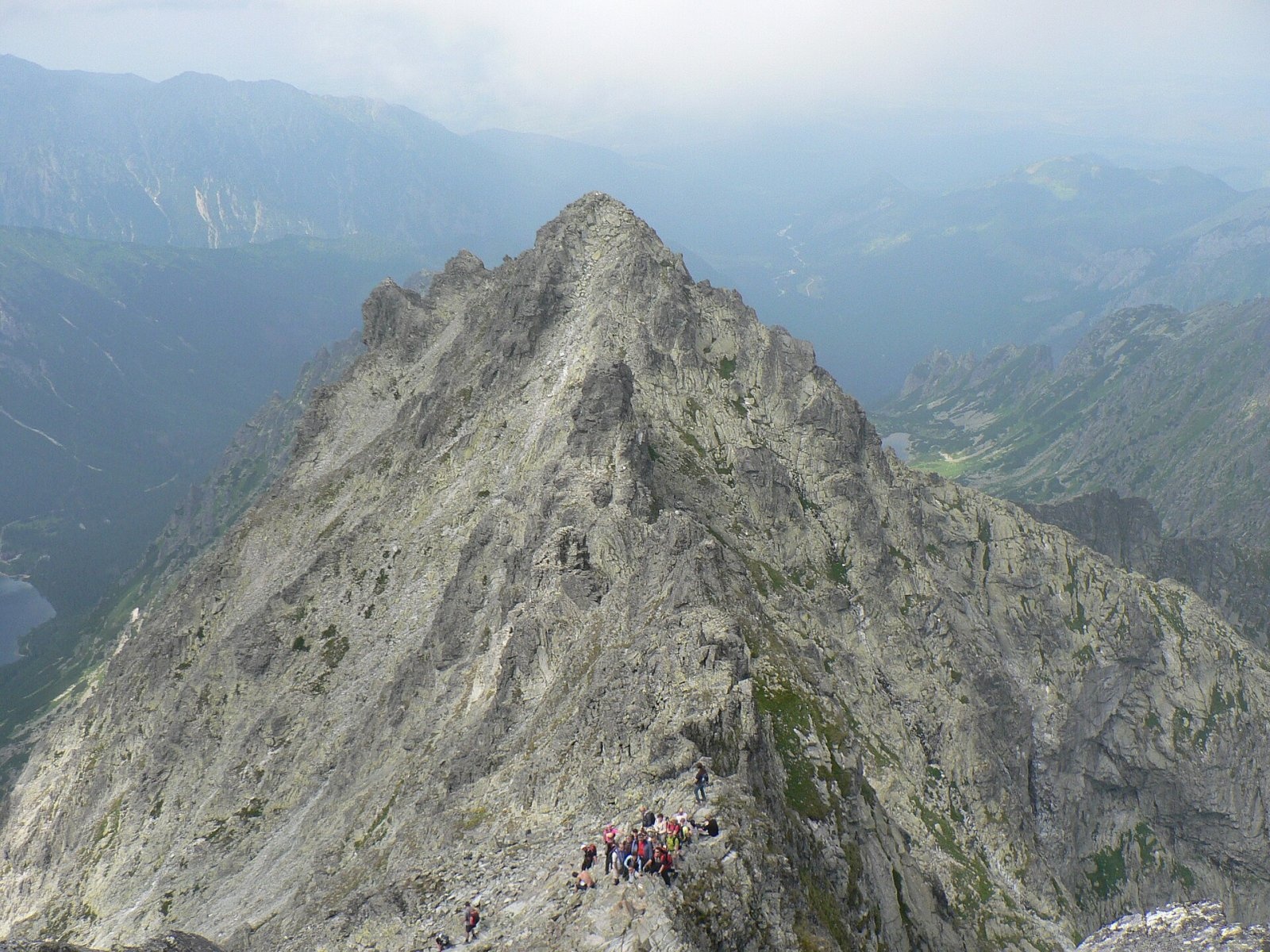
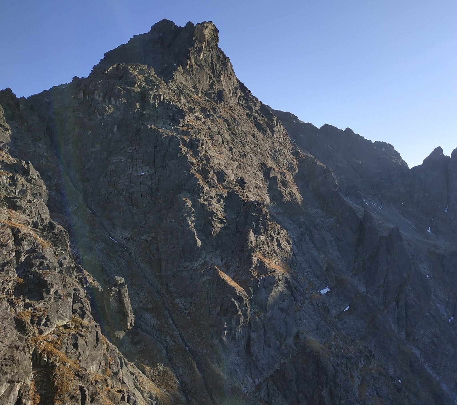
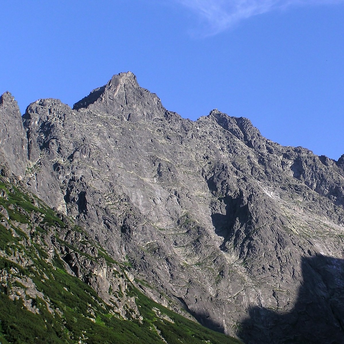
Niżnie Rysy (Slovak Malé Rysy, German Dénesspitze) is a 2,430 m summit of the High Tatras on the northern ridge of Rysy, which carries the Polish–Slovak border. The ridge separates the Polish Rybi Potok valley from the Slovak Bielovodská dolina. Niżnie Rysy lies between the middle (north-western) top of Rysy, separated by Przełęcz pod Rysami (2,365 m), and Żabi Szczyt Wyżni beyond Ciężka Przełączka. It is the third-highest mountain in Poland after Rysy and Mięguszowiecki Szczyt Wielki. The Polish and Slovak names come from neighbouring Rysy, while the German and Hungarian names honour the Spiš mountaineer Franz Dénes (1845–1934).
The massif has four granite towers: the southern (about 2,405 m), the main (2,430 m), Zadnia Turnia (about 2,410 m) and Skrajna Turnia (about 2,375 m). The sheer north-west face, about 650 m high, towers over Morskie Oko and Czarny Staw pod Rysami, and a side spur with the Tomkowe Igły needles — named after the Tatra guide Józef Gąsienica Tomków — runs west from the third tower.
How to get there / routes
There is no marked hiking trail to the summit. The easiest routes to the main top are graded very easy (0) or easy (0+) on the Tatra climbing scale: about 15 minutes from Przełęcz pod Rysami, or about 30 minutes from the marked trail via the Kocioł pod Rysami cirque. Both are reached by the red marked trail to Rysy from Morskie Oko via Czarny Staw pod Rysami. The southern top is much harder to reach. Many climbing routes, from grade II to VI, cross the north-west face.
The nearest starting points on the Polish side are Palenica Białczańska and Łysa Polana, from where the road leads to Morskie Oko; on the Slovak side, Štrbské Pleso.
What you can see from the summit
From the main top you look down on the Slovak side — the Bielovodská and Ťažká valleys — and on the Polish side to Morskie Oko and Czarny Staw pod Rysami. Niżnie Rysy itself is best seen from the shores of these lakes and from the summit of Rysy.
Nature and history
Plants rare in Poland, found in the country only in the Tatras and at few sites, grow on Niżnie Rysy: one-flowered chickweed, Carpathian cat's-foot, rock wormwood, recurved saxifrage, Hungarian fleabane and alpine bent. On the Polish side below Przełęcz pod Rysami there is the 7 m Tomkowa cave — a rarity in the granite part of the Tatras. Chamois and marmots visit the summit area.
The first summer ascent was made by Janusz Chmielowski, Adam Kroebl and Jakub Bachleda on 18 July 1905, the first winter ascent by Józef Lesiecki, Józef Oppenheim, Mariusz Zaruski and Stanisław Zdyb on 6 February 1914. Krzysztof Zdzitowiecki first reached the southern top in July 1964.
Safety, season and rules
The summit lies in Tatra National Park (TPN) on the Polish side and in TANAP on the Slovak side. Entry to TPN is paid; leaving the marked trails is allowed only for climbing under park rules, so only experienced climbers should go on their own, everyone else with a licensed guide. TANAP's high-mountain marked trails are closed from 1 November to 31 May. The red Rysy trail has chains, holds snow late into the season, and the slopes are avalanche-prone. On the Polish side rescue is provided by TOPR: 985 or +48 601 100 300; on the Slovak side by HZS: 18 300 (+421 18 300). The general emergency number is 112.
Interesting facts
- Niżnie Rysy should not be confused with the lower top of Rysy itself — they are different mountains with completely different German names: Meeraugspitze and Denesspitze.
- Bula pod Rysami (2,054 m) is often wrongly counted as part of the Niżnie Rysy massif; in fact it is connected to Rysy.
Photos: Rafal Sikora, CC BY-SA 3.0; Op, CC BY-SA 3.0; Krzysztof Dudzik-Górnicki (User:ToSter), CC BY-SA 3.0; Adam Opioła, CC BY-SA 4.0; Andrzej Makarczuk,, CC BY-SA 2.5; MOs810, CC BY-SA 4.0; Op, CC BY-SA 3.0 — Wikimedia Commons.
Getting there from Ukraine
Border crossings
- Krakovets – Korczowa — road, 24/7
- Shehyni – Medyka — road, 24/7 Pedestrian crossing is not confirmed by the Ukrainian border service — check dpsu.gov.ua before the trip.
- Smilnytsia – Krościenko — road, 24/7
- Hrushiv – Budomierz — road, 24/7
- Mostyska – Przemyśl (rail) — rail, 24/7
By car
Lviv – Zakopane ≈421 km, ≈5 h 10 min without border queues. Route: M-10 Lviv – Krakovets → Krakovets – Korczowa checkpoint → A4 motorway (Rzeszów – Tarnów – Kraków) → Kraków southern bypass → S7/DK7 → DK47 ('Zakopianka') via Nowy Targ → Zakopane. The A4 Katowice – Kraków section (Balice and Mysłowice toll plazas) is tolled, but this route does not use it. In summer and at weekends the DK47 near Zakopane is often congested.
Checked 23.10.2026; border crossing hours and timetables change — check before you travel.
Location on the map
Water and shelter nearby
- Hut under Rysy980 m · Standing · 2 250 m
- Spring below Kazalnica Mięguszowiecka1.6 km · Not verified · 1 884 m
- Spring below Mengusovský Volovec1.8 km · Not verified · 1 977 m
- Spring below Apostoły1.9 km · Not verified · 1 411 m
- Morskie Oko Hut2.3 km · Standing · 1 410 m
- Rumanov potok Spring2.4 km · Not verified · 1 934 m
- Spring below Zlomisková veža (south-east slope), 1 861 m2.6 km · Not verified · 1 861 m
- Spring below Zlomisková veža (south-east slope), 1 836 m2.6 km · Not verified · 1 836 m
- Spring below Zlomisková veža (south-east slope), 1 835 m2.7 km · Not verified · 1 835 m
Comments
Trails nearby
All trails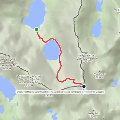 HardOne-dayMarkedMorskie Oko Rysyvia Czarny StawElevation profile1 401–2 501 m3.4 kmascent 1 100 m≈ 3 h walkingunder 1 km from Niżnie Rysy
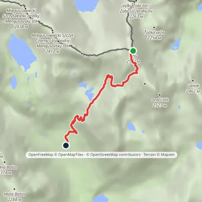 HardOne-dayMarkedJunction at Žabí potok RysyElevation profile1 626–2 501 m4.3 kmascent 875 m≈ 3 h walkingunder 1 km from Niżnie Rysy
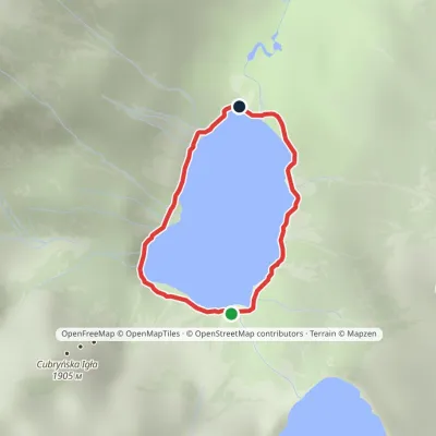 EasyOne-dayMarkedAround Morskie OkoElevation profile1 395–1 423 m2.5 kmascent 23 m≈ 45 min walking1.7 km from Niżnie Rysy
Nearby attractions
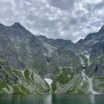 PeakRysyaltitude 2 501 munder 1 km from Niżnie Rysy2 trails to the topRysy (German Meeraugspitze, Hungarian Tengerszem-csúcs) is a mountain on the main ridge of the High Tatras, on the border between Poland and Slovakia.
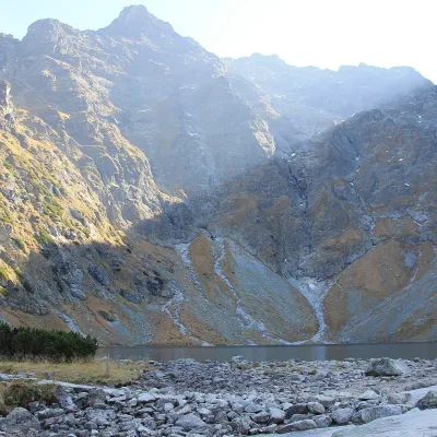 LakeCzarny Staw pod Rysami1 km from Niżnie RysyCzarny Staw pod Rysami (the Black Lake below Rysy) lies in a glacial cirque of the Rybi Potok Valley, directly above Morskie Oko.
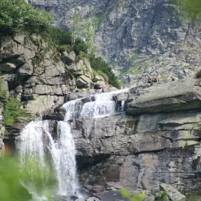 WaterfallCzarnostawiańska Siklawa (Black Lake Falls)1.3 km from Niżnie RysyCzarnostawiańska Siklawa (Black Lake Falls) is a cascading waterfall in the Polish High Tatras, in the Rybi Potok Valley (Dolina Rybiego Potoku) inside Tatra National...
Craft nearby
All craft places Cheese dairies & pasturesShepherd's Hut on Rusinowa PolanaBrzegi8.8 km from Niżnie RysyRusinowa Polana is one of the most beautiful mountain glades in the Polish Tatras, and from May to October it is home to the bacówka (shepherd's hut) of baca Stanisław...
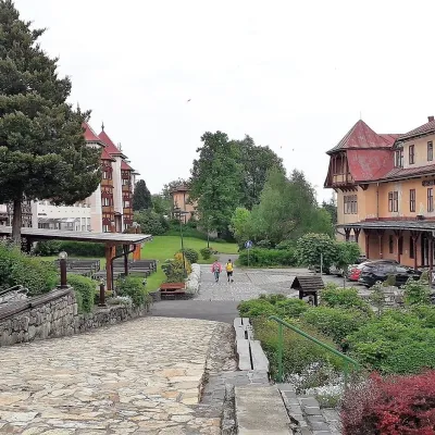 Water parks & thermal poolsClimatic spas of the High Tatras: Nový Smokovec, Polianka, KotlinaVysoké Tatry11 km from Niżnie RysyNový Smokovec is the best known of the climatic spas of the High Tatras. It grew up in a spruce forest at about 1010 m, south-west of Starý Smokovec, with which it...
 Cheese dairies & pasturesFurtek's Shepherd's Huts, Kuźnice and KalatówkiZakopane13 km from Niżnie RysyAbove Kuźnice — the southern edge of Zakopane where most hikes into the Western and High Tatras begin — the flocks are tended by baca Andrzej Staszel, nicknamed "Furtek".
 Koliby & Hutsul cuisineBąkowo Zohylina Wyźnio Highland TavernZakopane14 km from Niżnie RysyBąkowo Zohylina Wyźnio is a regional highland tavern in Zakopane housed in a wooden "szałas" (shepherd-hut-style building) with a view of the Tatras.
 Water parks & thermal poolsTermy Zakopiańskie (Aqua Park Zakopane)Zakopane15 km from Niżnie RysyTermy Zakopiańskie is a thermal water park right in Zakopane, on Jagiellońska Street, only a kilometre from Krupówki.
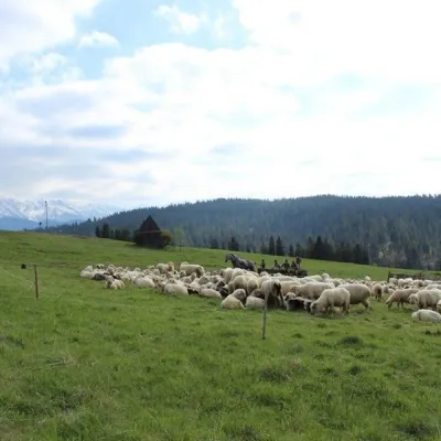 Cheese dairies & pasturesU Jancoka Shepherd's Hut, Brzegi: oscypek from Poland's first female bacaBrzegi15 km from Niżnie RysyThe U Jancoka shepherd's hut (bacówka) stands beside regional road 960, which runs from Bukowina Tatrzańska to the Łysa Polana border crossing, in the village of Brzegi.
