Mountain shelter
Hut under Rysy
Slovakia · High Tatras range · 2 250 m


- Photo: Michal Klajban · CC BY-SA 3.0 · Wikimedia Commons
- Photo: Rafał Kozubek · CC BY-SA 4.0 · Wikimedia Commons
- Photo: To zdjęcie wykonał użytkownik Wikipedii i Wikimedia Commons Tomasz Wachowski. Jeśli chcesz wykorzystać to zdjęcie, proszę o jego podpisanie w następujący sposób: autor: Tomasz Wachowski / Wikipedia, licencja: CC-BY-SA-3.0 W przypadku zamieszczenia zdjęcia na stronie internetowej, poproszę o przesłanie informacji mailowej z adresem tej strony. W przypadku zamieszczenia zdjęcia w publikacji drukowanej, poproszę o przesłanie egzemplarza na mój adres, który podam mailowo po nawiązaniu kontaktu na stronie mojej dyskusji. · CC BY-SA 3.0 · Wikimedia Commons
- Photo: Krzysztof Dudzik-Górnicki (User:ToSter) · CC BY-SA 3.0 · Wikimedia Commons
Condition
StandingNo hikers’ reports yet. According to open data the hut is open in summer only — check its website or call before setting out.
Last edited on the OSM map 22.01.2026
- 2 250 m
- Meals served
- Summer only
Practical info
- Run by: KST a IAMES
- Local name: Chata pod Rysmi
- Season: Summer only — open in summer only, 1 June to 31 October
- Food: Kitchen or buffet
- Built: 1933
- Contacts: chatapodrysmi.com
About
The Hut under Rysy is the highest mountain hut in Slovakia and in the whole High Tatras. It stands at 2250 m on the southern slope of Rysy, about 90 m below the Váha saddle that the summit trail crosses; the top is roughly an hour away.
The Czechoslovak Tourist Club built the hut in 1932 and it welcomed its first guests in summer 1933. The site below the cliffs was chosen because of the nearby border, and it proved prone to avalanches: snow damaged the building several times, worst of all in 2000 and 2001. After a complete rebuild the hut reopened in 2013. It is still supplied by porters who carry 60–90 kg loads on their backs.
The hut is open only from 1 June to 31 October; in winter the red trail from Žabí potok is shut under the TANAP seasonal closure. There is a kitchen and a small dining room. Mountain rescue (HZS): 18 300.
On the map
Coordinates: 49.17460, 20.08699
How to get there
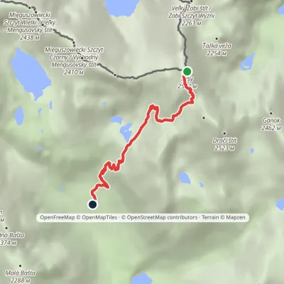
from Štrbské Pleso on the red and blue trails to the junction above Žabí potok (about 1 h 45 min), then the red trail up the Žabia dolina, another 1 h 45 min.
Trails nearby
Report the condition
Been here recently? Tell us what you saw and add photos — your report appears on the page right away with today’s date.
