Mnich
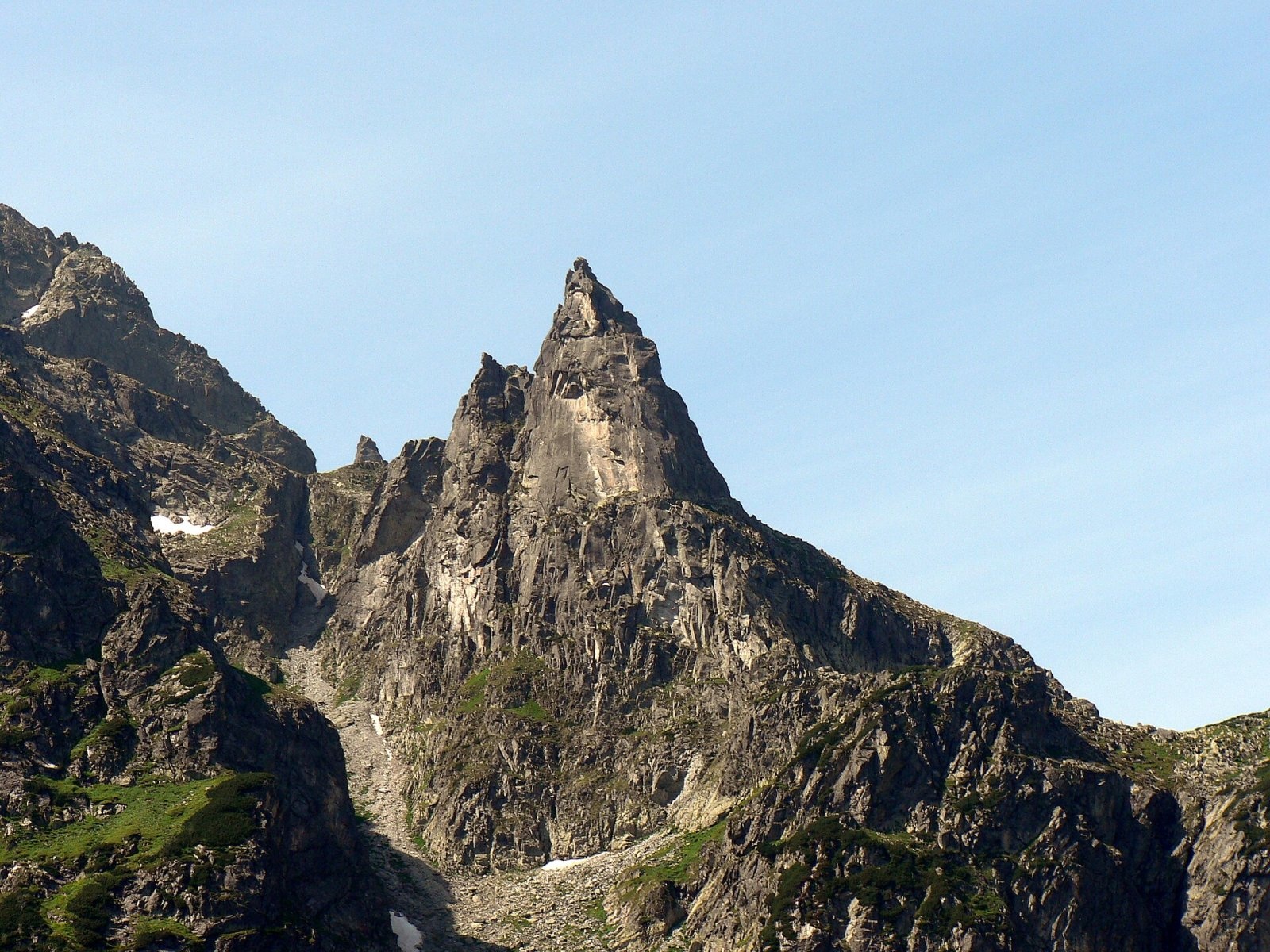
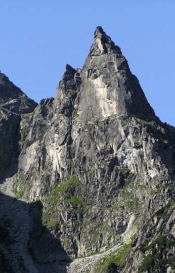
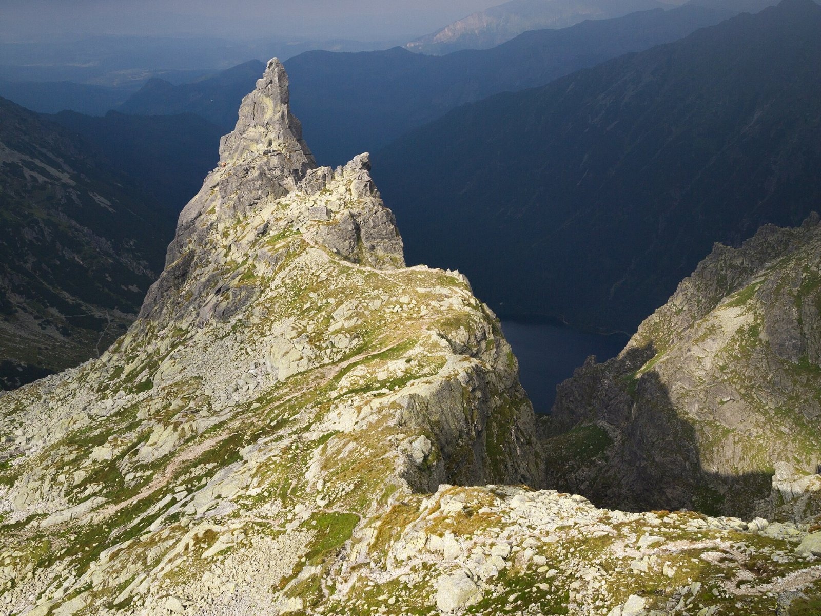
Mnich (Polish for "Monk"; Slovak Mních) is a sharp granite tower, 2,068 m high, in the Polish part of the High Tatras. It stands in the upper Rybi Potok valley above the south-western shore of the lake Morskie Oko, rising above it in a 675 m silhouette. Together with the Mięguszowieckie Peaks it is the most recognisable feature of the scenery around Morskie Oko. The tower is not connected to the main Tatra ridge: its south-western ridge fades into the scree below Cubryna.
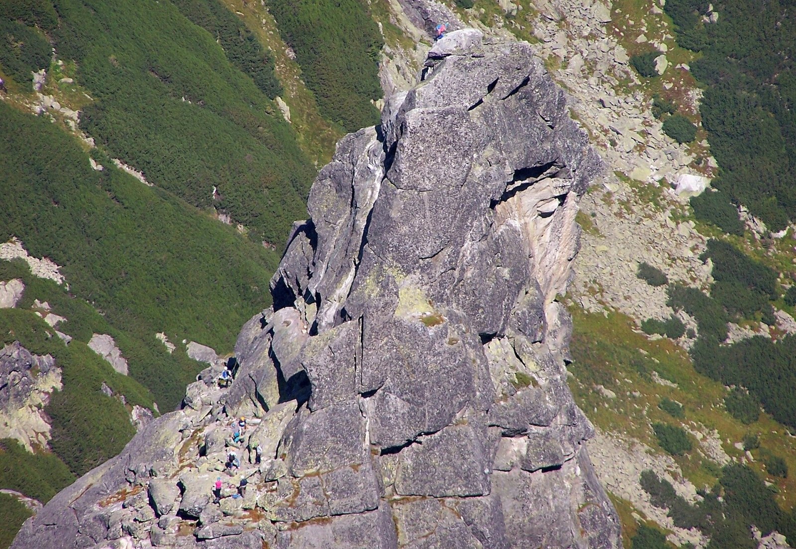
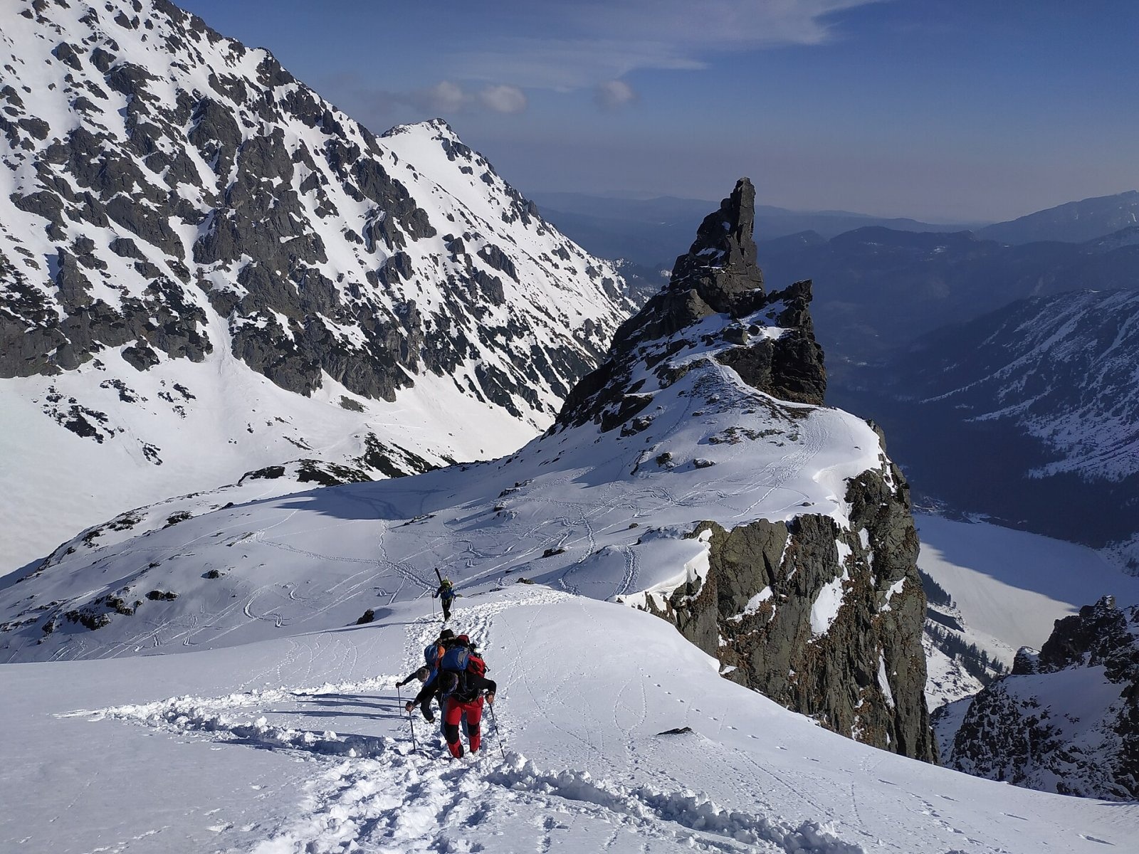
The Mnich massif has three tops — Mnich itself, Mniszek (about 2,045 m) and Ministrant; the walls of Ministrant hold the largest overhang in the Tatras. The tower itself has two close summits, the slightly higher being the north-eastern one, formed by a large sloping block.
How to get there / trails
No marked hiking trail leads to the summit of Mnich — it is a climbers' objective only. The easiest route, known as "through the slab", starts from the west, from the Dolina za Mnichem valley, and still requires climbing skills and a rope. The hardest is the almost vertical north-east face, about 260 m high and visible from Morskie Oko; several easier lines ("Przez płytę", "Klasyczna", "Orłowskiego") are often used for climbing courses.
Hikers see Mnich best from the shore of Morskie Oko and from the nearby marked trails. An asphalt road leads to the lake from the car park at Palenica Białczańska (8.5 km, closed to private cars, about 2 h 20 min). From Morskie Oko the yellow trail climbs over the threshold of Dolina za Mnichem and the slopes of Miedziane to the Szpiglasowa Pass (about 2 h 30 min), and from the valley threshold the red trail leads to the Wrota Chałubińskiego pass (about 1 hour). These trails give close views of the tower, and in Dolina za Mnichem you can clearly see the climbers' paths heading to its walls.
What you can see from the summit
According to German Wikipedia, the summit of Mnich offers one of the finest panoramas in the Tatras, over the whole Rybi Potok valley including Morskie Oko. To the south stands the similarly shaped but less spectacular Zadni Mnich, and to the south-east the massif of Cubryna and the Mięguszowieckie Peaks.
Nature and history
The name was most likely given by shepherds and hunters: the shape recalls a monk in a cloak with a hood. It was first recorded in 1721 by Gabriel Rzączyński, who wrote in Latin of a rock above Morskie Oko that from afar looks like a seated monk. In the 19th century Mnich was described by poets, including Seweryn Goszczyński. Three other peaks near Morskie Oko have similar names — Zadni Mnich, Żabi Mnich and Roztocki Mnich. Several caves lie in the east face at about 1,900 m, among them Studnia w Mnichu.
The first ascent was made in 1879 or 1880 by twenty-year-old Jan Gwalbert Pawlikowski and the guide Maciej Sieczka: they had 15 metres of hemp rope and climbed the whole route barefoot. The event is sometimes regarded as the birth of Polish Tatra mountaineering. The first woman on top, in 1902, was Wanda Herse, led by the guide Klimek Bachleda, and the first winter ascent dates from 6 March 1910. In 1941 the Nazis put a wooden swastika on the face visible from Morskie Oko; Polish climbers Czesław Łapiński and Kazimierz Paszucha loosened its fixings at night, and the sign fell in a gale.
Safety, season and rules
Mnich lies in Tatra National Park (TPN), which charges an entry fee. Leaving marked trails is allowed only for climbing in designated areas; the Morskie Oko area, including the side ridge of Mnich, is one of them. No special climbing licence is needed, but every climb must be registered — in the climbers' log book (at the PTTK hut by Morskie Oko) or online on the park's website. Approach the walls by the shortest safe route from the nearest marked trail; camping and bivouacking are forbidden in the park. Without climbing experience the summit can only be reached with a licensed mountain guide.
In winter the slopes of the Rybi Potok valley are prone to avalanches. Mountain rescue in the Tatras is provided by TOPR: 985 or +48 601 100 300, plus the general emergency number 112.
Interesting facts
- The outline of Mnich appears on the badges of Tatra mountain guides.
- In 2018 Mariusz Biedrzycki climbed the entire north-east face solo and unroped, from its foot to the summit.
- The tower has "starred" in films: in 1961 a short film, "Wariant R", was made about an ascent of the Długosz–Pietsch route.
Photos: Krzysztof Dudzik-Górnicki (User:ToSter), CC BY-SA 3.0; Andrzej Makarczuk, Public domain; Adam Opioła, CC BY-SA 4.0; Adam Opioła, CC BY-SA 4.0; Rafał Kozubek, CC BY-SA 4.0; The original uploader was Makarczuk at Polish Wikipedia., CC BY-SA 2.5; User:EMeczKa, CC BY-SA 4.0 — Wikimedia Commons.
Getting there from Ukraine
Border crossings
- Krakovets – Korczowa — road, 24/7
- Shehyni – Medyka — road, 24/7 Pedestrian crossing is not confirmed by the Ukrainian border service — check dpsu.gov.ua before the trip.
- Smilnytsia – Krościenko — road, 24/7
- Hrushiv – Budomierz — road, 24/7
- Mostyska – Przemyśl (rail) — rail, 24/7
By car
Lviv – Zakopane ≈421 km, ≈5 h 10 min without border queues. Route: M-10 Lviv – Krakovets → Krakovets – Korczowa checkpoint → A4 motorway (Rzeszów – Tarnów – Kraków) → Kraków southern bypass → S7/DK7 → DK47 ('Zakopianka') via Nowy Targ → Zakopane. The A4 Katowice – Kraków section (Balice and Mysłowice toll plazas) is tolled, but this route does not use it. In summer and at weekends the DK47 near Zakopane is often congested.
Checked 23.10.2026; border crossing hours and timetables change — check before you travel.
Location on the map
Water and shelter nearby
- Spring below Kazalnica Mięguszowiecka1 km · Not verified · 1 884 m
- Spring below Apostoły1.5 km · Not verified · 1 411 m
- Morskie Oko Hut1.5 km · Standing · 1 410 m
- Spring below Mengusovský Volovec1.8 km · Not verified · 1 977 m
- Spring below Mała Kotelnica / Malá Kotolnica (south slope), 1 627 m2.1 km · Not verified · 1 627 m
- Spring below Mała Kotelnica / Malá Kotolnica (south slope), 1 598 m2.3 km · Not verified · 1 598 m
- Five Polish Ponds Hut2.4 km · Standing · 1 671 m
- Wrzące Spring2.4 km · Not verified · 1 371 m
- Spring below Posledný chrbát (north-west slope)2.7 km · Not verified · 1 502 m
- Spring below Posledný chrbát (south-west slope)2.8 km · Not verified · 1 525 m
Comments
Trails nearby
All trails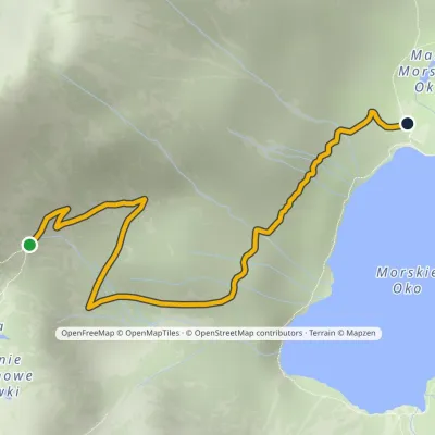 ModerateOne-dayMarkedPod Mnichem Junction to Szpiglasowa PassElevation profile1 409–1 794 m2.3 kmascent 8 m≈ 30 min walkingunder 1 km from Mnich
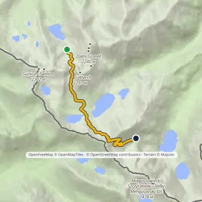 HardOne-dayMarkedZmarzły Staw Pod Mnichemvia Kozia Przełęcz, Szpiglasowa PrzełęczElevation profile1 711–2 113 m6.5 kmascent 682 m≈ 3 h walkingunder 1 km from Mnich
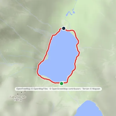 EasyOne-dayMarkedAround Morskie OkoElevation profile1 395–1 423 m2.5 kmascent 23 m≈ 45 min walkingunder 1 km from Mnich
Nearby attractions
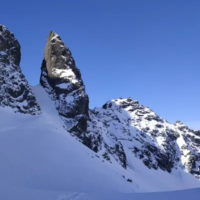 PeakZadni MnichBukowina Tatrzańskaaltitude 2 172 munder 1 km from MnichZadni Mnich (Slovak Druhý Mních, German Mönch II) is a 2,172 m rock summit on the main ridge of the High Tatras, on the Polish–Slovak border.
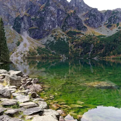 LakeMorskie Oko1.2 km from MnichMorskie Oko (“Eye of the Sea”) is a glacial lake in the Rybi Potok Valley at 1,395 m, at the foot of the Mięguszowieckie peaks.
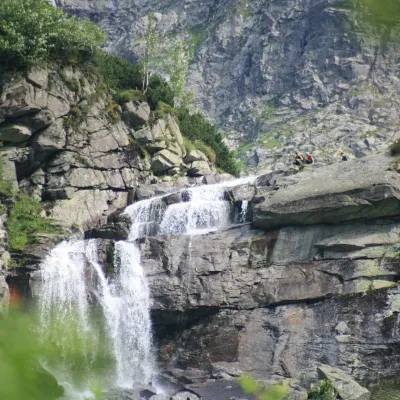 WaterfallCzarnostawiańska Siklawa (Black Lake Falls)1.4 km from MnichCzarnostawiańska Siklawa (Black Lake Falls) is a cascading waterfall in the Polish High Tatras, in the Rybi Potok Valley (Dolina Rybiego Potoku) inside Tatra National...
Craft nearby
All craft places Cheese dairies & pasturesShepherd's Hut on Rusinowa PolanaBrzegi8.2 km from MnichRusinowa Polana is one of the most beautiful mountain glades in the Polish Tatras, and from May to October it is home to the bacówka (shepherd's hut) of baca Stanisław...
 Cheese dairies & pasturesFurtek's Shepherd's Huts, Kuźnice and KalatówkiZakopane11 km from MnichAbove Kuźnice — the southern edge of Zakopane where most hikes into the Western and High Tatras begin — the flocks are tended by baca Andrzej Staszel, nicknamed "Furtek".
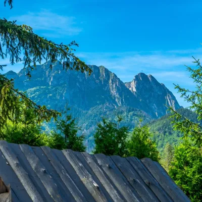 Koliby & Hutsul cuisineBąkowo Zohylina Wyźnio Highland TavernZakopane12 km from MnichBąkowo Zohylina Wyźnio is a regional highland tavern in Zakopane housed in a wooden "szałas" (shepherd-hut-style building) with a view of the Tatras.
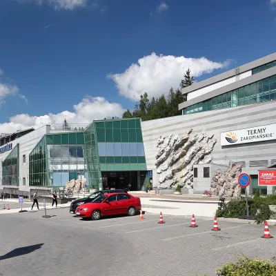 Water parks & thermal poolsTermy Zakopiańskie (Aqua Park Zakopane)Zakopane13 km from MnichTermy Zakopiańskie is a thermal water park right in Zakopane, on Jagiellońska Street, only a kilometre from Krupówki.
 Crafts & workshopsSztukomania Studio, Zakopane: handmade ceramics and pottery workshopsZakopane13 km from MnichSztukomania is a small ceramics and woodwork studio on Staszica street in Zakopane, a few minutes' walk from Krupówki.
 Water parks & thermal poolsClimatic spas of the High Tatras: Nový Smokovec, Polianka, KotlinaVysoké Tatry13 km from MnichNový Smokovec is the best known of the climatic spas of the High Tatras. It grew up in a spruce forest at about 1010 m, south-west of Starý Smokovec, with which it...
