Heľpa, station – Východná
Trail map
Route, springs and shelters: © OpenStreetMap contributors (ODbL) · elevation: Copernicus DEM © DLR e.V., © Airbus DS · Data & licences
About the trail
Route Heľpa, station – Východná. Has blue marking (regional route №2716, KST). Waymarking data: OpenStreetMap (© OpenStreetMap contributors, ODbL).
Officially marked regional tourist route No. 2716. The marking is blue, the sign is a horizontal stripe on a white background. Marked and maintained by: KST. Length of the route — 32.4 km. Location: mountain range — Low Tatras, Slovakia.
At a glance
A route of 32.4 km with 1,179 m of ascent from Heľpa, station to Východná. Estimated walking time: about 10 h, not counting stops — a very long day, so it is easier split into 2 days. Difficulty: hard. Waymarking: blue.
Route stages
- 0–4 kmClimb of 320 m to Muránsko
- 4–7 kmDescent of 330 m (down to 737 m)
- 7–15 kmGentle ups and downs at 730–880 m
- 15–24 kmClimb of 680 m to Priehybka Pass
- 24–29 kmDescent of 810 m (down to 742 m)
- 29–32 kmGentle ups and downs at 630–750 m
Steepest kilometre: km 21–22, a climb of 200 m (≈20%).
Water and overnight stays
Springs near the trail: at km 6, 7, 10, 15, 25, 27 and 30. There are no springs between km 15 and 25 — carry at least 2 l of water.
A possible split into days:
- Day 1: km 0–16, ≈5 h — overnight: no shelter nearby on the map, bring a tent
- Day 2: km 16–32, ≈5 h — finish
When to go
Best time: May to October. In winter deep snow is possible, so experience and winter gear are needed.
Getting there
Start: Heľpa, station. This is a one-way route: the finish is 22 km from the start in a straight line, so plan your way back in advance.
FAQ
- How long does the route take?
- Estimated walking time: about 10 h, not counting stops — a very long day, so it is easier split into 2 days.
- Is there water on the route?
- Springs near the trail: at km 6, 7, 10, 15, 25, 27 and 30. There are no springs between km 15 and 25 — carry at least 2 l of water.
Water and shelter on the route
- Spring below Nad Michalcovoukm 5.7 from the start · Not verified · 816 m
- Spring below Rybíková (south-west slope)km 6.4 from the start · Not verified · 749 m
- Ipoltica Springkm 7.3 from the start · Not verified · 755 m
- Spring below Garajkykm 10.4 from the start · 120 m off the path · Not verified · 800 m
- Dikula Springkm 15.4 from the start · 80 m off the path · Not verified · 899 m
- Spring below Veľká Vápenica (south-east slope)km 24.5 from the start · Not verified · 1 489 m
- Púčik-strúčik Springkm 27.4 from the start · Not verified · 1 064 m
- Spring below Holý vrch (west slope), 697 mkm 30.4 from the start · Not verified · 697 m
- Spring below Holý vrch (south-west slope), 668 mkm 31.1 from the start · 100 m off the path · Not verified · 668 m
Comments
Trails nearby
All trails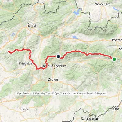 HardMulti-dayMarkedHorná Poruba, U Brdárov Pred ČuntavouElevation profile309–2 004 m241.6 kmascent 15 694 m
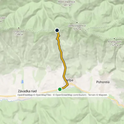 EasyOne-dayMarkedHeľpa, station PriehybaElevation profile636–1 190 m6.7 kmascent 553 m≈ 3 h walking
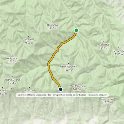 EasyOne-dayMarkedSedlo Priehyba Ipoltica Valley, endElevation profile835–1 190 m8.9 kmascent 355 m≈ 3 h walking
Craft nearby
All craft places Eco farmsFarma Východná — organic farm below the Tatras2.4 km from the trailFarma Východná is the highest-lying organic farm in Liptov, at 930 m in the village of Východná right below the Tatras.
 Horse ridingKone vo Východnej: horse rides below the Tatras4.6 km from the trailKone vo Východnej (“Horses in Východná”) is a small family horse farm on the meadows above the village of Východná in upper Liptov, with a sweeping view of the High...
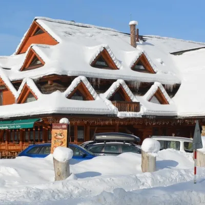 Koliby & Hutsul cuisineKoliba Strachanovka, Jánska valley18 km from the trailKoliba Strachanovka (Jánska koliba) is a large wooden koliba at the entrance to the Jánska valley in the village of Liptovský Ján, which locals consider one of the...
 Water parks & thermal poolsTERMAL raj thermal bath, Liptovský Ján18 km from the trailLiptovský Ján: thermal water at the entrance to Jánska dolina Liptovský Ján is an old village in southern Liptov, about 10 km from Liptovský Mikuláš, at the entrance...
 Cheese dairies & pasturesShepherds' Huts on Polana Chochołowska23 km from the trailPolana Chochołowska is the largest glade in the Polish Tatras and one of the largest in the whole range.
 Cheese dairies & pasturesShepherd's Hut in the Kościeliska Valley24 km from the trailJózef Słodyczka's bacówka (shepherd's hut) on the Wyżnia Kira Miętusia glade is probably the most easily reached shepherds' hut in the Polish Tatras.
