Veľké Solisko
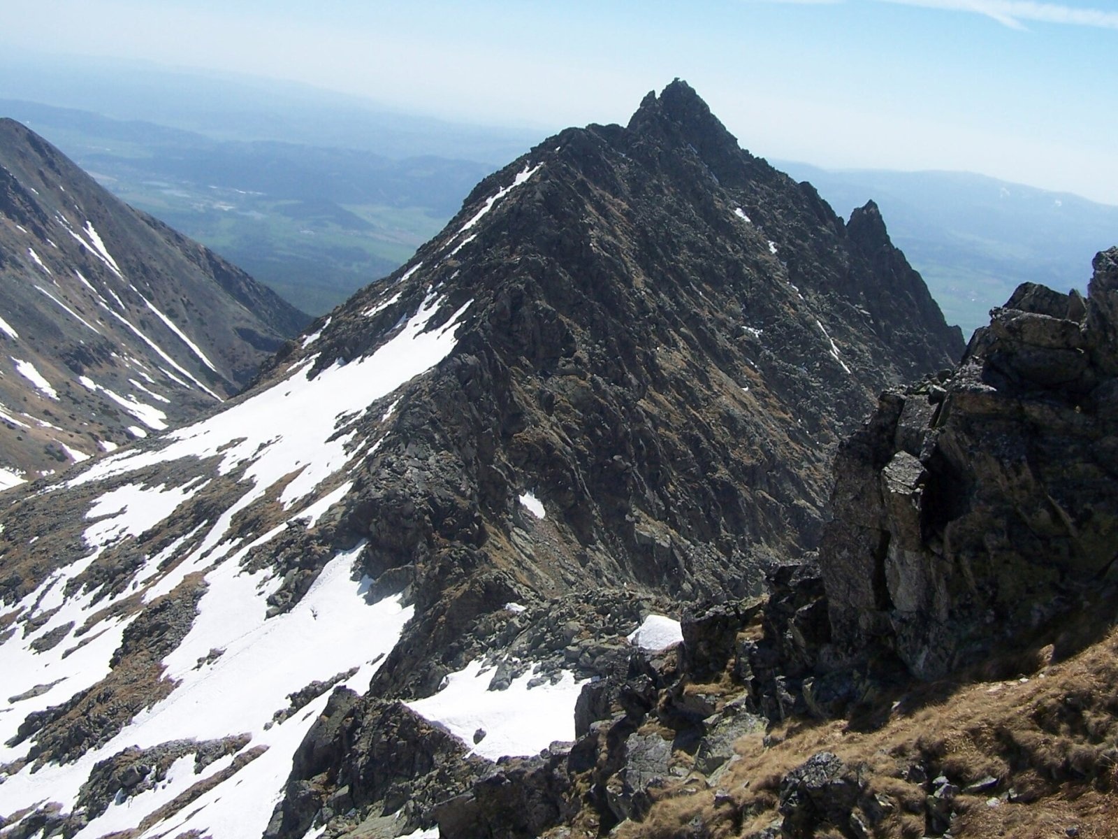
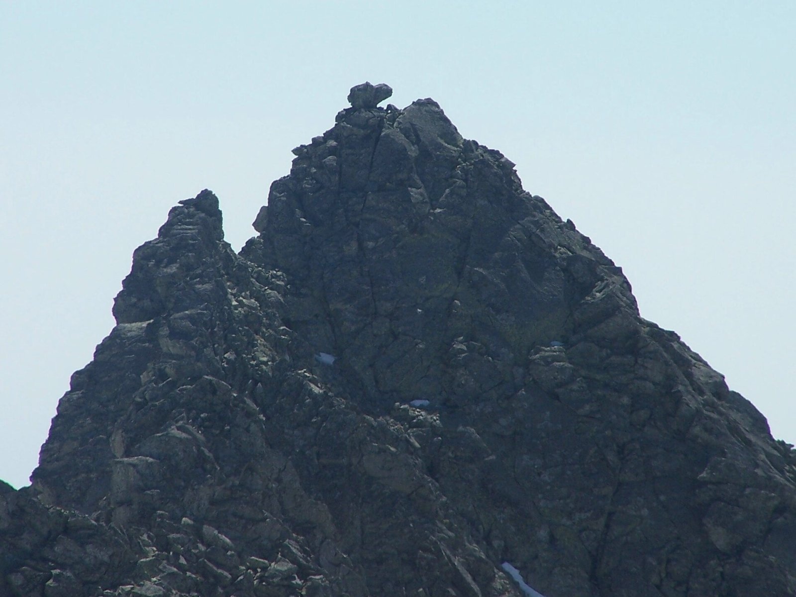
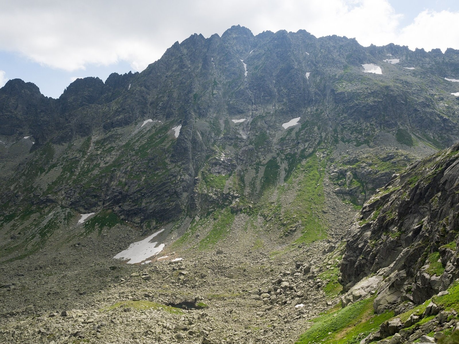
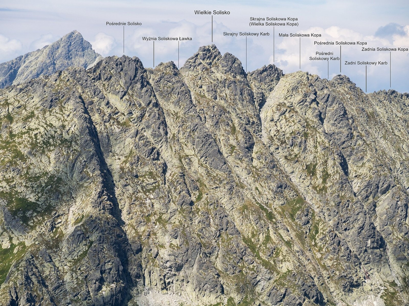
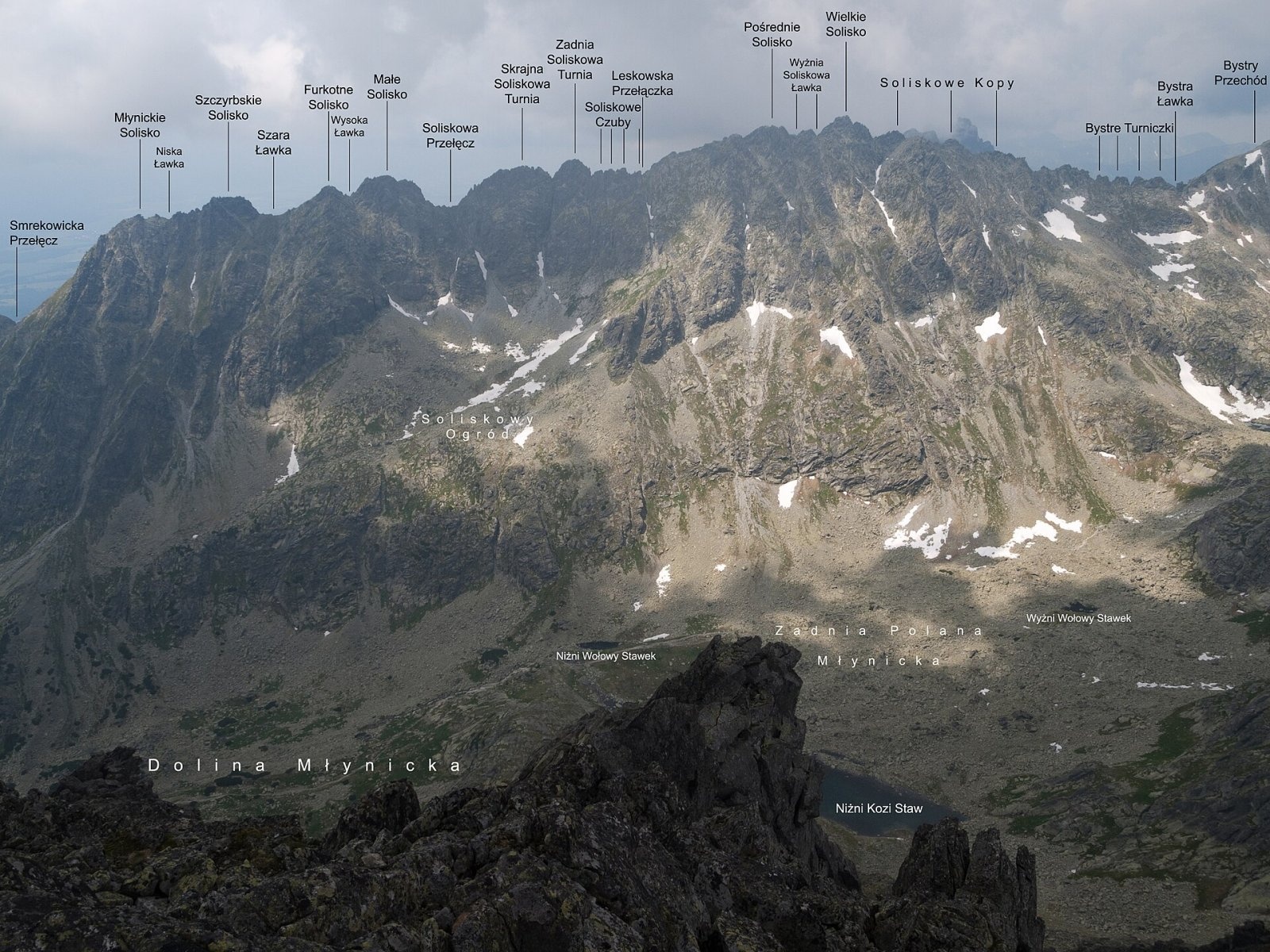
Veľké Solisko (Polish: Wielkie Solisko) is a 2,412 m peak in the Slovak High Tatras and the highest point of the Solisko ridge. This side ridge runs south from Furkotský štít on the Kriváň spur and separates two valleys — Mlynická dolina to the east and Furkotská dolina to the west. The mountain rises above the resort of Štrbské Pleso, about 5.7 km to the south in a straight line, and some 20 km from Poprad. The summit is crowned by a two-metre mushroom-shaped rock block, clearly visible against the sky. The Solisko ridge lies exactly on the watershed between two seas: the western slopes drain via the Furkotský potok, the Váh and the Danube to the Black Sea, the eastern ones via the Mlynica, Poprad, Dunajec and Vistula to the Baltic.
How to get there / routes
There is no marked hiking trail to the summit. Veľké Solisko lies in Tatra National Park (TANAP) and in the Mlynická dolina and Furkotská dolina national nature reserves; climbing off the marked trails is allowed only with a licensed mountain guide (horský vodca) or for members of mountaineering clubs under park rules. The climbing routes described in guidebooks are relatively easy, graded 0+ to II on the Tatra scale.
Hikers can see the mountain close up from marked trails:
- Yellow trail Mlynická dolina – Bystrá lávka – Furkotská dolina: the Bystrá lávka notch (2,315 m) lies just half a kilometre north of the summit, and the path skirts the Solisko ridge on both sides, past the lakes of both valleys.
- A chairlift runs from Štrbské Pleso to Chata pod Soliskom (its stations are about 2 km south of the summit), and from there a marked path climbs Predné Solisko (2,117 m) — the easiest way to view the Solisko ridge from the south. This outing is permitted in winter too.
The view from the summit
According to Slovak Wikipedia, the rocky summit offers a full panorama: many High Tatras peaks and valleys (Kriváň to the west, Furkotský štít and Hrubý vrch to the north, Rysy and Satan to the east) and, beyond, the Volovské vrchy, the Slovak Karst around Spiš and Gemer, Kozie chrbty, the Low Tatras, Veľká Fatra and part of the Orava Beskids. Below the summit lie lakes: the Wahlenberg tarns to the west, Capie pleso to the north-west and Nižné Kozie pleso to the east.
Nature and history
The west face, about 200 m high, drops to Vyšné Wahlenbergovo pleso, while the broad, not very steep east face, some 300 m of ribs and gullies, falls to Mlynická dolina. The pygmy buttercup grows abundantly on its slopes. The name most likely comes from a spot at the foot of Predné Solisko where shepherds put out salt (Slovak "soľ") for sheep and cattle; cartographers unfamiliar with the area transferred it first to the whole ridge and then to its individual peaks. Another theory derives it from an old German word linked to ore mining. Until recently the name Veľké Solisko also covered neighbouring Prostredné Solisko, then considered its subsidiary top. Sources give the height anywhere from 2,404 to 2,414 m.
The first recorded ascent was made on 19 July 1903 by Karol Englisch with the guide Paul Spitzkopf senior, from Furkotská dolina; Englisch named the peak Annaspitze, but the name did not stick. The first winter ascent was by Gyula Hefty and Lajos Rokfalusy in January 1912.
Safety, season and rules
TANAP's high-mountain trails, including the yellow route over Bystrá lávka, are closed from 1 November to 31 May (exceptions include the path to Predné Solisko). Even in summer snow may linger in the notches and gullies, and Tatra weather can change within minutes; ridges are dangerous in thunderstorms. Do not try to reach the summit on your own off the trails — it breaks park rules and is genuinely risky.
- Stay on marked trails; the summit itself only with a mountain guide.
- Emergency numbers in Slovakia: Mountain Rescue Service HZS 18 300 (from a foreign phone +421 18 300) and 112.
Interesting facts
- The roughly 2 m "mushroom" rock on the summit is one of the most distinctive features of the Solisko skyline.
- The Solisko ridge forms the boundary between two national nature reserves — Mlynická dolina and Furkotská dolina.
Photos: Adam Opioła, CC BY-SA 4.0; Adam Opioła, CC BY-SA 4.0; Rafał Kozubek, CC BY-SA 4.0; Rafał Kozubek, CC BY-SA 4.0; Rafał Kozubek, CC BY-SA 4.0; Jakub Hałun, CC BY-SA 4.0 — Wikimedia Commons.
Getting there from Ukraine
Border crossings
- Uzhhorod – Vyšné Nemecké — road, 24/7
- Malyi Bereznyi – Ubľa — road, 24/7 For cars and buses; pedestrians not confirmed by the Ukrainian border service, lorries up to 3.5 t.
- Mali Selmentsi – Veľké Slemence (pedestrian) — pedestrian, 09:00–21:00 Kyiv time Pedestrians and cyclists only; inconvenient for the Tatras without onward transport.
- Chop – Čierna nad Tisou (rail) — rail, 24/7
By car
Uzhhorod – Poprad ≈195 km, ≈2 h 55 min without queues: Uzhhorod – Vyšné Nemecké checkpoint → I/19 via Sobrance and Michalovce → Košice → D1 motorway via Prešov → Poprad (Liptovský Mikuláš is ≈56 km further on the D1, total ≈249 km). Košice – Poprad ≈112 km. The D1 requires an e-vignette (eznamka.sk). Note: from Lviv the fastest way to Poprad is through Poland — Krakovets – A4 – Kraków – Zakopane – Łysa Polana ≈468 km (≈5 h 50 min); via Uzhok and Malyi Bereznyi ≈419 km but slower (≈6 h 40 min). Zakopane – Poprad ≈69 km, Zakopane – Liptovský Mikuláš ≈80 km.
Checked 23.10.2026; border crossing hours and timetables change — check before you travel.
Location on the map
Comments
Trails nearby
All trails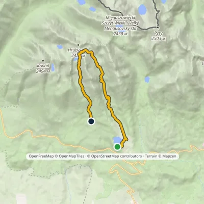 ModerateOne-dayMarkedŠtrbské Pleso Junction below Furkotská ValleyElevation profile1 349–2 298 m12.4 kmascent 924 m≈ 5 h walkingunder 1 km from Veľké Solisko
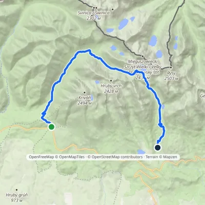 HardTwo-dayMarkedTri studničky, old forester's lodge Popradské Pleso, stopElevation profile1 105–2 142 m21.4 kmascent 1 129 m≈ 7.5 h walking1.7 km from Veľké Solisko
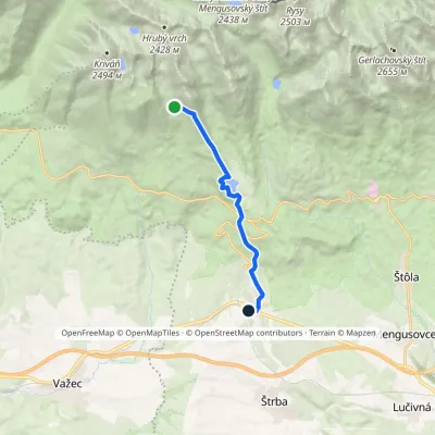 EasyOne-dayMarkedŠkutnastá Meadow Štrba, stationElevation profile894–1 826 m9.8 kmascent 47 m≈ 2.5 h walking1.8 km from Veľké Solisko
Nearby attractions
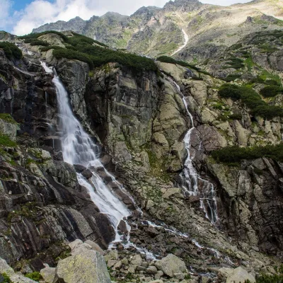 WaterfallSkok Waterfall1.4 km from Veľké SoliskoSkok (Vodopád Skok) is one of the most beautiful waterfalls of the Slovak Tatras. Here the Mlynica stream drops over a rock step that blocks the middle part of the...
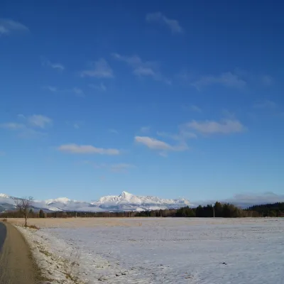 PeakKriváňaltitude 2 495 m2.3 km from Veľké SoliskoKriváň (Polish Krywań) is a 2495 m peak (precisely 2494.7 m) in the south-western part of the High Tatras in Slovakia.
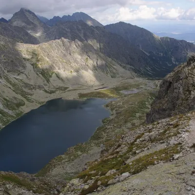 LakeVeľké Hincovo pleso2.7 km from Veľké SoliskoVeľké Hincovo pleso is the largest and deepest glacial lake in the Slovak part of the Tatras and in all of Slovakia.
Craft nearby
All craft places Horse ridingKone vo Východnej: horse rides below the Tatras11 km from Veľké SoliskoKone vo Východnej (“Horses in Východná”) is a small family horse farm on the meadows above the village of Východná in upper Liptov, with a sweeping view of the High...
 Cheese dairies & pasturesShepherd's Hut on Rusinowa Polana12 km from Veľké SoliskoRusinowa Polana is one of the most beautiful mountain glades in the Polish Tatras, and from May to October it is home to the bacówka (shepherd's hut) of baca Stanisław...
 Cheese dairies & pasturesFurtek's Shepherd's Huts, Kuźnice and Kalatówki13 km from Veľké SoliskoAbove Kuźnice — the southern edge of Zakopane where most hikes into the Western and High Tatras begin — the flocks are tended by baca Andrzej Staszel, nicknamed "Furtek".
 Koliby & Hutsul cuisineBąkowo Zohylina Wyźnio Highland Tavern14 km from Veľké SoliskoBąkowo Zohylina Wyźnio is a regional highland tavern in Zakopane housed in a wooden "szałas" (shepherd-hut-style building) with a view of the Tatras.
 Eco farmsFarma Východná — organic farm below the Tatras15 km from Veľké SoliskoFarma Východná is the highest-lying organic farm in Liptov, at 930 m in the village of Východná right below the Tatras.
 Water parks & thermal poolsTermy Zakopiańskie (Aqua Park Zakopane)15 km from Veľké SoliskoTermy Zakopiańskie is a thermal water park right in Zakopane, on Jagiellońska Street, only a kilometre from Krupówki.
