Brzegi
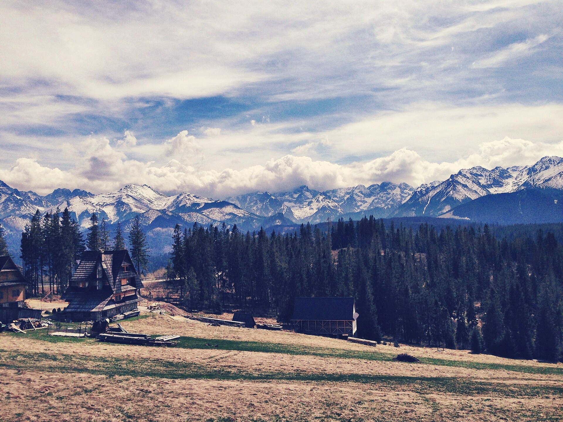
Photos: Eleonora Borodina, CC BY-SA 3.0 pl (Wikimedia Commons)
Brzegi is a village in the administrative district of Gmina Bukowina Tatrzańska, within Tatra County, Lesser Poland Voivodeship, in southern Poland, close to the border with Slovakia. It lies in the scenic region of Podhale and Spiš, on the eastern and western slopes of the Brzegowski Dział ridge, which is part of the Bukowina Foothills. The highest peak here is Cyrhla nad Białką (1155 m). The village is located in the valleys of streams flowing into the Białka river, and offers panoramic views of the Tatras, including Rysy, Gerlach, Muráň, and the Mięguszowieckie Peaks.
The village was established in 1625 under Wallachian law, though it was mentioned as early as the late 16th century. In 1698, King Augustus II granted local meadows called Wierzch Poroniec to the Bigos family. From 1975 to 1998, Brzegi belonged to the Nowy Sącz Voivodeship.
Brzegi is known for its landscapes, especially the scenic Glodówka meadow with a panorama of the Tatras, and for its traditional highlander culture. The village preserves old wooden cottages and roadside chapels, and the local community actively maintains highlander folklore. Many local women are renowned for their embroidery. The parish church of St. Anthony of Padua (built in 1950) is here, and on Rynias hill stands the Scala retreat house and the Chapel of Our Lady of the Mountains. In winter, ski lifts operate, and snow on Glodówka usually lasts until late April.
Visitors can explore numerous hiking trails, such as "Brzeziny – Psia Trawka" and "Wierch Poroniec – Rusinowa Polana," or climb Cyrhla nad Białką. Nearby attractions include the Mickiewicz Waterfalls and Rusinowa Polana, as well as craft workshops like the Bacówka "U Jancoka" in Brzegi and "Drewutnia" in Bukowina Tatrzańska. For accommodation, there are the Roztoka and Glodówka mountain huts, and for relaxation, the Bukovina Thermal Baths and Terma Bania.
Getting there from Ukraine
Lviv – Zakopane ≈421 km, ≈5 h 10 min without border queues. Route: M-10 Lviv – Krakovets → Krakovets – Korczowa checkpoint → A4 motorway (Rzeszów – Tarnów – Kraków) → Kraków southern bypass → S7/DK7 → DK47 ('Zakopianka') via Nowy Targ → Zakopane. In summer and at weekends the DK47 near Zakopane is often congested.
Sources: Wikipedia, Wikidata, OpenStreetMap, Karpaty.rocks data. More on Wikipedia
Trails nearby
All trails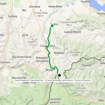 ModerateOne-dayMarkedTrybsz Polana PodokólneElevation profile661–902 m14.6 kmascent 468 m≈ 4.5 h walkingunder 1 km from the centre
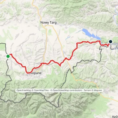 HardMulti-dayMarkedChochołów Trzy Kopce PassElevation profile469–1 132 m65.7 kmascent 1 966 m2.3 km from the centre
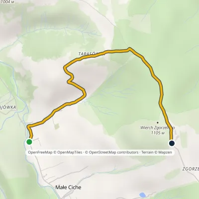 EasyOne-dayMarkedMałe Ciche Zgorzelisko Małe Ciche LichajówkiElevation profile838–1 101 m3.4 kmascent 263 m≈ 1.5 h walking3.3 km from the centre
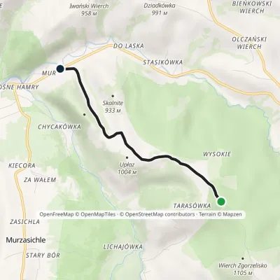 EasyOne-dayMarkedMałe Ciche Stasikówka Małe Ciche WysokieElevation profile808–1 047 m3.5 kmascent 2 m≈ 60 min walking3.5 km from the centre
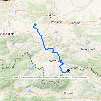 HardMulti-dayMarkedBrzeźnica KacwinElevation profile220–1 289 m143 kmascent 4 206 m4.5 km from the centre
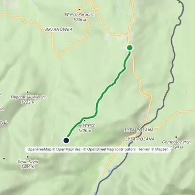 EasyOne-dayMarkedWierch Poroniec Rusinowa PolanaElevation profile1 102–1 209 m3.2 kmascent 124 m≈ 1 h walking4.8 km from the centre
Peaks nearby
All peaks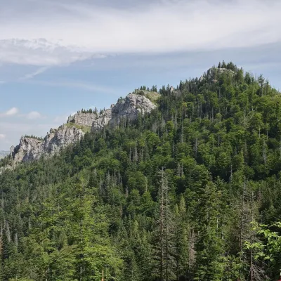 PeakNosalZakopanealtitude 1 206 m11 km from the centre1 trail to the topNosal is a low, wooded 1,206 m summit in the Western Tatras, right above Kuźnice on the south-eastern edge of Zakopane.
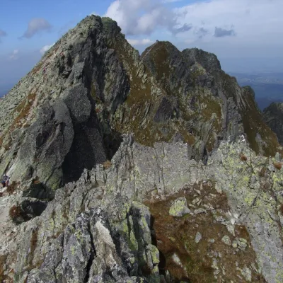 PeakZadni GranatZakopanealtitude 2 240 m13 km from the centreZadni Granat (Slovak Zadný Granát) is the highest of the three tops of the Granaty massif, at 2240 m. It stands on the long eastern ridge of Świnica in the Polish High...
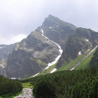 PeakKościelecZakopanealtitude 2 155 m14 km from the centreKościelec is a 2,155 m peak in the High Tatras, in Poland's Dolina Gąsienicowa. It stands on the side ridge of the Kościelce, which runs north from Zawratowa Turnia...
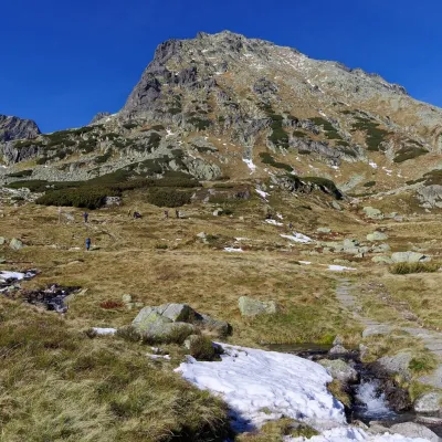 PeakKozi Wierchaltitude 2 291 m14 km from the centre2 trails to the topKozi Wierch (Slovak: Kozí vrch) is a 2,291 m peak in the High Tatras and the highest mountain with noticeable prominence lying entirely within Poland.
 PeakGubałówkaZakopanealtitude 1 126 m14 km from the centreGubałówka is a long, gentle hill above the north-western part of Zakopane and the best-known summit of the Gubałówka Foothills in Podhale.
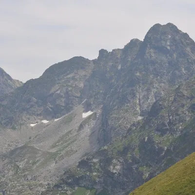 PeakŚwinicaZakopanealtitude 2 302 m15 km from the centreŚwinica (Slovak: Svinica) is a 2,302 m summit on the main ridge of the Tatra Mountains, right on the Polish–Slovak border.
What to visit
All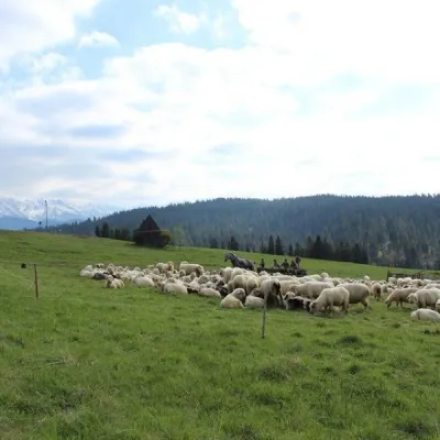 Cheese dairies & pasturesU Jancoka Shepherd's Hut, Brzegi: oscypek from Poland's first female bacaBrzegi1.7 km from the centreThe U Jancoka shepherd's hut (bacówka) stands beside regional road 960, which runs from Bukowina Tatrzańska to the Łysa Polana border crossing, in the village of Brzegi.
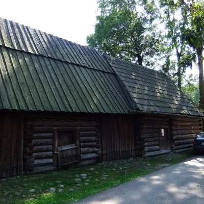 MuseumSołtys Farmstead in JurgówJurgów1.8 km from the centreThe Sołtys Farmstead (Zagroda Sołtysów) is a branch of the Tatra Museum in Jurgów, the south-westernmost village of Polish Spiš, three kilometres from Bukowina...
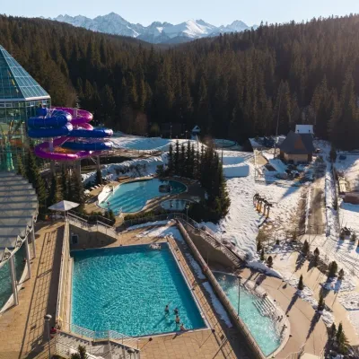 Water parks & thermal poolsTermy BukovinaBukowina Tatrzańska2.5 km from the centreTermy Bukovina is a modern thermal pool complex in Bukowina Tatrzańska, a village lying about a thousand metres above sea level on the edge of the Tatra National Park.
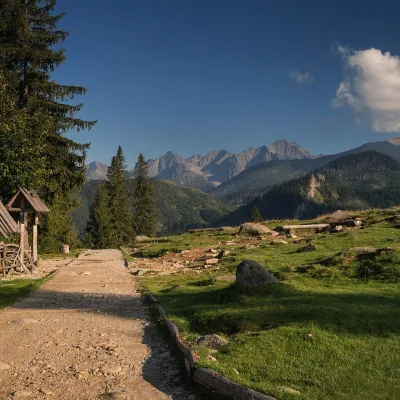 Mountain meadowRusinowa PolanaBrzegialtitude 1 210 m7.8 km from the centreRusinowa Polana is a large mountain glade in the Polish High Tatras, between Gęsia Szyja (1,489 m) and Goły Wierch (1,205 m), inside the Tatra National Park (TPN).
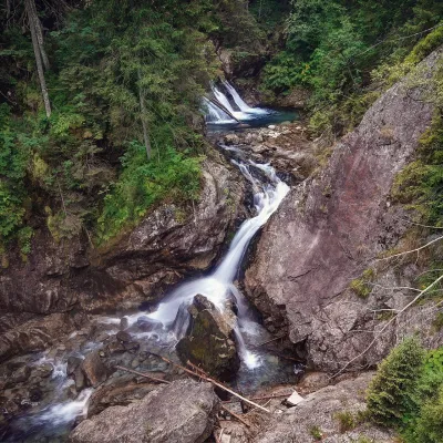 WaterfallWodogrzmoty Mickiewicza (Mickiewicz Waterfalls)Małe Ciche11 km from the centreWodogrzmoty Mickiewicza (the Mickiewicz Waterfalls) are a chain of falls in the High Tatras on the Roztoka stream, which flows out of the Valley of the Five Polish Lakes.
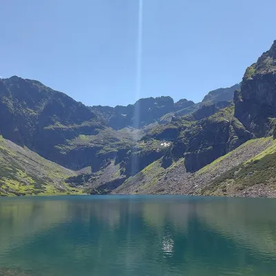 LakeCzarny Staw GąsienicowyZakopane13 km from the centreCzarny Staw Gąsienicowy lies in the High Tatras, in a glacial cirque in the eastern part of the Gąsienicowa Valley, at 1,624 m.
Craft nearby
All craft places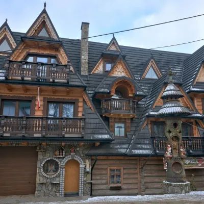 Crafts & workshopsDrewutnia, Bukowina Tatrzańska: glass painting workshops and highland furnitureBukowina Tatrzańska2.4 km from the centreDrewutnia ("the woodshed") calls itself a "shop for cultural needs". It is the family business of the Kuchtas of Bukowina Tatrzańska, who say they have lived here...
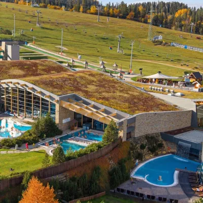 Water parks & thermal poolsTerma BaniaBiałka Tatrzańska7.1 km from the centreTerma Bania is a large thermal water park in the village of Białka Tatrzańska, at the foot of the Kotelnica ski slope.
 Cheese dairies & pasturesShepherd's Hut on Rusinowa PolanaBrzegi7.5 km from the centreRusinowa Polana is one of the most beautiful mountain glades in the Polish Tatras, and from May to October it is home to the bacówka (shepherd's hut) of baca Stanisław...
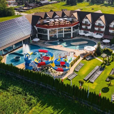 Water parks & thermal poolsTermy Szaflary (Termy Podhalańskie)Bańska Niżna11 km from the centreTermy Szaflary is a thermal complex in the village of Szaflary, between Nowy Targ and Zakopane. It used to be known as Termy Podhalańskie, a name still found in older...
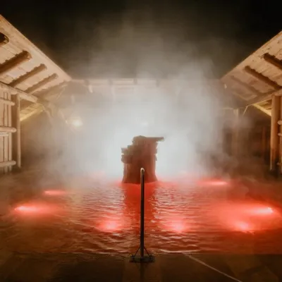 Water parks & thermal poolsTermy Gorący Potok (Szaflary)Bańska Niżna11 km from the centreTermy Gorący Potok is a complex of outdoor thermal pools in Szaflary, between Nowy Targ and Zakopane, about 15 km from Zakopane.
 Cheese dairies & pasturesFurtek's Shepherd's Huts, Kuźnice and KalatówkiZakopane12 km from the centreAbove Kuźnice — the southern edge of Zakopane where most hikes into the Western and High Tatras begin — the flocks are tended by baca Andrzej Staszel, nicknamed "Furtek".
Spas and thermal pools nearby
Water parks & thermal poolsTermy BukovinaBukowina Tatrzańska2.5 km from the centreTermy Bukovina is a modern thermal pool complex in Bukowina Tatrzańska, a village lying about a thousand metres above sea level on the edge of the Tatra National Park.Water parks & thermal poolsTerma BaniaBiałka Tatrzańska7.1 km from the centreTerma Bania is a large thermal water park in the village of Białka Tatrzańska, at the foot of the Kotelnica ski slope.Water parks & thermal poolsTermy Szaflary (Termy Podhalańskie)Bańska Niżna11 km from the centreTermy Szaflary is a thermal complex in the village of Szaflary, between Nowy Targ and Zakopane. It used to be known as Termy Podhalańskie, a name still found in older...Huts, shelters and springs nearby
Getting there from Ukraine
Border crossings
- Krakovets – Korczowa — road, 24/7
- Shehyni – Medyka — road, 24/7 Pedestrian crossing is not confirmed by the Ukrainian border service — check dpsu.gov.ua before the trip.
- Smilnytsia – Krościenko — road, 24/7
- Hrushiv – Budomierz — road, 24/7
- Mostyska – Przemyśl (rail) — rail, 24/7
By car
Lviv – Zakopane ≈421 km, ≈5 h 10 min without border queues. Route: M-10 Lviv – Krakovets → Krakovets – Korczowa checkpoint → A4 motorway (Rzeszów – Tarnów – Kraków) → Kraków southern bypass → S7/DK7 → DK47 ('Zakopianka') via Nowy Targ → Zakopane. The A4 Katowice – Kraków section (Balice and Mysłowice toll plazas) is tolled, but this route does not use it. In summer and at weekends the DK47 near Zakopane is often congested.
Checked 23.10.2026; border crossing hours and timetables change — check before you travel.
