Żabi Szczyt Wyżni
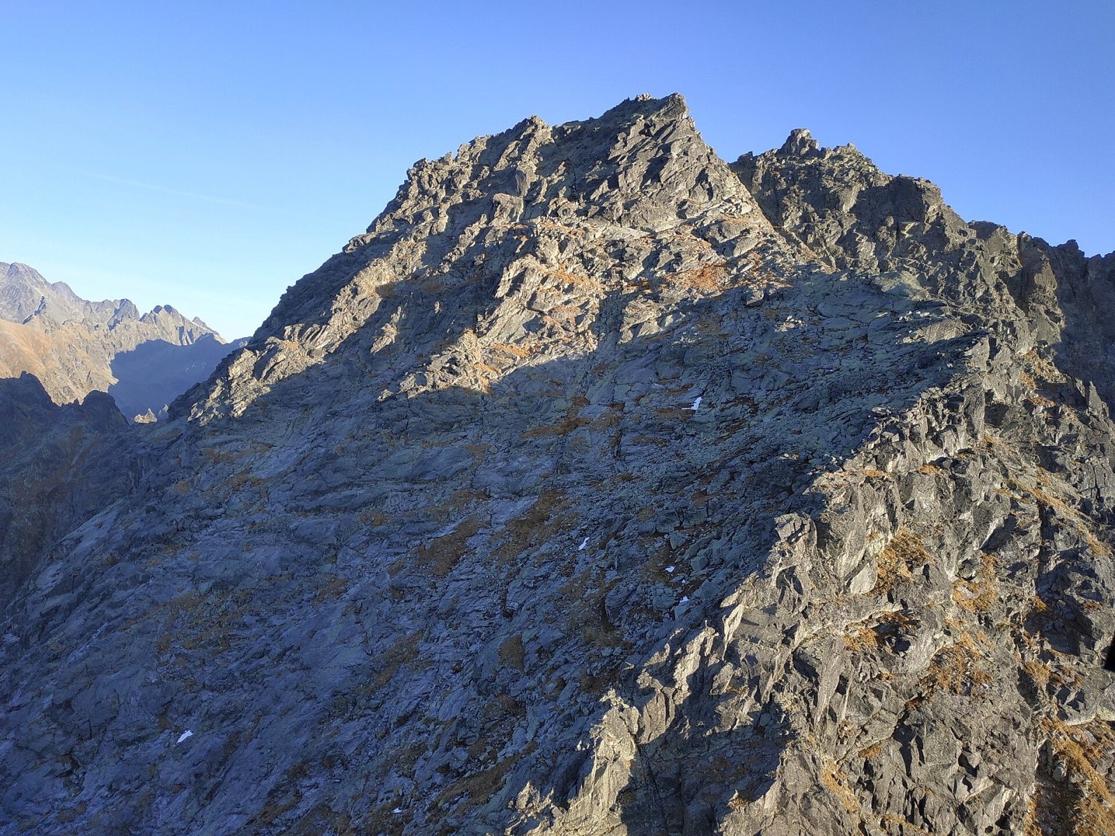
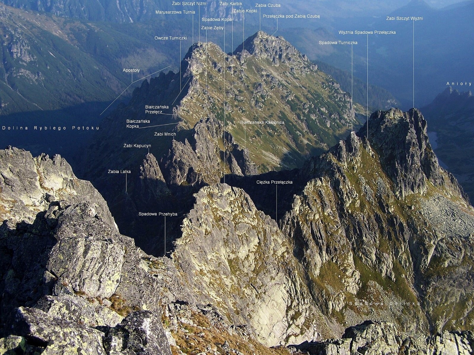
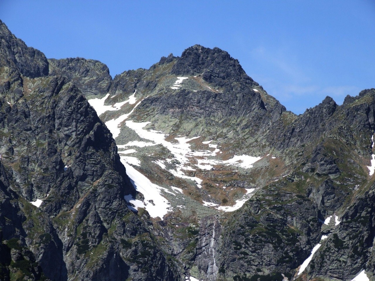
Żabi Szczyt Wyżni (Slovak Vyšný Žabí štít, German Große Froschspitze) is a summit about 2,263 m high in the High Tatras on the border between Poland and Slovakia. It stands on the northern branch of Rysy — the Żabia Grań (Frog Ridge), which separates the Slovak Bielovodská valley from the Polish Rybi Potok valley. It is a junction peak: right next to it on the Żabia Grań lies the Wyżnia Spadowa Przełączka notch (about 2,235 m), described by Polish Wikipedia as the only junction pass in the Tatras.
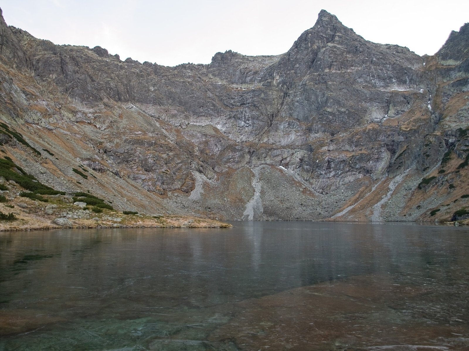
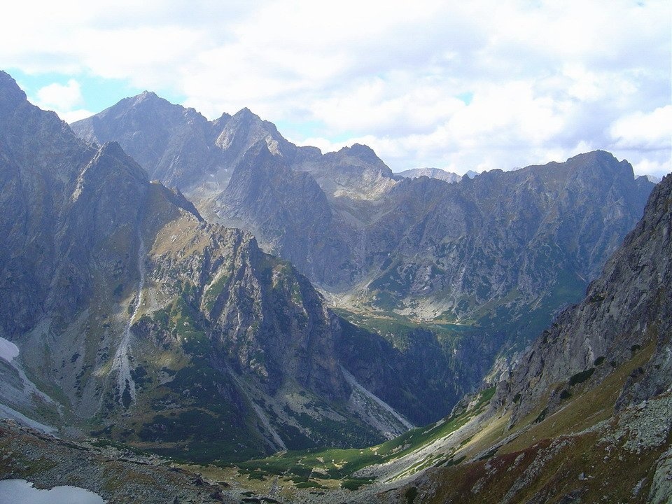
In a wider sense the massif is bounded by three passes: Ciężka Przełączka (towards Niżnie Rysy), Białczańska Przełęcz Wyżnia (towards Żabi Mnich) and Młynarzowa Przełęcz (towards the Młynarz massif). Defined this way, the massif is the highest part of the Frog Ridge and rises above three valleys: the Czarny Staw cirque in the Rybi Potok valley to the west, the Dolina Żabich Stawów Białczańskich to the north and the small Dolinka Spadowa to the south-east. In Slovak it is often inaccurately called "Veľký Žabí štít" — which is also the name used in OpenStreetMap.
How to get there / trails
No marked hiking trail leads to the summit. The easiest climbing routes are relatively simple, but they are still off-trail, so without climbing experience the summit is only accessible with a licensed mountain guide; on the Slovak side the peak lies in a nature reserve and can only be climbed with a guide. The nearest marked trails run through the Rybi Potok valley: an asphalt road leads from the car park at Palenica Białczańska to Morskie Oko (8.5 km, closed to private cars), and from there the red trail to Rysy passes Czarny Staw pod Rysami — the massif of Żabi Szczyt Wyżni towers above the Czarny Staw cirque.
The most important climbing routes ran up the north face, up to 500 m high, which drops into the Slovak valley of the Frog Lakes; the routes start higher up and are about 250 m long (grades III to VI on the Tatra scale). Today this face lies in a strict protection zone closed to hikers and climbers.
What you can see from the summit
The view from the top is largely blocked by Niżnie Rysy, although it is wider than from other summits of the Frog Ridge. According to Slovak Wikipedia you can see the nearby valleys and surrounding High Tatra peaks, part of the Belianske Tatras ridge and the foothills on the Polish side. The massif is set back a little to the east, so it cannot be seen from Morskie Oko; from the Frog Lakes valley the summit appears as a rocky pyramid, while from around Czarny Staw it looks unimpressive.
Nature and history
Like many other features of the Frog Ridge, the name comes from "Żabie", the old name for the whole area east of the Rybi Potok including the Dolina Żabich Stawów Białczańskich. Below the north face lie the Upper and Lower Bielovodské Žabie plesá, drained by the Žabí potok into the Białka (Biela voda) in the Dunajec basin. The Frog Lakes valley is a reserve with the highest level of protection, and the boundary of the climbing ban zone runs across the summit.
The first recorded ascent was made on 26 July 1905 by Janusz Chmielowski, Károly Jordán, Adam Kroebl, Stanisław Krygowski and Tadeusz Łopuszański with the guides Jakub and Klemens Bachleda, Jan Karpiel, Jędrzej Marusarz and Jan Stopka. The first winter ascent took place on 14 April 1930 (Stefan Bernadzikiewicz, Zbigniew Gieysztor, Antoni Kenar and Wiesław Stanisławski). In winter 1959 three climbers died on the north face when an avalanche swept them down to the lake.
Safety, season and rules
The summit lies in two national parks — Poland's TPN and Slovakia's TANAP — and on the Slovak side also in the Bielovodská dolina national nature reserve. TPN charges an entry fee, and leaving marked trails is permitted only for climbing in designated areas (the Morskie Oko area covers the ridges from the Białczańska pass via Rysy to Wrota Chałubińskiego); every climb must be registered in the climbers' log book or online on the park's website. The north face in Slovakia is completely closed. TANAP's high-mountain marked trails are closed from 1 November to 31 May.
The slopes around the Rybi Potok valley are prone to avalanches in winter. On the Polish side help comes from TOPR: 985 or +48 601 100 300; on the Slovak side from HZS: 18 300 (+421 18 300). The general emergency number is 112.
Photos: Rafik k, CC BY-SA 4.0; Adam Opioła, CC BY-SA 4.0; Adam Opioła, Jerzy Opioła, CC BY-SA 4.0; Kristo, CC BY-SA 3.0; Jerzy Opioła, CC BY-SA 4.0 — Wikimedia Commons.
Getting there from Ukraine
Border crossings
- Krakovets – Korczowa — road, 24/7
- Shehyni – Medyka — road, 24/7 Pedestrian crossing is not confirmed by the Ukrainian border service — check dpsu.gov.ua before the trip.
- Smilnytsia – Krościenko — road, 24/7
- Hrushiv – Budomierz — road, 24/7
- Mostyska – Przemyśl (rail) — rail, 24/7
By car
Lviv – Zakopane ≈421 km, ≈5 h 10 min without border queues. Route: M-10 Lviv – Krakovets → Krakovets – Korczowa checkpoint → A4 motorway (Rzeszów – Tarnów – Kraków) → Kraków southern bypass → S7/DK7 → DK47 ('Zakopianka') via Nowy Targ → Zakopane. The A4 Katowice – Kraków section (Balice and Mysłowice toll plazas) is tolled, but this route does not use it. In summer and at weekends the DK47 near Zakopane is often congested.
Checked 23.10.2026; border crossing hours and timetables change — check before you travel.
Location on the map
Water and shelter nearby
- Hut under Rysy1.5 km · Standing · 2 250 m
- Spring below Apostoły1.5 km · Not verified · 1 411 m
- Spring below Kazalnica Mięguszowiecka1.7 km · Not verified · 1 884 m
- Morskie Oko Hut2 km · Standing · 1 410 m
- Spring below Mengusovský Volovec2.1 km · Not verified · 1 977 m
- Wrzące Spring2.7 km · Not verified · 1 371 m
- Rumanov potok Spring2.8 km · Not verified · 1 934 m
Comments
Trails nearby
All trails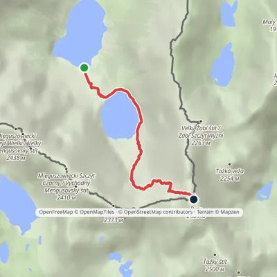 HardOne-dayMarkedMorskie Oko Rysyvia Czarny StawElevation profile1 401–2 501 m3.4 kmascent 1 100 m≈ 3 h walkingunder 1 km from Żabi Szczyt Wyżni
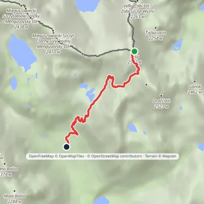 HardOne-dayMarkedJunction at Žabí potok RysyElevation profile1 626–2 501 m4.3 kmascent 875 m≈ 3 h walkingunder 1 km from Żabi Szczyt Wyżni
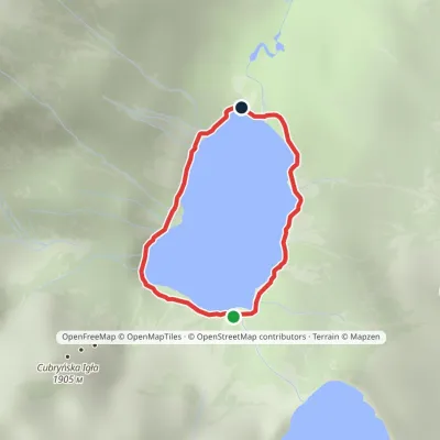 EasyOne-dayMarkedAround Morskie OkoElevation profile1 395–1 423 m2.5 kmascent 23 m≈ 45 min walking1.4 km from Żabi Szczyt Wyżni
Nearby attractions
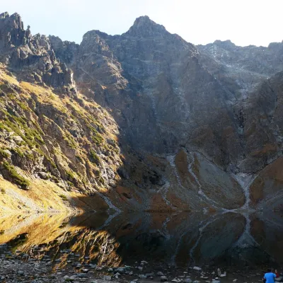 PeakNiżnie Rysyaltitude 2 430 munder 1 km from Żabi Szczyt WyżniNiżnie Rysy (Slovak Malé Rysy, German Dénesspitze) is a 2,430 m summit of the High Tatras on the northern ridge of Rysy, which carries the Polish–Slovak border.
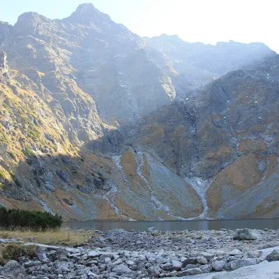 LakeCzarny Staw pod Rysamiunder 1 km from Żabi Szczyt WyżniCzarny Staw pod Rysami (the Black Lake below Rysy) lies in a glacial cirque of the Rybi Potok Valley, directly above Morskie Oko.
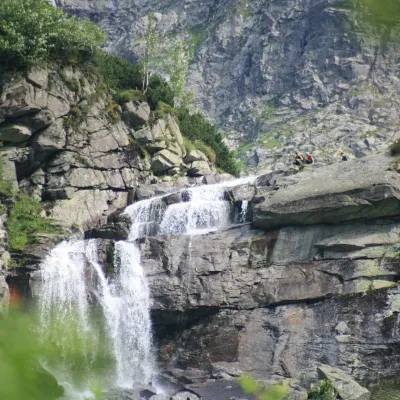 WaterfallCzarnostawiańska Siklawa (Black Lake Falls)1.2 km from Żabi Szczyt WyżniCzarnostawiańska Siklawa (Black Lake Falls) is a cascading waterfall in the Polish High Tatras, in the Rybi Potok Valley (Dolina Rybiego Potoku) inside Tatra National...
Craft nearby
All craft places Cheese dairies & pasturesShepherd's Hut on Rusinowa PolanaBrzegi8.3 km from Żabi Szczyt WyżniRusinowa Polana is one of the most beautiful mountain glades in the Polish Tatras, and from May to October it is home to the bacówka (shepherd's hut) of baca Stanisław...
 Water parks & thermal poolsClimatic spas of the High Tatras: Nový Smokovec, Polianka, KotlinaVysoké Tatry11 km from Żabi Szczyt WyżniNový Smokovec is the best known of the climatic spas of the High Tatras. It grew up in a spruce forest at about 1010 m, south-west of Starý Smokovec, with which it...
 Cheese dairies & pasturesFurtek's Shepherd's Huts, Kuźnice and KalatówkiZakopane12 km from Żabi Szczyt WyżniAbove Kuźnice — the southern edge of Zakopane where most hikes into the Western and High Tatras begin — the flocks are tended by baca Andrzej Staszel, nicknamed "Furtek".
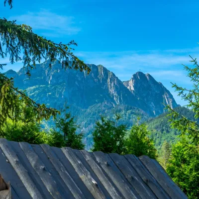 Koliby & Hutsul cuisineBąkowo Zohylina Wyźnio Highland TavernZakopane14 km from Żabi Szczyt WyżniBąkowo Zohylina Wyźnio is a regional highland tavern in Zakopane housed in a wooden "szałas" (shepherd-hut-style building) with a view of the Tatras.
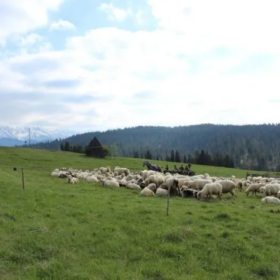 Cheese dairies & pasturesU Jancoka Shepherd's Hut, Brzegi: oscypek from Poland's first female bacaBrzegi15 km from Żabi Szczyt WyżniThe U Jancoka shepherd's hut (bacówka) stands beside regional road 960, which runs from Bukowina Tatrzańska to the Łysa Polana border crossing, in the village of Brzegi.
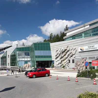 Water parks & thermal poolsTermy Zakopiańskie (Aqua Park Zakopane)Zakopane15 km from Żabi Szczyt WyżniTermy Zakopiańskie is a thermal water park right in Zakopane, on Jagiellońska Street, only a kilometre from Krupówki.
