Vysoká (Little Carpathians)
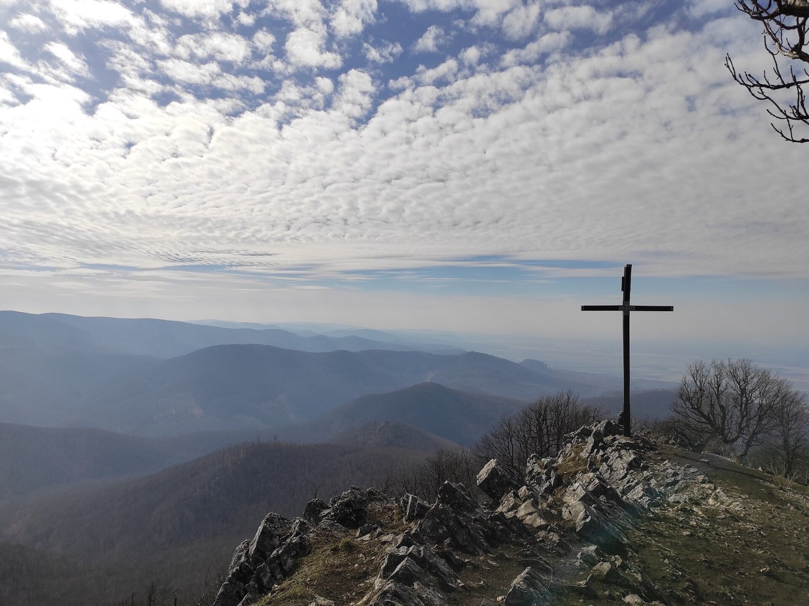
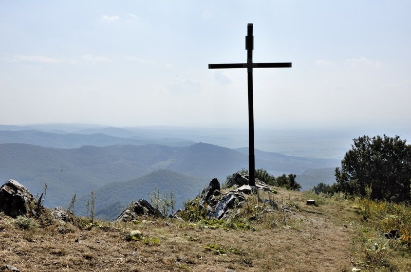
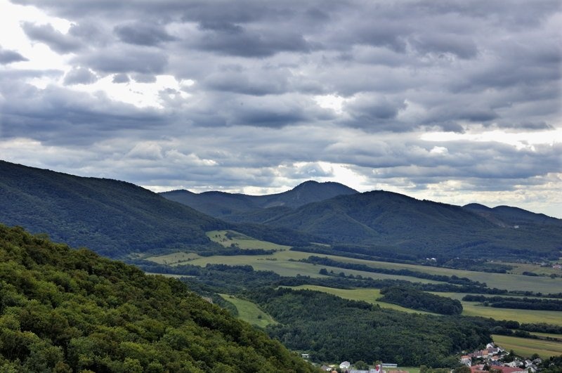
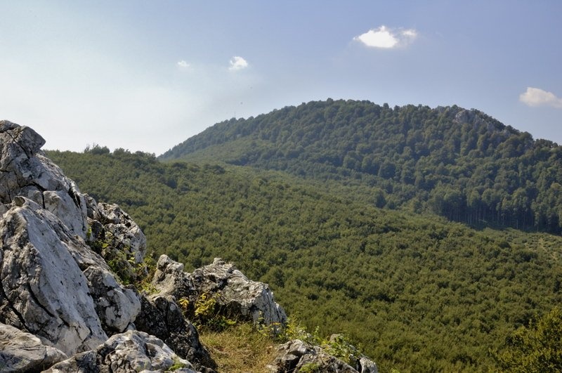
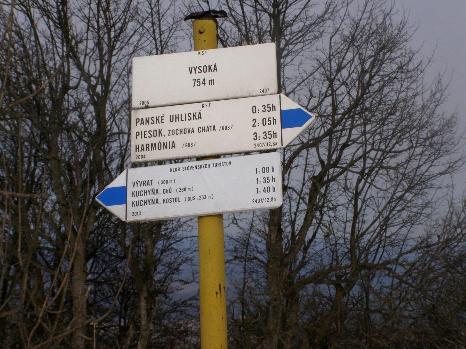
Vysoká is the second-highest summit of the Little Carpathians after Záruby. Slovak geodetic data give it 754.3 m; some other sources state 759 m. The mountain rises above the village of Kuchyňa, about 13 km east of Malacky, in Malacky District of the Bratislava Region. The nearest settlements are Kuchyňa to the west and Rohožník and Sološnica to the north.
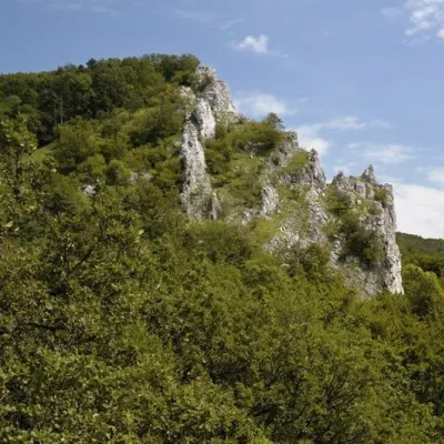
Vysoká lies in the central part of the range, in the Pezinok Carpathians geomorphological subunit, in their section called Biele hory. Like many other landmarks of the Little Carpathians it is a narrow ridge of limestone and dolomite running south-west to north-east. However, the Vysoká ridge stands about 1.5 km west of the main crest, which passes through Panské uhliská. The distinctive double-topped ridge has rock walls and scree. In origin the mountain is a classic residual hill: running water once eroded an old plateau and left this rocky massif of Cretaceous limestone.
Neighbouring summits include Zámok (559 m) and Veľký Peterklín (587 m) to the north, Horný vrch (643 m) and Taricové skaly (620 m) to the east, Skalnatá (704 m), Čertov kopec (752 m) and Javorina (703 m) to the south, and Prístodolok (591 m) to the west. The south-eastern and western part of the ridge drains via the Vývrat stream and the northern part via the Rohožnícky stream, both flowing into the Rudava in the Morava basin.
How to get there / routes
Vysoká is one of the most visited summits of the range. A blue-marked trail crosses the summit, linking Kuchyňa with the Zochova chata recreation area.
- From Kuchyňa – blue trail from the west. Together with Zochova chata it is the usual starting point for a day trip.
- From Zochova chata / Modra-Harmónia – blue trail from the south-east via Piesok.
- Along the red Štefánik trail (on the route of the Heroes of the SNP trail) to the Panské uhliská junction east of the summit: from the north from Sološnica (Sološnická dolina junction) or from the south from Pezinská Baba via Skalnatá.
Marked cycle routes do not reach the summit itself: the Štefánik cycle trail gets you to about 1 km and 150 vertical metres below it, from where you continue on foot along the blue trail. Sources give no official walking times. The Čermáčka shelter stands 600 m from the summit and the Maruškin prameň spring is about 650 m away.
What you can see from the summit
The forest on the summit ridge is broken, so you can see the surrounding peaks of the Little Carpathians, the Borská lowland and part of the Danubian lowland. In good conditions part of the White Carpathians, Považský Inovec and Tribeč are visible, often also the summits of Vtáčnik and the foothills of the Alps. In very good visibility the Schneeberg massif in the Northern Limestone Alps can be made out to the west. There is a cross and a trail signpost on the summit.
Nature and history
The whole massif is protected as the Vysoká nature reserve, declared in 1988 on 80.5 ha within the Little Carpathians Protected Landscape Area; it has the highest, fifth degree of protection. The reserve protects natural forest and rock communities in the southern part of Biele hory: oak-beech and beech forests, lime-beech and lime-maple stands on the margins, and lime-loving treeless communities of rocks and rock crevices on the summits. The slopes keep forests barely touched by people, with beech, elm, lime and sycamore maple.
On the way up you pass steep drops, streams, meadows and rock walls, and in the surroundings there are several small caves and springs. The woods are rich in wildlife, and mouflons are a notable presence. In the past limestone was mined under the mountain and taken to a nearby factory.
Safety, season and rules
Vysoká is a mountain for day hikes, but the summit ridge is rocky with steep drops, so take care there, especially in wet weather or in winter when the rock is slippery. In a reserve with the fifth degree of protection, stay on marked trails, do not pick plants and do not disturb animals. In the Slovak mountains help comes from the Mountain Rescue Service HZS: 18 300 (+421 18 300) or 112.
Interesting facts
- Vysoká is a classic residual hill – the remnant of an old plateau eroded by water.
- Other popular spots are nearby – the lookout tower on Veľká homoľa, Červený Kameň Castle and Štúr's trail.
- On a clear day even the Austrian Alps can be seen from the summit.
Photos: Michal Drábek, CC BY-SA 4.0; Stanislav Doronenko, CC BY 3.0; Doronenko, CC BY 3.0; Stanislav Doronenko, CC BY 3.0; Lure, CC BY-SA 3.0 — Wikimedia Commons.
Getting there from Ukraine
Border crossings
- Uzhhorod – Vyšné Nemecké — road, 24/7
- Malyi Bereznyi – Ubľa — road, 24/7 For cars and buses; pedestrians not confirmed by the Ukrainian border service, lorries up to 3.5 t.
- Mali Selmentsi – Veľké Slemence (pedestrian) — pedestrian, 09:00–21:00 Kyiv time Pedestrians and cyclists only; inconvenient for the Tatras without onward transport.
- Chop – Čierna nad Tisou (rail) — rail, 24/7
By car
From Uzhhorod to Žilina ≈330 km, ≈4 h 20 min without queues: Uzhhorod – Vyšné Nemecké → I/19 to Košice → D1 via Prešov, Poprad, Liptovský Mikuláš and Ružomberok (≈17 km on I/18 between D1 sections) → Žilina. To Terchová ≈314 km, ≈4 h 15 min: from the D1 onto I/70 and II/583. From Lviv through Poland: M-10 → Krakovets – Korczowa → A4 to Kraków → S7/DK7 to Chyżne – Trstená → R3, I/59 to Dolný Kubín → II/583 via Terchová to Žilina: to Terchová ≈493 km (≈6 h 30 min), to Žilina ≈518 km (≈7 h). Via the tolled A4 Kraków – Katowice, S1 and D3: ≈533 km, ≈6 h 35 min. The D1 requires an e-vignette (eznamka.sk).
Checked 23.10.2026; border crossing hours and timetables change — check before you travel.
Location on the map
Water and shelter nearby
- Čermáčka Hut600 m · Not verified · 535 m
- Nadej Spring1.5 km · Not verified · 392 m
- Spring below Gajdoš1.7 km · Not verified · 538 m
Comments
Trails nearby
All trails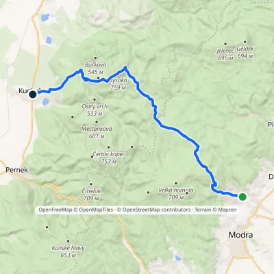 ModerateTwo-dayMarkedHarmónia Kuchyňa, churchElevation profile253–759 m18.4 kmascent 719 m≈ 6 h walkingunder 1 km from Vysoká (Little Carpathians)
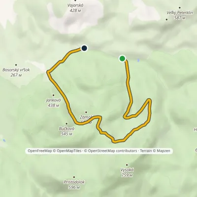 EasyOne-dayMarkedMalý Peterklin VajarskáElevation profile292–549 m6.6 kmascent 244 m≈ 2 h walkingunder 1 km from Vysoká (Little Carpathians)
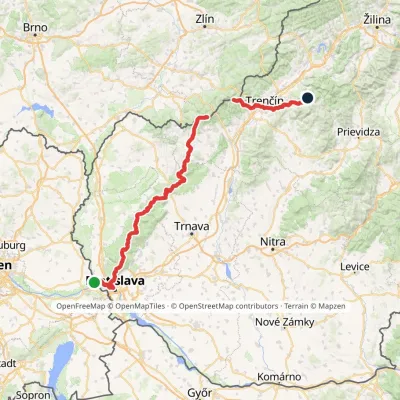 HardMulti-dayMarkedHrad Devín, parking Horná Poruba, U BrdárovElevation profile146–965 m190.1 kmascent 7 200 m1.1 km from Vysoká (Little Carpathians)
Nearby attractions
 PeakVápennáSološnicaaltitude 752 m6.3 km from Vysoká (Little Carpathians)Vápenná (also Roštún; German Rachsthurn) is a 752 m summit and the third highest peak of the Little Carpathians.
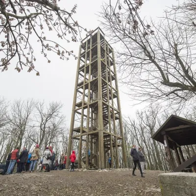 PeakVeľká homoľaModraaltitude 709 m6.7 km from Vysoká (Little Carpathians)Veľká homoľa is a summit 709 m high in the Little Carpathians (Malé Karpaty), in their Pezinok Carpathians part (Homoľské Karpaty).
 Wine & tastingsJuran z Modry winery: tastings in a Modra wine shopModra11 km from Vysoká (Little Carpathians)Modra is one of the main wine towns of the Little Carpathians: every other courtyard has its own cellar, and rows of vines climb the slopes above the town.
Craft nearby
All craft places Crafts & workshopsSlovak Folk Majolica in Modra: pottery tour and paintingModra12 km from Vysoká (Little Carpathians)Modra is a small wine town on the eastern slopes of the Little Carpathians, half an hour’s drive from Bratislava.
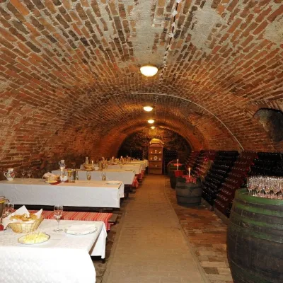 Wine & tastingsHACAJ winery in Pezinok: sparkling wine in a 300-year-old cellarPezinok15 km from Vysoká (Little Carpathians)Pezinok is the centre of the Little Carpathian Wine Route, a town where winegrowers’ houses with deep cellars line the old streets.
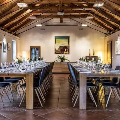 Wine & tastingsKarpatská Perla winery in Šenkvice: tastings and cellarŠenkvice16 km from Vysoká (Little Carpathians)From a home cellar to Winery of the Year Šenkvice is a wine village on the plain below the eastern slopes of the Little Carpathians, between Pezinok and Modra.
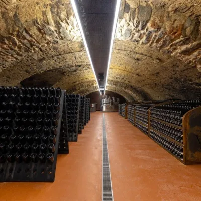 Wine & tastingsVIAJUR winery in Svätý Jur: tastings in the Pálffy cellarsSvätý Jur18 km from Vysoká (Little Carpathians)Wine in old cellars on the edge of Bratislava Svätý Jur is an old wine town at the very foot of the Little Carpathians, just beyond the Bratislava city limits.
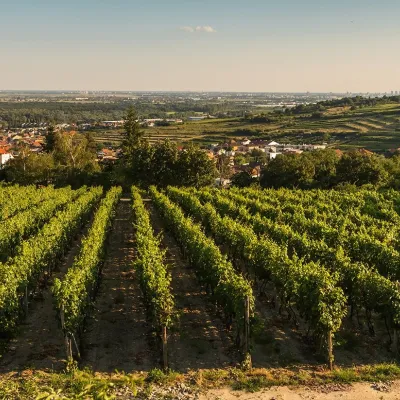 Wine & tastingsDubovský & Grančič Winery, Svätý Jur: tastings and sektSvätý Jur19 km from Vysoká (Little Carpathians)From sixty ares to “Winemaker of the Year” Svätý Jur is an old wine town on the southern slopes of the Little Carpathians, just beyond the Bratislava city limits.
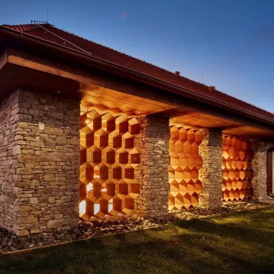 Honey & meaderiesVčelovina meadery, Smolenice: mead and honey beerSmolenice19 km from Vysoká (Little Carpathians)This is where the Včelovina meadery works — “a small production with a big heart”, as its founders put it.
