Mięguszowiecki Szczyt Czarny
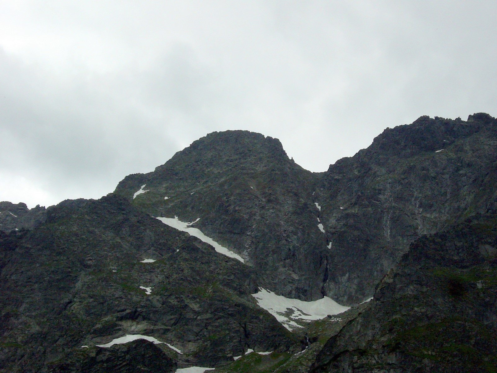
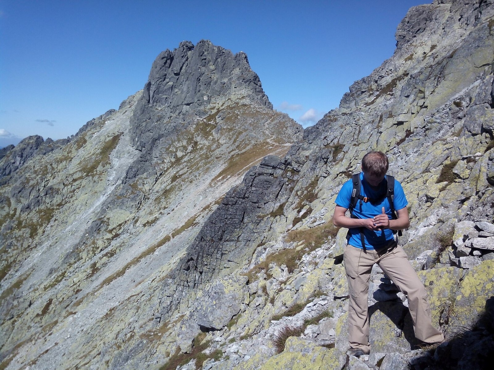
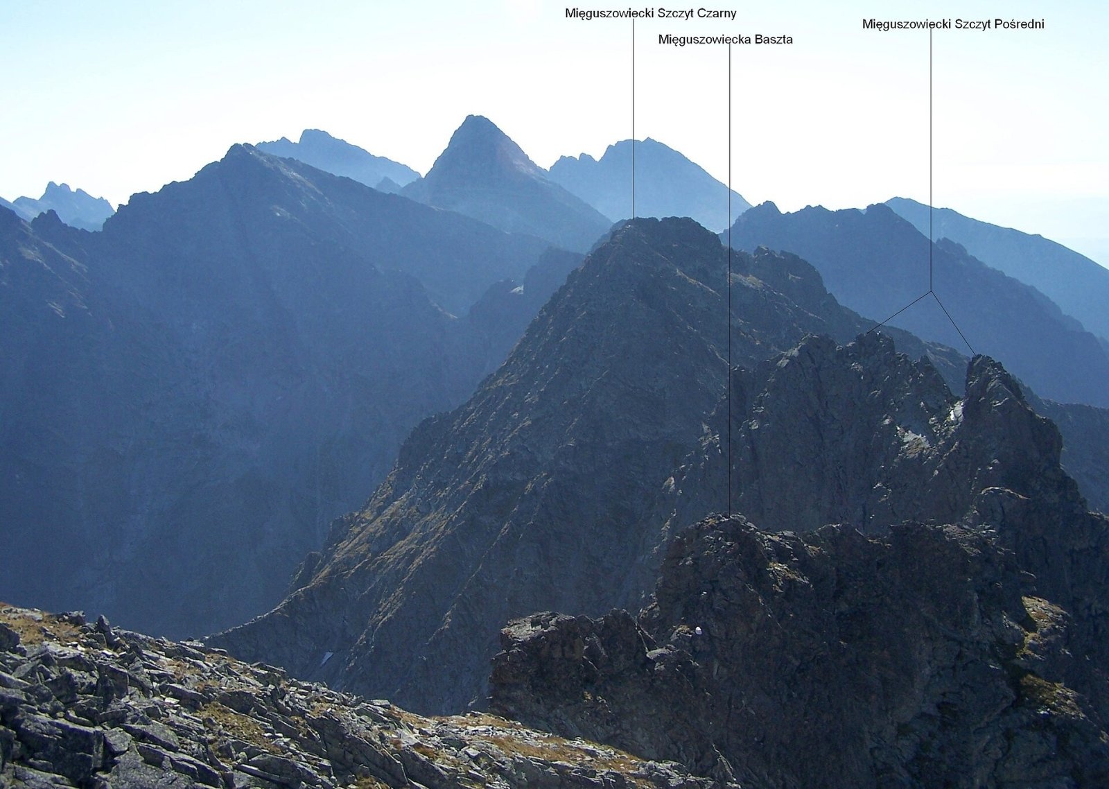
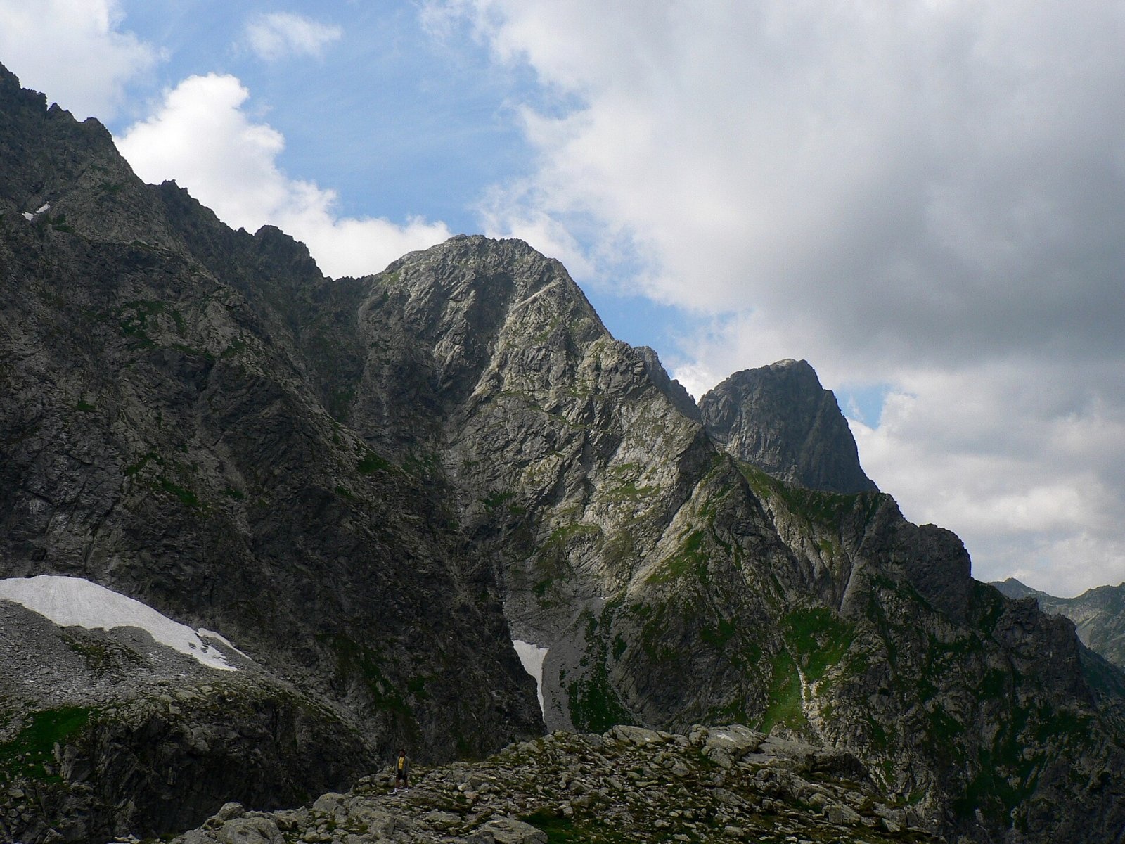
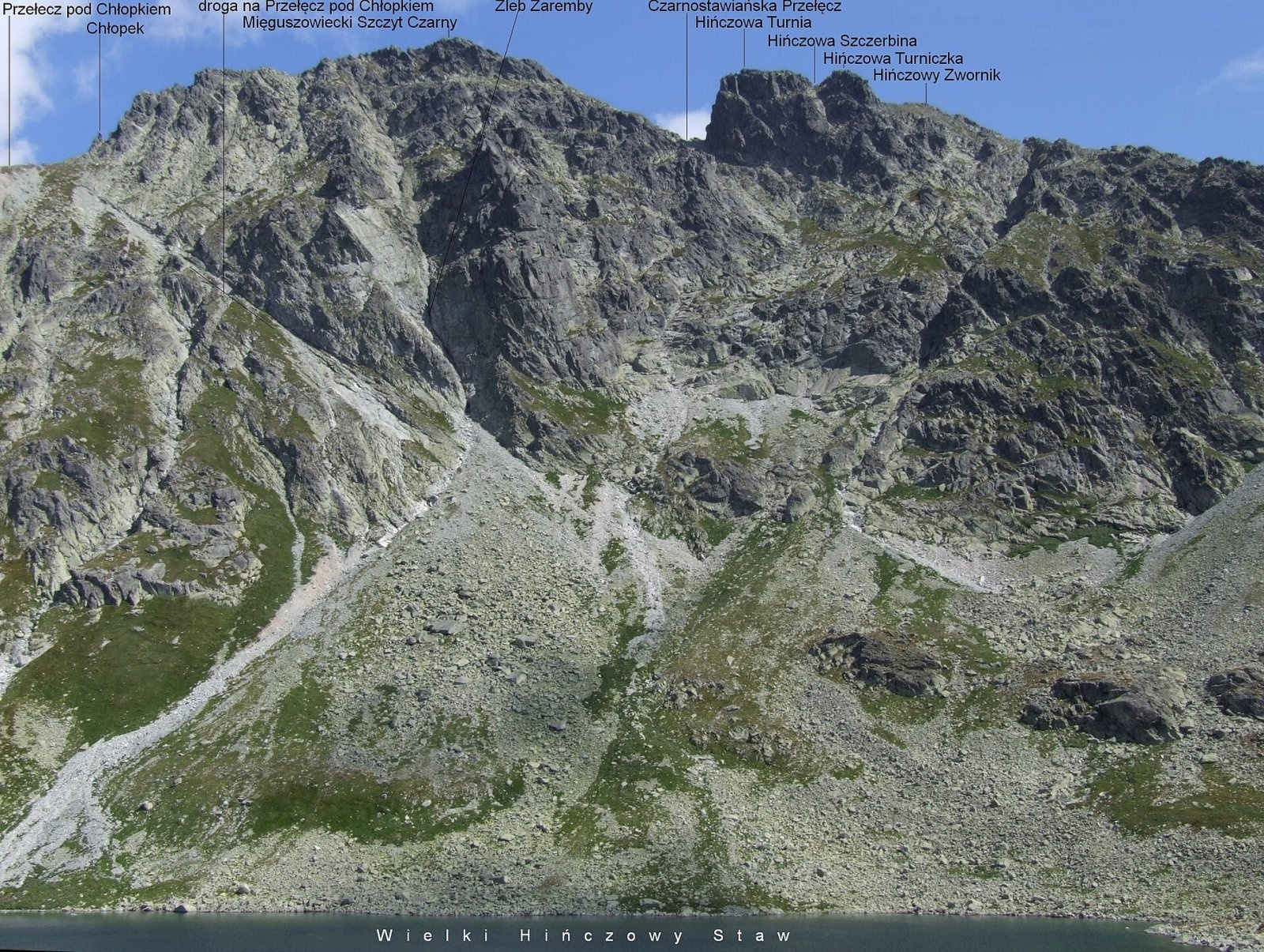
Mięguszowiecki Szczyt Czarny (Slovak: Východný Mengusovský štít, "Eastern Mengusovce Peak") is a High Tatra summit of about 2,405 m on the main Tatra ridge along the Polish–Slovak border. It is the easternmost of the three Mięguszowiecki peaks and the fourth-highest mountain in Poland. It rises above two major valleys: on the Polish side the Rybi Potok valley with the lakes Morskie Oko and Czarny Staw pod Rysami, on the Slovak side the Mengusovská dolina with its upper level, the Hincova dolina. The Polish name refers to Czarny Staw (Black Lake) — the mountain was once called Mięguszowiecki Szczyt nad Czarnym (Stawem) — while all the Mięguszowiecki peaks are named after the village of Mengusovce.
The Mięguszowiecka Przełęcz pod Chłopkiem pass (2,307 m), named after the small rock tower Chłopek on the south-west ridge, separates it from Mięguszowiecki Szczyt Pośredni; the Czarnostawiańska Przełęcz (about 2,340 m) separates it from Hińczowa Turnia, the end of the Wołowy Grzbiet. Guidebooks give different heights: Witold Henryk Paryski 2,404 m in his climbing guide and 2,410 m in the Great Tatra Encyclopedia, Arno Puškáš 2,398 m. LiDAR surveys in 2012 and 2018 measured 2,405 m.
How to get there / trails
There is no marked trail to the summit itself. The easiest ascent starts from the Mięguszowiecka Przełęcz pod Chłopkiem, reached by a marked green trail from Czarny Staw pod Rysami. The trail crosses the north face of the peak on a rock ledge called the Galeryjka. From the pass two unmarked variants lead to the summit: bypassing the ridge on the Hincova side (grade 0+ on the Tatra scale, about 30 min) or along the north-west ridge (II, 30 min). Slovak sources call it the most accessible of the three Mengusovské peaks, but on the Slovak side it may be climbed only with a mountain guide.
The faces of the peak are a popular climbing venue: dozens of routes from 0+ to V+, some with aid, run up the north, north-east, east and south-west faces.
The view from the top
A rocky summit at the very heart of the High Tatras. Close by stand the neighbouring Mięguszowiecki Szczyt Pośredni and Wielki, the Wołowy Grzbiet, Rysy, Wysoka and Gerlach, and below lie the cirques above Morskie Oko and the Hincova valley.
Structure of the mountain
The north-east rib, about 500 m long and some 700 m high, divides several glacial cirques — Bańdzioch and Wyżni Bańdzioch on one side and the Wyżni Czarnostawiański Kocioł on the other. A few dozen metres below the summit the rib forks, and its right arm ends in the Kazalnica Mięguszowiecka, one of the main climbing objectives of the Polish Tatras. The right part of the north face, 380 m high, drops to Bańdzioch; the east face is about 320 m high, and the south-west face, about 250 m, falls to the screes of the Hincova valley and is split by the Żleb Zaremby gully.
Nature and history
On the northern slopes the lower limit of the subnival belt drops almost to the saddle behind the Kazalnica. Lime-loving plants grow here alongside species of granite soils — a rarity in the High Tatras. For this reason, in July 1923 the summit was studied by the 5th International Phytogeographic Excursion led by Bogumił Pawłowski, who wrote that the flora of Mięguszowiecki Szczyt Czarny is one of the richest on the high Tatra summits, thanks to strong rock weathering and abundant moisture on the slopes. More than 70 species of flowering plants grow on its rocks, including two very rare ones: Tatra scurvygrass (Cochlearia tatrae, at 2,200–2,390 m) and Saxifraga retusa.
The first recorded summer ascent was made by Antonina Englisch and her son Karol with the guide Johann Hunsdorfer senior on 9 August 1903 from the Czarnostawiańska Przełęcz; the first winter ascent by Mieczysław Lerski and Jerzy Maślanka on 22 March 1910. Polish mountain guides, however, were already leading people here in the second half of the 19th century, probably before 1877. One Slovak route was first climbed in 1966 during a Mountain Rescue Service search for missing people.
Safety, season and rules
This is a summit for experienced people: even the easiest way from the pass is unmarked, on rock and scree, and the green trail to the pass is itself steep high-mountain terrain. In the Tatra National Park (TPN) hikers may walk only on marked trails; leaving them is mountaineering, so without experience go with a licensed mountain guide. In winter and spring avalanche danger is high, and in summer thunderstorms are frequent — start early.
Rescue on the Polish side is TOPR: 985 or +48 601 100 300; on the Slovak side HZS: 18 300 (+421 18 300); 112 works everywhere.
Photos: Krzysztof Dudzik-Górnicki (User:ToSter), CC BY 3.0; Adam Opioła, CC BY-SA 4.0; Foto: Adam Opioła, opis: Jerzy Opioła, CC BY-SA 4.0; Krzysztof Dudzik-Górnicki (User:ToSter), CC BY-SA 3.0; Jerzy Opioła, CC BY-SA 4.0; Adam Opioła, CC BY-SA 4.0; Adam Opioła, CC BY-SA 4.0 — Wikimedia Commons.
Getting there from Ukraine
Border crossings
- Krakovets – Korczowa — road, 24/7
- Shehyni – Medyka — road, 24/7 Pedestrian crossing is not confirmed by the Ukrainian border service — check dpsu.gov.ua before the trip.
- Smilnytsia – Krościenko — road, 24/7
- Hrushiv – Budomierz — road, 24/7
- Mostyska – Przemyśl (rail) — rail, 24/7
By car
Lviv – Zakopane ≈421 km, ≈5 h 10 min without border queues. Route: M-10 Lviv – Krakovets → Krakovets – Korczowa checkpoint → A4 motorway (Rzeszów – Tarnów – Kraków) → Kraków southern bypass → S7/DK7 → DK47 ('Zakopianka') via Nowy Targ → Zakopane. The A4 Katowice – Kraków section (Balice and Mysłowice toll plazas) is tolled, but this route does not use it. In summer and at weekends the DK47 near Zakopane is often congested.
Checked 23.10.2026; border crossing hours and timetables change — check before you travel.
Location on the map
Water and shelter nearby
- Spring below Kazalnica Mięguszowiecka470 m · Not verified · 1 884 m
- Spring below Mengusovský Volovec570 m · Not verified · 1 977 m
- Hut under Rysy1.7 km · Standing · 2 250 m
- Spring below Apostoły1.7 km · Not verified · 1 411 m
- Morskie Oko Hut2.1 km · Standing · 1 410 m
Comments
Trails nearby
All trails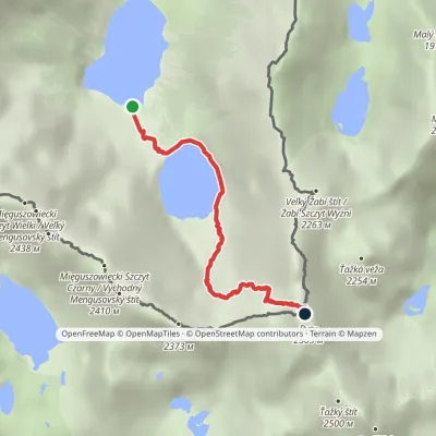 HardOne-dayMarkedMorskie Oko Rysyvia Czarny StawElevation profile1 401–2 501 m3.4 kmascent 1 100 m≈ 3 h walkingunder 1 km from Mięguszowiecki Szczyt Czarny
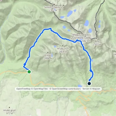 HardTwo-dayMarkedTri studničky, old forester's lodge Popradské Pleso, stopElevation profile1 105–2 142 m21.4 kmascent 1 142 m≈ 7.5 h walkingunder 1 km from Mięguszowiecki Szczyt Czarny
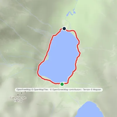 EasyOne-dayMarkedAround Morskie OkoElevation profile1 395–1 423 m2.5 kmascent 23 m≈ 45 min walking1.2 km from Mięguszowiecki Szczyt Czarny
Nearby attractions
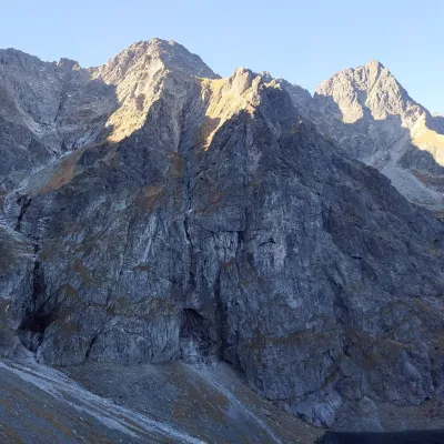 PeakKazalnica MięguszowieckaBukowina Tatrzańskaaltitude 2 159 munder 1 km from Mięguszowiecki Szczyt CzarnyKazalnica Mięguszowiecka (Slovak Kazateľnica Mengusovská) is a 2,159 m summit in the Polish High Tatras.
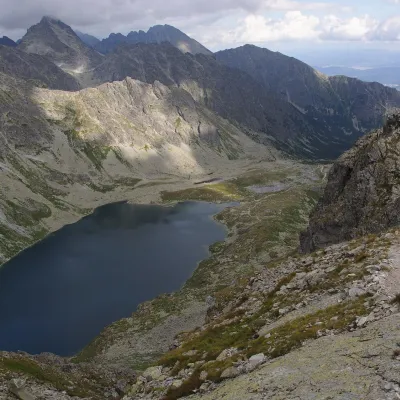 LakeVeľké Hincovo plesoVyšné Hágyunder 1 km from Mięguszowiecki Szczyt CzarnyVeľké Hincovo pleso is the largest and deepest glacial lake in the Slovak part of the Tatras and in all of Slovakia.
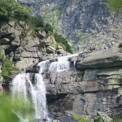 WaterfallCzarnostawiańska Siklawa (Black Lake Falls)1 km from Mięguszowiecki Szczyt CzarnyCzarnostawiańska Siklawa (Black Lake Falls) is a cascading waterfall in the Polish High Tatras, in the Rybi Potok Valley (Dolina Rybiego Potoku) inside Tatra National...
Craft nearby
All craft places Cheese dairies & pasturesShepherd's Hut on Rusinowa PolanaBrzegi9.1 km from Mięguszowiecki Szczyt CzarnyRusinowa Polana is one of the most beautiful mountain glades in the Polish Tatras, and from May to October it is home to the bacówka (shepherd's hut) of baca Stanisław...
 Cheese dairies & pasturesFurtek's Shepherd's Huts, Kuźnice and KalatówkiZakopane12 km from Mięguszowiecki Szczyt CzarnyAbove Kuźnice — the southern edge of Zakopane where most hikes into the Western and High Tatras begin — the flocks are tended by baca Andrzej Staszel, nicknamed "Furtek".
 Water parks & thermal poolsClimatic spas of the High Tatras: Nový Smokovec, Polianka, KotlinaVysoké Tatry12 km from Mięguszowiecki Szczyt CzarnyNový Smokovec is the best known of the climatic spas of the High Tatras. It grew up in a spruce forest at about 1010 m, south-west of Starý Smokovec, with which it...
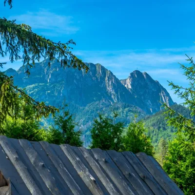 Koliby & Hutsul cuisineBąkowo Zohylina Wyźnio Highland TavernZakopane14 km from Mięguszowiecki Szczyt CzarnyBąkowo Zohylina Wyźnio is a regional highland tavern in Zakopane housed in a wooden "szałas" (shepherd-hut-style building) with a view of the Tatras.
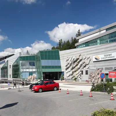 Water parks & thermal poolsTermy Zakopiańskie (Aqua Park Zakopane)Zakopane15 km from Mięguszowiecki Szczyt CzarnyTermy Zakopiańskie is a thermal water park right in Zakopane, on Jagiellońska Street, only a kilometre from Krupówki.
 Crafts & workshopsSztukomania Studio, Zakopane: handmade ceramics and pottery workshopsZakopane15 km from Mięguszowiecki Szczyt CzarnySztukomania is a small ceramics and woodwork studio on Staszica street in Zakopane, a few minutes' walk from Krupówki.
