Martin
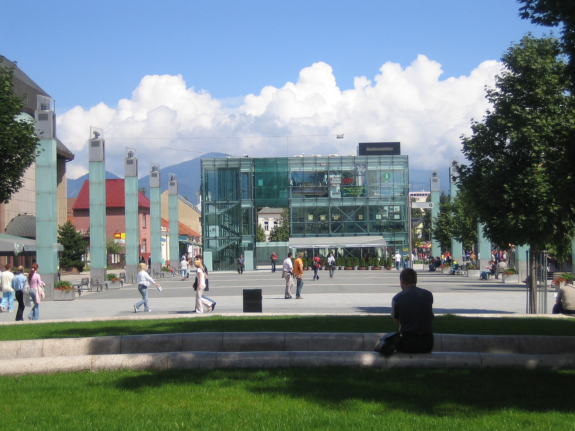
Photos: Francesco Brisa, CC BY-SA 3.0 (Wikimedia Commons); PeterPhoto, CC BY-SA 3.0 (Wikimedia Commons); hlavatka, CC BY 3.0 (Wikimedia Commons); Michal Jakubský, CC BY 3.0 (Wikimedia Commons); Alekme, CC BY-SA 3.0 (Wikimedia Commons); Alekme, CC BY-SA 3.0 (Wikimedia Commons)
Martin is a city in northern Slovakia, serving as the administrative center of the Martin District in the Žilina region. It is located at the foot of the Lesser Fatra and Greater Fatra mountains, at the confluence of the Turiec and Váh rivers. Martin lies in the Turiec Basin at an elevation of 402 m above sea level and is recognized as an important industrial and cultural hub of the Turiec region.
The first written mention of Martin dates back to 1284, when it was part of the Sklabiňa estate. In 1340, the town was granted Magdeburg rights. Martin played a significant role in the Slovak national revival: in 1861, a Slovak national assembly was held here, leading to the founding of Matica slovenská and the Slovak National Museum. On October 30, 1918, the Declaration of the Slovak Nation was proclaimed in Martin, supporting the union of Slovakia with the Czech lands.
Martin is known for its cultural heritage and natural surroundings. The city is a gateway to the Lesser Fatra mountains, home to peaks such as Veľký Kriváň and Malý Kriváň. Martin hosts the Museum of the Slovak Village and the Ethnographic Museum of the Slovak National Museum. The city also has a developed industrial sector, including machinery, furniture, paper, and food industries.
Visitors to Martin can enjoy a variety of outdoor activities. Over 30 hiking trails start in and around the city, including "Turie – Minčol", "Kunerad Castle – Valča", "Liberation Trail", and "Minčol – Martin, Turiec campsite". Mountain lovers can ascend Veľký Kriváň or Malý Kriváň. Mountain shelters such as Havranovo, Javorina, Martinské Hole, and Kľačianska Magura are available for hikers. The Museum of the Slovak Village and the Ethnographic Museum offer insights into local culture.
Getting there from Ukraine
From Uzhhorod to Žilina ≈330 km, ≈4 h 20 min without queues: Uzhhorod – Vyšné Nemecké → I/19 to Košice → D1 via Prešov, Poprad, Liptovský Mikuláš and Ružomberok (≈17 km on I/18 between D1 sections) → Žilina. To Terchová ≈314 km, ≈4 h 15 min: from the D1 onto I/70 and II/583. From Lviv through Poland: M-10 → Krakovets – Korczowa → A4 to Kraków → S7/DK7 to Chyżne – Trstená → R3, I/59 to Dolný Kubín → II/583 via Terchová to Žilina: to Terchová ≈493 km (≈6 h 30 min), to Žilina ≈518 km (≈7 h). Via the tolled A4 Kraków – Katowice, S1 and D3: ≈533 km, ≈6 h 35 min. The D1 requires an e-vignette (eznamka.sk).
Sources: Wikipedia, Wikidata, OpenStreetMap, Karpaty.rocks data. More on Wikipedia
Trails nearby
All trails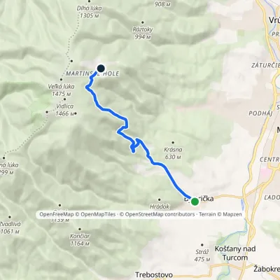 ModerateOne-dayMarkedBystrička Martinské hole, cottagesElevation profile452–1 287 m8.7 kmascent 835 m≈ 4 h walking4.3 km from the centre
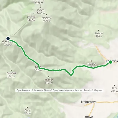 ModerateOne-dayMarkedBystrička Horná lúkaElevation profile451–1 300 m9.1 kmascent 854 m≈ 4 h walking4.3 km from the centre
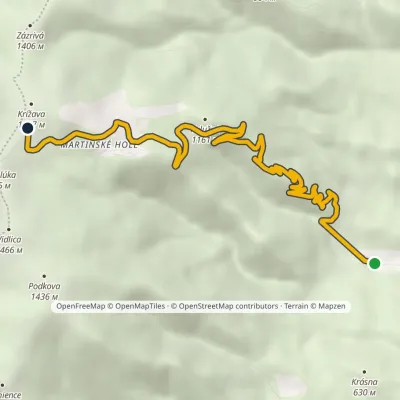 ModerateOne-dayMarkedMartin, Stráne Krížava, transmitterElevation profile505–1 444 m9.3 kmascent 939 m≈ 4 h walking4.3 km from the centre
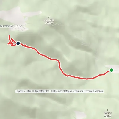 EasyOne-dayMarkedMartin, Stráne Ráztokavia Ferrata HZSElevation profile505–1 249 m4.7 kmascent 744 m≈ 2.5 h walking4.3 km from the centre
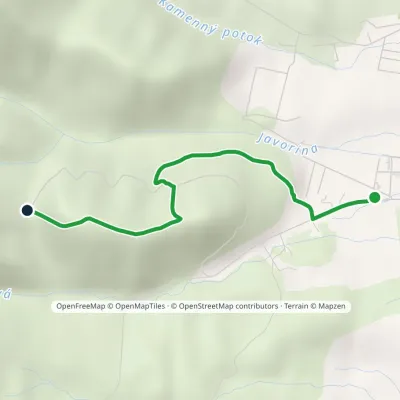 EasyOne-dayMarkedMartin, Turiec campsite Saddle behind HradišteElevation profile441–778 m3.2 kmascent 337 m≈ 1.5 h walking4.4 km from the centre
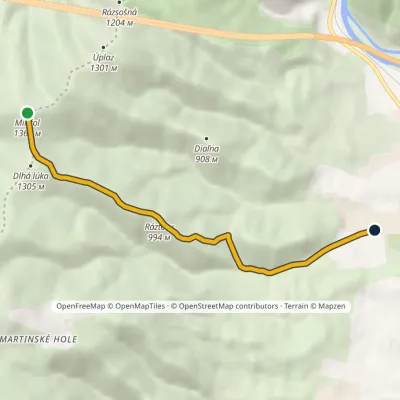 EasyOne-dayMarkedMinčol Martin, Turiec campsiteElevation profile441–1 364 m6.9 km≈ 1.5 h walking4.4 km from the centre
Peaks nearby
All peaks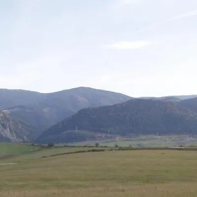 PeakMinčol (Lesser Fatra)Višňovéaltitude 1 364 m9.4 km from the centre1 trail to the topMinčol is a massive 1364 m mountain on the main ridge of the Lúčanská Fatra, part of the Lesser Fatra (Malá Fatra) in Slovakia.
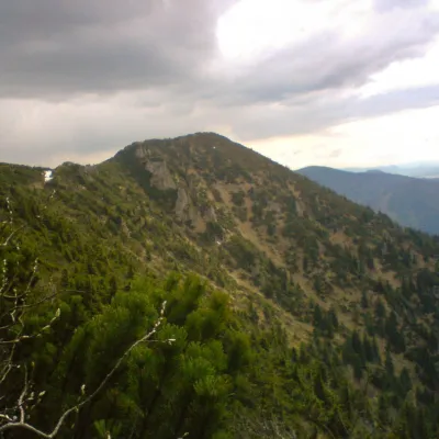 PeakSuchýKrasňanyaltitude 1 468 m11 km from the centre1 trail to the topSuchý (formerly Suchý Uplaz) is a 1468 m summit in the Lesser Fatra (Malá Fatra) in Slovakia and one of the most distinctive in its Kriváň part.
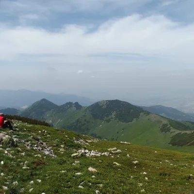 PeakStratenecKrasňanyaltitude 1 509 m12 km from the centre1 trail to the topStratenec is a 1,509 m peak in the Lesser Fatra (Malá Fatra) in Slovakia. It stands on the main ridge of the Krivánska Fatra, about 8 km north of Vrútky and 9 km north...
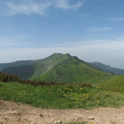 PeakMalý KriváňSučanyaltitude 1 668 m13 km from the centre2 trails to the topMalý Kriváň (also Malý Fatranský Kriváň; Polish Mały Krywań) is a 1668 m summit and the second highest mountain of the whole Malá Fatra after Veľký Kriváň.
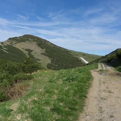 PeakVeľký KriváňTuranyaltitude 1 708 m15 km from the centre1 trail to the topVeľký Kriváň (Polish Wielki Krywań) is the highest peak of the Lesser Fatra (Malá Fatra) at 1,708 m. It stands on the main ridge of the Krivánska Fatra — the part of...
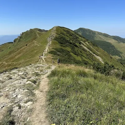 PeakChlebŠútovoaltitude 1 646 m16 km from the centre1 trail to the topChleb (Slovak for “bread”) is a 1,646 m summit on the main ridge of the Lesser Fatra (Malá Fatra) and the third highest peak of the range.
What to visit
All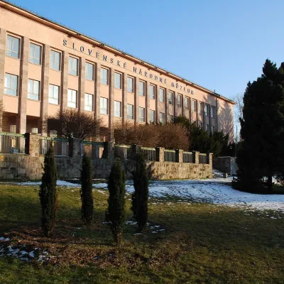 MuseumEthnographic Museum of the Slovak National Museum, MartinMartinunder 1 km from the centreThe Ethnographic Museum of the Slovak National Museum in Martin (SNM – Etnografické múzeum) is the main building of SNM – Museums in Martin and holds the most complete...
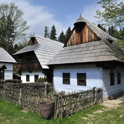 MuseumMuseum of the Slovak Village, MartinMartin3.8 km from the centreThe Museum of the Slovak Village (Múzeum slovenskej dediny) is the largest ethnographic open-air exhibition in Slovakia.
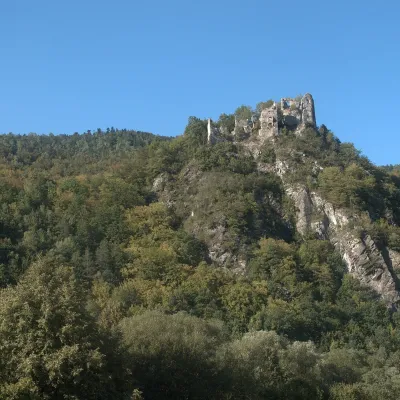 CastleStarý hrad (Old Castle)Nezbudská Lúčka12 km from the centreStarý hrad (Old Castle), known locally as Starhrad and in the past as Varín (Warna), is the ruin of a medieval castle on a granite crag on the right bank of the Váh,...
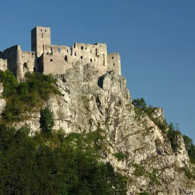 CastleStrečno CastleStrečno12 km from the centreThe castle guarding the gate of the Malá Fatra Strečno Castle (Hrad Strečno) stands on a 103 m limestone crag above the River Váh, 11 km from Žilina on the road to...
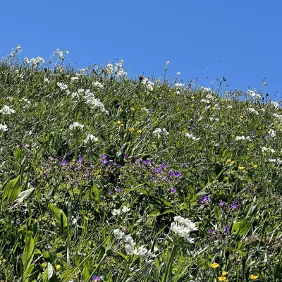 Mountain meadowThe hole of Malá Fatra: Chleb, Snilovské sedlo and HromovéŠútovoaltitude 1 647 m16 km from the centreThe hole of Malá Fatra are the treeless grassy ridges in the highest, Kriváň part of the range (Krivánska Malá Fatra) in northern Slovakia, above the Vrátna valley and...
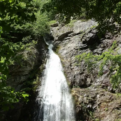 WaterfallŠútovo WaterfallŠútovo17 km from the centreThe Šútovo Waterfall (Šútovský vodopád) is the highest waterfall in the Malá Fatra mountains and one of the highest in Slovakia: the water drops 38 m.
Craft nearby
All craft places Water parks & thermal poolsSpa Aphrodite thermal pools, Rajecké TepliceRajecké Teplice19 km from the centreHot mineral water rises here, and it feeds the Spa Aphrodite resort, whose thermal pools, saunas and Natural Spa zone are open not only to patients but to anyone with...
 Cheese dairies & pasturesSalaš Krajinka near RužomberokRužomberok22 km from the centreSalaš Krajinka is a genuine sheep farm on the edge of Ružomberok in lower Liptov. It was founded in 1983 to keep a thousand sheep, and the owners have deliberately...
 Cheese dairies & pasturesFarma Brezany near Žilina: hand-stretched cheese and a distilleryBrezany23 km from the centreBrezany is a village a few kilometres south of Žilina, on the edge of the Žilina basin and the foothills leading towards the Rajec valley and the Strážov Hills.
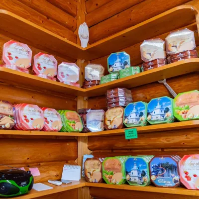 Cheese dairies & pasturesTuriec bryndza dairy, Turčianske Teplice: bryndza since 1917Turčianske Teplice24 km from the centreMore than a hundred years of Turiec bryndza Turiec is a wide basin between the ridges of the Veľká and Malá Fatra, a land of pastures and old sheep farming.
 Craft beer & breweriesURSUS craft brewery, Čutkovská valleyRužomberok24 km from the centreURSUS craft brewery (Remeselný pivovar URSUS) is the first brewery of the town of Ružomberok, tucked away in the picturesque Čutkovská valley in lower Liptov.
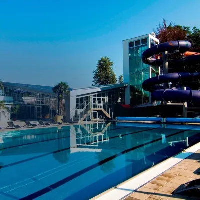 Water parks & thermal poolsSpa & Aquapark Turčianske TepliceTurčianske Teplice24 km from the centreTurčianske Teplice is one of Slovakia’s oldest spa towns. Its warm springs were first mentioned in 1281 in a deed of gift by King Ladislaus IV, and from 1533 they...
Spas and thermal pools nearby
Water parks & thermal poolsSpa Aphrodite thermal pools, Rajecké TepliceRajecké Teplice19 km from the centreHot mineral water rises here, and it feeds the Spa Aphrodite resort, whose thermal pools, saunas and Natural Spa zone are open not only to patients but to anyone with...Water parks & thermal poolsSpa & Aquapark Turčianske TepliceTurčianske Teplice24 km from the centreTurčianske Teplice is one of Slovakia’s oldest spa towns. Its warm springs were first mentioned in 1281 in a deed of gift by King Ladislaus IV, and from 1533 they...Huts, shelters and springs nearby
Getting there from Ukraine
Border crossings
- Uzhhorod – Vyšné Nemecké — road, 24/7
- Malyi Bereznyi – Ubľa — road, 24/7 For cars and buses; pedestrians not confirmed by the Ukrainian border service, lorries up to 3.5 t.
- Mali Selmentsi – Veľké Slemence (pedestrian) — pedestrian, 09:00–21:00 Kyiv time Pedestrians and cyclists only; inconvenient for the Tatras without onward transport.
- Chop – Čierna nad Tisou (rail) — rail, 24/7
By car
From Uzhhorod to Žilina ≈330 km, ≈4 h 20 min without queues: Uzhhorod – Vyšné Nemecké → I/19 to Košice → D1 via Prešov, Poprad, Liptovský Mikuláš and Ružomberok (≈17 km on I/18 between D1 sections) → Žilina. To Terchová ≈314 km, ≈4 h 15 min: from the D1 onto I/70 and II/583. From Lviv through Poland: M-10 → Krakovets – Korczowa → A4 to Kraków → S7/DK7 to Chyżne – Trstená → R3, I/59 to Dolný Kubín → II/583 via Terchová to Žilina: to Terchová ≈493 km (≈6 h 30 min), to Žilina ≈518 km (≈7 h). Via the tolled A4 Kraków – Katowice, S1 and D3: ≈533 km, ≈6 h 35 min. The D1 requires an e-vignette (eznamka.sk).
Checked 23.10.2026; border crossing hours and timetables change — check before you travel.
