Lavínový štít
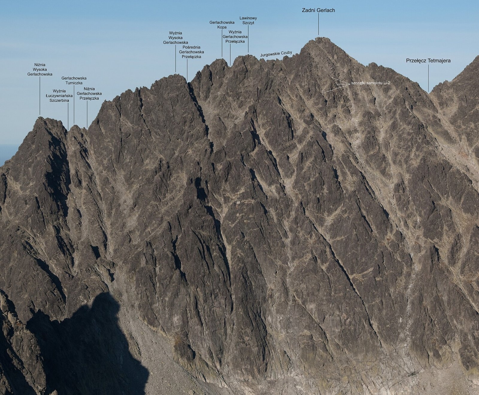
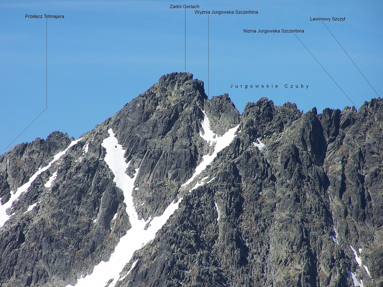
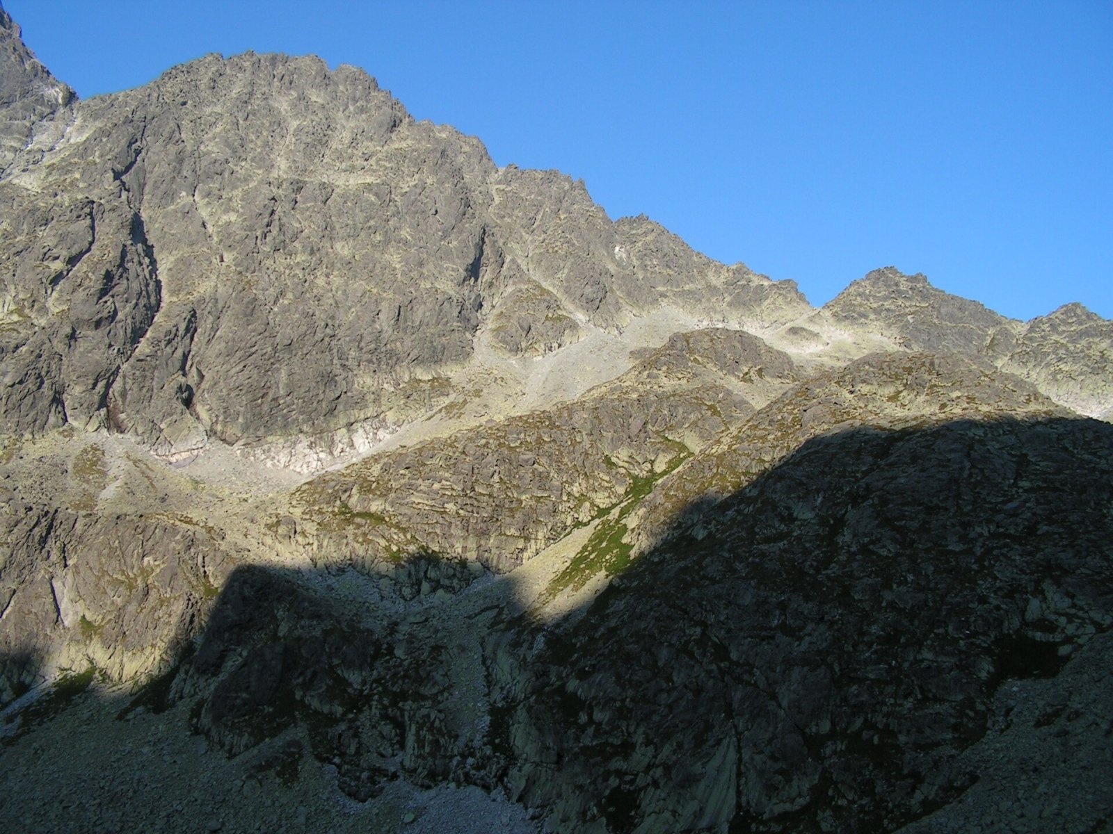
Lavínový štít (Polish Lawinowy Szczyt, German Lawinenspitze) is a rocky 2606 m summit in the Slovak High Tatras and one of the highest in the whole range: the Slovak encyclopedic entry ranks it fifth among the High Tatra peaks. It lies about 15 km north-west of Poprad, above the resort settlements of Vyšné Hágy, Nová Polianka and Tatranská Polianka, in the Prešov Region. The nearest settlements in our OSM data are Štrbské Pleso (about 6.5 km), Štôla (8.4 km) and Gerlachov (9.5 km). To the south-east, below the summit, stands the high mountain hut Sliezsky dom.
The peak is a distinct hump on the northern ridge of Zadný Gerlach (Zadný Gerlachovský štít), between its massif and Veľká Litvorová veža; Polish authors describe it as the middle top of the Zadný Gerlach massif. It thus belongs to the Gerlach ridge, which runs from the highest Tatra peak, Gerlachovský štít, to the Poľský hrebeň saddle. Lavínový štít forms a double summit with Lavínová veža, and the Gerlachovské sedlo saddle lies 226 m away. To the north-west falls the Kačacia dolina, drained by the Biela voda into the Dunajec basin; to the east lies the Velická dolina, whose stream flows to the Poprad river.
How to get there / routes
No marked hiking trail leads to the summit. The mountain lies in the Tatra National Park (TANAP), and the ridge carries the boundary of the Bielovodská dolina and Velická dolina national nature reserves, so hikers may only use marked trails. Lavínový štít itself can be climbed only with a licensed mountain guide or by experienced climbers under TANAP rules.
The nearest marked trail is the green one from Tatranská Polianka past Sliezsky dom to the Poľský hrebeň saddle; below the ridge it joins the blue trail from Lysá Poľana through the Bielovodská and Litvorová valleys and over the Prielom saddle to Zbojnícka chata and Tatranská Lomnica. The well-known climbing route to Gerlachovský štít, the so-called Martin route (Martinka), starts at Poľský hrebeň and passes over Lavínový štít. The sources give no walking times: the length of the climb depends on the guide, the weather and the group.
What you can see from the top
The rocky top offers an all-round panorama. Thanks to its height you can see many High Tatra peaks – including the surrounding Gerlachovský štít, Končistá, Batizovský štít, Gánok, Rysy, Východná Vysoká, Bradavica and Litvorový štít – as well as the northern part of the Belianske Tatras ridge. On clear days the view reaches the Orava Beskids, the Low Tatras, the Volovské vrchy, Branisko and many mountains of southern Poland.
Nature and history
Climbers named the peak in the early 20th century: the slopes of the surrounding ridges facing the Velická dolina are known for frequent avalanches in winter. The first summer ascent was made on 26 July 1904 by Janusz Chmielowski, Klemens Bachleda and Stanisław Stopka; the first winter ascent by Pavel Krupinský and Matthias Nitsch on 22 March 1936.
The height has been measured several times: old, inaccurate estimates gave about 2635 m, aneroid readings about 2610 m, trigonometric survey 2606.1 m, and a 2018 lidar survey, according to Polish sources, 2602.0 m. The name is also confusing: Arno Puškáš's guidebook and the encyclopedia Tatry príroda call this summit Lavínová veža and give the name Lavínový štít to the neighbouring Gerlachovská kopa.
Safety, season and rules
This is high-alpine rock terrain without paths or fixed protection – only for prepared people with a guide. Even the nearest high-mountain hiking trails of TANAP are closed every year from 1 November to 31 May. Tatra weather changes fast, and the slopes above the Velická dolina are avalanche-prone. In an emergency call the Slovak Mountain Rescue Service (HZS): 18 300 (+421 18 300) or 112.
Interesting facts
- A popular climbing route to Gerlachovský štít from Poľský hrebeň runs over Lavínový štít.
- The first winter ascent came 32 years after the first summer one.
- The name "avalanche peak" refers not to the summit itself but to the avalanche slopes above the Velická dolina.
Photos: Rafał Kozubek, CC BY-SA 4.0; Adam Opioła, CC BY-SA 4.0; Rafik k, CC BY-SA 4.0 — Wikimedia Commons.
Getting there from Ukraine
Border crossings
- Uzhhorod – Vyšné Nemecké — road, 24/7
- Malyi Bereznyi – Ubľa — road, 24/7 For cars and buses; pedestrians not confirmed by the Ukrainian border service, lorries up to 3.5 t.
- Mali Selmentsi – Veľké Slemence (pedestrian) — pedestrian, 09:00–21:00 Kyiv time Pedestrians and cyclists only; inconvenient for the Tatras without onward transport.
- Chop – Čierna nad Tisou (rail) — rail, 24/7
By car
Uzhhorod – Poprad ≈195 km, ≈2 h 55 min without queues: Uzhhorod – Vyšné Nemecké checkpoint → I/19 via Sobrance and Michalovce → Košice → D1 motorway via Prešov → Poprad (Liptovský Mikuláš is ≈56 km further on the D1, total ≈249 km). Košice – Poprad ≈112 km. The D1 requires an e-vignette (eznamka.sk). Note: from Lviv the fastest way to Poprad is through Poland — Krakovets – A4 – Kraków – Zakopane – Łysa Polana ≈468 km (≈5 h 50 min); via Uzhok and Malyi Bereznyi ≈419 km but slower (≈6 h 40 min). Zakopane – Poprad ≈69 km, Zakopane – Liptovský Mikuláš ≈80 km.
Checked 23.10.2026; border crossing hours and timetables change — check before you travel.
Location on the map
Water and shelter nearby
- Batizovský potok Spring1.1 km · Not verified · 2 016 m
- Spring below Zlomisková veža (south-east slope), 1 861 m2.3 km · Not verified · 1 861 m
- Rumanov potok Spring2.4 km · Not verified · 1 934 m
- Spring below Zlomisková veža (south-east slope), 1 836 m2.4 km · Not verified · 1 836 m
- Spring below Zlomisková veža (south-east slope), 1 835 m2.4 km · Not verified · 1 835 m
- Zbojnícka Hut2.8 km · Standing · 1 960 m
- Spring below Suchý vrch (south-west slope), 1 664 m2.8 km · Not verified · 1 664 m
- Spring below Suchý vrch (south-west slope), 1 639 m2.9 km · Not verified · 1 639 m
Comments
Trails nearby
All trails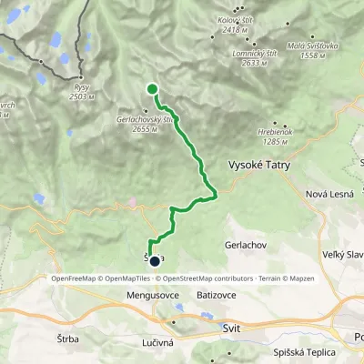 HardOne-dayMarkedNižné Hágy Junction below Poľský hrebeňElevation profile849–2 195 m14.6 kmascent 95 m≈ 4 h walkingunder 1 km from Lavínový štít
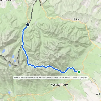 HardMulti-dayMarkedTatranská Lomnica Lysá PoľanaElevation profile853–2 268 m27.3 kmascent 1 415 m≈ 9.5 h walkingunder 1 km from Lavínový štít
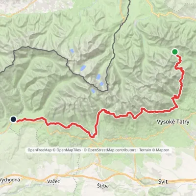 HardMulti-dayMarkedTatranská magistrála (Tatra Highway): Podbanské Veľké Biele plesoElevation profile929–2 043 m50.1 kmascent 1 639 m1.8 km from Lavínový štít
Nearby attractions
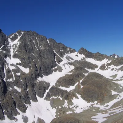 PeakZadný GerlachVyšné Hágyaltitude 2 616 munder 1 km from Lavínový štítZadný Gerlach (officially Zadný Gerlachovský štít, “Rear Gerlach”; Polish Zadni Gerlach) is a mighty 2,616 m junction summit on the main ridge of the High Tatras (2...
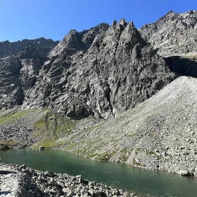 LakeDlhé pleso (Velická dolina)Nová Poliankaunder 1 km from Lavínový štítDlhé pleso (the Long Tarn) in Velická dolina is a small elongated lake in the High Tatras, within Tatra National Park (TANAP).
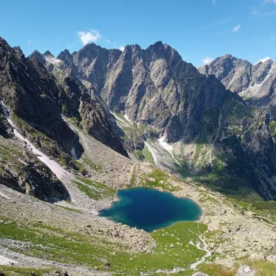 LakeLitvorové plesoVyšné Hágy1.1 km from Lavínový štítLitvorové pleso (Polish: Litworowy Staw) is a glacial cirque lake in the upper part of Litvorová dolina, a side branch of Bielovodská dolina on the northern side of...
Craft nearby
All craft places Water parks & thermal poolsClimatic spas of the High Tatras: Nový Smokovec, Polianka, KotlinaVysoké Tatry7.1 km from Lavínový štítNový Smokovec is the best known of the climatic spas of the High Tatras. It grew up in a spruce forest at about 1010 m, south-west of Starý Smokovec, with which it...
 Cheese dairies & pasturesShepherd's Hut on Rusinowa PolanaBrzegi11 km from Lavínový štítRusinowa Polana is one of the most beautiful mountain glades in the Polish Tatras, and from May to October it is home to the bacówka (shepherd's hut) of baca Stanisław...
 Cheese dairies & pasturesFurtek's Shepherd's Huts, Kuźnice and KalatówkiZakopane16 km from Lavínový štítAbove Kuźnice — the southern edge of Zakopane where most hikes into the Western and High Tatras begin — the flocks are tended by baca Andrzej Staszel, nicknamed "Furtek".
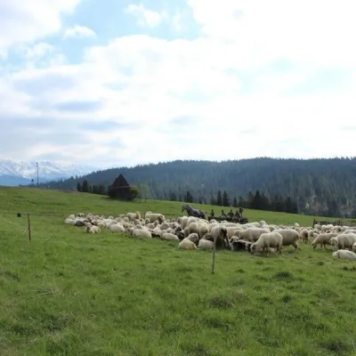 Cheese dairies & pasturesU Jancoka Shepherd's Hut, Brzegi: oscypek from Poland's first female bacaBrzegi17 km from Lavínový štítThe U Jancoka shepherd's hut (bacówka) stands beside regional road 960, which runs from Bukowina Tatrzańska to the Łysa Polana border crossing, in the village of Brzegi.
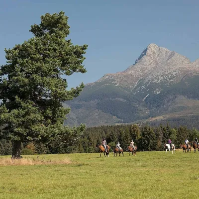 Horse ridingKone vo Východnej: horse rides below the TatrasVýchodná17 km from Lavínový štítKone vo Východnej (“Horses in Východná”) is a small family horse farm on the meadows above the village of Východná in upper Liptov, with a sweeping view of the High...
 Water parks & thermal poolsAquaCity Poprad water parkPoprad17 km from Lavínový štítAquaCity Poprad is a large year-round water park and wellness complex in the town of Poprad, a few minutes from the centre; according to the complex, the High Tatras...
