Clăbucetul Taurului
Clăbucetul Taurului (Romanian: Clăbucetul Taurului, "Bull's Cap") is a mountain in the Baiu Mountains (Southern Carpathians) on the border of Brașov and Prahova Counties, between the resort towns of Predeal and Azuga. Its highest peak is 1,521 m according to OpenStreetMap (Wikipedia lists 1,520 m). The Romanian word clăbucet means "cap" and is often found in the names of low, rounded mountains. The nearest settlements are Azuga (about 2.5 km as the crow flies), Predeal (about 4.6 km), and Bușteni (about 6.8 km).
According to the Hungarian Wikipedia, the massif stretches from north to south; on the west it is bordered by the Prahova valley, on the east by the Limbășel stream valley. Most of the area is covered by coniferous forests, which give way to alpine meadows and rich pastures higher up. The mountain has two summits: the northern Clăbucet (1,456 m) and the southern Clăbucetul Taurului (locally called Pițiponcu). In the saddle between them, at 1,324 m, stands Gârbova Hut, where you can eat and spend the night.
Nature and history
According to English and Hungarian Wikipedia, in the early 19th century the mountain belonged to the Filipescu family; in 1844, the boyar Alecu Filipescu-Vulpea donated it to the Predeal Monastery. After secularization in 1863, it became state property, and at the end of the century it passed to the royal crown estates. In autumn 1916, during World War I, fighting took place here: shell craters are still visible near the summit, and in 2018 a monument to the fallen was erected on the top. The first ski slope on Clăbucet appeared in 1942, the first ski lift in 1964; a hut with 80 places on the northern summit (Clăbucet Plecare) burned down in 1999 and remains in ruins.
Getting there / routes
The Hungarian Wikipedia notes that the mountain can be hiked at any time of year and even in bad weather, and climbing the summits does not require special fitness or equipment. From Predeal, a blue triangle trail starts at the ski slope; in winter, the northern summit can be reached by ski lift. From Azuga, there are two marked trails: the blue triangle from the gas station on the DN1 road, and the blue dot from the upper part of town. You can also approach via the Limbășel valley (blue dot) and from the Piatra Mare Mountains (blue cross). The blue triangle route "Predeal – Gârbova hut – Azuga" goes directly over the mountain.
The northern and northeastern slopes are ski runs where snow lasts for several months.
The view from the top
According to the Hungarian Wikipedia, both summits offer a wonderful panorama of the surrounding mountains: the Baiu, Bucegi (there, 9 km to the southwest, is Coștila Peak), Piatra Craiului, Postăvaru, Piatra Mare, and Ciucaș ridges.
Safety, season and rules
In winter, the northern slopes are ski runs—do not walk on them while skiing is in progress. In fog on the meadows, stay on the marked trails. Bears are common in the Romanian Carpathians: do not leave marked paths, make noise, avoid hiking at dusk, and do not keep food in your tent; near sheepfolds, shepherd dogs may attack—do not run, stop and shield yourself with your backpack (advice from Salvamont România).
In case of emergency, call the national mountain rescue dispatcher 0SALVAMONT — 0725 826 668 or 112.
Getting there from Ukraine
Border crossings
- Porubne – Siret — road and pedestrian, 24/7
- Diakivtsi – Racovăț — road and pedestrian, 24/7 No freight traffic.
- Krasnoilsk – Vicovu de Sus — road and pedestrian, 08:00–20:00 Cars up to 3.5 t and pedestrians only; not 24/7.
- Solotvyno – Sighetu Marmației — road and pedestrian, 24/7 Passenger traffic only: vehicles up to 3.5 t with up to 9 seats, pedestrians.
- Diakove – Halmeu — road, 24/7 No pedestrian crossing.
By car
Chernivtsi – Bușteni ≈426 km, ≈7 h 32 min (via Diakivtsi – Racovăț); Rakhiv – Bușteni ≈454 km, ≈8 h 01 min (via Solotvyno – Sighetu Marmației); Uzhhorod – Bușteni ≈557 km, ≈9 h 15 min (via Diakove – Halmeu). Times without border queues, our road routing (GraphHopper, OSM).
Checked 03.11.2026; border crossing hours and timetables change — check before you travel.
Comments
Travellers’ experience: reports, tips, questions.
No one has reported on this trail yet. Been here lately? Tell others what it is like now.
Water and shelter nearby
- Gârbova Hut980 m · Standing · 1 324 m
Trails nearby
All trails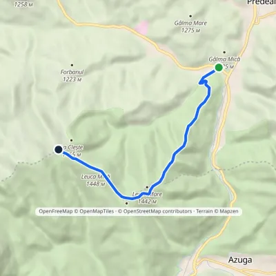 EasyOne-dayMarkedPredeal Baiului Saddlevia Clăbucetul Baiului RidgeElevation profile998–1 448 m7 kmascent 483 m≈ 2.5 h walking3.1 km from Clăbucetul Taurului
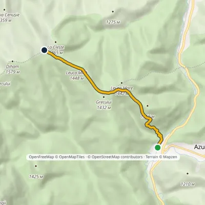 EasyOne-dayMarkedAzuga station Baiului SaddleElevation profile935–1 448 m5.3 kmascent 536 m≈ 2 h walking3.1 km from Clăbucetul Taurului
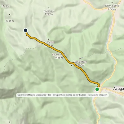 EasyOne-dayMarkedAzuga station Diham HutElevation profile935–1 448 m6.2 kmascent 531 m≈ 2.5 h walking3.2 km from Clăbucetul Taurului
Nearby attractions
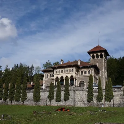 CastleCantacuzino Castle in Bușteni: a Neo-Romanian palace below the BucegiBușteni6.5 km from Clăbucetul TauruluiThe "Nabob's" palace facing the mountains Cantacuzino Castle (Castelul Cantacuzino) stands on a slope above the small town of Bușteni in the Prahova Valley, directly...
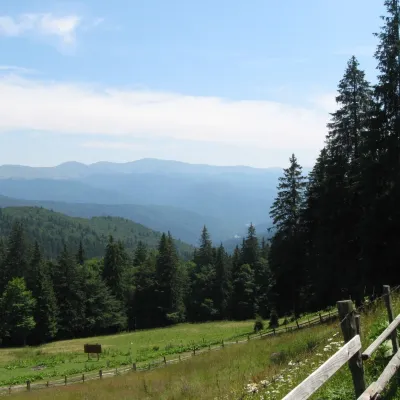 Mountain meadowPoiana IzvoarelorBuștenialtitude 1 448 m7.2 km from Clăbucetul TauruluiPoiana Izvoarelor ("the meadow of the springs") is a mountain meadow at about 1,455 m on the south-eastern slope of Mount Diham, in the northern part of the Bucegi...
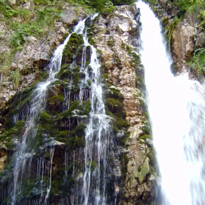 WaterfallUrlătoarea Waterfall (Cascada Urlătoarea)Bușteni · Bucegi Mountains9.3 km from Clăbucetul Tauruluiheight 15 m1 141 m above sea levelUrlătoarea Waterfall (Cascada Urlătoarea) is one of the best known in Romania. It lies on the eastern slope of the Bucegi Mountains, in the Bucegi Natural Park, very...
Craft nearby
All craft places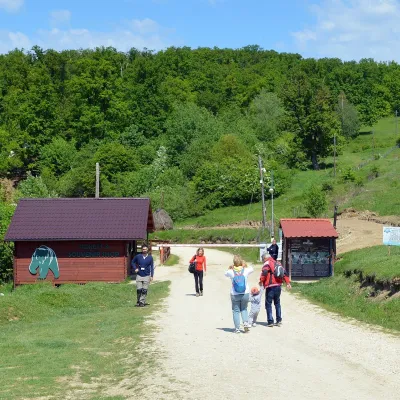 Wildlife parks & animal farmsLibearty Bear Sanctuary in Zărnești: a forest for rescued bearsVulcan21 km from Clăbucetul TauruluiThe AMP Libearty Bear Sanctuary lies near the town of Zărnești in Brașov County, at the edge of a forest below the Piatra Craiului massif.
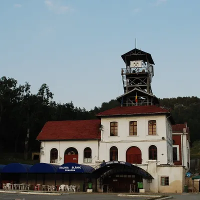 Water parks & thermal poolsSlănic Salt Mine: a 208 m deep microclimate and salt lakesSlănic37 km from Clăbucetul TauruluiThe Slănic Salt Mine (Salina Slănic), or the Unirea mine (Mina Unirea), is one of Romania's best-known show salt mines.
 Water parks & thermal poolsPucioasa: sulphur baths and inhalations in the Carpathian foothillsPucioasa44 km from Clăbucetul TauruluiPucioasa is a small spa town in Dâmbovița County, in the valley of the Ialomița river among the wooded hills of the Carpathian foothills, about 20 km north of the city...
