Starorobociański Wierch (Klin)
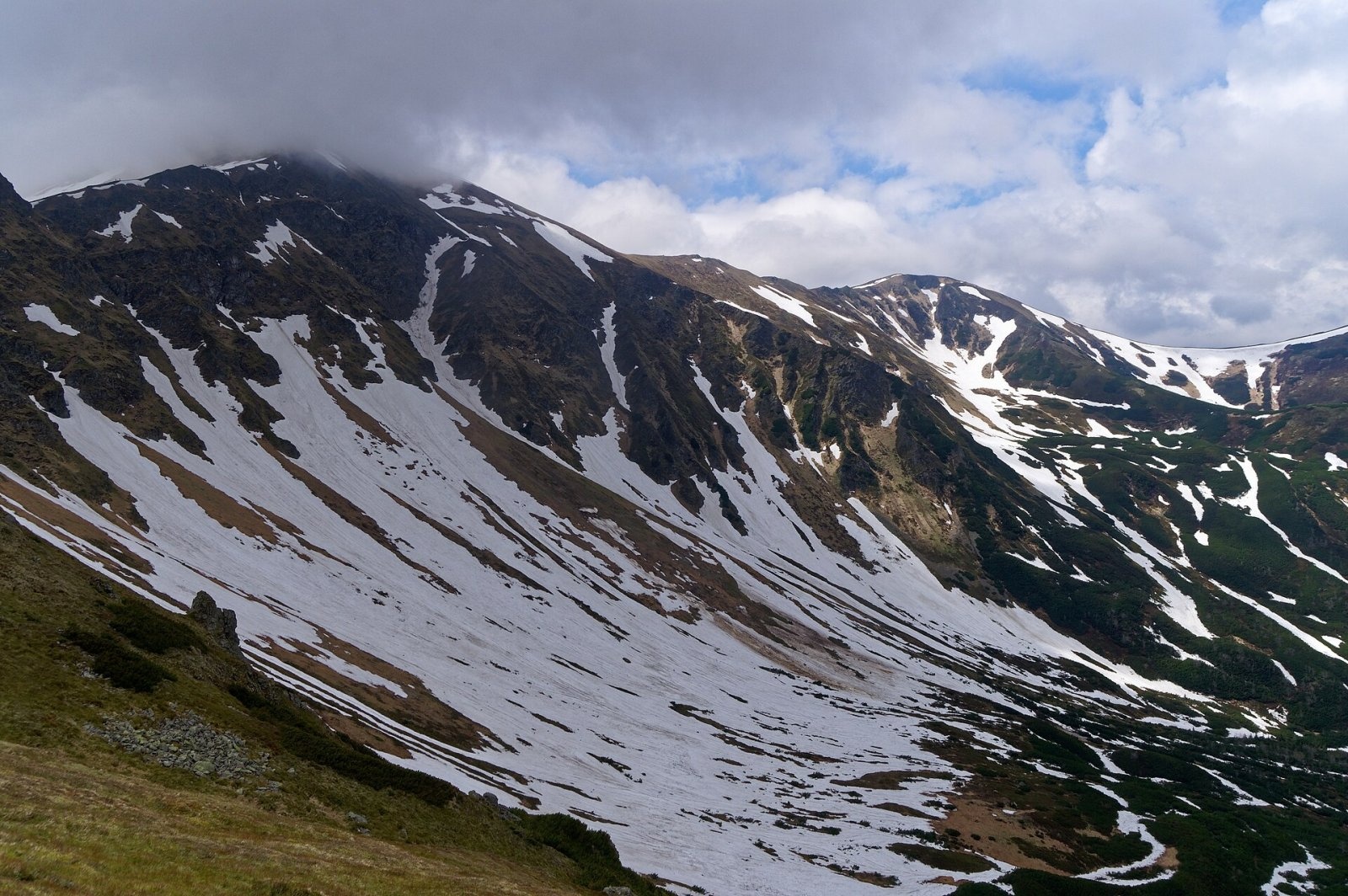
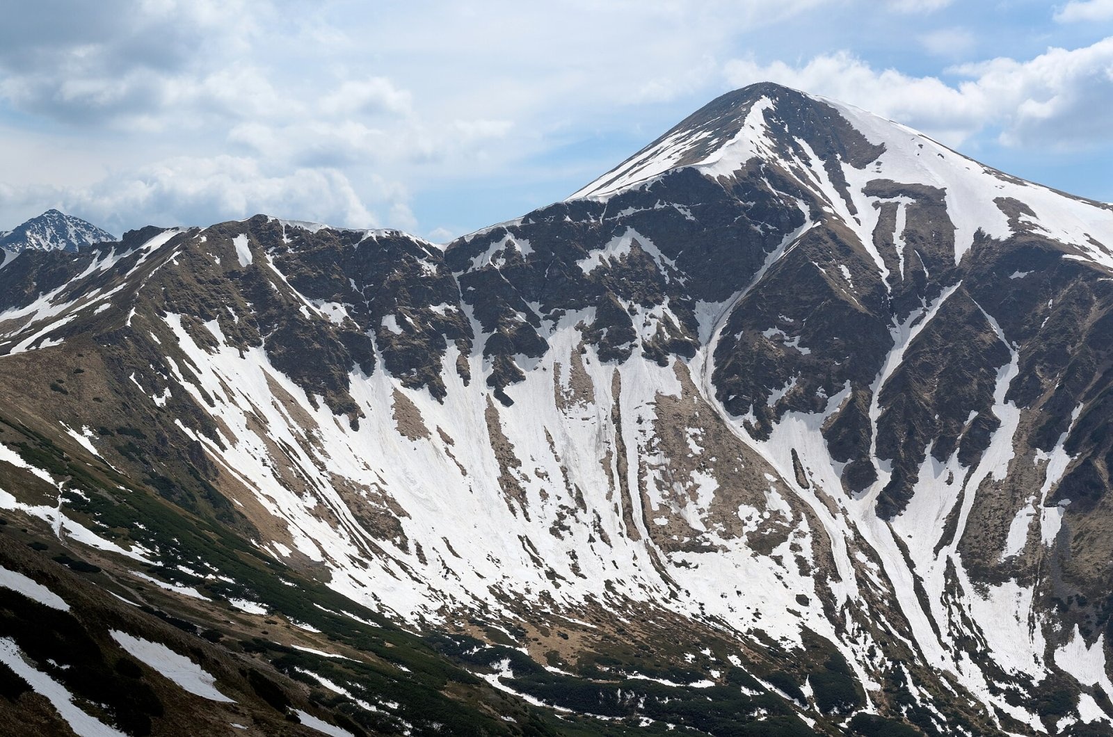
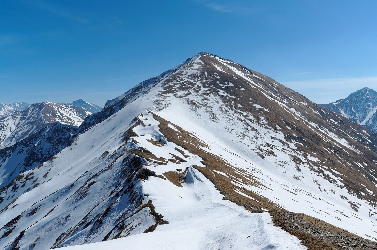
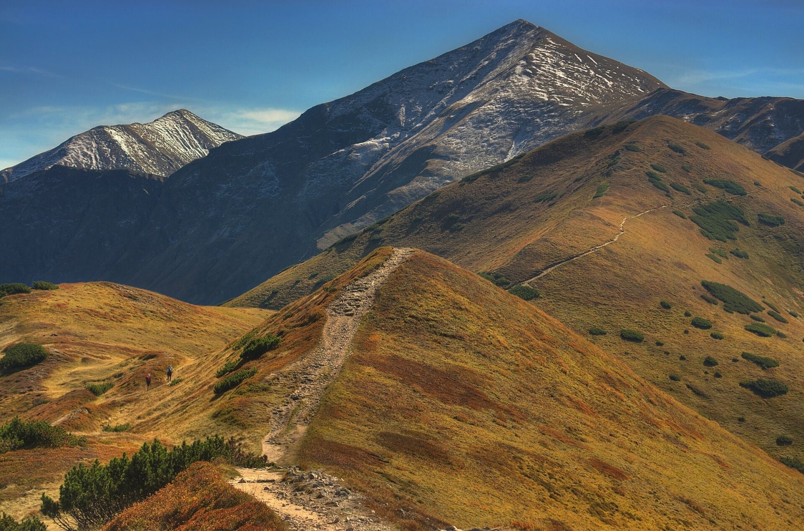
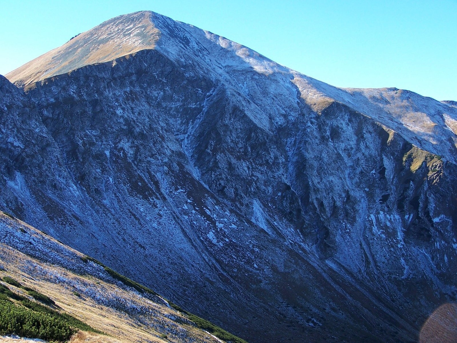
Starorobociański Wierch (Slovak: Klin, "the wedge") is a 2,176 m peak on the main ridge of the Western Tatras, which carries the border between Poland and Slovakia. It is the highest summit of the Polish part of the Western Tatras and one of the highest in the whole range. To the west, beyond the Starorobociańska pass, stands Kończysty Wierch; to the east, beyond the Gaborowa pass, Siwy Zwornik and Blyšť. The mountain towers over the Polish Starorobociańska valley (the largest branch of Dolina Chochołowska) and the Slovak Zadná Račkova and Gáborova valleys. Its summit is a short north–south crest that drives like a wedge between the Gáborova and Račkova valleys — hence the Slovak name. The nearest settlements are the hamlets of Siwa and Kiry at the mouths of the Chochołowska and Kościeliska valleys (about 9 km), and Podbanské on the Slovak side (about 8.5 km). The peak lies in both the TPN and TANAP national parks.
How to get there: routes
A red ridge trail runs over the summit along the border: about 40 minutes from Kończysty Wierch (30 minutes back) and about 25 minutes east to the Liliowy Karb pass. From the Polish side, the most popular ways up to the ridge are:
- from the Chochołowska valley through the Starorobociańska valley and Siwa Przełęcz — about 3 h 45 min (2 h 50 min down);
- from the Chochołowska valley via Trzydniowiański Wierch and Kończysty Wierch — about 4 h (3 h 10 min down);
- from the Ornak hut (Kościeliska valley) via Iwaniacka Przełęcz, Ornak and Siwa Przełęcz — about 4 h 30 min (3 h 40 min down);
- from the Chochołowska valley via Iwaniacka Przełęcz, Ornak and Siwa Przełęcz — about 4 h 45 min.
On the Slovak side a yellow trail climbs the Račkova valley to Račkovo sedlo, and a green trail leads from the Pod Klinom junction through the Gáborova valley to Gáborovo sedlo; from either saddle you continue along the red ridge. From the west you can follow the ridge from Volovec over Končistá.
What you can see from the summit
Standing almost in the middle of the Tatra chain and rising above its neighbours, Starorobociański Wierch is an excellent viewpoint. The panorama takes in both the Western and the High Tatras; Bystrá with Blyšť, Kamienista, Ciemniak and the Roháče look particularly impressive from here. Slovak sources add that in good visibility you can see the Sub-Tatra basin, Oravská Magura, the Orava Beskids and the Low Tatras.
Nature and history
From both south and north the mountain looks like a lofty pyramid — Eugeniusz Janota called it "pyramidal" in 1860. It is built of metamorphic rocks and igneous granitoids, and its slopes are stony. The north side is the steepest: the summit rises about 500 m above the glacial cirque of the Starorobociańska valley, where the walls of Wielkie Jamy and Zdrapy, split by the Krzywy Żleb gully, stand above the large Zagony scree. Between the summit and Kończysty Wierch the ridge is cut for several hundred metres by a shallow ridge-top trench — a classic split ridge. In winter powerful avalanches sweep down the steep grassy slopes. Among the rare plants found here is Hungarian fleabane (Erigeron hungaricus).
The Polish name comes from the former Stara Robota ("old work") pasture in the Starorobociańska valley, named after old, abandoned mine workings: ores were probably extracted here as early as the 16th century, and the area appears in mining records in 1766. Shepherds grazed their flocks even on the steep slopes, and on the Slovak side all the grassy slopes were used right up to the summit. The mountain has its treasure legends: the famous storyteller Sabała claimed that robbers had hidden ducats below the summit, at the spot where the sun first shines on St Michael's Day. The first ascent is credited to the Swedish naturalist Göran Wahlenberg, who measured its height in 1813. The first winter ascent was made in 1910 by skiers of the ZON society — Henryk Bednarski, Jerzy Cybulski, Stefan Jaworski, Gustaw Kaleński and Józef Lesiecki.
Safety, season and rules
On the Polish side the rules of the Tatra National Park (TPN) apply: there is an entrance fee, leaving marked trails is forbidden, walking on trails is banned from dusk to dawn between 1 March and 30 November, and from 1 December to the end of February trails are closed from 22:00 to 05:00. The Slovak approaches (the Račkova and Gáborova valleys) lie in TANAP's high-mountain zone and are closed from 1 November to 31 May under the park's current visitor rules (formerly until 15 June).
The routes are long, with more than 1,200 m of ascent, and the open ridge offers no shelter from wind or storms. In winter the slopes of Starorobociański Wierch are avalanche-prone, so go only with proper equipment and experience, after checking the avalanche forecast.
Emergency numbers: in Poland, TOPR 985 or +48 601 100 300; in Slovakia, HZS 18 300 (+421 18 300); 112 works in both countries.
Interesting facts
- The name "Old Work" comes from ancient mines — ores were sought and extracted here centuries ago.
- The Slovak name Klin ("wedge") describes the summit crest pushing between two valleys.
- Its height was first measured in 1813 by the Swede Göran Wahlenberg, who is also credited with the first ascent.
Photos: Jakub Hałun, CC BY-SA 4.0; Jakub Hałun, CC BY-SA 4.0; Jakub Hałun, CC BY-SA 4.0; Bartek Bodak, CC BY-SA 3.0 pl; Jerzy Opioła, CC BY-SA 4.0; Jerzy Opioła, CC BY-SA 4.0; Maciej Kraus, CC BY 2.0 — Wikimedia Commons.
Getting there from Ukraine
Border crossings
- Krakovets – Korczowa — road, 24/7
- Shehyni – Medyka — road, 24/7 Pedestrian crossing is not confirmed by the Ukrainian border service — check dpsu.gov.ua before the trip.
- Smilnytsia – Krościenko — road, 24/7
- Hrushiv – Budomierz — road, 24/7
- Mostyska – Przemyśl (rail) — rail, 24/7
By car
Lviv – Zakopane ≈421 km, ≈5 h 10 min without border queues. Route: M-10 Lviv – Krakovets → Krakovets – Korczowa checkpoint → A4 motorway (Rzeszów – Tarnów – Kraków) → Kraków southern bypass → S7/DK7 → DK47 ('Zakopianka') via Nowy Targ → Zakopane. The A4 Katowice – Kraków section (Balice and Mysłowice toll plazas) is tolled, but this route does not use it. In summer and at weekends the DK47 near Zakopane is often congested.
Checked 23.10.2026; border crossing hours and timetables change — check before you travel.
Location on the map
Comments
Trails nearby
All trails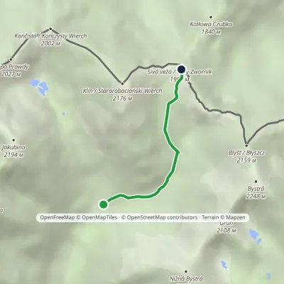 EasyOne-dayMarkedJunction under Klin Gáborovo SaddleElevation profile1 450–1 949 m2.5 kmascent 454 m≈ 1.5 h walkingunder 1 km from Starorobociański Wierch (Klin)
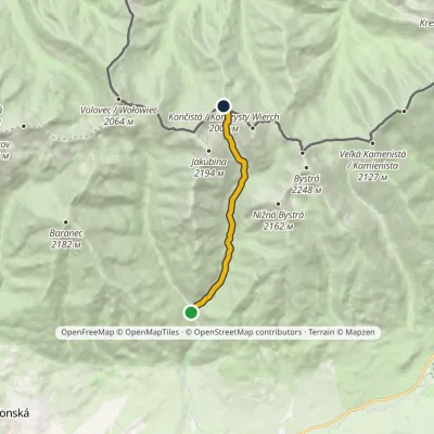 ModerateOne-dayMarkedProstredná Meadow Račkovo SaddleElevation profile962–1 996 m7.5 kmascent 1 014 m≈ 4 h walkingunder 1 km from Starorobociański Wierch (Klin)
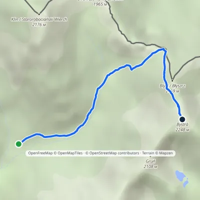 EasyOne-dayMarkedJunction in Gáborova Valley BystráElevation profile1 450–2 232 m3.2 kmascent 744 m≈ 2.5 h walking1.1 km from Starorobociański Wierch (Klin)
Nearby attractions
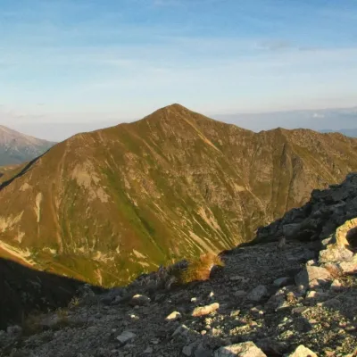 PeakBystráaltitude 2 248 m2.1 km from Starorobociański Wierch (Klin)Bystrá (Polish: Bystra) is the highest peak of the Western Tatras at 2,248 m. It lies entirely in Slovakia, about 600 m south of the main ridge that carries the Polish...
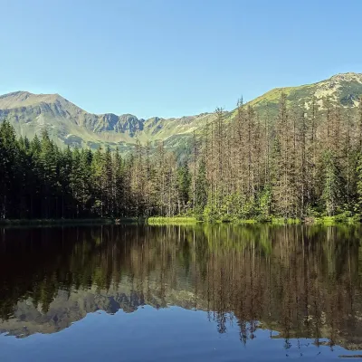 LakeSmreczyński Staw Lake4.1 km from Starorobociański Wierch (Klin)Smreczyński Staw is a small glacial lake in the upper part of the Kościeliska Valley, at the mouth of the Pyszniańska Valley, at 1,226 m.
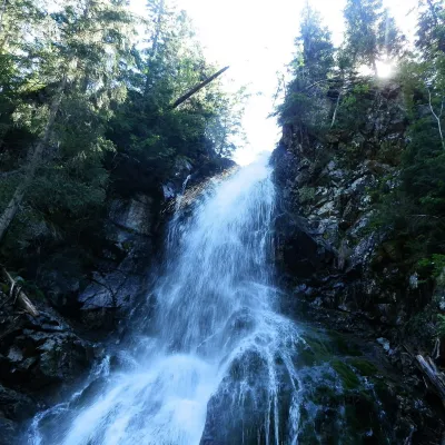 WaterfallRoháčsky Waterfall6.8 km from Starorobociański Wierch (Klin)Roháčsky waterfall (Roháčsky vodopád) is the best-known waterfall of the Western Tatras, in the Roháče massif about 12 km east of the village of Zuberec in Orava.
Craft nearby
All craft places Cheese dairies & pasturesShepherds' Huts on Polana Chochołowska4.6 km from Starorobociański Wierch (Klin)Polana Chochołowska is the largest glade in the Polish Tatras and one of the largest in the whole range.
 Cheese dairies & pasturesShepherd's Hut in the Kościeliska Valley8.3 km from Starorobociański Wierch (Klin)Józef Słodyczka's bacówka (shepherd's hut) on the Wyżnia Kira Miętusia glade is probably the most easily reached shepherds' hut in the Polish Tatras.
 Water parks & thermal poolsOravice thermal pools12 km from Starorobociański Wierch (Klin)The Oravice thermal pools (Termálne kúpalisko Oravice) are the municipal thermal baths in the mountain settlement of Oravice at the foot of the Western Tatras.
 Water parks & thermal poolsMeander Thermal Resort, Oravice12 km from Starorobociański Wierch (Klin)Meander Thermal & Ski Resort (formerly Meander Park) is a thermal water park and ski centre in the mountain settlement of Oravice in northern Slovakia, at the foot of...
 Koliby & Hutsul cuisineBąkowo Zohylina Wyźnio Highland Tavern14 km from Starorobociański Wierch (Klin)Bąkowo Zohylina Wyźnio is a regional highland tavern in Zakopane housed in a wooden "szałas" (shepherd-hut-style building) with a view of the Tatras.
 Horse ridingKone vo Východnej: horse rides below the Tatras14 km from Starorobociański Wierch (Klin)Kone vo Východnej (“Horses in Východná”) is a small family horse farm on the meadows above the village of Východná in upper Liptov, with a sweeping view of the High...
