Bystrá
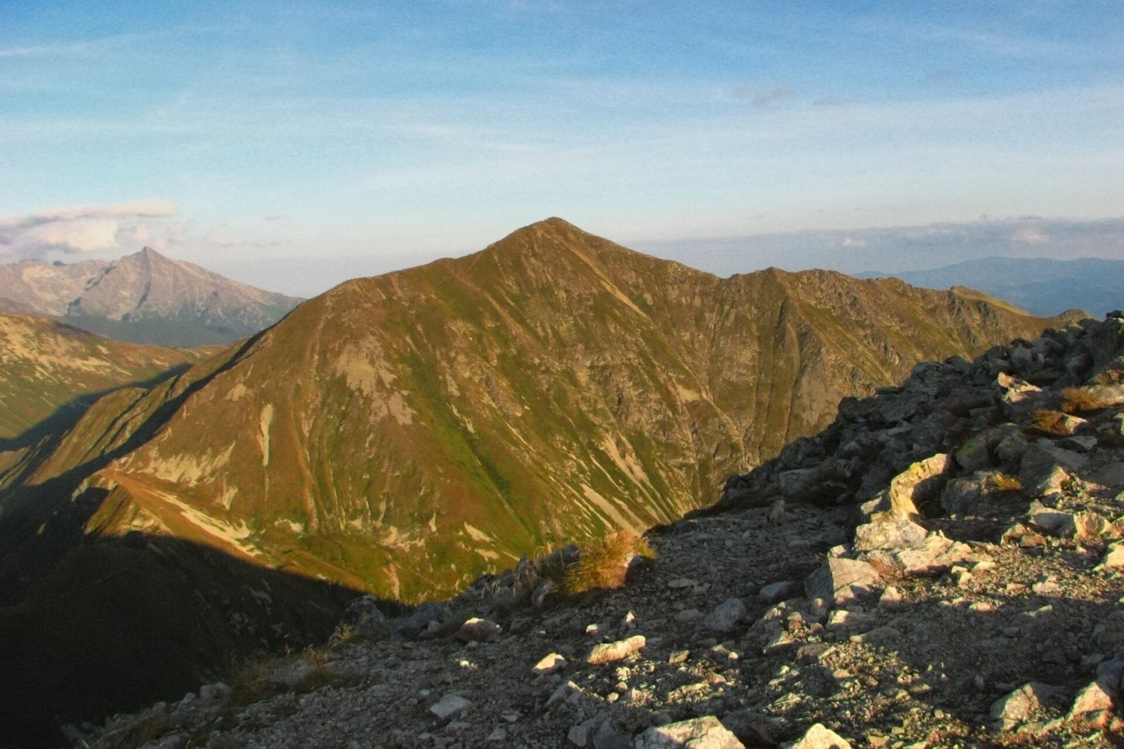
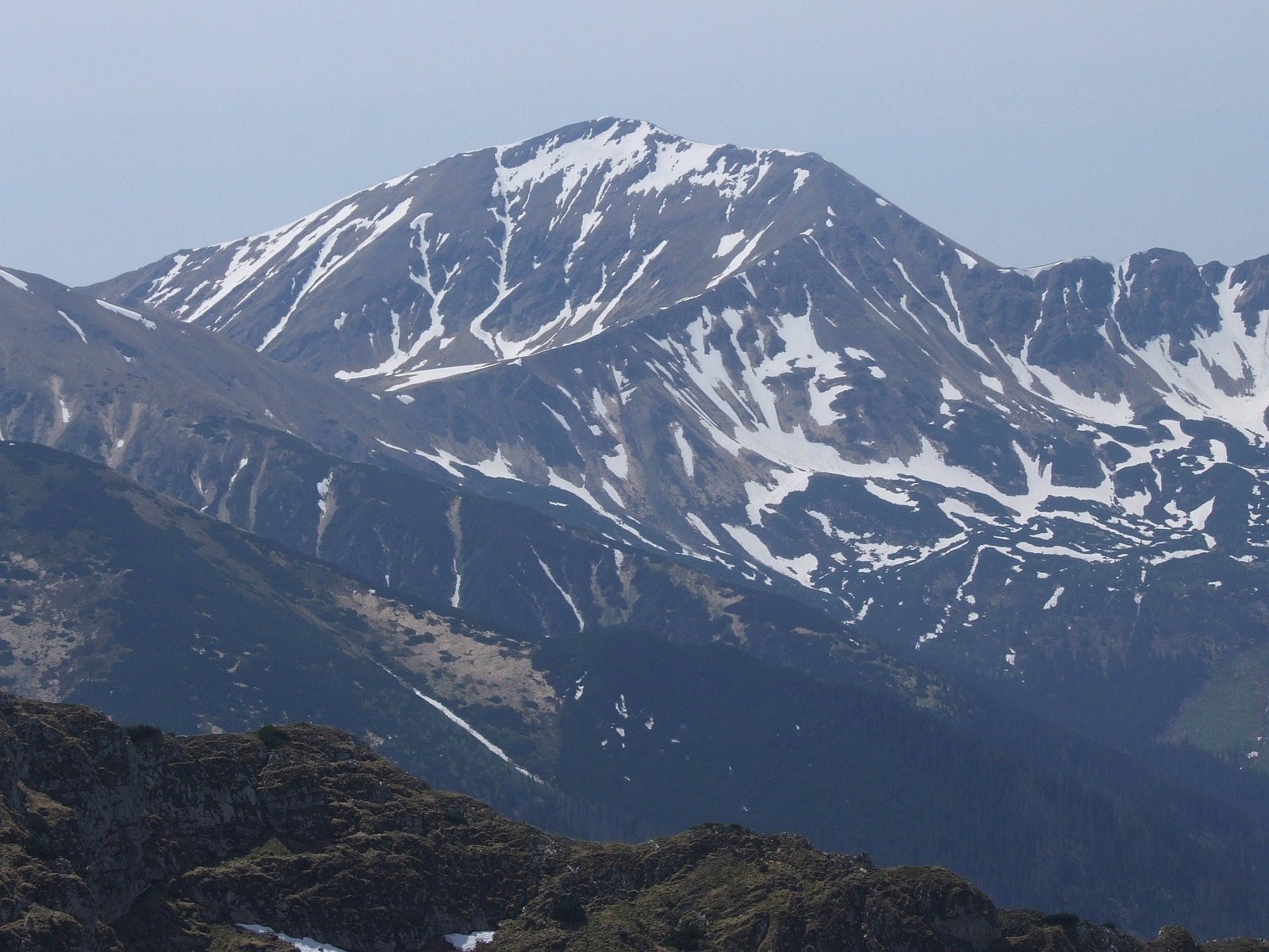
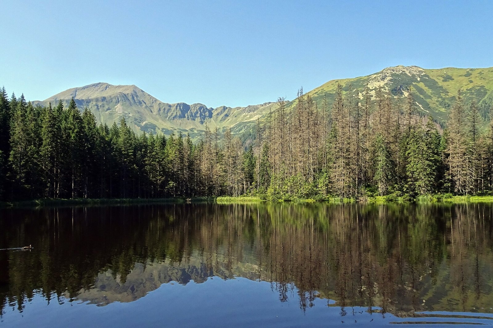
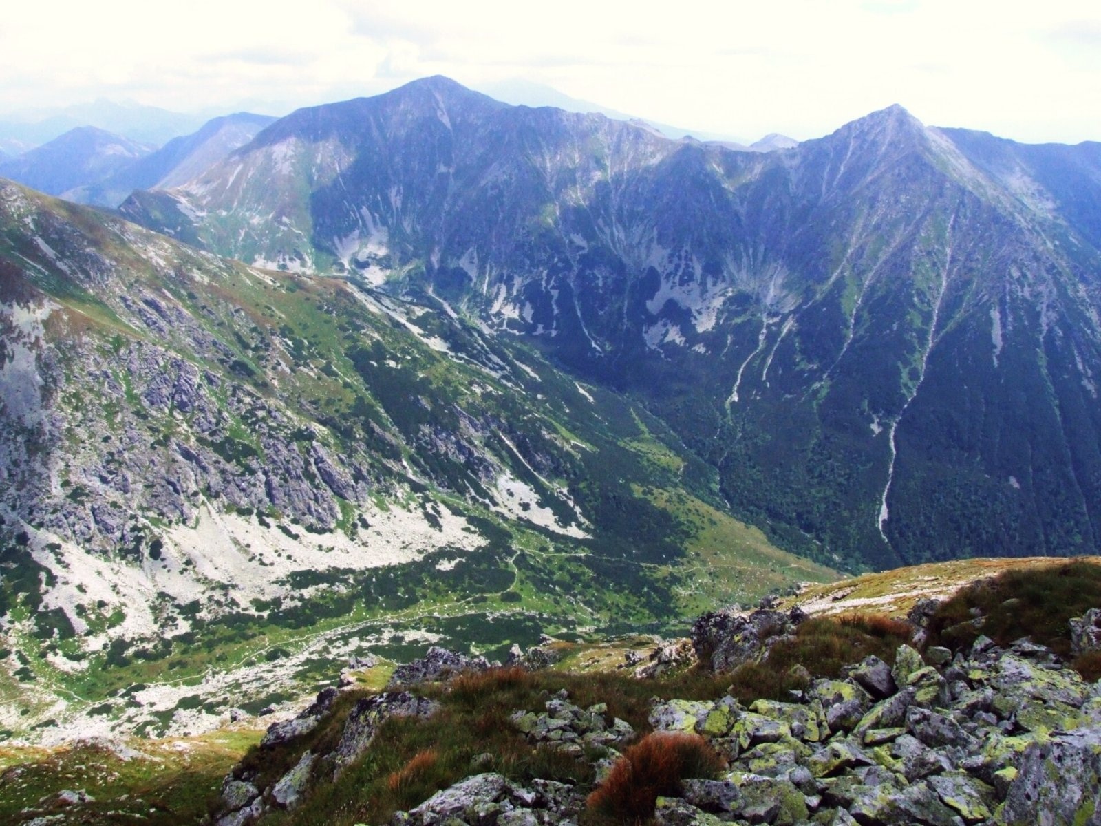
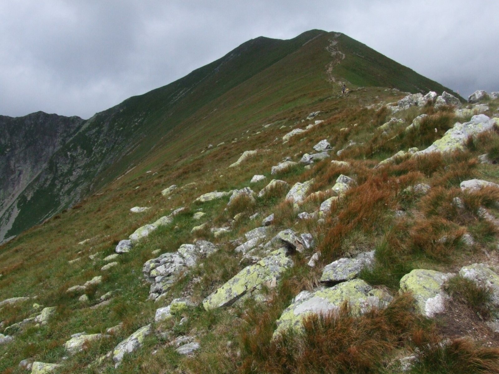
Bystrá (Polish: Bystra) is the highest peak of the Western Tatras at 2,248 m. It lies entirely in Slovakia, about 600 m south of the main ridge that carries the Polish–Slovak border. The mountain rises above three valleys — Gáborova (the upper part of Račkova), Kamenistá and Bystrá — and is the junction of three ridges: a short northern one linking it to Blyšť (Błyszcz) on the main ridge, a south-western one with Nižná Bystrá and a south-eastern one with Kotlová. The nearest settlement is Podbanské, roughly 6.5 km to the south-east, with the village of Pribylina in the Liptov region a little further away. Bystrá lies in the Tatra National Park (TANAP) and, thanks to its height and easy access, is one of the most popular objectives in the Western Tatras.
How to get there: routes
Two trails marked by the Slovak Hiking Club lead to the summit, both from the Slovak side:
- Yellow trail — from the Tatranská cesta mládeže road (No. 537) near Pribylina up the Bystrá valley, past the Bystré plesá lakes, straight to the top. Polish guidebooks give about 4 hours up and 3 hours down.
- Blue trail — along the slopes below the main ridge to the Bystré sedlo saddle, then across the flank of Blyšť to the summit; about 40 minutes from the saddle. You can join it from Podbanské through the Kamenistá valley and Pyšné sedlo, or from Pribylina through the Úzka, Račkova and Gáborova valleys.
There is no direct marked trail from Poland: hikers climb from the Kościeliska valley to the main ridge and continue to Bystrá on the Slovak trails. The path from Blyšť to the summit (about 15 minutes) is not an official trail, so it should not be used inside the national park. Plan carefully — both approaches are long and involve a big height gain.
What you can see from the summit
The grassy, rocky summit offers an all-round panorama. In 1928 the Polish geographer Jerzy Młodziejowski wrote that the view from Bystrá could move not just a specialist but any ordinary hiker. Among the High Tatras the sharp outlines of Świnica and Kriváň stand out; to the west the folded ridges of the Western Tatras run one behind another, and to the north rise the massive limestone walls of Czerwone Wierchy and Kominiarski Wierch. Slovak sources add that in good visibility you can make out the Low Tatras, Veľká and Malá Fatra, the Orava Beskids, Slovak Paradise, Kozie chrbty and the Volovec Mountains.
Nature and history
Bystrá is built of crystalline schists with layers of white granite. Below its southern faces, in glacial cirques, lie the two Bystré plesá lakes, with the small Anitino očko pool further down. Livestock once grazed the steep slopes right up to the summit; by midsummer they turn rusty red with highland rush (Juncus trifidus). In winter huge avalanches — among the largest in the Tatras — slide down these tall, almost entirely grassy slopes.
Local highlanders used to call the mountain Pyszna after the pasture below it; Balthasar Hacquet's 1796 map labels it Pysna Mons, while Matej Bel (1736) and Rizzi Zannoni (1772) already used the form "Bistro". Its first ascent cannot be named, as ores were prospected and mined in the area for a long time. Austrian military surveyors probably reached the summit in the early 1820s, and Ludwik Zejszner still saw their triangulation pyramid there in 1838; from then on Bystrá was one of the key points for mapping the Tatras. The first known winter ascent was made by Ada Świderska with the guide Klimek Bachleda. Before the Second World War the mountain was a very popular outing — people even climbed it at night to watch the sunrise, staying in a hut in the Pyszna valley that was burnt down by the Germans during the war.
Safety, season and rules
Both marked routes to Bystrá lie in TANAP's high-mountain zone and are subject to its seasonal closure: under the park's current visitor rules, trails above the tree line are closed from 1 November to 31 May (formerly until 15 June). Check the current status on the TANAP website before setting out, and stay on marked trails.
There are no chained sections, but the slopes are steep and high, Tatra weather changes fast and thunderstorms are dangerous on the open ridge. Wet grass and rock are slippery: in October 2025 an experienced hiker was killed in a fall while descending from the summit and was found in the Gáborova valley. Allow plenty of time, carry warm clothing and water, and watch the forecast.
In an emergency call the Slovak Mountain Rescue Service (HZS) on 18 300 (+421 18 300 from a foreign phone) or 112. Rescue operations in Slovakia may be charged, so take out insurance that covers mountain hiking.
Interesting facts
- Bystrá is the highest peak of the Western Tatras even though it does not lie on the main ridge.
- Its old name, Pyszna, survives in the names of the Pyszna valley and the Pyšné sedlo saddle.
- A triangulation pyramid already stood on the summit in 1838 — one of the reference points for early maps of the Tatras.
Photos: Adrian Tync, CC BY-SA 4.0; Jerzy Opioła, CC BY-SA 4.0; Downar, CC BY-SA 4.0; Jerzy Opioła, CC BY-SA 4.0; Jerzy Opioła, CC BY-SA 4.0; Rafik k, CC BY-SA 4.0; Krzysztof Dudzik-Górnicki (User:ToSter), CC BY-SA 4.0 — Wikimedia Commons.
Getting there from Ukraine
Border crossings
- Uzhhorod – Vyšné Nemecké — road, 24/7
- Malyi Bereznyi – Ubľa — road, 24/7 For cars and buses; pedestrians not confirmed by the Ukrainian border service, lorries up to 3.5 t.
- Mali Selmentsi – Veľké Slemence (pedestrian) — pedestrian, 09:00–21:00 Kyiv time Pedestrians and cyclists only; inconvenient for the Tatras without onward transport.
- Chop – Čierna nad Tisou (rail) — rail, 24/7
By car
Uzhhorod – Poprad ≈195 km, ≈2 h 55 min without queues: Uzhhorod – Vyšné Nemecké checkpoint → I/19 via Sobrance and Michalovce → Košice → D1 motorway via Prešov → Poprad (Liptovský Mikuláš is ≈56 km further on the D1, total ≈249 km). Košice – Poprad ≈112 km. The D1 requires an e-vignette (eznamka.sk). Note: from Lviv the fastest way to Poprad is through Poland — Krakovets – A4 – Kraków – Zakopane – Łysa Polana ≈468 km (≈5 h 50 min); via Uzhok and Malyi Bereznyi ≈419 km but slower (≈6 h 40 min). Zakopane – Poprad ≈69 km, Zakopane – Liptovský Mikuláš ≈80 km.
Checked 23.10.2026; border crossing hours and timetables change — check before you travel.
Location on the map
Comments
Trails nearby
All trails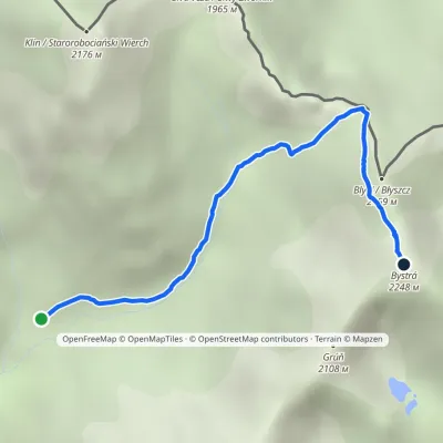 EasyOne-dayMarkedJunction in Gáborova Valley BystráElevation profile1 450–2 232 m3.2 kmascent 744 m≈ 2.5 h walkingunder 1 km from Bystrá
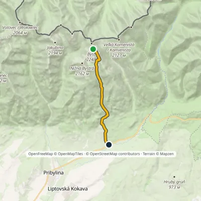 EasyOne-dayMarkedHrdovo BystráElevation profile849–2 232 m9.1 km≈ 2.5 h walkingunder 1 km from Bystrá
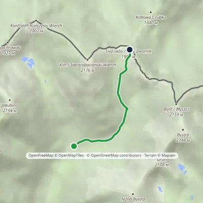 EasyOne-dayMarkedJunction under Klin Gáborovo SaddleElevation profile1 450–1 949 m2.5 kmascent 454 m≈ 1.5 h walking1 km from Bystrá
Nearby attractions
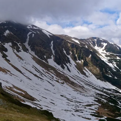 PeakStarorobociański Wierch (Klin)altitude 2 176 m2.1 km from BystráStarorobociański Wierch (Slovak: Klin, "the wedge") is a 2,176 m peak on the main ridge of the Western Tatras, which carries the border between Poland and Slovakia.
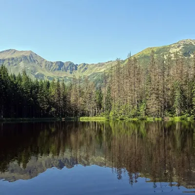 LakeSmreczyński Staw Lake4 km from BystráSmreczyński Staw is a small glacial lake in the upper part of the Kościeliska Valley, at the mouth of the Pyszniańska Valley, at 1,226 m.
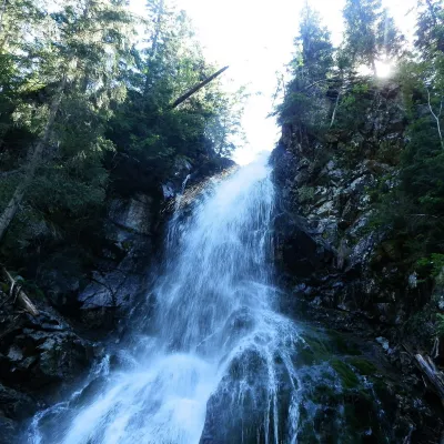 WaterfallRoháčsky Waterfall8.7 km from BystráRoháčsky waterfall (Roháčsky vodopád) is the best-known waterfall of the Western Tatras, in the Roháče massif about 12 km east of the village of Zuberec in Orava.
Craft nearby
All craft places Cheese dairies & pasturesShepherds' Huts on Polana Chochołowska6.5 km from BystráPolana Chochołowska is the largest glade in the Polish Tatras and one of the largest in the whole range.
 Cheese dairies & pasturesShepherd's Hut in the Kościeliska Valley8.9 km from BystráJózef Słodyczka's bacówka (shepherd's hut) on the Wyżnia Kira Miętusia glade is probably the most easily reached shepherds' hut in the Polish Tatras.
 Horse ridingKone vo Východnej: horse rides below the Tatras12 km from BystráKone vo Východnej (“Horses in Východná”) is a small family horse farm on the meadows above the village of Východná in upper Liptov, with a sweeping view of the High...
 Koliby & Hutsul cuisineBąkowo Zohylina Wyźnio Highland Tavern14 km from BystráBąkowo Zohylina Wyźnio is a regional highland tavern in Zakopane housed in a wooden "szałas" (shepherd-hut-style building) with a view of the Tatras.
 Cheese dairies & pasturesFurtek's Shepherd's Huts, Kuźnice and Kalatówki14 km from BystráAbove Kuźnice — the southern edge of Zakopane where most hikes into the Western and High Tatras begin — the flocks are tended by baca Andrzej Staszel, nicknamed "Furtek".
 Eco farmsFarma Východná — organic farm below the Tatras14 km from BystráFarma Východná is the highest-lying organic farm in Liptov, at 930 m in the village of Východná right below the Tatras.
