Plačlivé
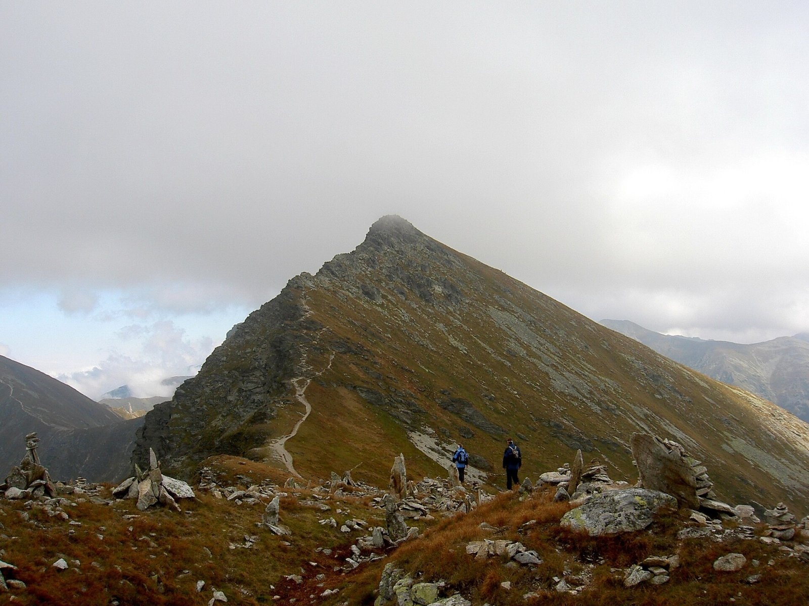
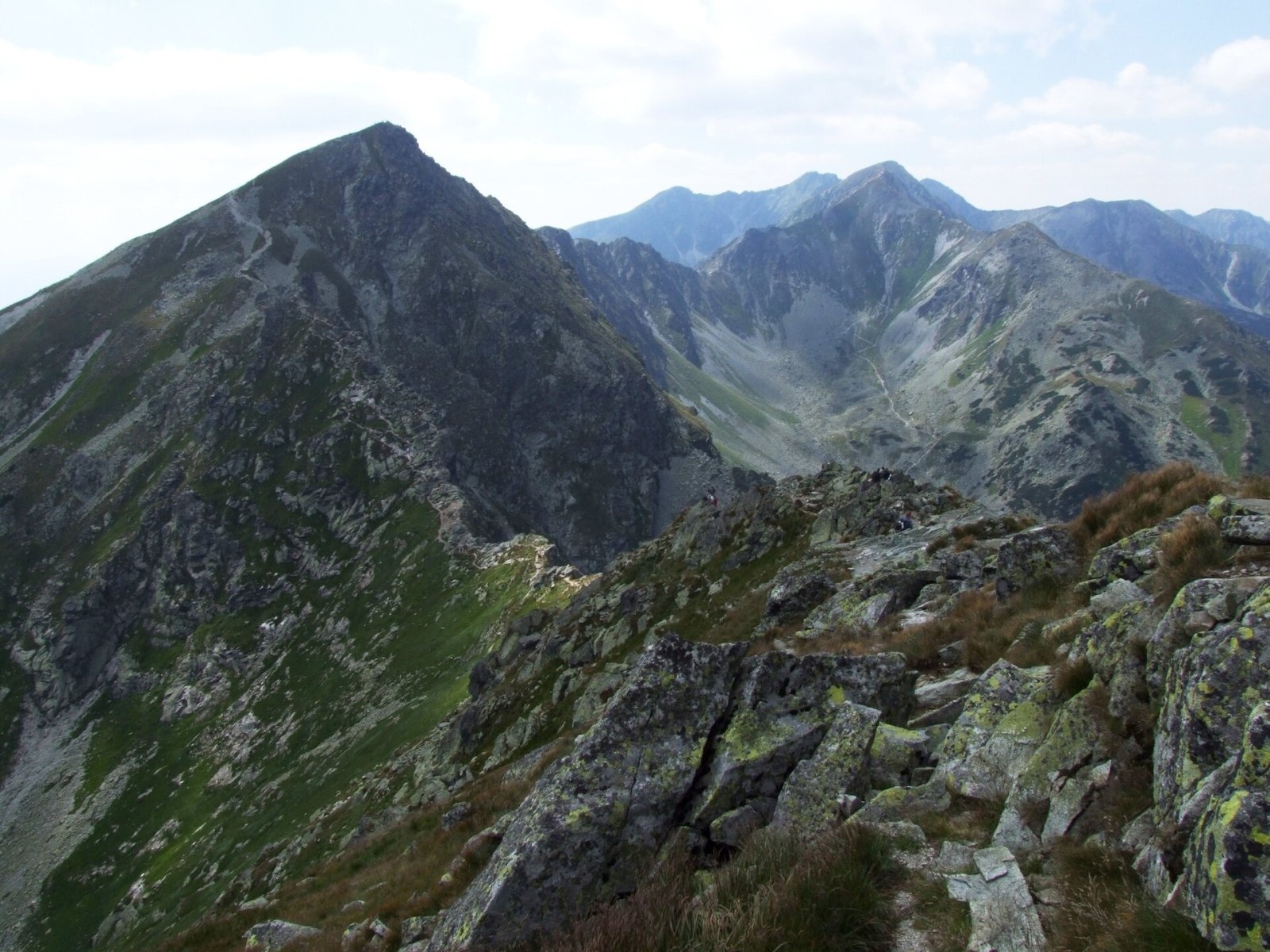
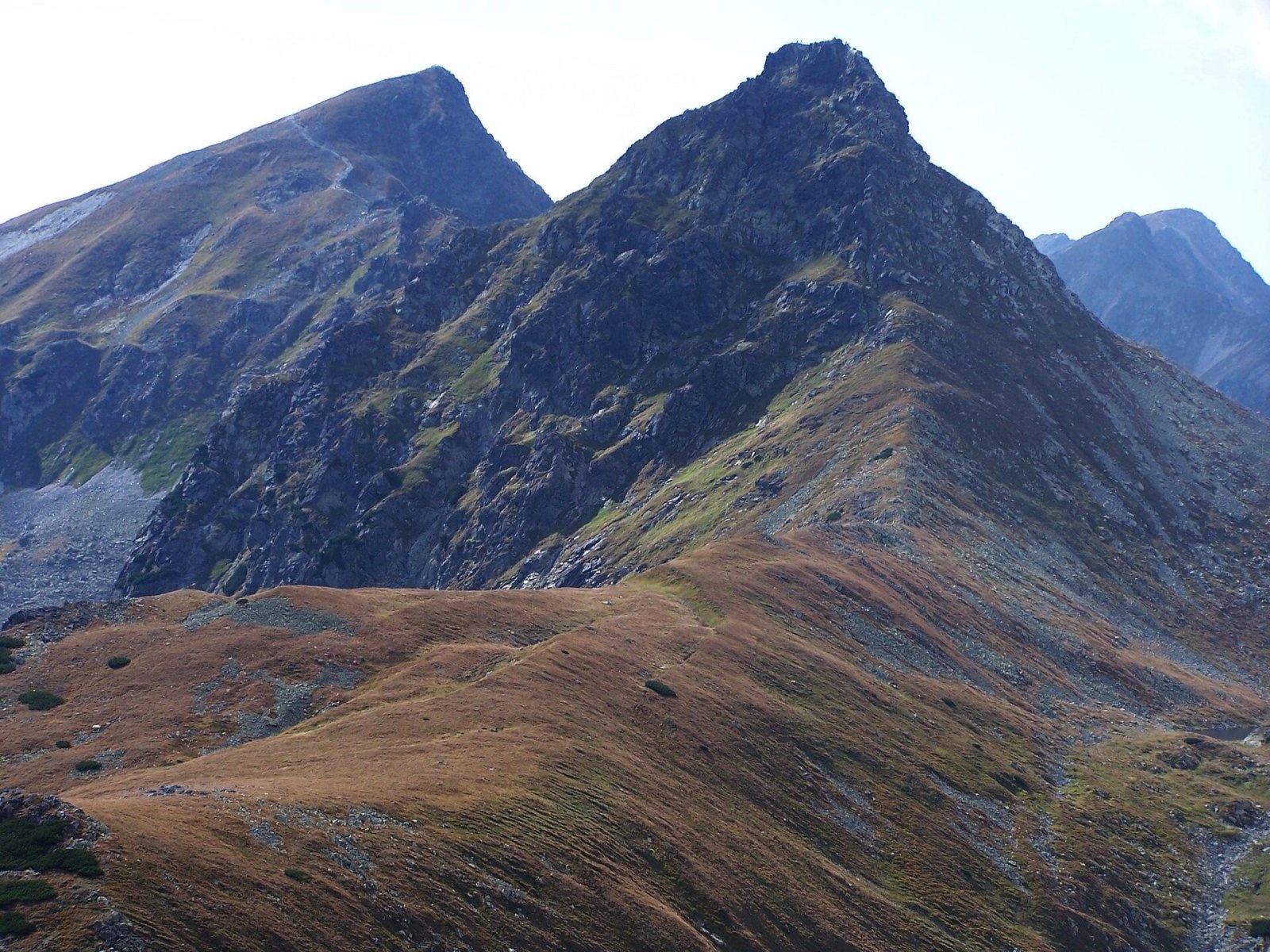
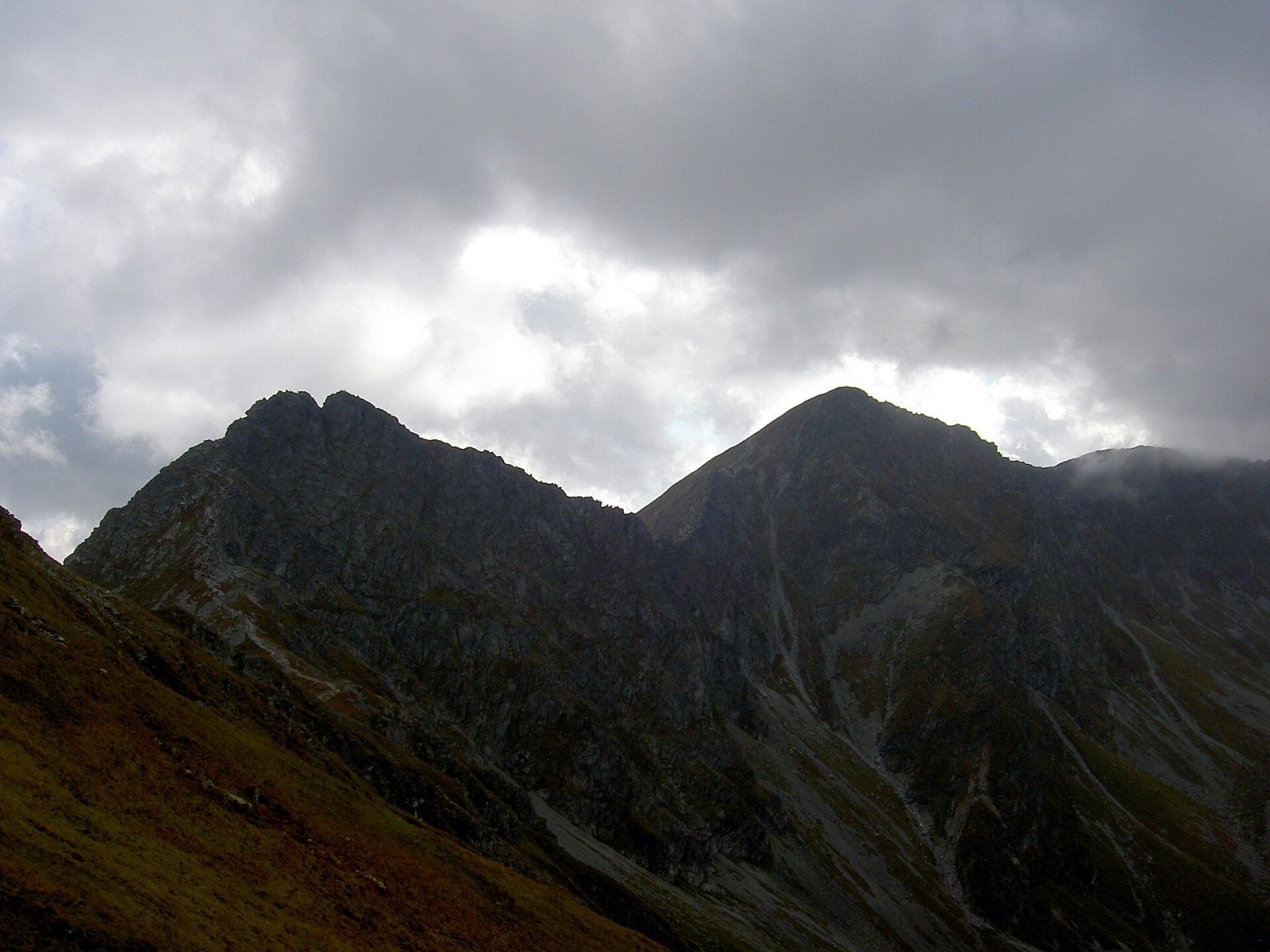
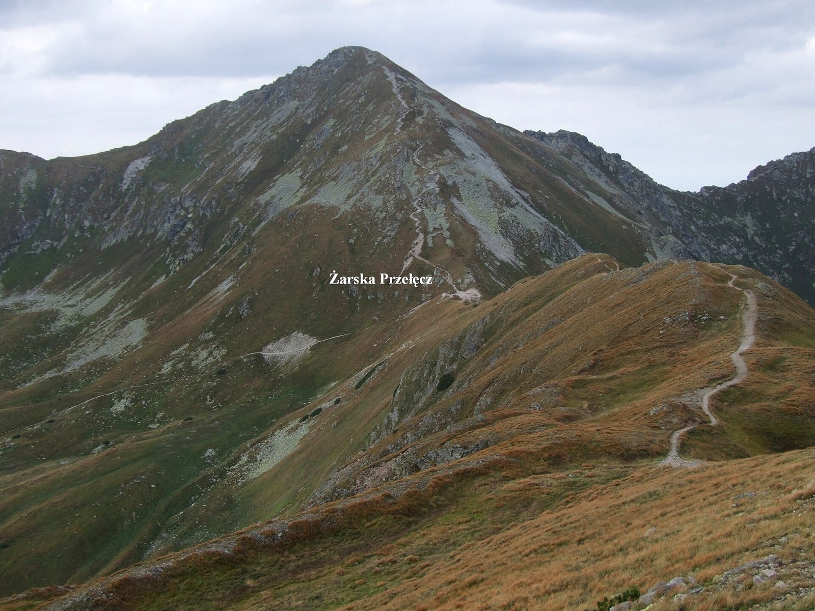
Plačlivé (also Plačlivô, formerly Plačlivý Roháč; Polish Rohacz Płaczliwy) is a 2,125 m peak on the main ridge of the Western Tatras in Slovakia, in the part known as the Roháče. It lies in the Žilina Region on the border of Orava and Liptov, on the boundary of the Liptovský Mikuláš and Tvrdošín districts: the northern slopes belong to the Orava village of Zuberec, the south-western ones to Žiar in Liptov and the eastern ones to Jamník. The mountain rises above the head of the Žiarska dolina, about 15 km north-east of Liptovský Mikuláš; the nearest villages are Konská (about 9 km) and Žiar (about 10 km) to the south-west, and on the Orava side the Zverovka settlement of Zuberec. Plačlivé lies in Tatra National Park (TANAP), its northern part in the Roháčske plesá national nature reserve.
Plačlivé is one of the two Roháče, higher than neighbouring Ostrý Roháč but gentler in shape. The summit is a sharp rocky crest with steep walls to the south and north; the north face drops 200–250 m to the glacial cirque of the Smutná dolina. To the west Smutné sedlo separates Plačlivé from Tri kopy, to the north-east the Roháčske sedlo separates it from Ostrý Roháč. A massive side ridge runs south over Žiarske sedlo to Baranec, dividing the Jamnícka and Žiarska valleys. On the northern side, in the Smutná dolina at the head of the Roháčska dolina, lie the Roháče tarns and Ťatliak Lake. Water drains north via the Studený potok to the Orava, and south via the Smrečianka and Jamnícky potok to the Váh.
Getting there / routes
The red-marked Western Tatras ridge trail (KST 0862) from Sivý vrch to Pyšné sedlo crosses the summit. From the west it comes from Baníkov via Tri kopy and Smutné sedlo, from the east from Hrubý vrch via Volovec, Jamnícke sedlo and Ostrý Roháč. According to Polish guidebooks, it takes about 45 min from Smutné sedlo to the summit (30 min down), and the traverse Plačlivé – Ostrý Roháč takes about an hour. The Roháče section is considered the most technically difficult and exposed trail of the Western Tatras.
The yellow route KST 8618 starts at the summit and leads via Žiarske sedlo to Smrek and Baranec (about 2 h 05 min to Baranec). Blue trails reach the ridge from the Ťatliakova chata via Smutné sedlo, from the Žiarska dolina to Smutné sedlo and up the Jamnícka dolina to Jamnícke sedlo, and green trails climb to Žiarske sedlo from the Žiarska and Jamnícka valleys.
The view from the top
The prominent rocky summit gives an all-round view. Czech and Slovak sources mention the surrounding Western Tatras peaks – Tri kopy, Ostrý Roháč, Baranec – and nearby valleys and, in good visibility, the Orava Beskids, the Orava Magura, the Greater Fatra, the Low Tatras and the mountains of southern Poland.
Nature and history
The name means the “weeping” mountain: according to German Wikipedia, its slopes are often hidden in rain clouds in wet weather. The summit has been climbed for a long time – visitors included the painter Juliusz Kossak, the composer Mieczysław Karłowicz and the physician Tytus Chałubiński. The oldest recorded ascent was made by the botanist Pál Kitaibel around 1804; in 1813 Ludwik Zejszner and Göran Wahlenberg measured its height with a barometer. The steep north face was first climbed in 1907 by the brothers Walery and Ferdynand Goetel with Tadeusz Pawlewski, and the first winter ascent was made in 1911 by Mariusz Zaruski and Janusz Żuławski with a group of climbers. Detailed botanical research on the summit was carried out by Bolesław Kotula in 1880.
Safety, season and rules
The red trail from Smutné sedlo has chain-protected passages, and the ridge between Plačlivé and Ostrý Roháč runs above the precipitous north face; some sections can be bypassed on a path along the gentler southern slope. The most exposed spot is the Roháčsky kôň. The route requires sure footing, a head for heights and dry weather; the ridge is dangerous in thunderstorms. The yellow trail from Žiarske sedlo is an easier alternative.
TANAP high-mountain trails are closed every year from 1 November to 31 May, when the ascent is prohibited. In summer stay on marked paths; current restrictions are published by the TANAP administration. Mountain Rescue Service HZS: 18 300 (+421 18 300) or 112.
Interesting facts
- Plačlivé is almost 40 m higher than its famous neighbour Ostrý Roháč.
- On the gentle west ridge beyond Smutné sedlo stand many stone cairns built by hikers – the spot is called Nohavica.
- The height of the summit was first measured as early as 1813, with a barometer.
Photos: Dezidor, CC BY 3.0; jerzy Opioła, CC BY-SA 3.0; Jerzy Opioła, CC BY-SA 3.0; Dezidor, CC BY 3.0; Jerzy Opioła, CC BY-SA 3.0; Bockay, CC BY-SA 3.0 — Wikimedia Commons.
Getting there from Ukraine
Border crossings
- Uzhhorod – Vyšné Nemecké — road, 24/7
- Malyi Bereznyi – Ubľa — road, 24/7 For cars and buses; pedestrians not confirmed by the Ukrainian border service, lorries up to 3.5 t.
- Mali Selmentsi – Veľké Slemence (pedestrian) — pedestrian, 09:00–21:00 Kyiv time Pedestrians and cyclists only; inconvenient for the Tatras without onward transport.
- Chop – Čierna nad Tisou (rail) — rail, 24/7
By car
From Uzhhorod ≈275 km, ≈3 h 35 min without queues: Uzhhorod – Vyšné Nemecké → I/19 to Košice → D1 motorway via Prešov, Poprad and Liptovský Mikuláš to Ružomberok (≈270 km, ≈3 h 25 min from the border). From Lviv it is faster through Poland: M-10 → Krakovets – Korczowa → A4 to Kraków → S7/DK7 to the Chyżne – Trstená border → R3 and I/59 via Dolný Kubín to Ružomberok: ≈482 km, ≈6 h 15 min (via Uzhok and Ubľa ≈500 km, ≈7 h 30 min). The D1 requires an e-vignette (eznamka.sk).
Checked 23.10.2026; border crossing hours and timetables change — check before you travel.
Location on the map
Water and shelter nearby
- Vybíja Spring1.1 km · Not verified · 1 663 m
- Spring below Rakoń1.7 km · Not verified · 1 421 m
- Závratný potok Spring1.8 km · Not verified · 1 586 m
- Ťatliak Hut1.8 km · Standing · 1 393 m
- Spring below Zelenô (north-west slope), 1 430 m2.3 km · Not verified · 1 430 m
- Spring below Zelenô (north-west slope), 1 427 m2.3 km · Not verified · 1 427 m
- Spring below Zelenô (north slope)2.3 km · Not verified · 1 413 m
- Spring below Predná Zábrať (south slope), 1 348 m2.4 km · Not verified · 1 348 m
- Spring below Zadná Zábrať2.5 km · Not verified · 1 602 m
- Spring below Baranec (north-west slope), 1 995 m2.5 km · Not verified · 1 995 m
- Spring below Baranec (north-west slope), 1 792 m2.5 km · Not verified · 1 792 m
- Spring below Baranec (north-west slope), 1 859 m2.5 km · Not verified · 1 859 m
- Spring below Príslop (south-east slope)2.6 km · Not verified · 1 774 m
- Spring below Ostredok (west slope), 1 235 m2.6 km · Not verified · 1 235 m
- Spring below Baranec (north-west slope), 1 835 m2.6 km · Not verified · 1 835 m
- Spring below Príslop (south slope), 1 844 m2.7 km · Not verified · 1 844 m
Comments
Trails nearby
All trails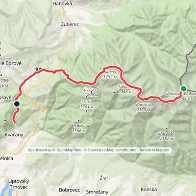 HardMulti-dayMarkedÚstie Kvačianskej doliny Pyšné sedlovia VolovecElevation profile644–2 178 m27.6 kmascent 1 566 m≈ 10 h walkingunder 1 km from Plačlivé
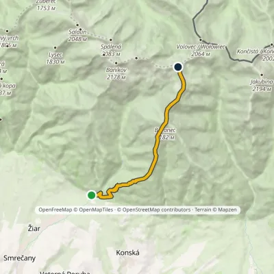 HardOne-dayMarkedMouth of Žiarska Valley PlačlivéElevation profile882–2 185 m9.7 kmascent 1 564 m≈ 5.5 h walkingunder 1 km from Plačlivé
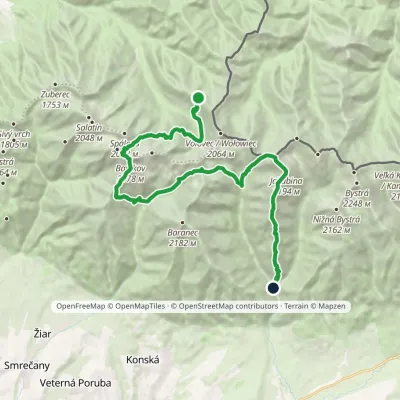 HardMulti-dayMarkedSedlo Zábrať Junction of Jamnická and Račková ValleysElevation profile962–2 194 m26.6 kmascent 2 635 m≈ 12 h walkingunder 1 km from Plačlivé
Nearby attractions
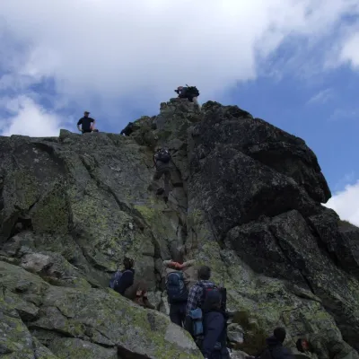 PeakOstrý Roháčaltitude 2 088 munder 1 km from PlačlivéOstrý Roháč (Polish: Rohacz Ostry) is a rocky, twin-summited 2,088 m mountain on the main ridge of the Western Tatras in Slovakia.
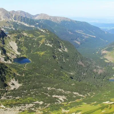 LakeRoháčske plesá1.1 km from PlačlivéRoháčske plesá are a cascade of four glacial lakes at the head of Roháčska dolina in the Western Tatras, in the Orava region.
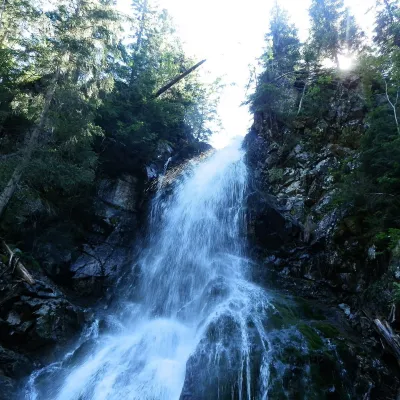 WaterfallRoháčsky WaterfallZuberec2.4 km from PlačlivéRoháčsky waterfall (Roháčsky vodopád) is the best-known waterfall of the Western Tatras, in the Roháče massif about 12 km east of the village of Zuberec in Orava.
Craft nearby
All craft places Cheese dairies & pasturesShepherds' Huts on Polana ChochołowskaKościelisko5.4 km from PlačlivéPolana Chochołowska is the largest glade in the Polish Tatras and one of the largest in the whole range.
 Water parks & thermal poolsOravice thermal poolsVitanová11 km from PlačlivéThe Oravice thermal pools (Termálne kúpalisko Oravice) are the municipal thermal baths in the mountain settlement of Oravice at the foot of the Western Tatras.
 Water parks & thermal poolsMeander Thermal Resort, OraviceVitanová11 km from PlačlivéMeander Thermal & Ski Resort (formerly Meander Park) is a thermal water park and ski centre in the mountain settlement of Oravice in northern Slovakia, at the foot of...
 Cheese dairies & pasturesShepherd's Hut in the Kościeliska ValleyKościelisko12 km from PlačlivéJózef Słodyczka's bacówka (shepherd's hut) on the Wyżnia Kira Miętusia glade is probably the most easily reached shepherds' hut in the Polish Tatras.
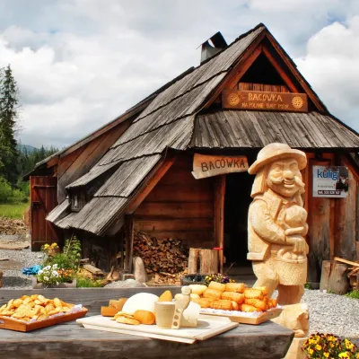 Cheese dairies & pasturesBiały Potok Shepherd's Hut, Witów: oscypek and cheese workshopsKościelisko12 km from PlačlivéBiały Potok meadow in the village of Witów lies between the entrances to two of the most visited Tatra valleys, Chochołowska and Kościeliska.
 Craft beer & breweriesLiptovar brewery, Liptovský Mikuláš: craft beer and brewpubLiptovský Mikuláš16 km from PlačlivéLiptovský Mikuláš is the main town of the Liptov region, a short drive from the Low and Western Tatras, the Demänovská Valley and the Liptovská Mara reservoir.
