Zhenetsky Hook waterfall


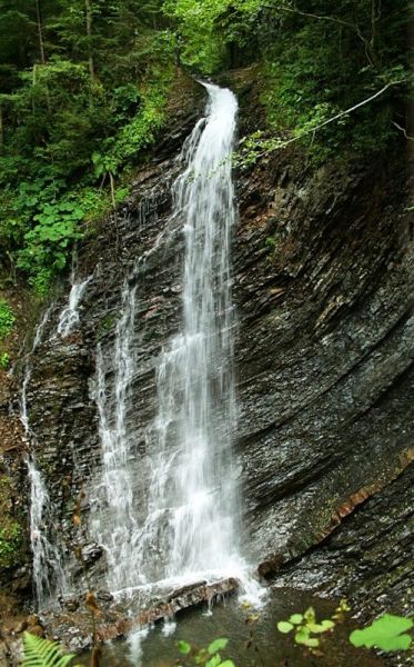
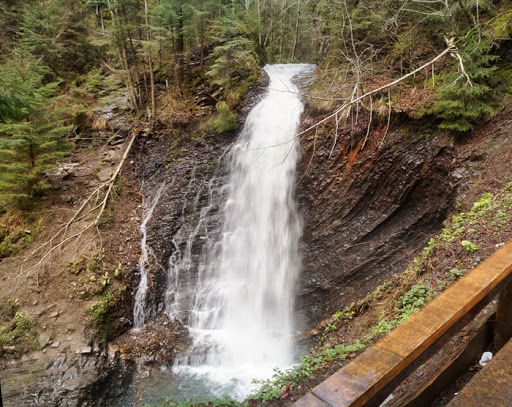
Zhenetskyi Huk is one of the most convenient Carpathian waterfalls for tourists, as it is accessible by a direct, asphalt road. It is also one of the most beautiful waterfalls in the world. Zhenetskyi Huk gets a truly unique look during snowmelt and after heavy rains, when, in addition to the main stream, water flows in thin threads from the top of the rock, creating several more mini-waterfalls around.
The Zhenetskyi Huk waterfall is located on the Zhenets stream, which flows into the Prut river, between the Yavirnyk and Khomyaka-Sinyaka ranges near the villages of Mykulychyn and Tatariv(Nadvirna district, Ivano-Frankivsk region) at a distance of about 5 km from the highway, 9 km from the Tatariv station and 10 km from the Mykulychyn station in the Carpathian National Nature Park.
The Zhenetskyi Huk waterfall is located at an altitude of 900 meters above sea level and was formed in the postwar years as a result of a flood. Water falls freely from the mountain from a height of 15 meters. The locals named the waterfall Guk because of the noise coming from it.
History of the Zhenetskyi Huk waterfall
Zhenetskyi Huk is a fairly young waterfall. It was formed as a result of a flood in the postwar years. The water falls from a height of 15 meters. In winter, Guk partially freezes, and the rocks are covered with filigree ice, under which water still flows. In the sun, the ice sparkles like real crystal. The name of the waterfall was given by the locals because of the loudness of the water fall.
Routes
Visiting the Guk waterfall is included in four mountain routes. The most popular of these is the Zhenets-Huk ecological and educational trail, which runs along the Zhenets stream. You can also drive a car along this road without any problems. However, there is a barrier at the beginning of the route and you will have to pay for the passage.
The Eastern Carpathian tourist route is considered more difficult, with a length of 8 kilometers and a duration of approximately 4 hours. It starts on the left side of the checkpoint and leads to Mount Khomyak. On the opposite side, a shorter route to Mount Krugloyavirnyk begins, which lasts 2.5-3 hours.
It is convenient to look at Huk from both the bottom and the top, as there are observation decks. Down by the waterfall, you can sit down and have a snack, and walk over the stream on wooden bridges and take photos against the backdrop of picturesque nature.
Not far from Guk, you can find another waterfall - Narinetskyi. Although it is little known, with a height of only 10 meters, it is worth finding the road to this waterfall. It leads to the Narinets stream, which is the left tributary of the Zhenets.
Getting there
The waterfall is located in the Gorgany massif, in a valley between the ridges of the Khomyak and Yavirnyk mountains. You need to go to the Zhenets stream in the village of Tatariv, Nadvirna district, Ivano-Frankivsk region. The road access to Huk begins between the villages of Mykulychyn and Tatariv. Buses also run regularly from these villages. When you get off at the turn to the waterfall, you have to follow the sign across the railroad tracks, pay the toll and move on for another hour, almost 7 km. At first there is an asphalt road (approximately to the middle), and then a good dirt road.
This place is also famous for the fact that the residence of former Ukrainian President Viktor Yushchenko is located nearby. And instead of a trail, a quite decent road leads to the waterfall, fenced with a barrier at the entrance.
At a glance
- Type: waterfall
- Elevation: ≈860 m above sea level (digital elevation model)
- Range: Gorgany
- Nearest settlement: Mykulychyn
- Coordinates: 48.39115, 24.49966
- Routes nearby on Karpaty.rocks: 16
How to get there
The nearest settlement in our data is Mykulychyn. Get directions in Google Maps.
Routes nearby
Karpaty.rocks routes that pass within 1 km of this place, most viewed first. Length and ascent come from our track and a digital elevation model, time from Naismith's rule (without stops).
- Tatariv village, via Mount Khomiak and Zhenetskyi Huk Waterfall to Zhenets tract (Mykulychyn village) — 21.9 km, ascent 904 m, ≈7 h of walking
- Zhenets tract, via Mount Khomiak and Zhenetskyi Huk Waterfall to Zhenets tract — 21.3 km, ascent 937 m, ≈7 h of walking, loop
- Zhenets tract – Zhenetskyi Huk Waterfall — 7 km, ascent 205 m, ≈2 h of walking
- Yaremche, via Mount Yavirnyk-Horhan to Zhenetskyi Huk Waterfall — 7.5 km, ascent 669 m, ≈3 h of walking
- Zhenets tract, via Huk Waterfall, Mount Khomiak and Mount Syniak to Zhenets tract — 32.9 km, ascent 1,605 m, ≈11 h of walking, loop
All routes nearby in the catalogue
When to go
Like most Carpathian waterfalls, it carries the most water in spring when the snow melts and after heavy rain; in dry weeks at the end of summer the flow weakens. In winter the waterfall may partly freeze and the paths can be slippery.
Safety
Rocks near the water are slippery: keep away from the edge of the drop and do not climb wet rocks, especially with children.
In an emergency call 101 or 112. Carpathian mountain rescue contacts.
FAQ — Zhenetsky Hook waterfall
Zhenetsky Hook waterfall: where is it and how to get there?
The nearest settlement in our data is Mykulychyn (Gorgany range). Coordinates: 48.39115, 24.49966. Get directions in Google Maps.
Zhenetsky Hook waterfall: at what elevation?
About 860 m above sea level, according to a digital elevation model.
Zhenetsky Hook waterfall: which routes pass nearby?
The most viewed on Karpaty.rocks: Tatariv village, via Mount Khomiak and Zhenetskyi Huk Waterfall to Zhenets tract (Mykulychyn village) (21.9 km); Zhenets tract, via Mount Khomiak and Zhenetskyi Huk Waterfall to Zhenets tract (21.3 km); Zhenets tract – Zhenetskyi Huk Waterfall (7 km).
Zhenetsky Hook waterfall: when is the best time to go?
Like most Carpathian waterfalls, it carries the most water in spring when the snow melts and after heavy rain; in dry weeks at the end of summer the flow weakens. In winter the waterfall may partly freeze and the paths can be slippery.
Zhenetsky Hook waterfall: where to stay nearby?
Places to stay nearby (Mykulychyn and around): hotels, guesthouses and cottages.
Video
 Женецький водоспад ГукНаталя Чумак
Location on the map
Comments
Places to stay nearby
All stays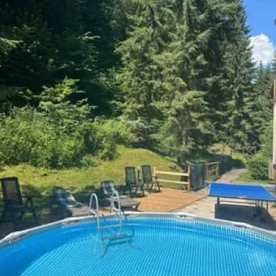 HotelDykyi MedTatariv3.9 km from Zhenetsky Hook waterfallPoolSaunaSPANearby: Narinetskyi waterfall 2.2 kmMt Khomiak 3.6 km47 trailsfrom 1 800 UAH per night
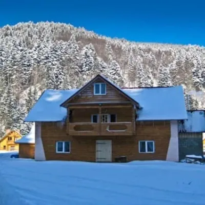 HotelPanski-HouseMykulychyn4.5 km from Zhenetsky Hook waterfallHot tubSaunaBBQNearby: Narinetskyi waterfall 2.7 kmMt Khomiak 4.2 km51 trailsfrom 860 UAH per night
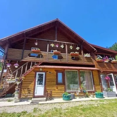 Hotelu NataliiMykulychyn4.5 km from Zhenetsky Hook waterfallBBQParkingWi‑FiNearby: Narinetskyi waterfall 2.7 kmMt Khomiak 4.2 km51 trailsfrom 1 200 UAH per night
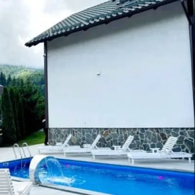 HotelHirska Sonata Hotel & ApartmentsMykulychyn4.5 km from Zhenetsky Hook waterfallPoolSaunaBBQNearby: Narinetskyi waterfall 2.7 kmMt Khomiak 4.2 km51 trailsfrom 3 300 UAH per night
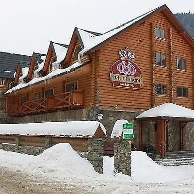 HotelTry pidkowyMykulychyn4.6 km from Zhenetsky Hook waterfallSaunaBBQParkingNearby: Narinetskyi waterfall 2.8 kmMt Khomiak 4.3 km51 trailsfrom 1 560 UAH per night
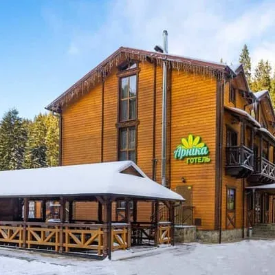 HotelArnikaPolianytsia (Bukovel)4.8 km from Zhenetsky Hook waterfallHot tubSaunaBBQNearby: Mt Khomiak 2.2 kmPolonyna Khomyakov 3.0 km21 trailsfrom 1 175 UAH per night
Trails nearby
All trails EasyOne-dayMarkedZhenets tract Zhenetskyi Huk WaterfallElevation profile648–869 m7 kmascent 218 m≈ 2 h walkingunder 1 km from Zhenetsky Hook waterfall
 HardTwo-dayMarkedTatariv village to Zhenets tract (Mykulychyn village)via Mount Khomiak, Zhenetskyi Huk WaterfallElevation profile642–1 542 m21.9 kmascent 929 m≈ 7.5 h walkingunder 1 km from Zhenetsky Hook waterfall
 EasyOne-dayMarkedPidlisniv hamlet Huk Zhenetskyi WaterfallElevation profile647–866 m4.8 km≈ 1 h walkingunder 1 km from Zhenetsky Hook waterfall
Nearby attractions
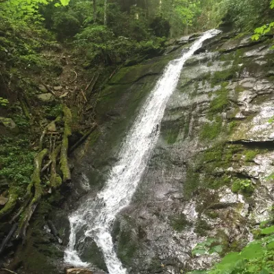 WaterfallNarinetskyi waterfall, MykulychynMykulychyn1.8 km from Zhenetsky Hook waterfallNarinetskyi Waterfall is a waterfall in the Ukrainian Carpathians, on the Noretskyi Stream (a left tributary of the Zhenets River).
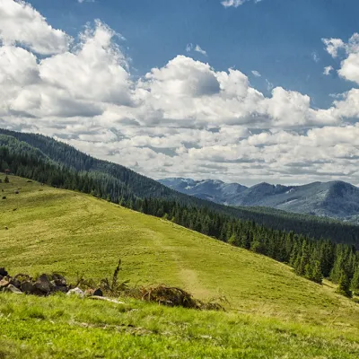 Mountain meadowPolonyna KhomyakovTatarivaltitude 1 295 m1.8 km from Zhenetsky Hook waterfallYou can climb here from the Guk waterfall even in a short winter day, spend the night, and in the morning go to the tops of the Khomyak or Sinyak mountains (depending...
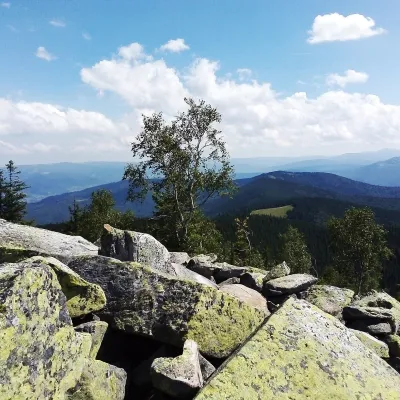 PeakMount Yavirnyk-GorganYaremchealtitude 1 467 m · Gorgany range1.8 km from Zhenetsky Hook waterfallYavirnyk-Gorgan is the highest summit of the Yavirnyk ridge in the south-eastern Gorgany, 1,467 m high.
Craft nearby
All craft places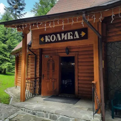 Koliby & Hutsul cuisineKolyba “Dykyi Med”, TatarivTatariv3.8 km from Zhenetsky Hook waterfallThe Dykyi Med (“Wild Honey”) kolyba is the heart of a private estate of the same name in the Zhenets area of Tatariv, in a valley the locals call the Honey Valley.
 Theme parksDinoPark, Polianytsia (Bukovel)Yablunytsia4.9 km from Zhenetsky Hook waterfallDinoPark in Polianytsia is an open-air dinosaur theme park at the entrance to Bukovel resort. It is easy to spot from the road: a huge dinosaur figure stands right by...
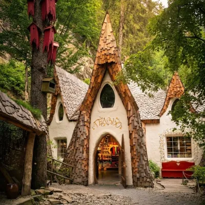 Theme parksGedzio Park of Legends, YaremcheYaremche6.1 km from Zhenetsky Hook waterfallGedzio Park of Legends is a fairy-tale theme park in Yaremche, a few steps from the Probiy waterfall. It is designed as the imaginary settlement of Obinor, home to...
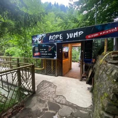 Adventures & attractionsRope jumping at Probiy waterfall, YaremcheYaremche6.1 km from Zhenetsky Hook waterfallRope jumping at the Probiy waterfall is the loudest adrenaline thrill in Yaremche. The Active Day team runs jumps right above the rocky canyon of the Prut, a few dozen...
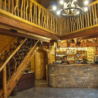 Koliby & Hutsul cuisineNa Penkakh Koliba, YaremcheYaremche6.3 km from Zhenetsky Hook waterfallNa Penkakh koliba in Yaremche (“On the Stumps”) sits on quiet Svobody Street, right at the forest edge and near the start of the popular Dovbush Trail.
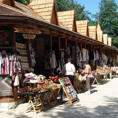 Markets & fairsHutsul souvenir market, YaremcheYaremche6.6 km from Zhenetsky Hook waterfallYaremche is undoubtedly the center of Hutsul crafts, and everyone knows it. The Hutsuls are an ancient and at the same time interesting ethnic group of Ukrainians...
