Zhenets tractloop, via Huk Waterfall, Mount Khomiak, Mount Syniak
Unmarked trailmore
It may be partly marked. Unmarked trails have no information boards, signposts or auxiliary signs (water, campsite, etc.). The decision to walk the trail is entirely your own responsibility.
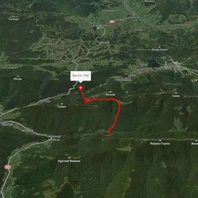
Trail map
Where to stay nearby
About the trail
Route Zhenets tract, via Huk Waterfall, Mount Khomiak and Mount Syniak to Zhenets tract. Along the route you will see: Polonyna Khomyakov, Mount Khomiak, Mount Sinyak, Narinetskyi waterfall, Mykulychyn, Zhenetsky Hook waterfall.
At a glance
A loop route of 32.9 km with 1,746 m of ascent, starting and finishing at Zhenets tract. Estimated walking time: about 11 h, not counting stops — a very long day, so it is easier split into 2 days. Difficulty: hard. Waymarking is missing or partial.
Route stages
- 0–7 kmClimb of 700 m to Mountain shelter on Polonyna Khomiakiv
- 7–15 kmGentle ups and downs at 1,310–1,500 m, past Mount Khomiak
- 15–18 kmClimb of 330 m to Mount Sinyak (1,665 m)
- 18–25 kmDescent of 860 m (down to 793 m)
- 25–33 kmGentle ups and downs at 660–860 m
Steepest kilometre: km 23–24, a descent of 290 m (≈27%), near Mountain shelter on Polonyna Khomiakiv.
Water and overnight stays
Springs near the trail: at km 1, 4, 7, 9, 13, 21, 27, 30 and 33. Some springs run low or dry up in late summer.
Huts and shelters near the trail: Mountain shelter on Polonyna Khomiakiv (km 7), Mountain shelter on Polonyna Khomiakiv (2) (km 8), Mountain shelter on Polonyna Khomiakiv (km 8), Mountain shelter on Polonyna Khomiakiv (3) (km 23). Places to stay near the start: Mykulychyn.
A possible split into days:
- Day 1: km 0–14, ≈5.5 h — overnight: no shelter nearby on the map, bring a tent
- Day 2: km 14–33, ≈5.5 h — finish
When to go
Best time: June to September. In winter only for experienced hikers with proper gear: avalanche danger is possible. About 4 km of the route runs above 1,500 m, where the weather changes quickly — check the forecast.
Getting there
Start: Zhenets tract. Most places to stay near the start are in Mykulychyn. This is a loop: it brings you back to the start.
FAQ
- How long does the route take?
- Estimated walking time: about 11 h, not counting stops — a very long day, so it is easier split into 2 days.
- Is there water on the route?
- Springs near the trail: at km 1, 4, 7, 9, 13, 21, 27, 30 and 33. Some springs run low or dry up in late summer.
- Where can I stay overnight?
- Huts and shelters near the trail: Mountain shelter on Polonyna Khomiakiv (km 7), Mountain shelter on Polonyna Khomiakiv (2) (km 8), Mountain shelter on Polonyna Khomiakiv (km 8), Mountain shelter on Polonyna Khomiakiv (3) (km 23). Places to stay near the start: Mykulychyn.
Water and shelter on the route
- Spring (Tatariv, 3)km 1.4 from the start · Not verified · 840 m
- Stream water (Tatariv)km 2 from the start · Not verified · 889 m
- Spring below Mount Khomiak (11)km 4.1 from the start · Not verified · 1 085 m
- Spring on Polonyna Khomiakiv (3)km 6.5 from the start · Not verified · 1 335 m
- Mountain shelter on Polonyna Khomiakivkm 6.8 from the start · Standing · 1 324 m
- Mountain shelter on Polonyna Khomiakiv (2)km 7.1 from the start · Not verified · 1 312 m
- Mountain shelter on Polonyna Khomiakivkm 7.1 from the start · 80 m off the path · Not verified · 1 301 m
- Spring on Polonyna Khomiakivkm 8.8 from the start · Not verified · 1 323 m
- Spring below Mount Khomiakkm 9.7 from the start · 80 m off the path · Not verified · 1 410 m
- Spring on Polonyna Khomiakiv (2)km 12.3 from the start · 170 m off the path · Not verified · 1 336 m
- Spring below Mount Khomiak (2)km 19.3 from the start · Not verified · 1 443 m
- Mountain shelter on Polonyna Khomiakiv (3)km 21.1 from the start · Not verified · 1 325 m
- Spring (Tatariv)km 25 from the start · Not verified · 836 m
- Spring below Mount Khomiak (6)km 25.7 from the start · Dried up · 803 m
- Spring (Tatariv, 2)km 27.7 from the start · 250 m off the path · Not verified · 831 m
- Spring (Tatariv, 4)km 30.6 from the start · 120 m off the path · Not verified · 652 m
Comments
What to see on the trail
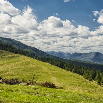 Polonyna Khomyakovaltitude 1 525 mA large sloping meadow on the northern slopes of the Sinyaka-Homiak ridge. From here, there are trails to the valley of the Zhenets stream (a long...
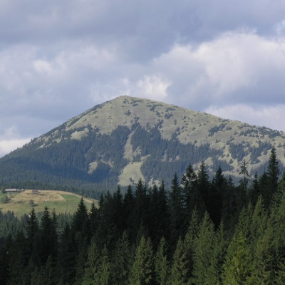 Mount Khomiakaltitude 1 542 mKhomyak is a 1542-meter-high peak of the Gorgan mountain range. Rumor has it that the mountain was named so because its shape resembles the back of...
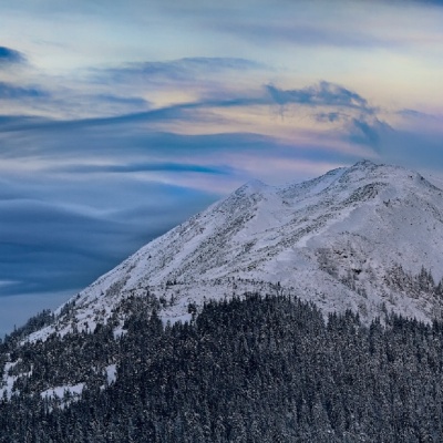 Mount Sinyakaltitude 1 665 mMount Sinyak, 1665 meters high, is one of the peaks of the Gorgan massif of the Ukrainian Carpathians, located in the Nadvirna district of Ivano...
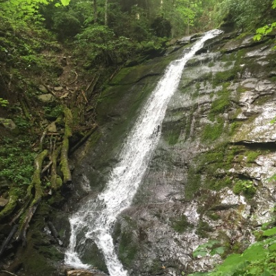 Narinetskyi waterfall, Mykulychynaltitude 622 mNarinetskyi Waterfall is a waterfall in the Ukrainian Carpathians, on the Noretskyi Stream (a left tributary of the Zhenets River).
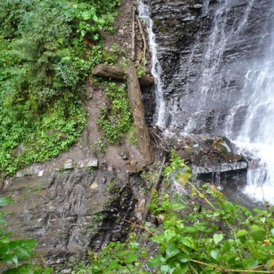 Zhenetsky Hook waterfallaltitude 622 mZhenetskyi Huk is one of the most convenient Carpathian waterfalls for tourists, as it is accessible by a direct, asphalt road.
Trails nearby
All trails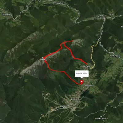 ModerateOne-dayUnmarkedPolianytsia village loopvia Mount Khomiak, Mount SyniakElevation profile864–1 656 m14.1 kmascent 1 089 m≈ 5.5 h walking
 HardMulti-dayMarkedEast Carpathian Tourist TrailElevation profile635–1 819 m278.1 kmascent 14 105 m
 ModerateOne-dayMarkedZhynets tract road to Bukovelvia Khomiakiv polonynaElevation profile786–1 385 m7.7 kmascent 846 m≈ 3.5 h walking