Condition
Not verifiedNo recent reports. Carry water and, if you pass by, tell us what you saw.
Last edited on the OSM map 14.10.2022
- 840 m
About
Gorgany range, about 840 m above sea level. The nearest settlement is Tatariv, about 3.7 km in a straight line. 8 of the site’s trails pass nearby, including “Zhenets tract (Mykulychyn village), via Mount Khomiak, Mount Syniak and Mount Malyi Horhan to Bystrytsia village”.
There is no confirmation that the water is drinkable — boil or filter it first. The nearest hut or shelter is “Campsite weather shelter”, 710 m away.
In an emergency in the mountains call the rescuers: 101 or 112.
Comments
Travellers’ experience: reports, tips, questions.
No one has written here yet. Be the first — your experience helps others.
On the map
Coordinates: 48.36715, 24.54095
How to get there
Trails nearby
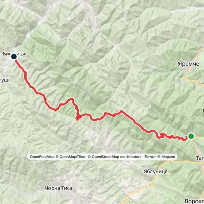 HardTwo-dayZhenets tract (Mykulychyn village) to Bystrytsia villagevia Mount Khomiak, Mount Syniak +1Elevation profile643–1 665 m45.3 kmascent 1 626 m
 ModerateOne-dayMarkedZhenets tract to Zhenets tract (Mykulychyn village)via Mount Khomiak, Huk Zhenetskyi WaterfallElevation profile647–1 542 m18.6 kmascent 963 m≈ 6.5 h walking
 HardOne-dayMarkedZhenets tract to Zhenets tract (Mykulychyn village)via Mount Khomiak, Huk Zhenetskyi WaterfallElevation profile645–1 542 m19.9 kmascent 1 046 m≈ 6.5 h walking
 HardTwo-dayMykulychyn village loopvia Mount Yahidna, Mount Lisniv +3Elevation profile595–1 355 m52.6 kmascent 1 710 m
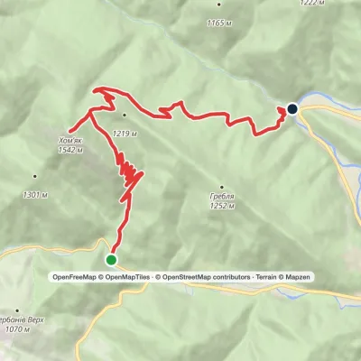 ModerateOne-dayMarkedPolianytsia village to Zhenets tract (Mykulychyn village)via Mount KhomiakElevation profile654–1 542 m14.6 kmascent 758 m≈ 5 h walking
 Hard1–2 daysMarkedZhenets tract to Yaremchevia Mount Khomiak, Mount Syniak +1Elevation profile621–1 665 m31.3 kmascent 1 458 m≈ 10.5 h walking
Nearest settlement: Tatariv, about 3.7 km in a straight line.
Report the condition
Been here recently? Tell us what you saw and add photos — your report appears on the page right away with today’s date.
No photos yet — send yours together with a condition report.
