Malá Baňa
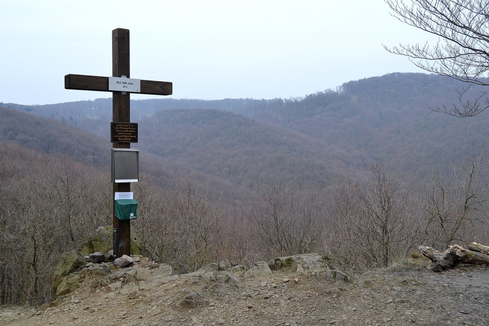
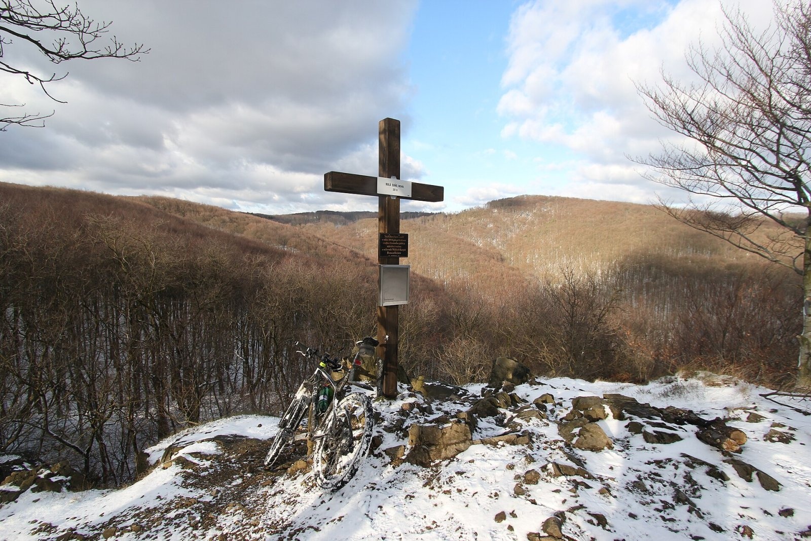
Malá Baňa is a modest 361 m summit in the Little Carpathians (Malé Karpaty), directly above the Bratislava borough of Rača. It is one of the closest "real" mountain outings from the city: the top is only about 1.5 km from the last houses of Rača, and around it stretch the wooded slopes that separate Bratislava from Borinka (5 km), Marianka (6 km) and the small town of Svätý Jur (7 km). The hill belongs to the southern edge of the Little Carpathians – a range that starts in Bratislava itself and runs north-east for almost a hundred kilometres.
Malá Baňa is a typical weekend summit: a short climb, a well-kept top and forest quiet a few minutes from the tram terminus. That is why it is often recommended for walks with small children and for first hikes.
How to get there / routes
- The blue trail (KST 2403) runs right over the summit. The easiest start is the large car park by the Rača amphitheatre (Račiansky amfiteáter): the climb takes about 30–40 minutes, a little longer with small children.
- The marked trail also starts above the Rača cemetery, by the "Cintorín Rača" tram stop, so the summit is easy to reach by public transport.
- A short spur marked with a blue triangle leads from the blue trail to the viewpoint.
The blue trail continues deeper into the Little Carpathians, so Malá Baňa can be the first stop of a longer forest walk.
What you can see from the top
The summit has a rocky outcrop that looks over the surrounding wooded ridges of the Little Carpathians. In winter, when the trees are bare, the view is especially wide: deep forest valleys and the neighbouring hills above Rača.
Nature and history
The slopes of Malá Baňa are covered with broadleaf forest typical of the southern Little Carpathians, and rocks break through the soil on the top. "Baňa" means "mine" in Slovak – such names in the Little Carpathians recall old mining. A wooden cross stands on the summit, put up by Roman Kučera, a hiker and Little Carpathians enthusiast. A summit book is kept on the cross, and visitors can stamp it with a commemorative stamp. The summit is part of the Czech "turistické známky" collectible series as number 730.
Nearby there are benches, a swing, a fireplace and a "mountain book box" – a tiny library for swapping books. These small touches have made Malá Baňa a favourite place for Bratislava families.
Safety, season and rules
The walk to Malá Baňa is easy and possible in any season. In winter and after rain the path and the rocks on top can be slippery – keep an eye on children near the edge of the outcrop. Light fires only in the fireplace and only when there is no drought ban. In Slovakia the Mountain Rescue Service (HZS) operates: 18 300 (+421 18 300); the general emergency number is 112.
Interesting facts
- The summit lies within the capital – it is part of the Rača borough.
- The cross carries a summit book and a commemorative stamp for collectors.
- A book box for swapping books stands on the top.
Photos: Ľuboš Repta, CC BY-SA 4.0; Romanko Kučera, CC BY-SA 4.0 — Wikimedia Commons.
Getting there from Ukraine
Border crossings
- Uzhhorod – Vyšné Nemecké — road, 24/7
- Malyi Bereznyi – Ubľa — road, 24/7 For cars and buses; pedestrians not confirmed by the Ukrainian border service, lorries up to 3.5 t.
- Mali Selmentsi – Veľké Slemence (pedestrian) — pedestrian, 09:00–21:00 Kyiv time Pedestrians and cyclists only; inconvenient for the Tatras without onward transport.
- Chop – Čierna nad Tisou (rail) — rail, 24/7
By car
Uzhhorod – Poprad ≈195 km, ≈2 h 55 min without queues: Uzhhorod – Vyšné Nemecké checkpoint → I/19 via Sobrance and Michalovce → Košice → D1 motorway via Prešov → Poprad (Liptovský Mikuláš is ≈56 km further on the D1, total ≈249 km). Košice – Poprad ≈112 km. The D1 requires an e-vignette (eznamka.sk). Note: from Lviv the fastest way to Poprad is through Poland — Krakovets – A4 – Kraków – Zakopane – Łysa Polana ≈468 km (≈5 h 50 min); via Uzhok and Malyi Bereznyi ≈419 km but slower (≈6 h 40 min). Zakopane – Poprad ≈69 km, Zakopane – Liptovský Mikuláš ≈80 km.
Checked 23.10.2026; border crossing hours and timetables change — check before you travel.
Location on the map
Water and shelter nearby
- Občasný prameň Spring, 348 m90 m · Not verified · 348 m
- Spariská510 m · Not verified · 385 m
- Nad Hájnikom Spring550 m · Not verified · 285 m
- Zlatá studnička Spring670 m · Not verified · 365 m
- Pokoj Spring750 m · Not verified · 318 m
- U Karola Spring860 m · Not verified · 380 m
- Jarošova Spring1.1 km · Has water · 388 m
- Spring below Spariská (south slope), 374 m1.3 km · Not verified · 374 m
- Zbojníčka Spring1.4 km · Not verified · 434 m
- Spring below Spariská (south slope), 361 m1.4 km · Not verified · 361 m
- Kvapkavka Spring1.7 km · Not verified · 396 m
- Spring below Piesky (west slope), 408 m1.7 km · Not verified · 408 m
- Ondrejov Spring, 371 m1.8 km · Not verified · 371 m
- Himligárka Spring1.8 km · Not verified · 435 m
- Máriin Spring1.8 km · Not verified · 395 m
- Spring below Spariská (north slope)1.9 km · Not verified · 415 m
Comments
Trails nearby
All trails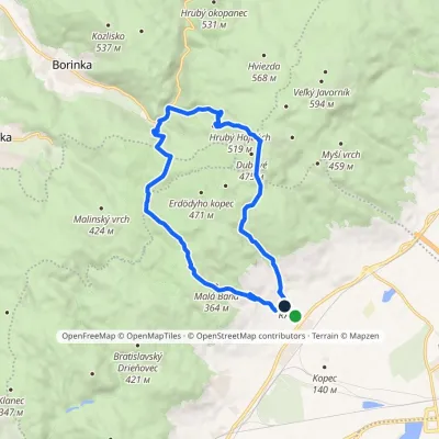 ModerateOne-dayMarkedRača Rača, loopElevation profile153–525 m16.3 kmascent 573 m≈ 5 h walkingunder 1 km from Malá Baňa
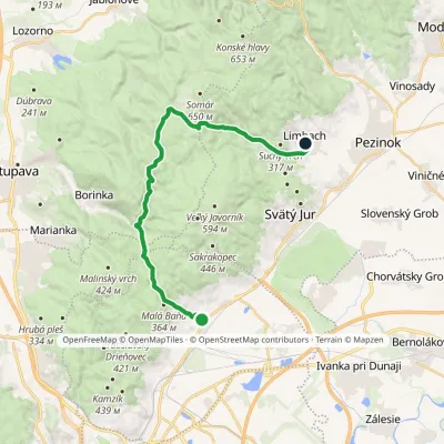 ModerateTwo-dayMarkedRača Limbach, PDElevation profile153–577 m21.8 kmascent 629 m≈ 6.5 h walkingunder 1 km from Malá Baňa
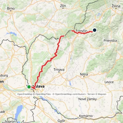 HardMulti-dayMarkedHrad Devín, parking Horná Poruba, U BrdárovElevation profile146–965 m190.1 kmascent 7 200 m1.2 km from Malá Baňa
Nearby attractions
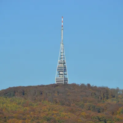 PeakKamzíkMariankaaltitude 439 m4.9 km from Malá BaňaKamzík (German Gemsenberg, Hungarian Zerge-hegy) is a 439 m summit of the Little Carpathians standing right above Bratislava, about 3 km north-west of the city centre.
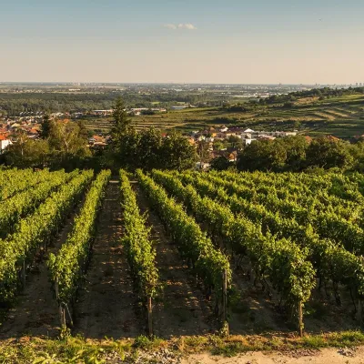 Wine & tastingsDubovský & Grančič Winery, Svätý Jur: tastings and sektSvätý Jur6.8 km from Malá BaňaFrom sixty ares to “Winemaker of the Year” Svätý Jur is an old wine town on the southern slopes of the Little Carpathians, just beyond the Bratislava city limits.
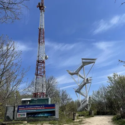 PeakDevínska KobylaMariankaaltitude 514 m10 km from Malá BaňaDevínska Kobyla (German Thebener Kogel, Hungarian Dévényi-tető) is a 514 m summit at the very south-western tip of the Little Carpathians, the highest peak of the...
Craft nearby
All craft places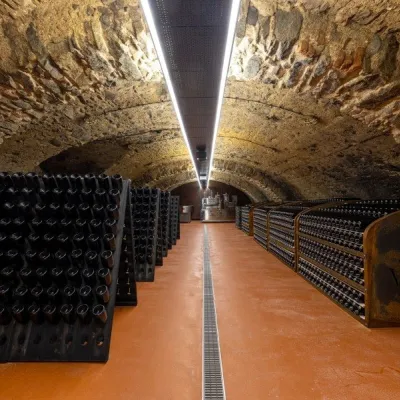 Wine & tastingsVIAJUR winery in Svätý Jur: tastings in the Pálffy cellarsSvätý Jur7.2 km from Malá BaňaWine in old cellars on the edge of Bratislava Svätý Jur is an old wine town at the very foot of the Little Carpathians, just beyond the Bratislava city limits.
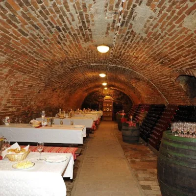 Wine & tastingsHACAJ winery in Pezinok: sparkling wine in a 300-year-old cellarPezinok13 km from Malá BaňaPezinok is the centre of the Little Carpathian Wine Route, a town where winegrowers’ houses with deep cellars line the old streets.
 Crafts & workshopsSlovak Folk Majolica in Modra: pottery tour and paintingModra18 km from Malá BaňaModra is a small wine town on the eastern slopes of the Little Carpathians, half an hour’s drive from Bratislava.
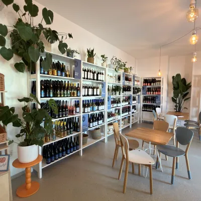 Wine & tastingsJuran z Modry winery: tastings in a Modra wine shopModra19 km from Malá BaňaModra is one of the main wine towns of the Little Carpathians: every other courtyard has its own cellar, and rows of vines climb the slopes above the town.
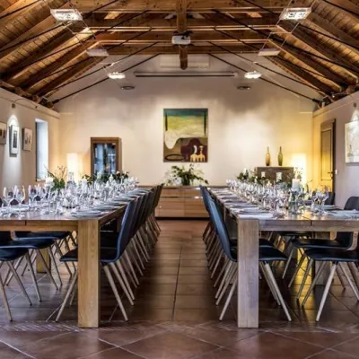 Wine & tastingsKarpatská Perla winery in Šenkvice: tastings and cellarŠenkvice19 km from Malá BaňaFrom a home cellar to Winery of the Year Šenkvice is a wine village on the plain below the eastern slopes of the Little Carpathians, between Pezinok and Modra.
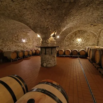 Wine & tastingsMagula Winery, Suchá nad Parnou: biodynamic wines and a farmSuchá nad Parnou36 km from Malá BaňaSuchá nad Parnou is a wine village on the south-eastern slopes of the Little Carpathians, near Trnava.
