Ľadový štít
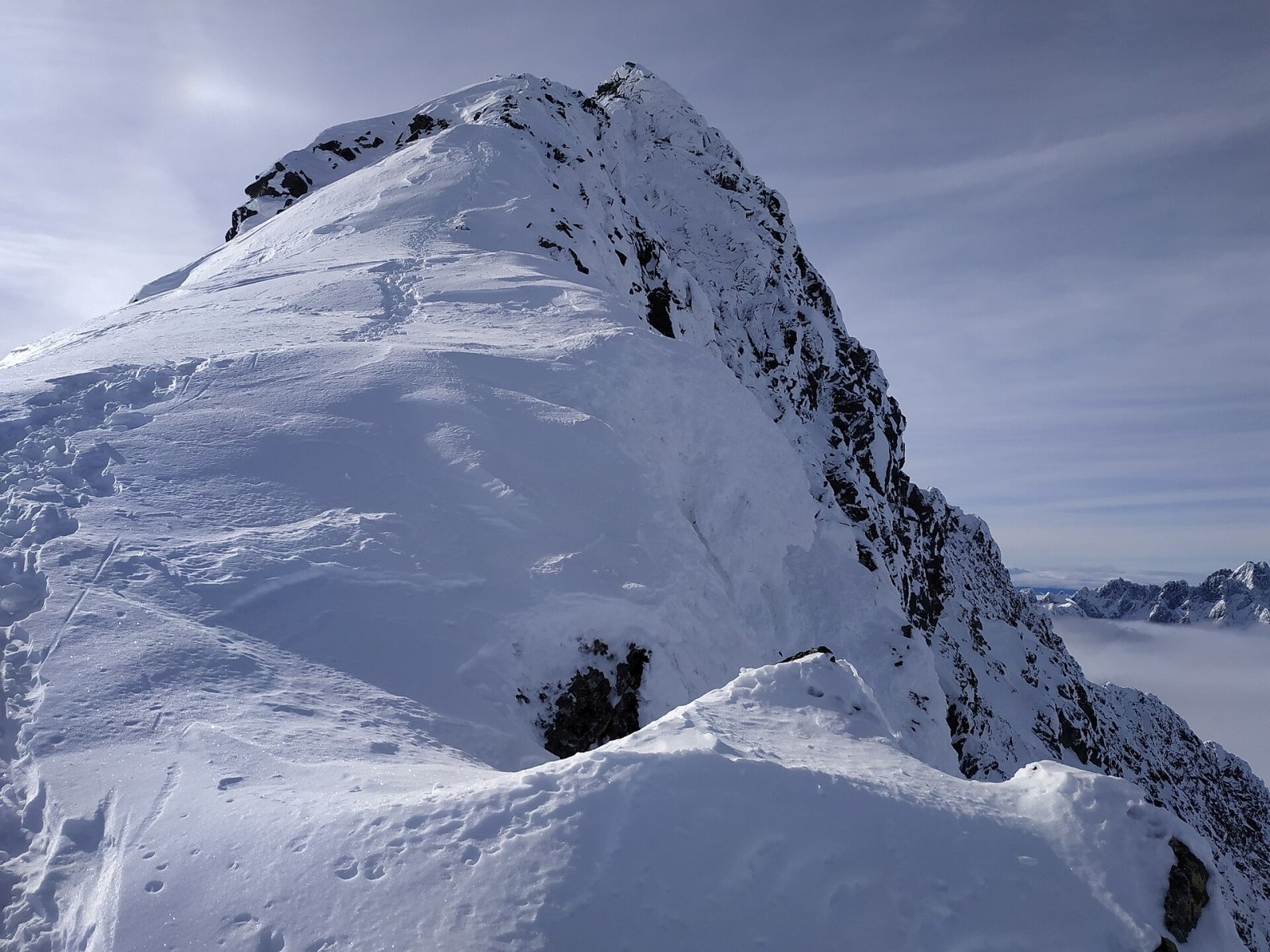
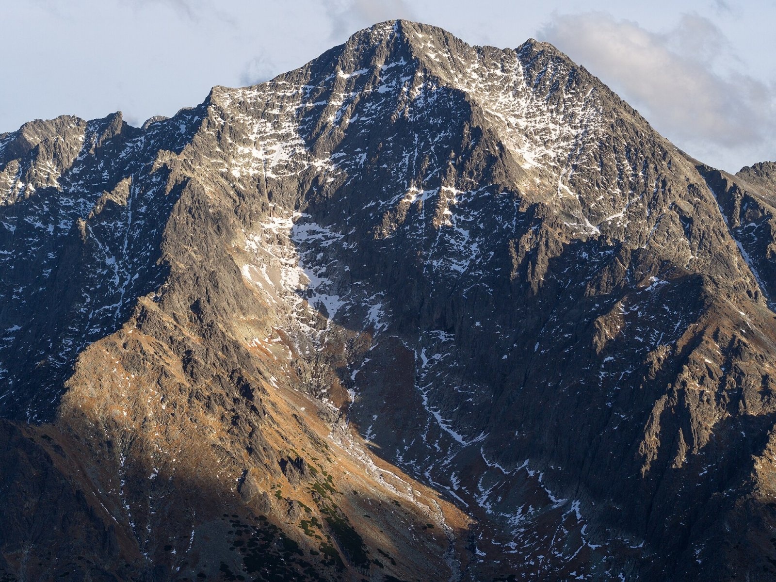
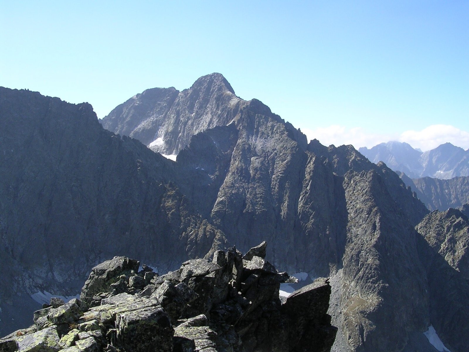
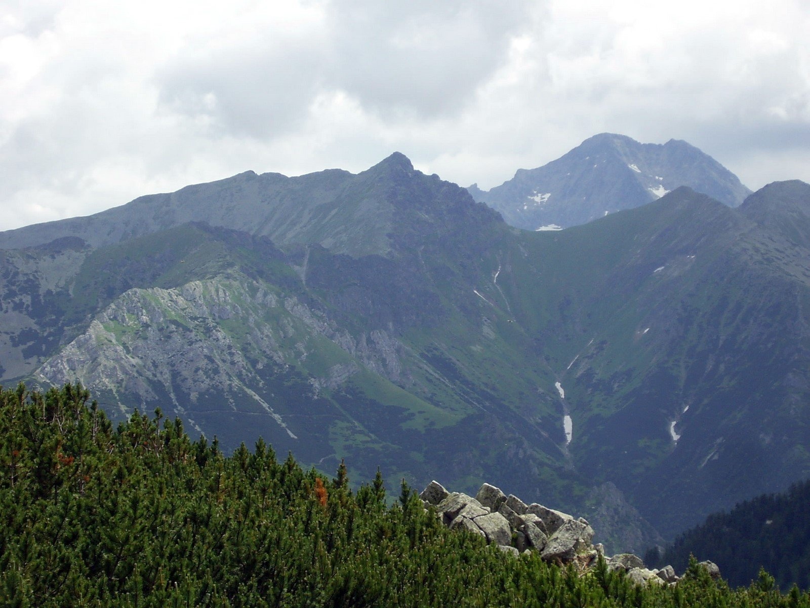
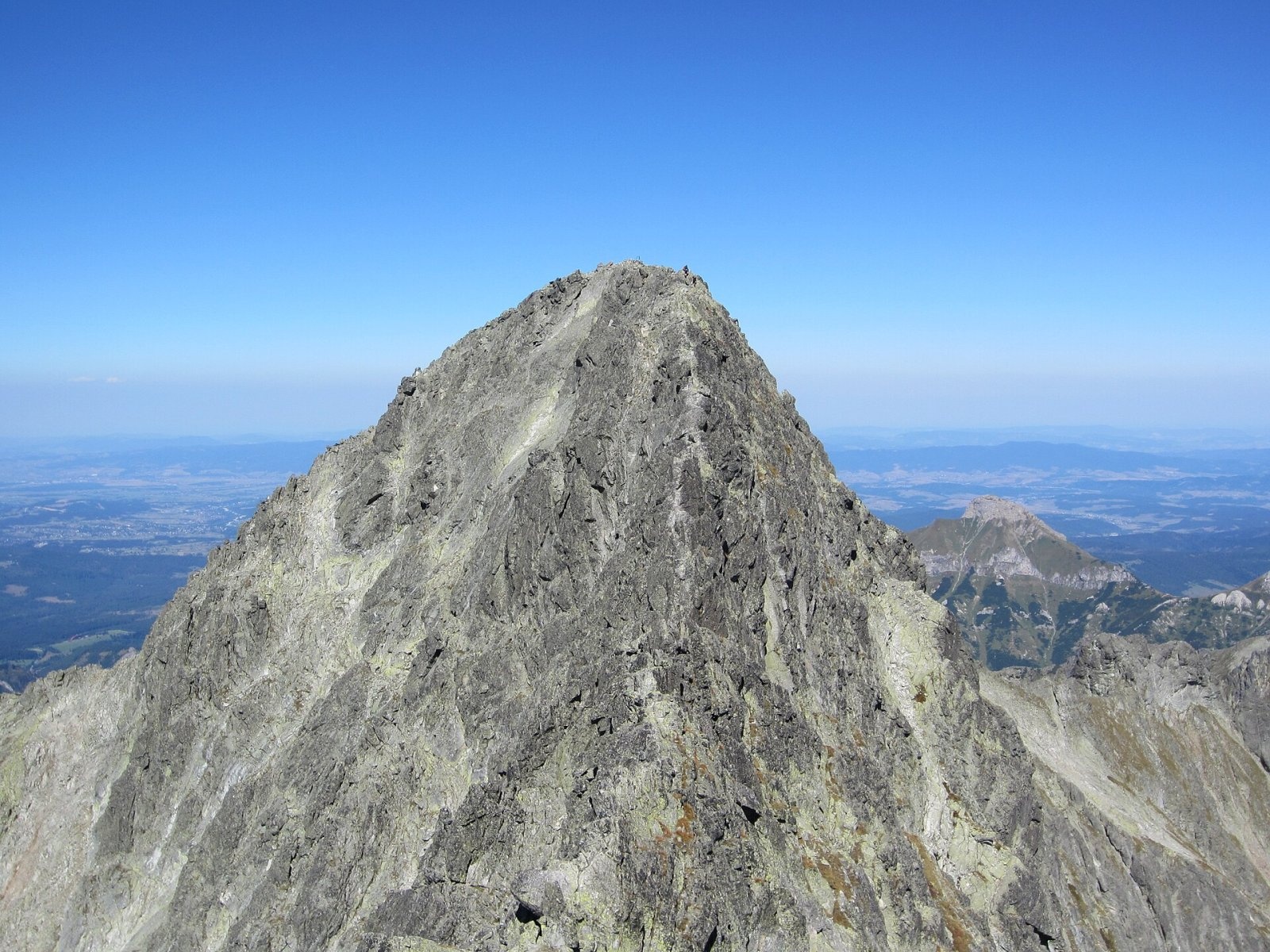
Ľadový štít (Ice Peak; Polish Lodowy Szczyt, German Eistaler Spitze) is a 2,628 m summit on the main ridge of the High Tatras, the third-highest in the whole Tatras (and in the whole Carpathians) after Gerlachovský and Lomnický štít. It rises above Tatranská Lomnica, about 16 km north of Poprad, in the Prešov Region; below it to the south-east lies the basin of the Five Spiš Tarns with the Téry hut. The summit belongs to the Tatra National Park (TANAP), and the boundary between two strict nature reserves — Javorová dolina and Studené doliny — runs across it.
The massif is deeply dissected: ridges drop from Ľadový štít into the Javorová valley and separate the hanging valleys of Zadná Javorová, Suchá Javorová and Ľadová (Snow) dolinka. The Suchý hrebeň ridge runs west from the summit. The mightiest walls face north and north-west, where firn fields lie all year — the source of the name (the Ľadová dolinka, where snow and ice last through the summer). Water from the western slopes drains via the Javorinka into the Dunajec basin, from the eastern ones through the Malá Studená valley to the Poprad river.
The name
The oldest names are the Latin Mons Anserinus and German Gans (goose), used by Juraj Buchholtz on his 1717 panorama of the Tatras. They are explained by the creeping avens that grows abundantly on the summit and was mistaken for silverweed (goose-grass). The present name appears in 19th-century documents.
Can you climb it?
There is no marked trail to the summit. The nearest is the green-marked trail from Tatranská Javorina up the Javorová valley over the Sedielko saddle (2,372 m) to the Téry hut, which passes about 600 m from the top. The easiest route to Ľadový štít is only grade I on the UIAA scale, but for hikers the summit is accessible only with a licensed mountain guide; off-trail climbing in TANAP is reserved for organised climbers under the park's rules. The way from Sedielko over Malý Ľadový štít is hard to navigate, and the north ridge over the «Horse» (II) is very exposed. Well-known rock routes include the Grósz route (III) and the Brnčal pillar (IV) on the south-east face above the Five Spiš Tarns.
TANAP's high-mountain trails, including the one over Sedielko, are closed every year from 1 November to 31 May, so the real season for guided ascents is summer and early autumn.
The view
The rocky top offers an all-round panorama: almost every summit of the High Tatras, the Belianske Tatras ridge, the deep valleys around and, in good visibility, part of the Poprad basin and mountains of central and eastern Slovakia and southern Poland. The massif itself looks best from Podhale, and from the south together with Lomnický and Kežmarský štít.
Nature and history
The Ľadový štít massif is the richest site of rock-face vegetation in the Tatras: 85 species of herbaceous plants have been counted here, 30 of which reach their highest Tatra occurrence on it.
Stanisław Staszic tried and failed to reach the summit as early as 1805. The first documented ascent took place around 31 August 1843: the Englishman John Ball, Wilhelm Richter, a Hungarian painter and guides from Jurgów climbed it via the Suchý žľab couloir. Slovak sources also mention a probable ascent by three Berlin students in 1835. In 1867 the Zakopane parish priest Józef Stolarczyk stood on the top, and in 1873 the poet Adam Asnyk. The first winter ascent was made on 28 December 1891 by Theodor Wundt and the guide Jakub Horvay. Ľadový štít belongs to the Great Crown of the Tatras.
Safety
This is a summit for experienced people with a rope: loose rock, firn even in August, sudden thunderstorms. In an emergency call the Slovak Mountain Rescue Service (HZS): 18 300 (from a foreign phone +421 18 300) or 112.
Photos: Adam Opioła, CC BY-SA 4.0; Rafał Kozubek, CC BY-SA 4.0; Tescobar, CC BY 3.0; Krzysztof Dudzik-Górnicki (User:ToSter), CC BY 3.0; Milan Bališin, CC BY-SA 4.0 — Wikimedia Commons.
Getting there from Ukraine
Border crossings
- Uzhhorod – Vyšné Nemecké — road, 24/7
- Malyi Bereznyi – Ubľa — road, 24/7 For cars and buses; pedestrians not confirmed by the Ukrainian border service, lorries up to 3.5 t.
- Mali Selmentsi – Veľké Slemence (pedestrian) — pedestrian, 09:00–21:00 Kyiv time Pedestrians and cyclists only; inconvenient for the Tatras without onward transport.
- Chop – Čierna nad Tisou (rail) — rail, 24/7
By car
Uzhhorod – Poprad ≈195 km, ≈2 h 55 min without queues: Uzhhorod – Vyšné Nemecké checkpoint → I/19 via Sobrance and Michalovce → Košice → D1 motorway via Prešov → Poprad (Liptovský Mikuláš is ≈56 km further on the D1, total ≈249 km). Košice – Poprad ≈112 km. The D1 requires an e-vignette (eznamka.sk). Note: from Lviv the fastest way to Poprad is through Poland — Krakovets – A4 – Kraków – Zakopane – Łysa Polana ≈468 km (≈5 h 50 min); via Uzhok and Malyi Bereznyi ≈419 km but slower (≈6 h 40 min). Zakopane – Poprad ≈69 km, Zakopane – Liptovský Mikuláš ≈80 km.
Checked 23.10.2026; border crossing hours and timetables change — check before you travel.
Location on the map
Water and shelter nearby
- Spring below Nižný kolový chlapík1.3 km · Not verified · 2 051 m
- Téry Hut1.5 km · Standing · 2 015 m
- Spring below Čierna vežička1.7 km · Not verified · 2 055 m
- Spring below Predná Javorová veža1.9 km · Not verified · 1 585 m
- Spring below Strelecká veža2.3 km · Not verified · 1 704 m
- Zbojnícka Hut2.7 km · Standing · 1 960 m
Comments
Trails nearby
All trails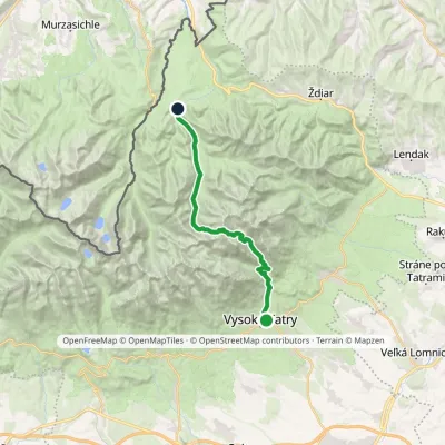 HardTwo-dayMarkedStary Smokowiec Tatrzańska JaworinaElevation profile996–2 342 m22.4 kmascent 1 382 m≈ 8.5 h walkingunder 1 km from Ľadový štít
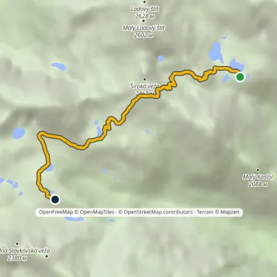 HardOne-dayMarkedTéryho chata Zbojnícka chataElevation profile1 970–2 260 m4.9 kmascent 247 m≈ 1.5 h walkingunder 1 km from Ľadový štít
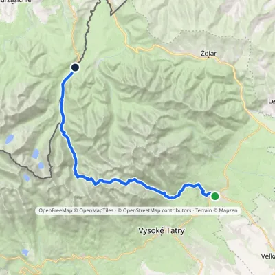 HardMulti-dayMarkedTatranská Lomnica Lysá PoľanaElevation profile853–2 268 m27.3 kmascent 1 415 m≈ 9.5 h walking2.3 km from Ľadový štít
Nearby attractions
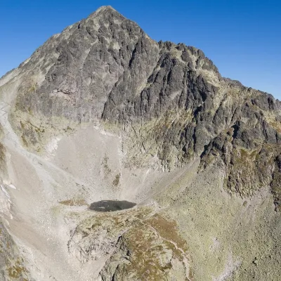
 PeakMalý Ľadový štítTatranská Javorinaaltitude 2 602 munder 1 km from Ľadový štítMalý Ľadový štít (formerly Ľadová kopa; Polish Lodowa Kopa; German Markasitturm) is a 2602 m summit on the main ridge of the Slovak High Tatras.
 LakeModré plesoStarý Smokovecunder 1 km from Ľadový štítModré pleso (the Blue Tarn) is the highest permanent lake in the whole Tatras. It lies at 2,192 m (Czech and German sources give 2,189 m) in Dolinka pod Sedielkom, a...
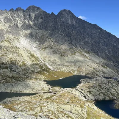 LakePäť Spišských plies (Five Spiš Tarns)Starý Smokovec1.2 km from Ľadový štítPäť Spišských plies (the Five Spiš Tarns) is a group of five glacial lakes at the very head of Malá Studená dolina in the Slovak High Tatras, within Tatra National...
Craft nearby
All craft places Water parks & thermal poolsClimatic spas of the High Tatras: Nový Smokovec, Polianka, KotlinaVysoké Tatry7.2 km from Ľadový štítNový Smokovec is the best known of the climatic spas of the High Tatras. It grew up in a spruce forest at about 1010 m, south-west of Starý Smokovec, with which it...
 Cheese dairies & pasturesShepherd's Hut on Rusinowa PolanaBrzegi9.8 km from Ľadový štítRusinowa Polana is one of the most beautiful mountain glades in the Polish Tatras, and from May to October it is home to the bacówka (shepherd's hut) of baca Stanisław...
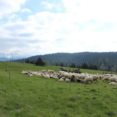 Cheese dairies & pasturesU Jancoka Shepherd's Hut, Brzegi: oscypek from Poland's first female bacaBrzegi15 km from Ľadový štítThe U Jancoka shepherd's hut (bacówka) stands beside regional road 960, which runs from Bukowina Tatrzańska to the Łysa Polana border crossing, in the village of Brzegi.
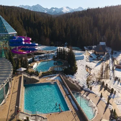 Water parks & thermal poolsTermy BukovinaBukowina Tatrzańska15 km from Ľadový štítTermy Bukovina is a modern thermal pool complex in Bukowina Tatrzańska, a village lying about a thousand metres above sea level on the edge of the Tatra National Park.
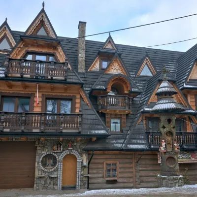 Crafts & workshopsDrewutnia, Bukowina Tatrzańska: glass painting workshops and highland furnitureBukowina Tatrzańska16 km from Ľadový štítDrewutnia ("the woodshed") calls itself a "shop for cultural needs". It is the family business of the Kuchtas of Bukowina Tatrzańska, who say they have lived here...
 Cheese dairies & pasturesFurtek's Shepherd's Huts, Kuźnice and KalatówkiZakopane17 km from Ľadový štítAbove Kuźnice — the southern edge of Zakopane where most hikes into the Western and High Tatras begin — the flocks are tended by baca Andrzej Staszel, nicknamed "Furtek".
