Hájny grúň
Hájny grúň is a forested 1208 m summit in the northern part of the Poľana mountains in Central Slovakia. It rises above the village of Strelníky, about 15 km south-west of the town of Brezno, on the boundary of the Banská Bystrica and Brezno Districts of the Banská Bystrica Region, within the cadastres of Ľubietová and Hronec. The nearest settlements are Strelníky and Ľubietová to the west and Osrblie to the north-east; they are 6 to 10 km away in a straight line, so large uninhabited forests surround the summit.
The mountain's greatest peculiarity is its position on the map: Slovak geographers regard Hájny grúň as the geometric centre of Slovakia, i.e. the centre of gravity of the state territory. A little to the north, around the peaks of Ľubietovský Vepor and Hrb, the "centre of Slovakia" has been set with an accuracy of 5–10 km, and an official table with coordinates stands there.
How to get there / routes
- Red trail – the Rudná magistrála (KST 0804), one of the longest ridge routes in Slovakia, runs right over the summit. From the south it comes from the town of Detva via the highest peak of the Poľana mountains (1457.8 m) and the Jasenová saddle (1103.5 m), from the north from the saddle below Hrb via Vepor (1277 m).
- Marked side trails meet at the Krížne junction: from Strelníky via Ľubietovská Bukovina, from the Kyslinky hamlet and from the Tri vody junction near Osrblie via the Jasenová saddle, from Ponická Huta via the Bukovina junction.
There are springs near the Jasenová saddle, including a spring area below it – a handy place to refill water on the long ridge walk.
What you can see from the top
Forest covers the summit, so the view is very limited. From open spots you see mainly the neighbouring peaks of Poľana and the Vepor Mountains. In favourable conditions a large part of the Low Tatras ridge, the Starohorské vrchy, the Greater Fatra and the Kremnica Mountains come into view, with Fabova hoľa and Klenovský Vepor dominating to the east. Occasionally the peaks of the High Tatras show up to the north above the Low Tatras ridge.
Nature and history
Hájny grúň stands on a ridge that runs north from the caldera of the ancient Poľana stratovolcano towards Vepor and Hrb. The Poľana mountains are the remnant of a large volcano, so the peaks here are built of volcanic rocks. The northern neighbour is Vepor (1277 m), to the west lies Ľubietovská Bukovina (1194 m), to the south Grúň (1026 m). The Jasenová saddle separates the summit from Brusniansky grúň (1271 m) to the south-east, and Hrončecký grúň (973 m) lies to the east. The whole area belongs to the Hron basin: the western slopes drain to tributaries of the Hutná, the eastern ones via the Osrblianka and the Hronček towards the Kamenistý potok.
The mountain lies in the Poľana Protected Landscape Area (CHKO Poľana), which is also a UNESCO biosphere reserve. Extensive beech and fir-beech forests grow here.
Safety, season and rules
Here the Rudná magistrála is long and remote: carry water, a map and a headlamp and plan your time – the nearest villages are far away. In winter the routes are deep in snow. In the protected area stay on marked trails and do not light fires. In Slovakia the Mountain Rescue Service (HZS) operates: 18 300 (+421 18 300); the general emergency number is 112.
Interesting facts
- Hájny grúň is the geometric centre of Slovakia – the "centre of gravity" of its territory.
- The Rudná magistrála, the red trail across the Slovak Ore Mountains, runs over the summit.
- The mountain lies on the rim of the caldera of the ancient Poľana volcano.
Getting there from Ukraine
Border crossings
- Uzhhorod – Vyšné Nemecké — road, 24/7
- Malyi Bereznyi – Ubľa — road, 24/7 For cars and buses; pedestrians not confirmed by the Ukrainian border service, lorries up to 3.5 t.
- Mali Selmentsi – Veľké Slemence (pedestrian) — pedestrian, 09:00–21:00 Kyiv time Pedestrians and cyclists only; inconvenient for the Tatras without onward transport.
- Chop – Čierna nad Tisou (rail) — rail, 24/7
By car
From Uzhhorod to Brezno ≈274 km, ≈3 h 50 min without queues: Uzhhorod – Vyšné Nemecké → I/19 to Košice → D1 via Prešov and Poprad to the exit near Liptovský Hrádok → I/18 and I/72 over the Čertovica Pass to Brezno. To Banská Bystrica ≈322 km, ≈4 h 30 min: D1 to Ružomberok, then I/59 via Donovaly. From Lviv: to Brezno via Uzhok and Ubľa ≈498 km (≈7 h 45 min) or through Poland ≈554 km (≈7 h 05 min); to Banská Bystrica through Poland (Kraków – Chyżne – Trstená – Dolný Kubín – Ružomberok) ≈535 km, ≈7 h 15 min. The D1 requires an e-vignette (eznamka.sk).
Checked 23.10.2026; border crossing hours and timetables change — check before you travel.
Water and shelter nearby
- Spring below Ľubietovská Bukovina (east slope)880 m · Not verified · 1 052 m
- Spring under Jaseňová Saddle960 m · Not verified · 1 107 m
- Spring below Hájny grúň (north slope)1.1 km · Not verified · 1 076 m
- Jasenová Hut1.2 km · Not verified · 1 119 m
- Spring below Ľubietovská Bukovina (south-east slope)1.7 km · Not verified · 1 157 m
- Spring below Ľubietovská Bukovina (north slope)1.7 km · Not verified · 1 108 m
- Hut below Ľubietovská Bukovina1.8 km · Not verified · 1 110 m
- Spring below Vepor1.8 km · Not verified · 1 101 m
- Hut on Majerová Meadow2 km · Not verified · 1 013 m
- Spring below Grúň (north-east slope), 933 m2 km · Not verified · 933 m
- Spring below Ľubietovská Bukovina (north-west slope), 1 135 m2.1 km · Not verified · 1 135 m
- Strelnícky Hut2.3 km · Not verified · 1 155 m
- Spring below Ľubietovská Bukovina (north-west slope), 1 155 m2.4 km · Not verified · 1 155 m
- Spring below Brusniansky grúň (south-east slope)2.7 km · Not verified · 1 214 m
- Spring below Hrončecký grúň2.7 km · Not verified · 754 m
- Spring below Ľubietovská Bukovina (north-west slope), 1 104 m2.8 km · Not verified · 1 104 m
Comments
Trails nearby
All trails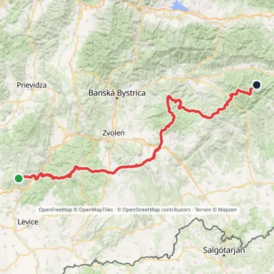 HardMulti-dayMarkedRudná magistrála: Veľký Inovec KadakElevation profile196–1 458 m195.4 kmascent 6 404 munder 1 km from Hájny grúň
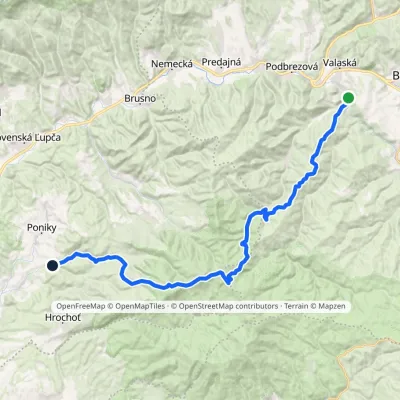 HardMulti-dayMarkedPonická Huta HronecElevation profile484–1 245 m35.7 kmascent 1 143 m≈ 11 h walkingunder 1 km from Hájny grúň
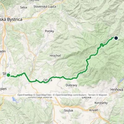 HardMulti-dayMarkedSliač HrončekElevation profile301–1 138 m43.4 kmascent 1 362 m≈ 13.5 h walkingunder 1 km from Hájny grúň
Nearby attractions
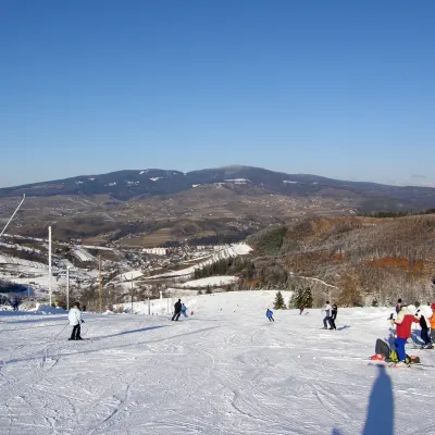 PeakPoľanaHriňováaltitude 1 458 m6.1 km from Hájny grúňPoľana is a 1457.8 m summit, the highest point of the mountain massif of the same name in central Slovakia.
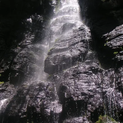 WaterfallBystrô waterfall on the Poľana volcanoHriňová7.7 km from Hájny grúňThe Bystrý potok waterfall (Vodopád Bystrého potoka), known locally simply as Bystrô or Bystré, is one of the best-known waterfalls in central Slovakia.
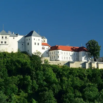 CastleĽupča CastleSlovenská Ľupča16 km from Hájny grúňĽupča Castle (Ľupčiansky hrad, Hrad Ľupča) rises above the village of Slovenská Ľupča in the Hron valley, about 10 km east of Banská Bystrica.
Craft nearby
All craft places Water parks & thermal poolsBrusno Spa: mineral springs, treatments and Caracalla SpaBrusno12 km from Hájny grúňBrusno Spa (Kúpele Brusno) lies in the Hron valley (Horehronie), about 20 km north-east of Banská Bystrica, on the northern slopes of the Vepor massif in the Slovak...
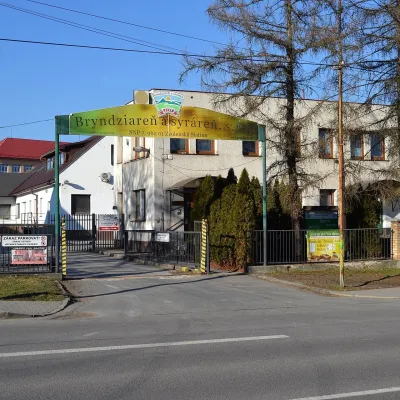 Cheese dairies & pasturesZvolenská Slatina bryndza dairy: the oldest, since 1797Zvolenská Slatina21 km from Hájny grúňBryndza with more than 220 years behind it Zvolenská Slatina is a large village in the Podpoľanie region, a few kilometres from Zvolen, at the foot of the volcanic...
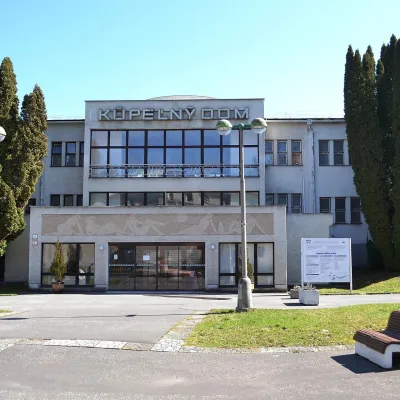 Water parks & thermal poolsSliač spa: warm carbonated water and a thermal swimming areaSliač24 km from Hájny grúňSliač is a spa in the Zvolen Basin above the Hron valley, between Zvolen and Banská Bystrica. The spa quarter with its 46-hectare park lies on a slope above the former...
 Craft shopsÚĽUV Banská Bystrica: folk-craft shop and craft schoolBanská Bystrica24 km from Hájny grúňÚĽUV (Ústredie ľudovej umeleckej výroby, the Centre for Folk Art Production) is a state institution that has looked after Slovak folk crafts since 1945: it keeps a...
 Craft beer & breweriesUrpiner brewery in Banská Bystrica: tour and beer from the tankBanská Bystrica25 km from Hájny grúňBanská Bystrica is the centre of Central Slovakia and grew rich on copper mining in the 14th–16th centuries.
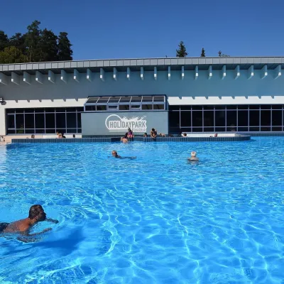 Water parks & thermal poolsKováčová: thermal spa and Holidaypark aquapark near ZvolenKováčová28 km from Hájny grúňKováčová is a spa village on the south-western edge of the Zvolen Basin, 4 km west of Zvolen at the foot of the Kremnica Mountains; the village centre lies at 303 m.
