Carpathian Guide: what our AI chat can do — mountain weather, trails, places to stay

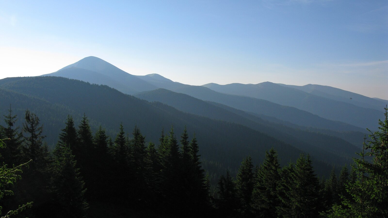
On every page of Karpaty.rocks there is a round blue button in the bottom right corner. Behind it is the Carpathian Guide, our assistant powered by artificial intelligence. You can write to it in plain words, as you would to a friend who knows the mountains well: “What will the weather be like on Hoverla on Saturday?”, “Where to stay in Yaremche?”, “Trails near Bukovel”. The guide answers briefly and to the point, and under the answer it shows cards from our catalogue: places to stay, trails, peaks and sights, with photos, prices and distances.
Here is what the guide can already do, where it can be wrong and how to get the best answer from it. All examples in this article are real answers given by the guide on 6 October 2026.
Try it now: tap an example and the guide will answer right here.
What the guide can do
- finds places to stay, trails, peaks and sights among thousands of places in our catalogue and shows them as cards with photos;
- understands the page you are on: on a trail page “nearby” means near this trail, on a place-to-stay page it means near that place;
- sorts “nearby” results by distance and, when no place is named, offers to show what is closest to you;
- knows the weather on peaks, in resorts and villages for the week ahead and tells you whether a hike is a good idea;
- remembers the conversation: you can follow up with “And on Sunday?”;
- answers in English, Ukrainian and Polish, in the language of the page where you opened it.
Weather for a hike: “Is it worth hiking Pip Ivan?”
This is the guide’s newest skill. Ask about the weather on a peak, in a resort, in a village or on a trail, and the guide will not give you a generic regional forecast but our own hiking forecast. We take data from the Norwegian Meteorological Institute (MET Norway) and recalculate it for the real altitude: separately for the start, the summit and the finish of a trail. Every day gets a verdict: “Great”, “Good”, “Caution” or “Not advised”, explained by the temperature up high and down below, how it feels, wind and gusts, rain, thunderstorms and fog.
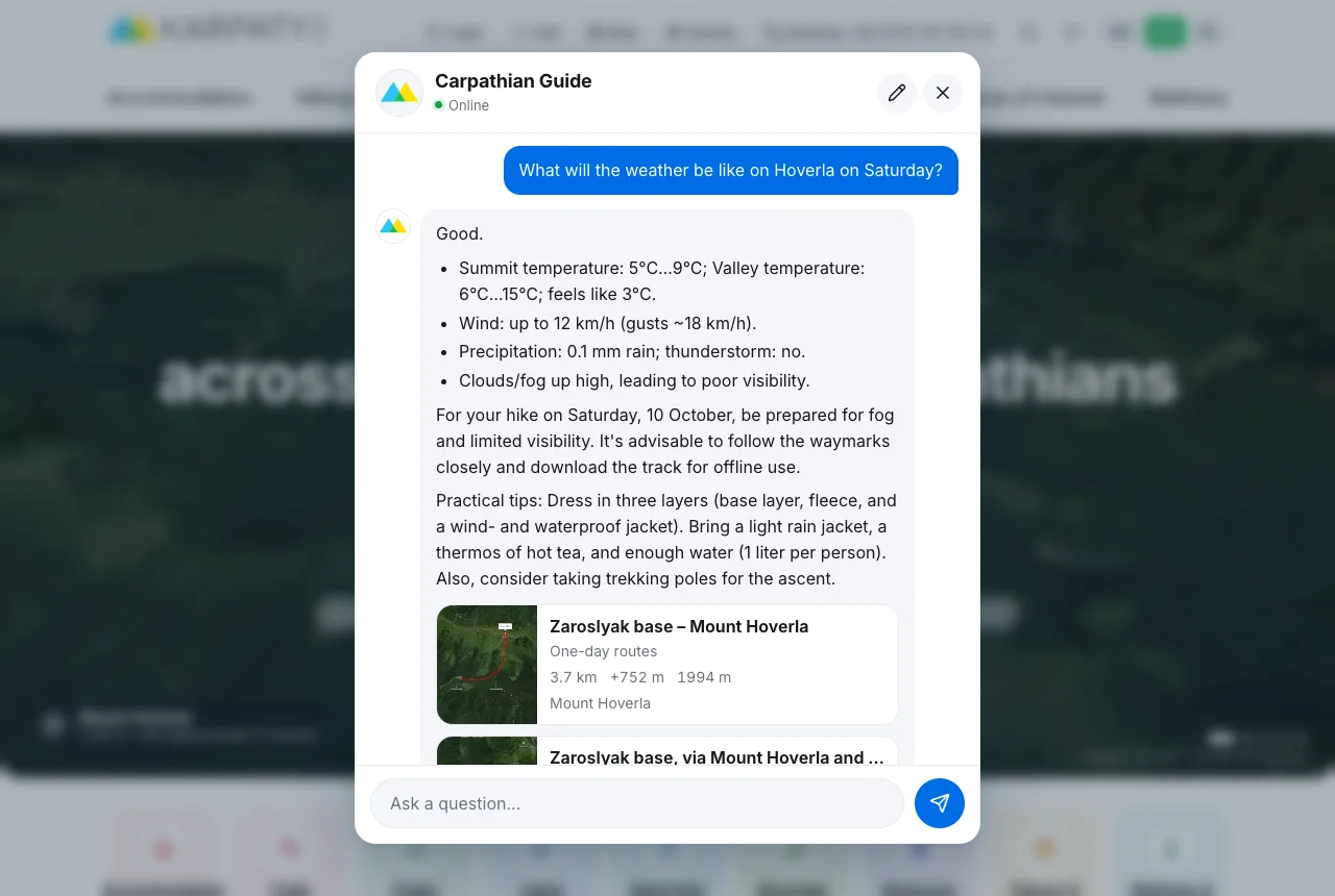
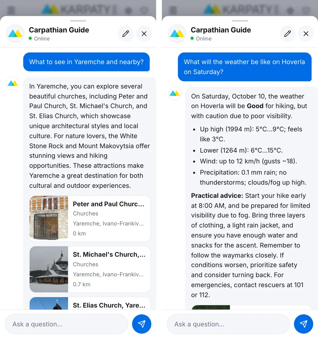
Asked about Hoverla on Saturday, the guide said “Good”: 5…9 °C up high but feeling like 3 °C, wind up to 12 km/h, with clouds and fog on the summit. Hence the advice: start early, follow the waymarks closely, dress in three layers and take water. Trails to Hoverla are right under the answer.
What else the guide can tell you about the weather:
- the best day for a hike in the coming week;
- what to take for exactly this forecast;
- a warning about a thunderstorm on an open ridge, strong wind, frost, snowfall or fog, with clear advice to postpone the hike or turn back in time;
- the rescue numbers 101 and 112;
- a link to the detailed forecast on the Carpathian weather page with 16 peaks, 12 resorts and a search for any village.
The guide remembers what you talked about
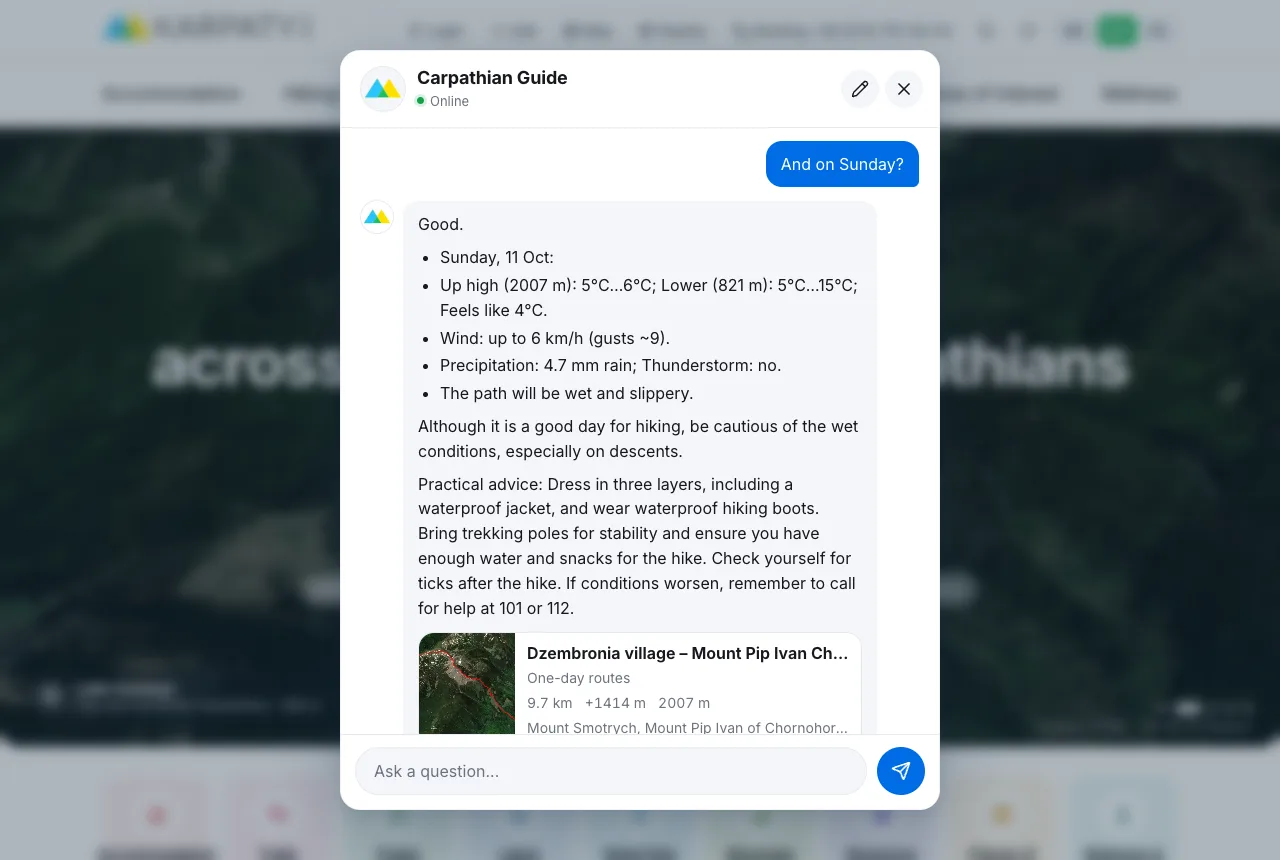
We asked “Is it worth hiking Pip Ivan on Saturday?” and then simply “And on Sunday?”. The guide understood that we still meant Pip Ivan and answered for Sunday, with its verdict, the expected rain and practical advice.
Where to stay
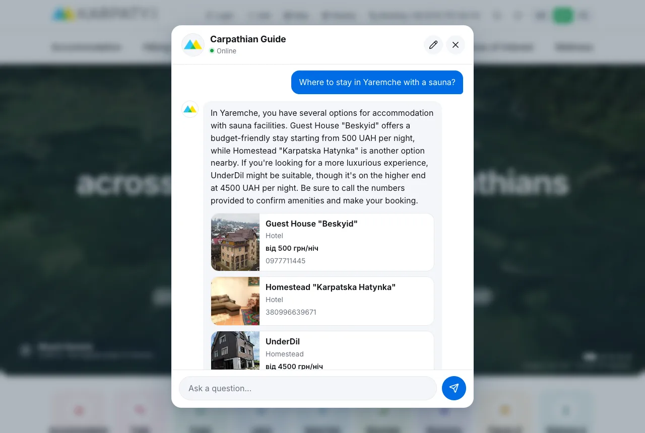
Ask where to stay in a town or village, and the guide shows places from our catalogue with photos, a price “from … UAH/night” where we have one, and a phone number. You can mention what matters to you, such as a sauna, breakfast, a budget or the number of guests. The guide reads these wishes most precisely in Ukrainian; in English and Polish it matches them by meaning, so double-check the details.
Prices and availability change, so confirm them on the place’s page or with the hosts before your trip.
The guide knows where you are
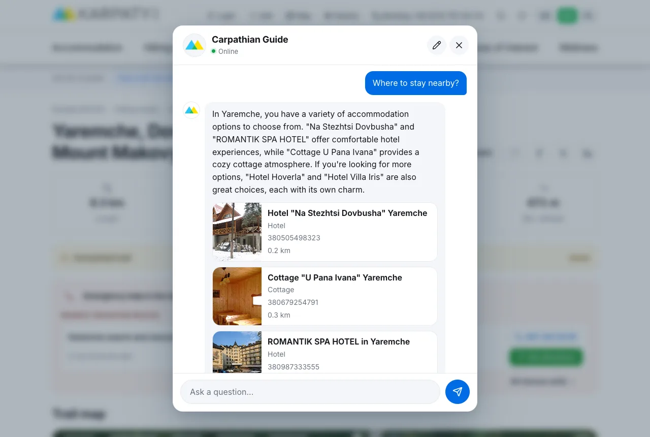
The guide sees which page you have open. On the page of the trail “Yaremche, Dovbush Rocks and Mount Makovytsia to Yaremche” we asked “Where to stay nearby?”, and the guide showed places 200–300 metres from the start of the trail, with the distance in every card.
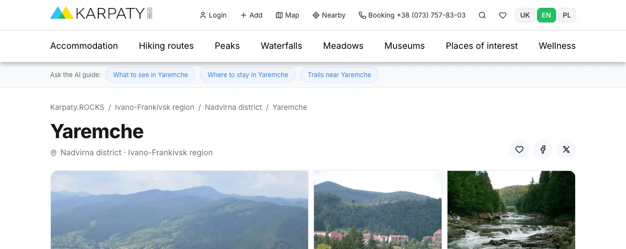
So you do not have to think up a question, pages of trails, places to stay, sights, restaurants, villages and towns have a line “Ask the AI guide:” above the content, with ready questions for that very page. For example, on the Yaremche page: “What to see in Yaremche”, “Where to stay in Yaremche”, “Trails near Yaremche”.
Nearby, by distance
For “what is nearby” or “trails nearby” the guide sorts the results by distance: from the place whose page you have open, or from the place you named. If you are on the home page and have not named a place, the guide asks you to type one or shows a “Show places near me” button under the answer. Your browser asks for permission, and the guide shows what is closest to you. Your location is never sent without your consent.
On your phone
On a phone the guide opens as a panel at the bottom of the screen. Close it with the cross or by swiping it down. The conversation is not lost: you can open a place from a card and come back to the chat. The pencil button starts a new conversation.
Example questions
Tap an example and the guide will answer right here.
Weather
Places to stay
Trails and places
What the guide cannot do and where it can be wrong
- The forecast covers about a week. The first two days are the most accurate, later days are less certain. About the weather “in January” or “in summer” the guide speaks in general terms; that is not a forecast.
- The guide is artificial intelligence. It can make mistakes, mix up a name or retell details inaccurately. Check prices, availability, timetables and trail conditions on the place’s page or with the hosts.
- The guide does not book. You can book on the page of the place to stay.
- The guide does not answer questions about crossing the border, weapons or drugs.
- The guide does not replace rescuers. In an emergency in the mountains call 101 or 112; contacts of the nearest rescue teams are on the mountain search and rescue units page.
We review conversations with the guide to improve its answers, so please do not share personal data in the chat.
The guide and our other tools
- Carpathian weather: a detailed hiking forecast for peaks, resorts and villages;
- Carpathian map: trails, places to stay and 3D terrain on one map (see our article);
- Trip planner: turn the places the guide suggested into a plan for several days, with a PDF and GPX.
The guide is new and we improve it every day. If it answers strangely or does not know something, let us know. Have a great time in the mountains!
Comments
You may also be interested in
 The best maps of the Carpathians: trails, 3D terrain and places to stay on one map
 The Carpathian Pearl of Kosiv was once called the "Hutsul Davos"Про цей феномен Карпат бодай краєм вуха чув кожен шанувальник народного мистецтва та промислів. І не лише в Україні, але й далеко за її...
 "Life and Death in Hutsulshchyna" (2016). Documentary film by Bohdan KutyepovТроє братів Череміських живуть у горах, де не мріють про iPhone7, бо щоб заробити на половину його вартості, ціле літо треба лягати...