The best maps of the Carpathians: trails, 3D terrain and places to stay on one map

For years we have been piecing the Carpathians together: trails, springs, mountain meadows, guesthouses, waterfalls. Now it all sits on one map. More than 800 hiking trails with real GPS tracks, more than three thousand places to stay with prices, peaks, springs, shelters, real 3D terrain and satellite imagery. All of it in Ukrainian, English and Polish, and all of it free.
To be honest, we don't know of another site about the Ukrainian Carpathians that brings all of this together. That is why we dare to say our Carpathian maps are now the best you'll find. Here is why, with real examples.
The screenshots show the Ukrainian interface; the English version looks the same.
What makes these maps better
- 813 trails with real tracks and an elevation profile that moves together with the map;
- what's on the trail: springs, shelters, camping spots, peaks and sights, each with the kilometre where you reach it;
- over 3,000 places to stay with prices right on the map;
- real 3D terrain, satellite and topographic maps;
- your own route between any two points, with distance, time and climb;
- GPX for every trail, so you can follow the track in your navigation app with no signal;
- a directions button next to every place;
- made for your phone, free, no sign-up.
The big Carpathian map
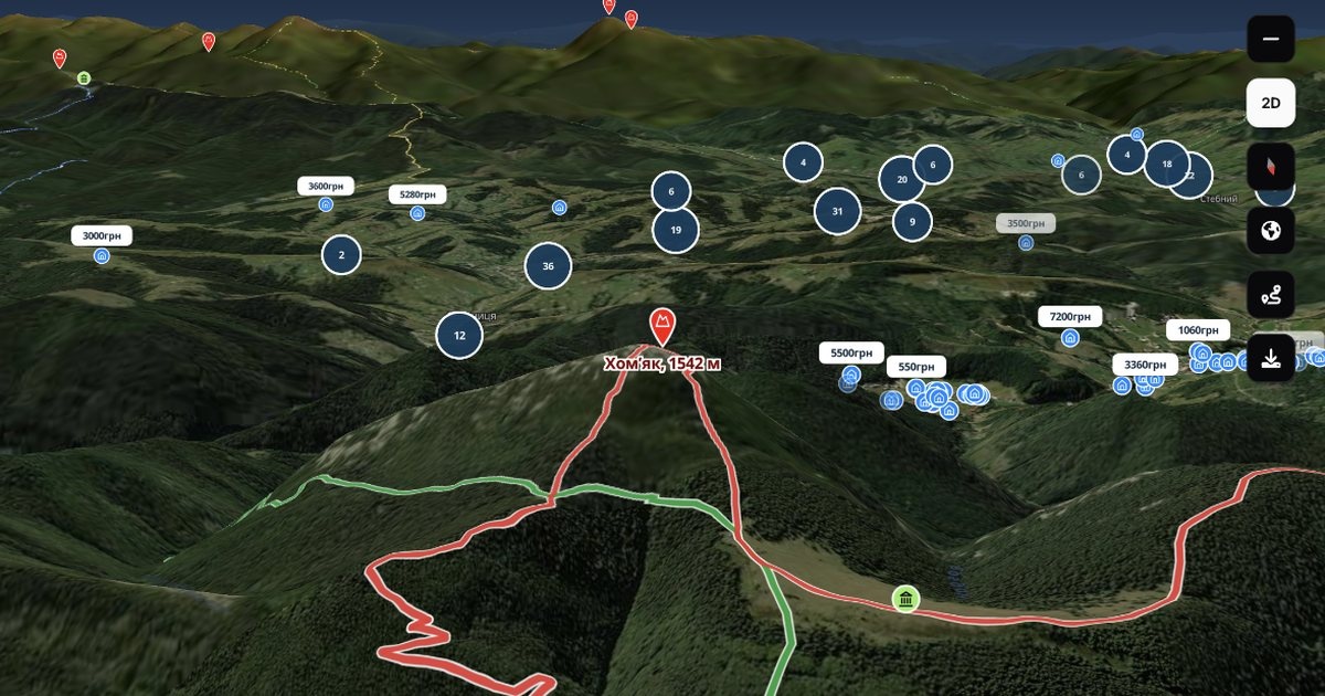
Let's start with the main thing: karpaty.rocks/map. Accommodation, trails, peaks, waterfalls and museums are all here. There is search, filters and a dark theme for planning in the evening. On the left you see a list of what is currently on the map: move the map and the list updates.
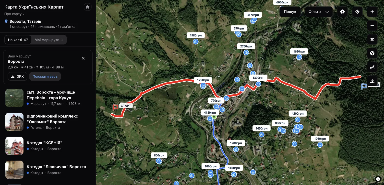
The most useful feature is route planning. Put a start and a finish on the map and our own routing server finds the way along paths and roads. You immediately see the distance, the approximate time and how much you will climb. The route is saved under My routes, so it is still there next time, and you can download it as GPX.
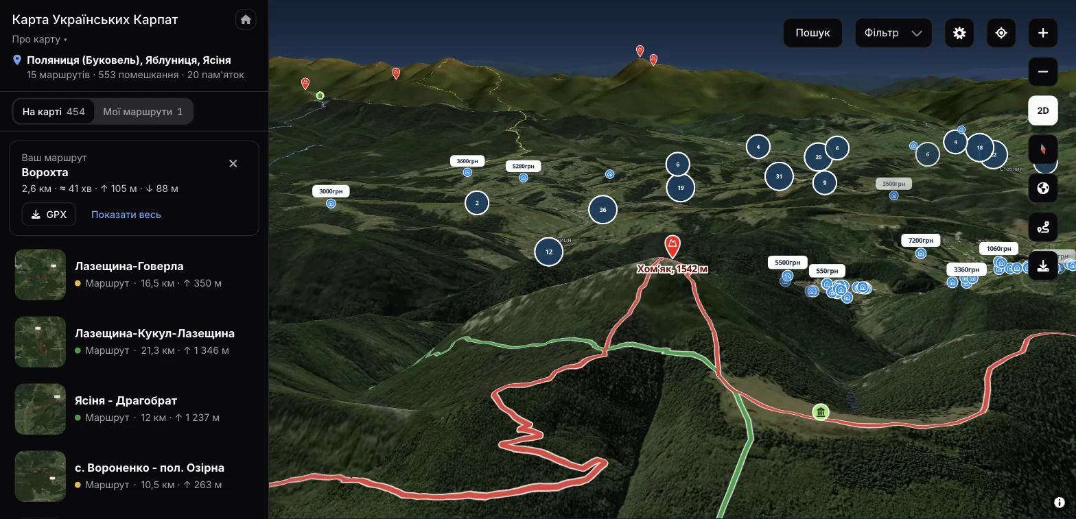
Open the map in 3D and the mountains look the way they do from a summit. Here is Mount Khomiak: you can see the trails converging on it and where you can stay on its slopes.
Trail pages: the route, the elevation and what lies ahead
On every hiking trail page the route is drawn in the colour of its waymarks, with Start and Finish labels. Under the map there is an elevation profile. Move your finger or mouse along it and a dot on the map shows where you will be at that kilometre. You see straight away where the steep climbs are and where you can catch your breath.
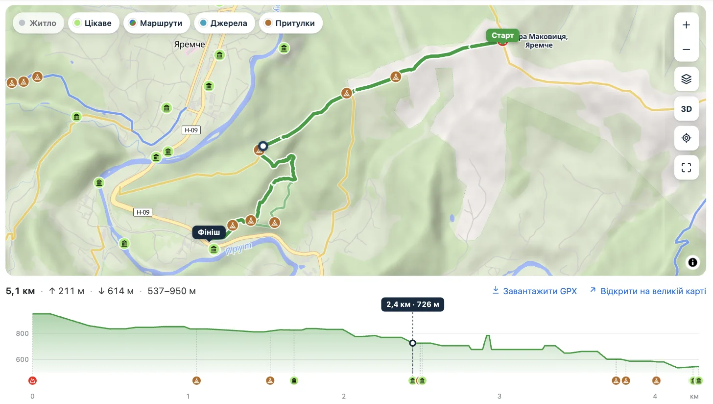
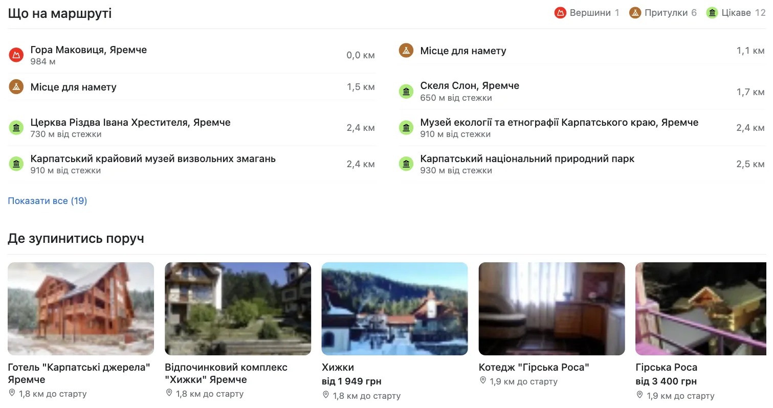
Further down is the On the trail list: peaks, springs, shelters and camping spots, sights you will pass or find close by. Each item shows its kilometre and how far it is from the path. The Where to stay nearby block lists accommodation close to the start and the finish, with prices.
You can download the track as GPX and open it in a navigation app on your phone or watch. Mobile coverage in the mountains is patchy, so it is worth having the track offline.
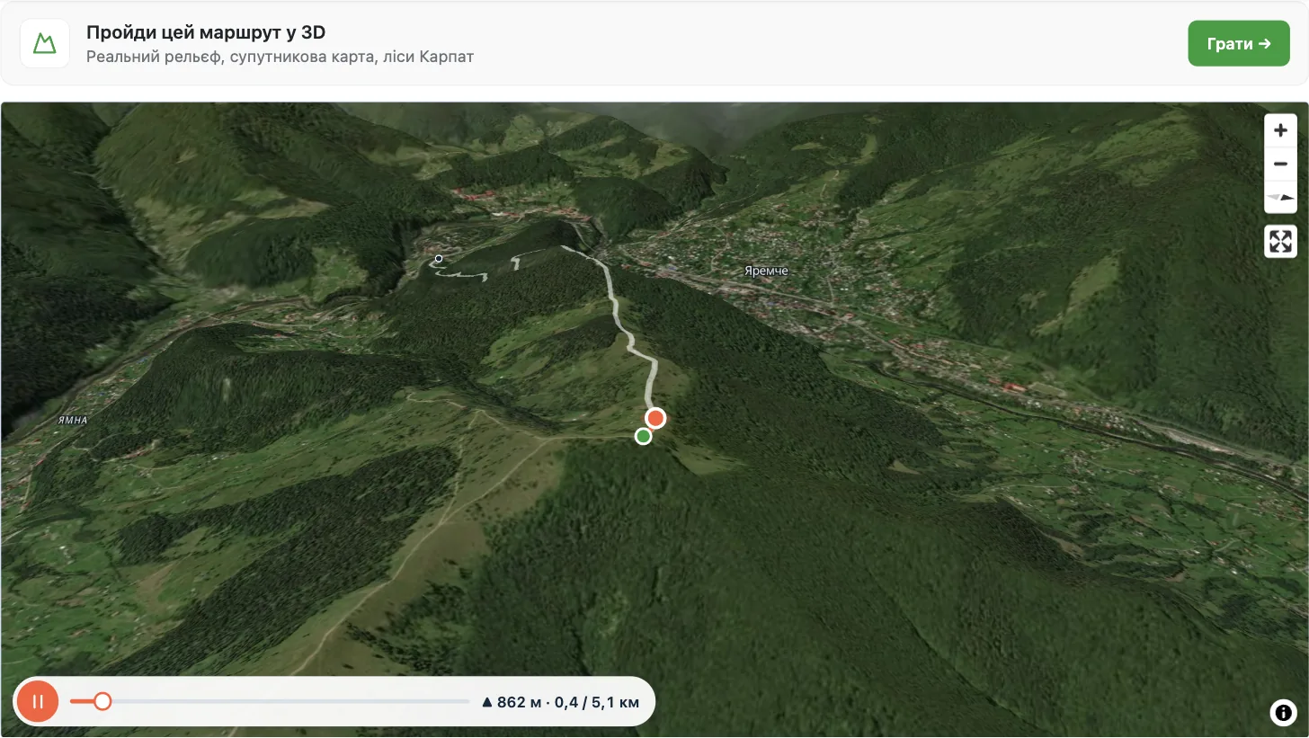
At the end of the page there is a 3D flyover: the camera follows the trail over real terrain. You can pause it, jump ahead and see the altitude and distance covered. A minute of watching explains a route better than a long description: where the forest is, where the open meadows are, which way you come down.
A map on every hotel, village and attraction page
Each hotel, guesthouse, waterfall or village page now has a map below the description. It shows the place itself and, around it, accommodation with prices, things to see and trails nearby. Tap a price and a card pops up with a photo and a link.
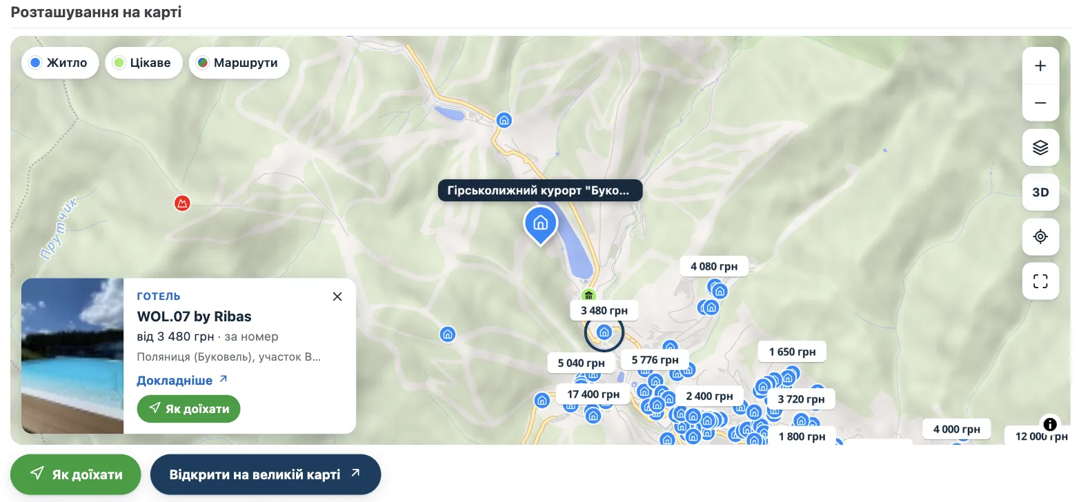
Below the map there are two buttons. One opens Google Maps with directions to the place. The other opens the Carpathian map at the same spot, so you can see what else is around.
Catalogue on the map: every result, not just page one
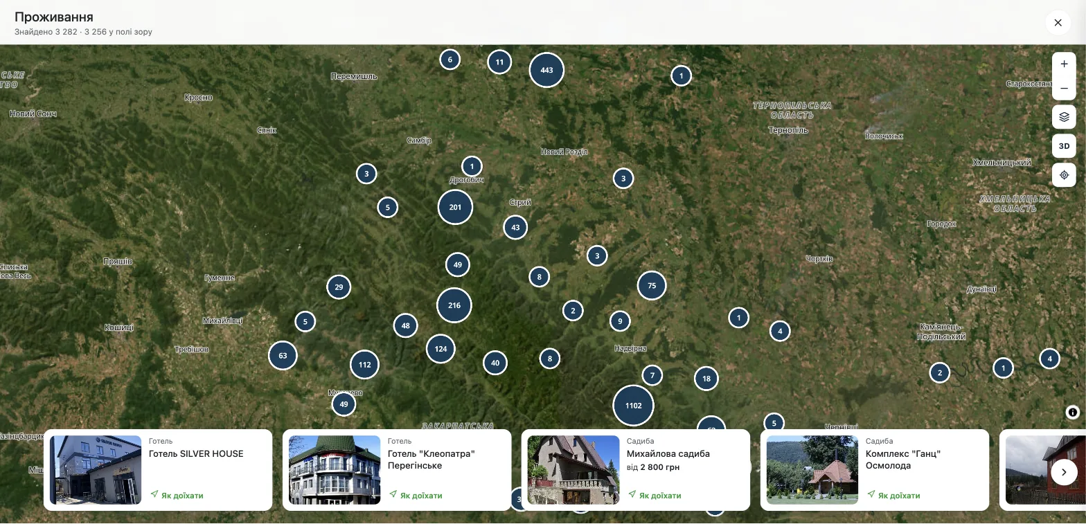
The accommodation and trail catalogues, among others, have a show-on-map button. It puts every result of your filters on the map, not just the first twenty. For accommodation that is over three thousand places. A strip of cards runs along the bottom: swipe through it and the map flies to each place.
One map, your settings
All maps on the site run on the same open-source engine, so they work the same everywhere. There are three styles: Standard with hillshading, Satellite and Topo with contour lines and footpaths. The 3D button turns the mountains into real relief, and there is a fullscreen mode and a locate button. The map remembers your choice: switch on satellite and 3D on one page and every other map will open the same way.
Example: a half-day hike to Makovytsia from Yaremche
Makovytsia is a modest mountain above Yaremche, a good choice for half a day. Here is how to plan it in five minutes:
- Open the Yaremche – Mount Makovytsia trail page. You immediately see the length (5.1 km) and the height difference: about 400 metres, from 537 to 950 m.
- Run along the elevation profile to see where the steepest sections are.
- Check what is on the trail: the summit of Makovytsia (984 m), camping spots, the Elephant rock, museums in Yaremche. Each comes with its kilometre.
- Download the GPX and load it into your navigation app while you still have signal.
- Pick a place to stay near the start or the finish. Prices are shown right away.
- Want to see the whole route first? Play the 3D flyover.
Example: finding a place to stay in Bukovel
Open the accommodation catalogue, set your filters (price, type of place, things like a pool or sauna) and show the results on the map. Zoom in on Polianytsia: prices are right on the map, so it is easy to compare staying next to the lifts with staying a few kilometres away. Found something you like? Tap the directions button and Google Maps takes it from there. Our page about the Bukovel ski resort covers the resort itself and has a map of the accommodation around it.
Bonus: walk the trail in a game
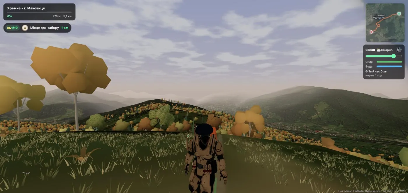
On the same terrain we built a 3D game, Exploring the Carpathians: pick a hero and walk a real trail, collecting stamps at real peaks and springs in your Traveller's Passport. Every trail page has a Play button that starts that very trail.
We walk these trails ourselves and will keep improving the maps. If you notice a mistake or a missing path or spring, leave a comment under this article or under the trail itself. And you can start right now: open the Carpathian map and find your next hike.