Baníkov
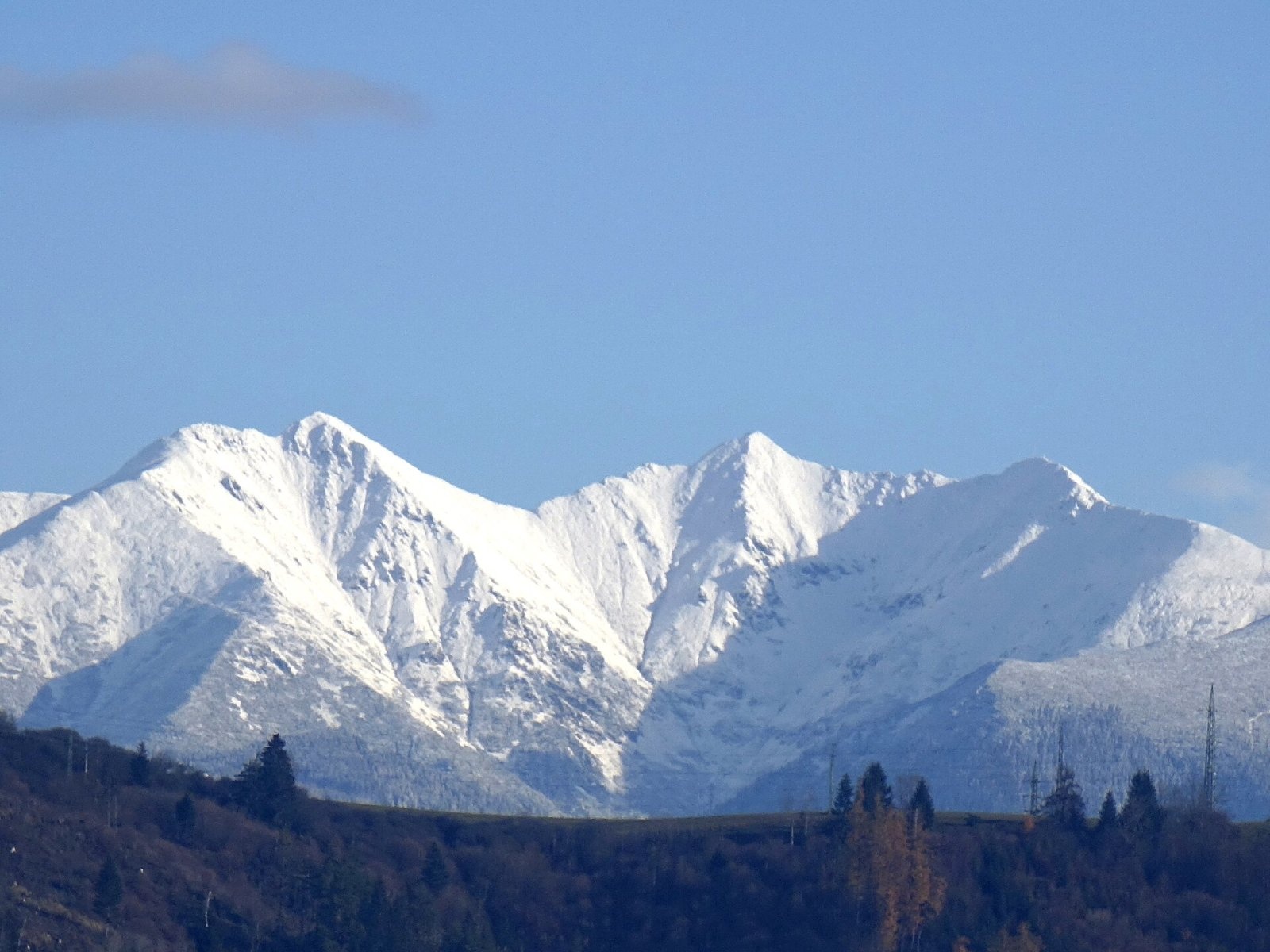
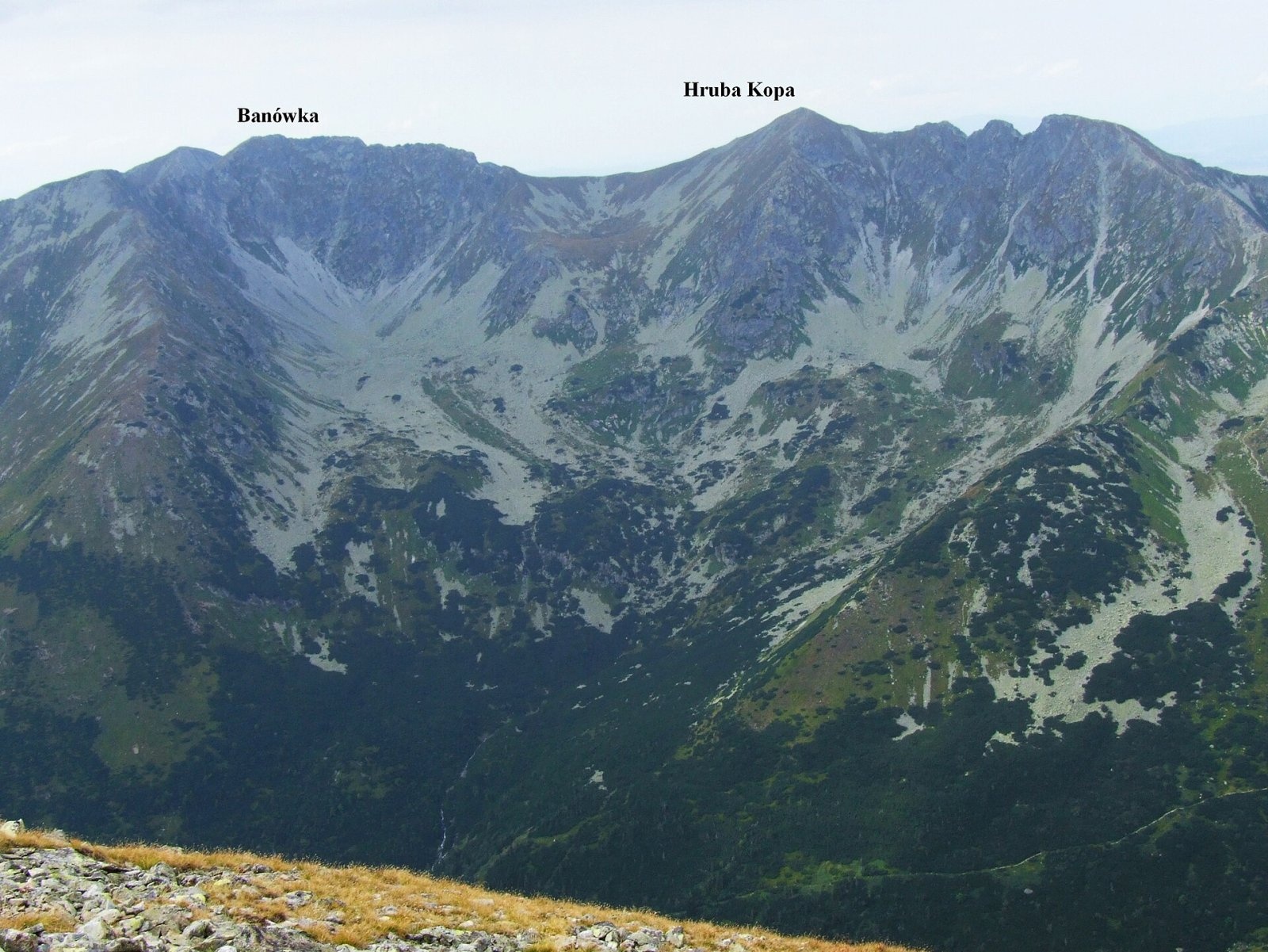
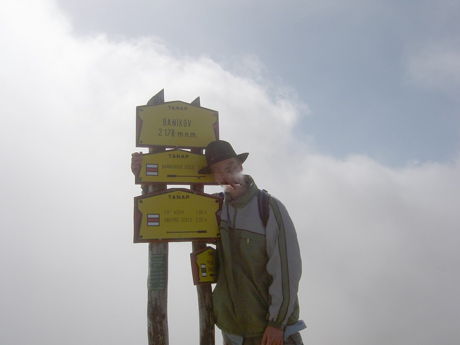
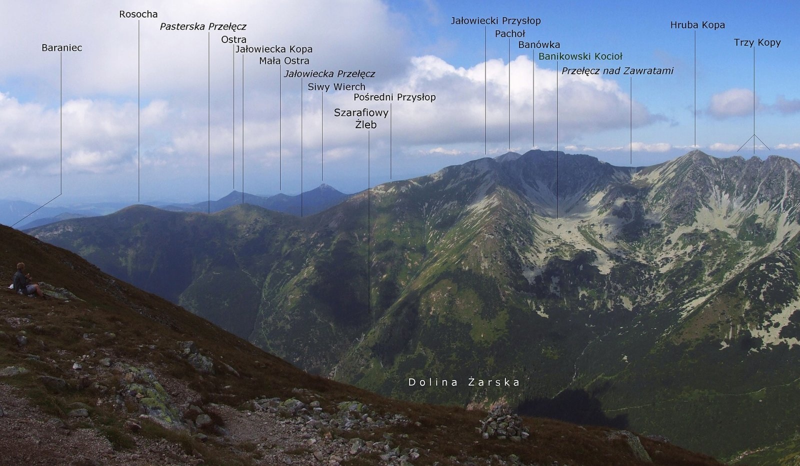
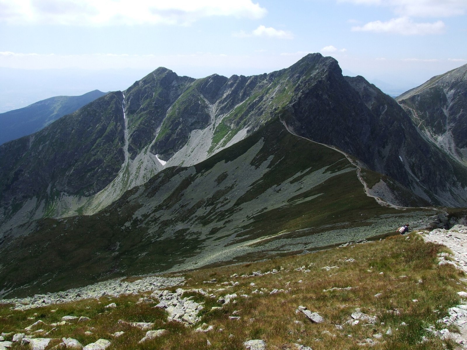
Baníkov (Polish: Banówka) is a 2,178 m peak in the Western Tatras — the highest point on the main ridge of the range and the fourth-highest summit of the Western Tatras after Bystrá, Jakubina and Baranec. It lies in Slovakia, in the Roháče group, on the boundary between the historic regions of Orava and Liptov. The mountain rises above the Roháčska valley (its Spálená branch), the Parichvost valley (part of Jalovecká dolina) and the Žiarska valley. To the north-west the Baníkovské sedlo saddle separates it from Pachoľa (2,167 m), and to the east, beyond another saddle, stands Hrubá kopa. The nearest settlements are Jalovec, about 4.5 km to the south-west, and the Zverovka resort near Zuberec, about 5.5 km to the north-west. The peak lies in the Tatra National Park (TANAP).
How to get there: routes
Baníkov is a junction of several marked trails:
- Red ridge trail along the main crest of the Western Tatras. From the east it comes from Smutné sedlo over Tri kopy and Hrubá kopa — about 2 hours to the summit. This section is rocky and in places very exposed, with chains; Polish sources rate the stretch from the saddle between Hrubá kopa and Baníkov as one of the hardest sections of any hiking trail in the Tatras. Westwards the red trail drops to Baníkovské sedlo (about 30 minutes) and continues over Pachoľa and Brestová.
- Green trail — from the former buffet by the Roháčske plesá lakes in the Roháčska valley to Baníkovské sedlo, then with the red trail to the top (about 3 h 50 min up, 2 h 50 min down). The green trail then continues south over Príslop to the Žiarska chata hut in the Žiarska valley (about 2 hours down from the summit, about 3 hours in the opposite direction).
- From Jalovec — yellow markings to the junction below Lysec, then blue through the Parichvost valley to Baníkovské sedlo (Czech sources give about 4 h 45 min).
What you can see from the summit
Baníkov forms a long, almost level crest with only faintly defined tops, and it offers a broad all-round panorama: nearly all of the Western and High Tatras, the neighbouring valleys and the Liptov basin. Slovak sources also list the Skorušinské vrchy, the Orava Beskids, Oravská Magura, Malá and Veľká Fatra, the Chočské vrchy and the Low Tatras. The Polish mountaineers Kazimierz Paszucha and Czesław Łapiński, who traversed the ridge on 24 April 1948, described the snow-covered Low Tatras, the silver thread of the Váh river winding through the valley below them, and Babia Góra and Pilsko to the north.
Nature and history
Unlike most of the grassy summits of the Western Tatras, Baníkov is built of crystalline rock — the Roháče granodiorites — and looks more like the High Tatras. Its north side falls in a wall about 350 m high into the Spálená valley, with huge scree cones at its foot. Directly below the southern slopes, at the head of the Žiarska valley, lies a glacial cirque. A distinctive rock needle, Baníkovská ihla, rises on the east ridge. Rare alpine plants grow on the northern walls, including the frost gentian (Gentiana frigida), mossy saxifrage (Saxifraga bryoides), the alpine buttercup (Ranunculus alpestris) and the glacier buttercup (Ranunculus glacialis).
The name refers to mining: the Slovak word "baník" means "miner". In the 18th century iron ore was sought below the slopes of Baníkov, as in many other parts of the Tatras, but with little success. The Polish name Banówka comes from the Liptov dialect form "Banovka", derived from "bania", an old word for a mine.
Safety, season and rules
All routes to Baníkov lie in TANAP's high-mountain zone. Under the park's current visitor rules, trails above the tree line are closed from 1 November to 31 May (formerly until 15 June); TANAP publishes the current exceptions and closed sections. Walking is allowed only on marked trails.
The Roháče ridge is one of the most demanding parts of the Western Tatras. The trail crosses large blocks and slabs, sometimes above drops, so you need sure footing, a head for heights and good boots. Rain makes the rock very slippery, and thunderstorms are dangerous on the open crest — start early and do not begin the traverse if the forecast is poor. The routes are long with a large height gain, so pace yourself.
Emergency numbers: the Slovak Mountain Rescue Service (HZS) 18 300 (+421 18 300 from a foreign phone) and 112. Rescue operations in Slovakia may be charged, so make sure your insurance covers mountain hiking.
Interesting facts
- Baníkov is the highest summit on the main ridge of the Western Tatras, although the range as a whole is topped by Bystrá, which stands off the ridge.
- Its name is a "miner's" one: iron ore was sought here in vain in the 18th century.
- Thanks to their granodiorite, Baníkov and the neighbouring Roháče look like a piece of the High Tatras among the grassy Western Tatras.
Photos: Ing.Mgr.Jozef Kotulič, CC BY-SA 4.0; Jerzy Opioła, CC BY-SA 3.0; Dezidor, CC BY 3.0; Jerzy Opioła, CC BY-SA 4.0; Jerzy Opioła, CC BY-SA 3.0; Jerzy Opioła, CC BY-SA 3.0; Rafał Kozubek, CC BY-SA 4.0 — Wikimedia Commons.
Getting there from Ukraine
Border crossings
- Uzhhorod – Vyšné Nemecké — road, 24/7
- Malyi Bereznyi – Ubľa — road, 24/7 For cars and buses; pedestrians not confirmed by the Ukrainian border service, lorries up to 3.5 t.
- Mali Selmentsi – Veľké Slemence (pedestrian) — pedestrian, 09:00–21:00 Kyiv time Pedestrians and cyclists only; inconvenient for the Tatras without onward transport.
- Chop – Čierna nad Tisou (rail) — rail, 24/7
By car
From Uzhhorod ≈275 km, ≈3 h 35 min without queues: Uzhhorod – Vyšné Nemecké → I/19 to Košice → D1 motorway via Prešov, Poprad and Liptovský Mikuláš to Ružomberok (≈270 km, ≈3 h 25 min from the border). From Lviv it is faster through Poland: M-10 → Krakovets – Korczowa → A4 to Kraków → S7/DK7 to the Chyżne – Trstená border → R3 and I/59 via Dolný Kubín to Ružomberok: ≈482 km, ≈6 h 15 min (via Uzhok and Ubľa ≈500 km, ≈7 h 30 min). The D1 requires an e-vignette (eznamka.sk).
Checked 23.10.2026; border crossing hours and timetables change — check before you travel.
Location on the map
Comments
Trails nearby
All trails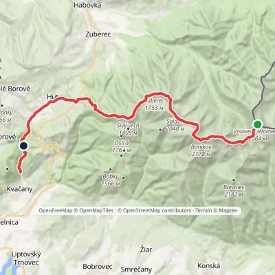 HardMulti-dayMarkedÚstie Kvačianskej doliny Pyšné sedlovia VolovecElevation profile644–2 169 m27.6 kmascent 1 322 m≈ 9.5 h walkingunder 1 km from Baníkov
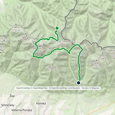 HardMulti-dayMarkedSedlo Zábrať Junction of Jamnická and Račková ValleysElevation profile962–2 176 m26.6 kmascent 2 450 m≈ 11.5 h walkingunder 1 km from Baníkov
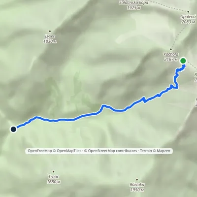 EasyOne-dayMarkedJunction below Lysec Baníkovské sedloElevation profile1 038–2 041 m4.7 km≈ 1 h walkingunder 1 km from Baníkov
Nearby attractions
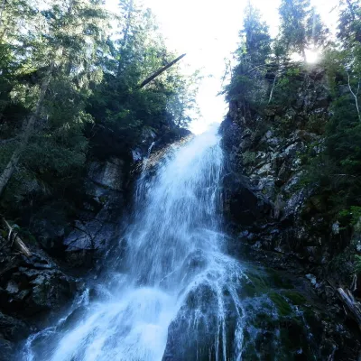 WaterfallRoháčsky Waterfall2.4 km from BaníkovRoháčsky waterfall (Roháčsky vodopád) is the best-known waterfall of the Western Tatras, in the Roháče massif about 12 km east of the village of Zuberec in Orava.
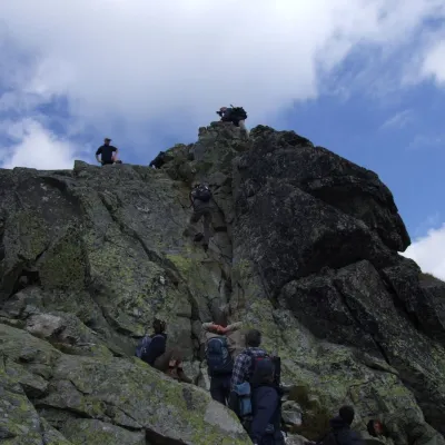 PeakOstrý Roháčaltitude 2 088 m3.4 km from BaníkovOstrý Roháč (Polish: Rohacz Ostry) is a rocky, twin-summited 2,088 m mountain on the main ridge of the Western Tatras in Slovakia.
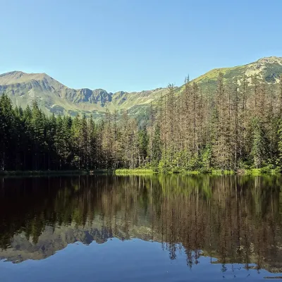 LakeSmreczyński Staw Lake11 km from BaníkovSmreczyński Staw is a small glacial lake in the upper part of the Kościeliska Valley, at the mouth of the Pyszniańska Valley, at 1,226 m.
Craft nearby
All craft places Cheese dairies & pasturesShepherds' Huts on Polana Chochołowska7.3 km from BaníkovPolana Chochołowska is the largest glade in the Polish Tatras and one of the largest in the whole range.
 Water parks & thermal poolsOravice thermal pools12 km from BaníkovThe Oravice thermal pools (Termálne kúpalisko Oravice) are the municipal thermal baths in the mountain settlement of Oravice at the foot of the Western Tatras.
 Water parks & thermal poolsMeander Thermal Resort, Oravice12 km from BaníkovMeander Thermal & Ski Resort (formerly Meander Park) is a thermal water park and ski centre in the mountain settlement of Oravice in northern Slovakia, at the foot of...
 Cheese dairies & pasturesShepherd's Hut in the Kościeliska Valley14 km from BaníkovJózef Słodyczka's bacówka (shepherd's hut) on the Wyżnia Kira Miętusia glade is probably the most easily reached shepherds' hut in the Polish Tatras.
 Water parks & thermal poolsAquapark Tatralandia14 km from BaníkovAquapark Tatralandia is a large year-round water leisure complex near Liptovský Mikuláš, on the northern shore of the Liptovská Mara reservoir.
 Water parks & thermal poolsTERMAL raj thermal bath, Liptovský Ján18 km from BaníkovLiptovský Ján: thermal water at the entrance to Jánska dolina Liptovský Ján is an old village in southern Liptov, about 10 km from Liptovský Mikuláš, at the entrance...
