Sestrč
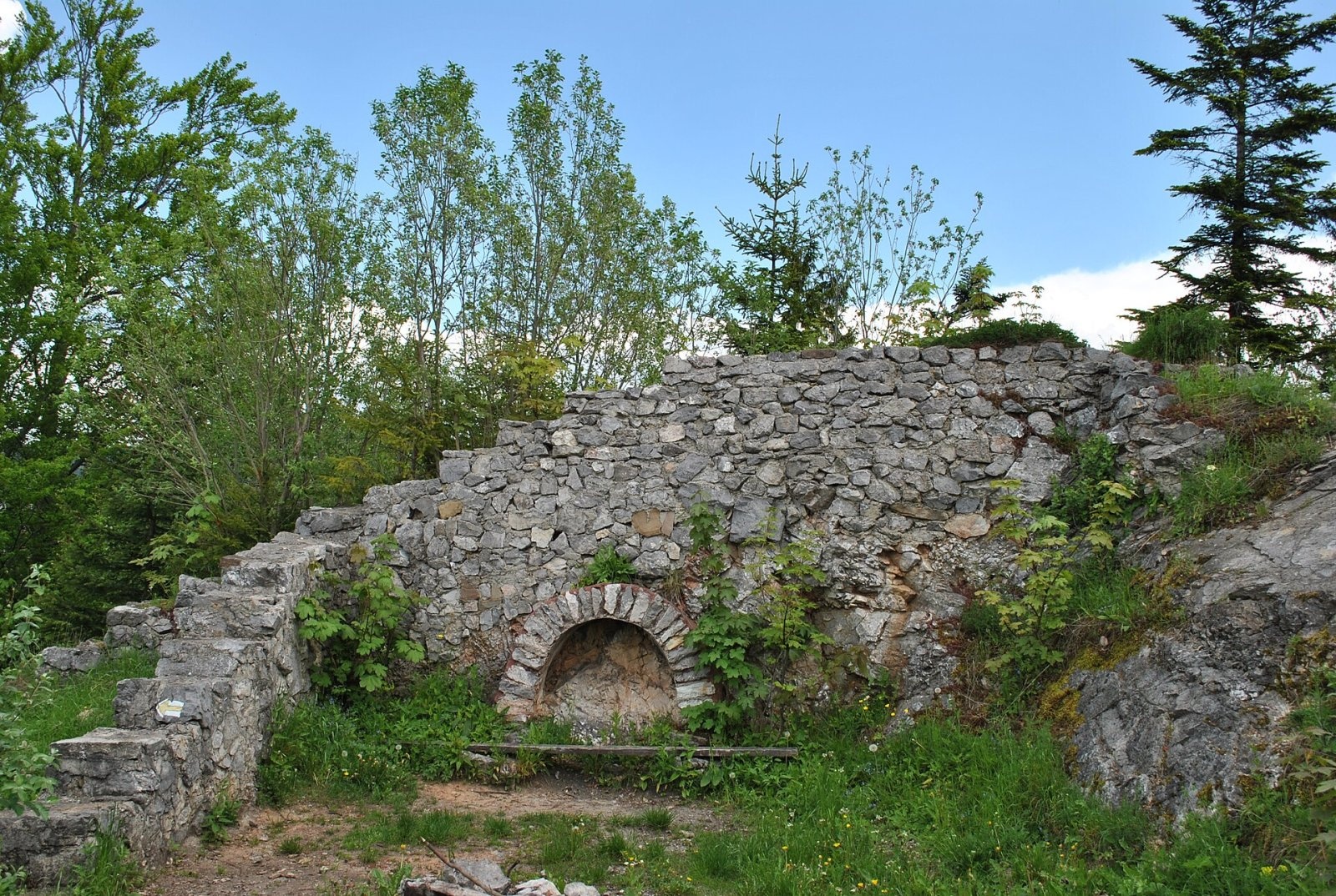
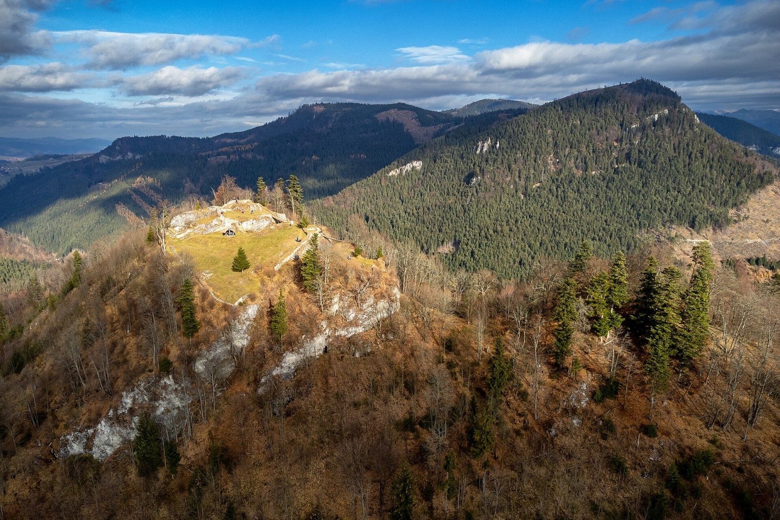
Sestrč is a 999.9 m summit in the Choč Mountains (Chočské vrchy) in the Liptov region of northern Slovakia. It belongs to the Sielnica Hills (Sielnické vrchy) subunit and rises above the villages of Kalameny and Bukovina, near the boundary of the Liptovský Mikuláš and Ružomberok Districts. On the summit stand the ruins of Liptov Castle (Liptovský hrad, also Sielnica Castle or Liptov Old Castle) – once the highest-lying castle in Slovakia and one of the highest in Central Europe. The nearest villages are Kalameny and Liptovská Anna (about 3 km), Lúčky (3 km) and Bukovina (3.5 km).
Sestrč lies between Kráľová (876.6 m) to the south and the Poľana saddle (845 m), which separates it from Sielnická hora (1051.4 m) to the north-north-west. The eastern slopes drop steeply into the Sestrčská dolina, the gentler western ones to the Kalamenianka valley. The eastern side of the ridge running north from the summit to the Poľana saddle is markedly rocky. The prominence is about 200 m.
How to get there / routes
- Red trail Vlachy – Havránok – Bukovina – Sedlo pod Kráľovou – Liptov Castle.
- Yellow trail from Kalameny via Sedlo pod Kráľovou to the castle and on to the Poľana saddle.
- Green trail – the Kalameny – Liptov Castle educational trail with panels on the castle's history.
- The blue trail KST 2701 also crosses the summit.
The whole castle area is open to the public.
What you can see from the top
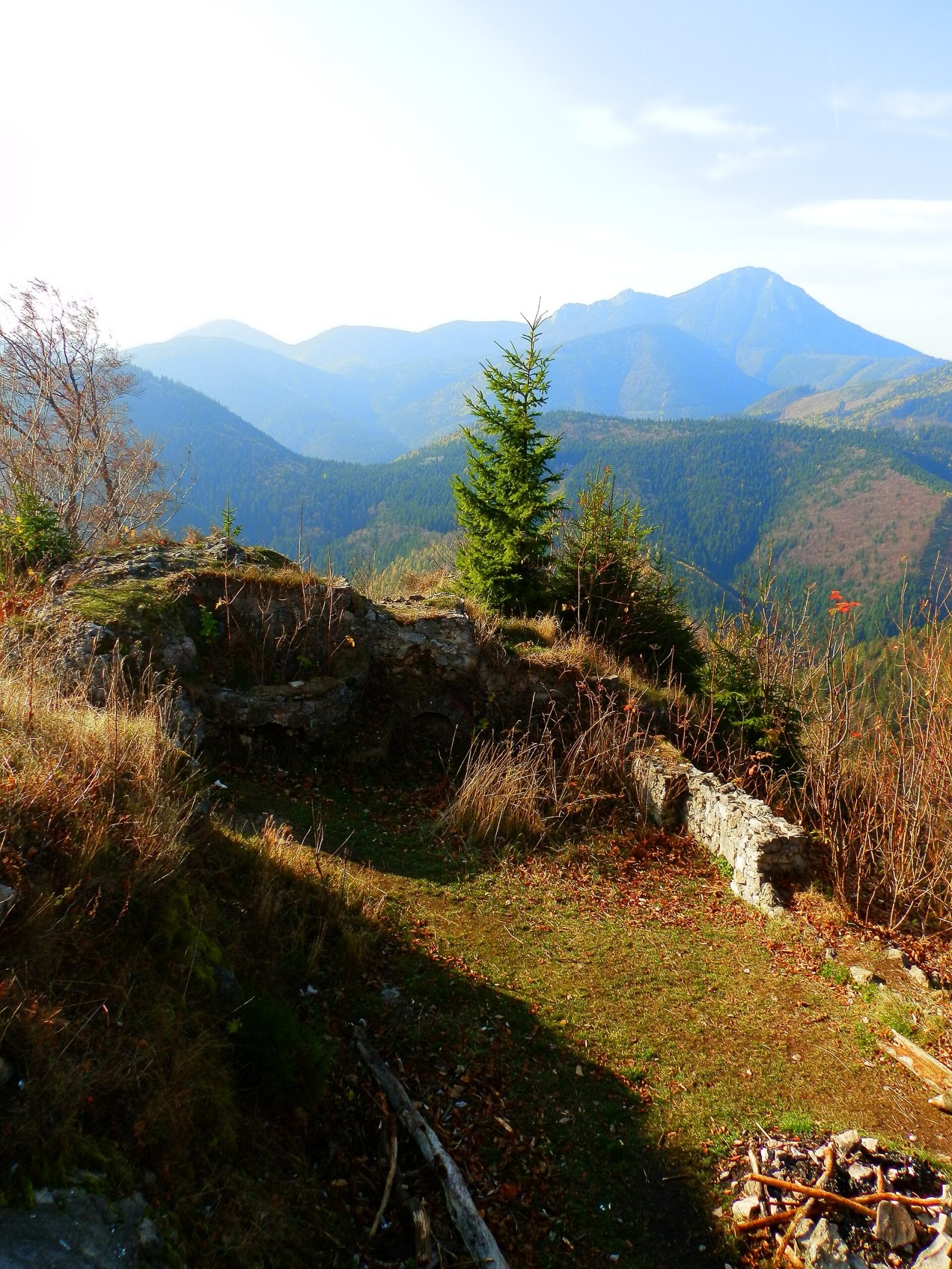
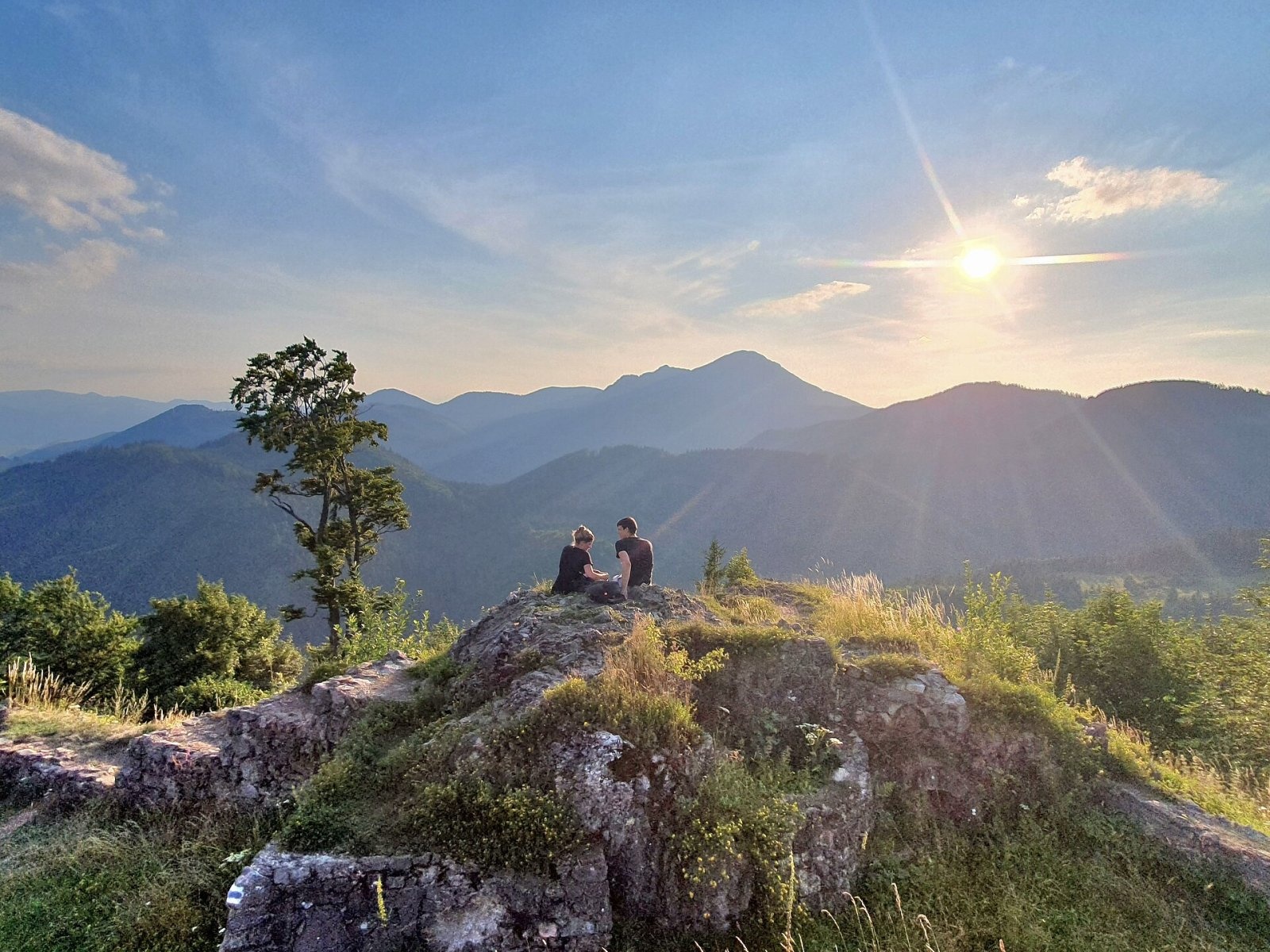
The summit plateau offers a fine all-round view: the Liptov Basin with the Liptovská Mara reservoir, neighbouring Veľký Choč, and below, the valleys of the Kalamenianka and Sestrč with the village of Malatiná.
Nature and history
People settled on Sestrč very early. There is a cave in the summit rock that was inhabited already in the Eneolithic. Later a Hallstatt hillfort stood here, protected by a high semicircular rampart; bronze objects found on the hill probably date from this period. The castle itself is first recorded in 1262: King Béla IV had it built on the site of a defunct hillfort from the 1st century BC. It served for defence, was destroyed and enlarged several times (13th–14th centuries), and from 1340 it was the seat of Liptov County. In 1431–1434 it was occupied by Hussite troops; in 1454 it passed to Pongrác, who renovated the residential part and strengthened it with an outer parkán wall. After a conspiracy against the king was crushed in 1471, King Matthias Corvinus took the castle and had it completely destroyed.
The original castle consisted of a residential tower, a cistern, a small courtyard and two gates. In the 1980s archaeologists uncovered the remains of two cisterns, a palace and towers, found many arrowheads and smithing material, and reconstructed and conserved the foundations.
Safety, season and rules
Rock cliffs surround the summit plateau – take care on the ruins and near the edge, especially with children. Do not climb the walls or take stones away: the ruins are a monument. In winter the paths are slippery. In Slovakia the Mountain Rescue Service (HZS) operates: 18 300 (+421 18 300); the general emergency number is 112.
Interesting facts
- Liptov Castle was the highest-lying castle in Slovakia.
- King Matthias Corvinus destroyed the castle after the conspiracy of 1471.
- The summit rock holds a cave lived in as early as the Eneolithic.
Photos: Patrik Kunec, CC BY-SA 4.0; Zbooycio, CC BY-SA 4.0; Michal Jakubský, CC BY 3.0; Martingazak, CC BY-SA 4.0 — Wikimedia Commons.
Getting there from Ukraine
Border crossings
- Uzhhorod – Vyšné Nemecké — road, 24/7
- Malyi Bereznyi – Ubľa — road, 24/7 For cars and buses; pedestrians not confirmed by the Ukrainian border service, lorries up to 3.5 t.
- Mali Selmentsi – Veľké Slemence (pedestrian) — pedestrian, 09:00–21:00 Kyiv time Pedestrians and cyclists only; inconvenient for the Tatras without onward transport.
- Chop – Čierna nad Tisou (rail) — rail, 24/7
By car
From Uzhhorod ≈275 km, ≈3 h 35 min without queues: Uzhhorod – Vyšné Nemecké → I/19 to Košice → D1 motorway via Prešov, Poprad and Liptovský Mikuláš to Ružomberok (≈270 km, ≈3 h 25 min from the border). From Lviv it is faster through Poland: M-10 → Krakovets – Korczowa → A4 to Kraków → S7/DK7 to the Chyżne – Trstená border → R3 and I/59 via Dolný Kubín to Ružomberok: ≈482 km, ≈6 h 15 min (via Uzhok and Ubľa ≈500 km, ≈7 h 30 min). The D1 requires an e-vignette (eznamka.sk).
Checked 23.10.2026; border crossing hours and timetables change — check before you travel.
Location on the map
Water and shelter nearby
- Čutkov Spring450 m · Not verified · 755 m
- Spring below Nad Stanislavovou (east slope)550 m · Not verified · 728 m
- Spring below Nad Stanislavovou (north-east slope), 777 m630 m · Not verified · 777 m
- Spring below Nad Stanislavovou (north-east slope), 762 m670 m · Not verified · 762 m
- Spring below Nad Stanislavovou (north-east slope), 794 m740 m · Not verified · 794 m
- Captured spring below Nad Stanislavovou800 m · Not verified · 782 m
- Spring below Nad Stanislavovou (south slope), 662 m830 m · Not verified · 662 m
- Spring below Nad Stanislavovou (south-west slope), 724 m850 m · Not verified · 724 m
- Studnička Anička Spring860 m · Not verified · 647 m
- Spring below Nad Stanislavovou (south-west slope), 668 m870 m · Not verified · 668 m
- Spring below Nad Stanislavovou (south slope), 636 m870 m · Not verified · 636 m
- Spring below Nad Stanislavovou (south slope), 638 m990 m · Not verified · 638 m
- Spring below Kráľov (west slope), 638 m1 km · Not verified · 638 m
- Spring below Kráľov (west slope), 628 m1.1 km · Not verified · 628 m
- Tri studničky, 627 m1.1 km · Not verified · 627 m
- Pravnačianka Spring1.3 km · Not verified · 805 m
Comments
Trails nearby
All trails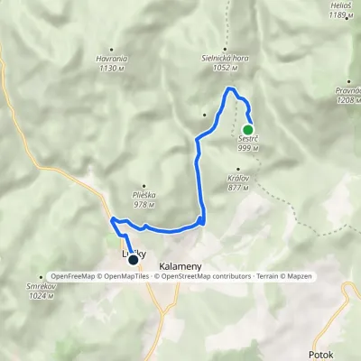 EasyOne-dayMarkedLúčky, municipal office Liptovský hradElevation profile578–999 m6.4 kmascent 519 m≈ 2.5 h walkingunder 1 km from Sestrč
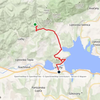 ModerateOne-dayMarkedVlachy Liptovský CastleElevation profile520–999 m13.7 kmascent 649 m≈ 4.5 h walkingunder 1 km from Sestrč
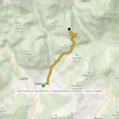 EasyOne-dayMarkedKalameny loopElevation profile563–999 m3.6 kmascent 436 m≈ 2 h walkingunder 1 km from Sestrč
Nearby attractions
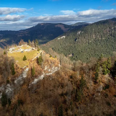 CastleLiptov Castle (ruins)Liptovská Sielnicaunder 1 km from SestrčLiptov Castle (Liptovský hrad), also known as Liptov Old Castle or Sielnica Castle, is the ruin of a medieval fortress on the summit of Sestrč (999.9 m) in the Choč...
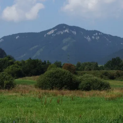 PeakPravnáčLiptovská Annaaltitude 1 206 m1.9 km from SestrčPravnáč (Polish Prawnacz) is a 1206 m summit in the Choč Mountains (Chočské vrchy) in northern Slovakia.
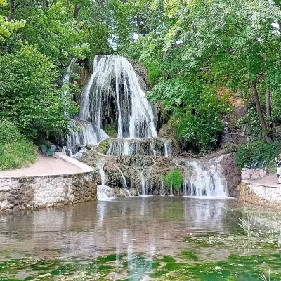 WaterfallLúčanský vodopád (Lúčky Waterfall)Lúčky2.8 km from SestrčLúčanský vodopád is an unusual travertine waterfall right in the centre of the spa village of Lúčky in Lower Liptov, at the foot of the Chočské vrchy hills, 13 km from...
Craft nearby
All craft places Water parks & thermal poolsLúčky Spa and AQUA-VITAL ParkLúčky2.8 km from SestrčLúčky Spa (Kúpele Lúčky) lies in a quiet valley beneath the Choč Mountains, in the village of Lúčky near Ružomberok.
 Water parks & thermal poolsBešeňová Water ParkBešeňová5.3 km from SestrčBešeňová — the "thermal heart of Liptov" Bešeňová Water Park (Vodný park Bešeňová) lies on the edge of the village of the same name in the western part of the Liptov...
 Koliby & Hutsul cuisineSalaš Dechtáre above Liptovská MaraGalovany8.6 km from SestrčSalaš Dechtáre is a wooden koliba above the Liptovská Mara reservoir that is described as one of Slovakia’s first commercial salaš restaurants.
 Water parks & thermal poolsAquapark TatralandiaLiptovský Mikuláš11 km from SestrčAquapark Tatralandia is a large year-round water leisure complex near Liptovský Mikuláš, on the northern shore of the Liptovská Mara reservoir.
 Craft beer & breweriesURSUS craft brewery, Čutkovská valleyRužomberok15 km from SestrčURSUS craft brewery (Remeselný pivovar URSUS) is the first brewery of the town of Ružomberok, tucked away in the picturesque Čutkovská valley in lower Liptov.
 Cheese dairies & pasturesSalaš Krajinka near RužomberokRužomberok15 km from SestrčSalaš Krajinka is a genuine sheep farm on the edge of Ružomberok in lower Liptov. It was founded in 1983 to keep a thousand sheep, and the owners have deliberately...
