Pravnáč
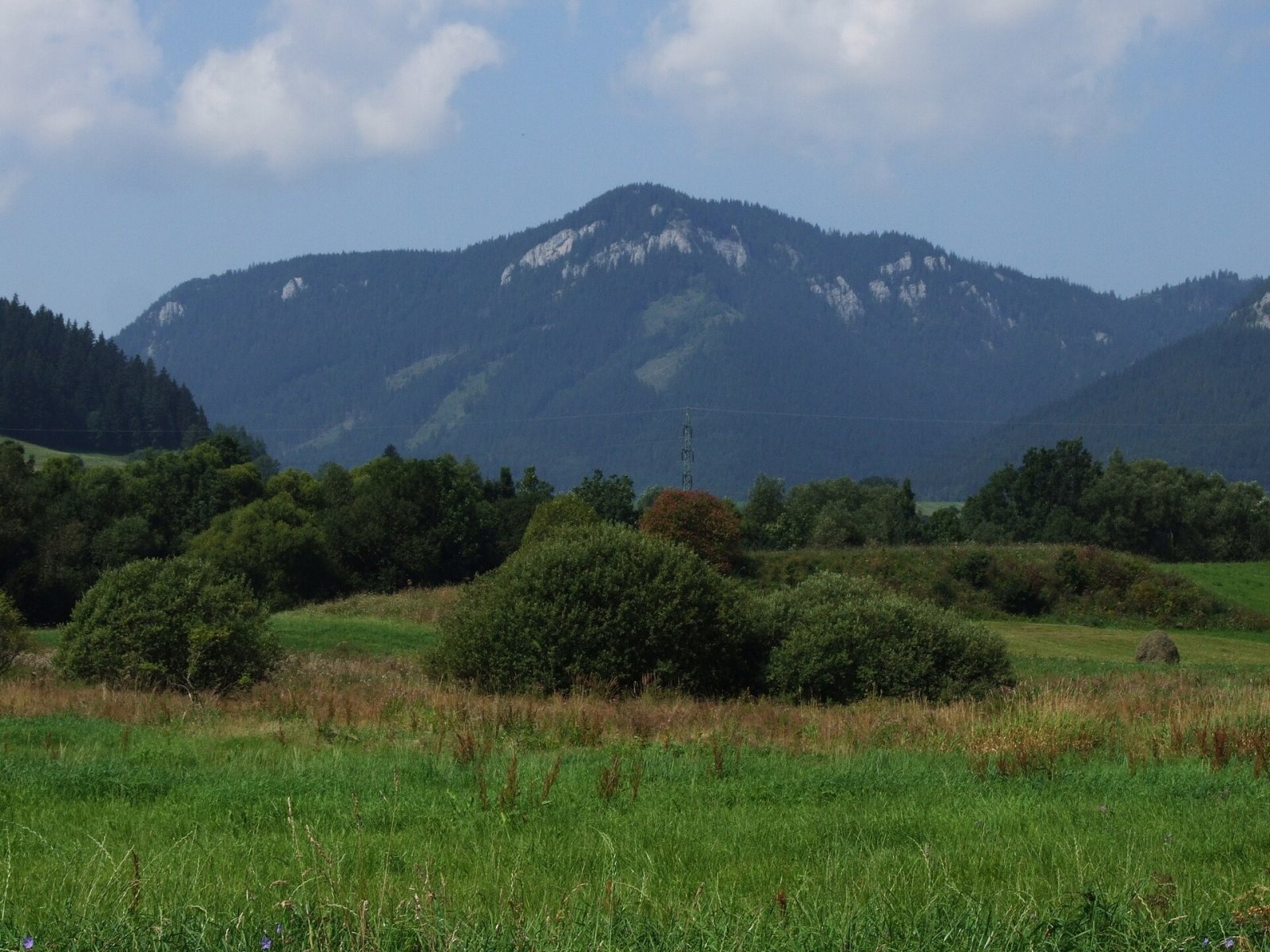
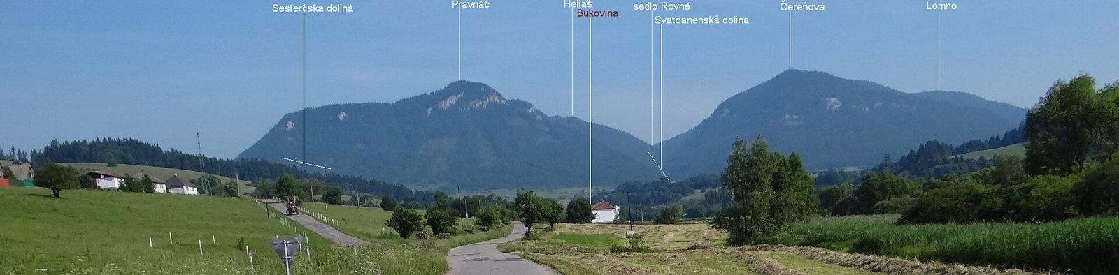
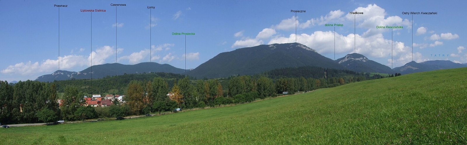
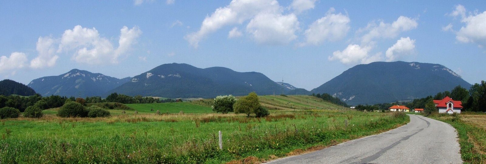
Pravnáč (Polish Prawnacz) is a 1206 m summit in the Choč Mountains (Chočské vrchy) in northern Slovakia. It belongs to the eastern part of the range, the Prosečné group, and rises directly above the village of Liptovská Anna, about 14 km north-west of Liptovský Mikuláš. The summit lies in the Žilina Region, Liptovský Mikuláš District, within the cadastre of Liptovská Anna. Nearby are the villages of Bukovina (about 3 km), Ižipovce (3 km), Prosiek and Malatiná (about 4 km).
The Pravnáč massif occupies the western part of the Prosečné group between the Sestrčská dolina valley to the west and the valley of Liptovská Anna (Annina dolina) to the east. To the north the Prietržná saddle (1095 m) links it with the Heliaš massif (1186 m), while to the south the mountain drops steeply to the Choč foothills in the Liptov Basin. Neighbouring peaks are Čerenová (1221 m) to the east, Holubí vrch (740 m) to the south, Sestrč (1000 m) and Sielnická hora (1051 m) to the west. The summit's prominence is about 173 m.
How to get there / routes
A green trail (KST 5620) crosses the summit:
- from Liptovská Anna – about 1.5 h up, about 1 h down;
- from the Rovné saddle via Heliaš and the Prietržná saddle – about 1 h, 45 min back; Rovné can also be reached from the Svorad junction over Lomné (1278 m).
Both options are easy to combine into a loop over Heliaš, starting and finishing in Liptovská Anna.
What you can see from the top
People climb Pravnáč mainly for the view. Patchy forest covers the summit, but the rocky top opens a wide panorama of the Liptov Basin and the mountains around it: the Low Tatras and the Greater Fatra. The neighbouring Choč Mountains are well visible, and from open spots in good weather the ridge of the Orava Magura, the Western Tatras, the northern Lesser Fatra and part of the Orava Beskids.
Nature and history
The lower parts of the massif are built mostly of Lower Cretaceous marls and marly limestones, the upper parts by a solid cap of Middle Triassic limestone. The summit plateau is fairly broad and flat, yet the rocky top is clearly marked. At 1000–1100 m the summit is ringed by a distinct, though discontinuous, belt of cliffs and rock walls with a rich limestone-loving flora. The whole massif is forested. The eastern slopes drain to the Annin potok, the southern and western ones to the Sestrč stream.
Safety, season and rules
The climb is short but steep; take care on the limestone rocks near the top, especially in rain and in winter, when the stone is slippery. There is no water on the summit. Stay on the marked path – there are cliffs around the top. In Slovakia the Mountain Rescue Service (HZS) operates: 18 300 (+421 18 300); the general emergency number is 112.
Interesting facts
- The mountain has two layers of rock: Cretaceous marls below and Triassic limestone on top.
- Polish guidebooks call the mountain Prawnacz and the Prietržná saddle Przetargana Przełęcz.
- The slopes of Pravnáč are best seen from Prosiek and from the road to Bukovina, where most photos of the mountain were taken.
Photos: Jerzy Opioła, CC BY-SA 4.0; Jerzy Opioła, CC BY-SA 3.0; Jerzy Opioła, CC BY-SA 4.0; Jerzy Opioła, CC BY-SA 4.0 — Wikimedia Commons.
Getting there from Ukraine
Border crossings
- Uzhhorod – Vyšné Nemecké — road, 24/7
- Malyi Bereznyi – Ubľa — road, 24/7 For cars and buses; pedestrians not confirmed by the Ukrainian border service, lorries up to 3.5 t.
- Mali Selmentsi – Veľké Slemence (pedestrian) — pedestrian, 09:00–21:00 Kyiv time Pedestrians and cyclists only; inconvenient for the Tatras without onward transport.
- Chop – Čierna nad Tisou (rail) — rail, 24/7
By car
From Uzhhorod ≈275 km, ≈3 h 35 min without queues: Uzhhorod – Vyšné Nemecké → I/19 to Košice → D1 motorway via Prešov, Poprad and Liptovský Mikuláš to Ružomberok (≈270 km, ≈3 h 25 min from the border). From Lviv it is faster through Poland: M-10 → Krakovets – Korczowa → A4 to Kraków → S7/DK7 to the Chyżne – Trstená border → R3 and I/59 via Dolný Kubín to Ružomberok: ≈482 km, ≈6 h 15 min (via Uzhok and Ubľa ≈500 km, ≈7 h 30 min). The D1 requires an e-vignette (eznamka.sk).
Checked 23.10.2026; border crossing hours and timetables change — check before you travel.
Location on the map
Water and shelter nearby
- Spring in Pravnáči490 m · Not verified · 922 m
- Spring below Pravnáč (south-east slope), 895 m550 m · Not verified · 895 m
- Spring below Pravnáč (south-east slope), 878 m560 m · Not verified · 878 m
- zrub PZ Prosecné810 m · Not verified · 1 104 m
- Patro Spring940 m · Not verified · 878 m
- Pravnačianka Spring1 km · Not verified · 805 m
- Captured spring below Pravnáč1.1 km · Not verified · 711 m
- Cingo Spring1.2 km · Not verified · 986 m
- Spring below Heliaš1.7 km · Not verified · 1 030 m
- Hut below Holubí vrch (north slope), 624 m1.7 km · Not verified · 624 m
- Spring below Holubí vrch (north slope), 616 m1.8 km · Not verified · 616 m
- Hut below Holubí vrch (north slope), 614 m1.8 km · Not verified · 614 m
- Spring below Holubí vrch (north slope), 614 m1.8 km · Not verified · 614 m
- Spring below Nad Stanislavovou (north-east slope), 777 m2.1 km · Not verified · 777 m
- Spring below Nad Stanislavovou (north-east slope), 794 m2.1 km · Not verified · 794 m
- Spring below Holubí vrch (north slope), 624 m2.2 km · Not verified · 624 m
Comments
Trails nearby
All trails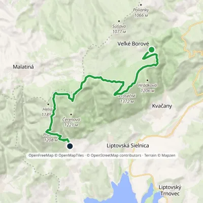 ModerateTwo-dayMarkedLiptovská Anna Dolina Borovianky, junctionElevation profile662–1 372 m17 kmascent 1 132 m≈ 6.5 h walkingunder 1 km from Pravnáč
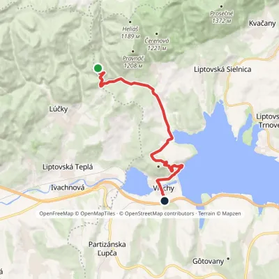 ModerateOne-dayMarkedVlachy Liptovský CastleElevation profile520–999 m13.7 kmascent 649 m≈ 4.5 h walking1.5 km from Pravnáč
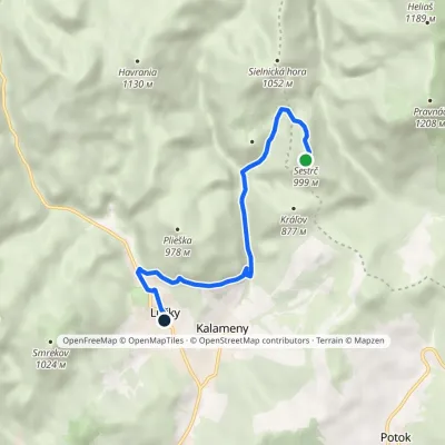 EasyOne-dayMarkedLúčky, municipal office Liptovský hradElevation profile578–999 m6.4 kmascent 519 m≈ 2.5 h walking1.8 km from Pravnáč
Nearby attractions
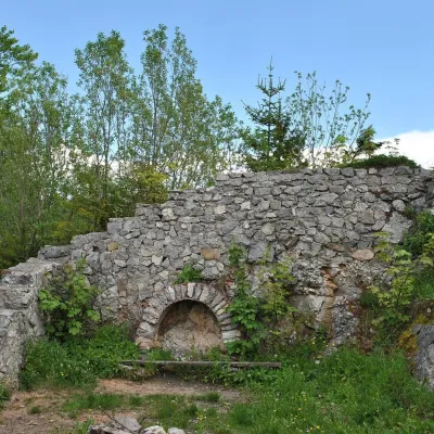 PeakSestrčLiptovská Sielnicaaltitude 1 000 m1.9 km from PravnáčSestrč is a 999.9 m summit in the Choč Mountains (Chočské vrchy) in the Liptov region of northern Slovakia.
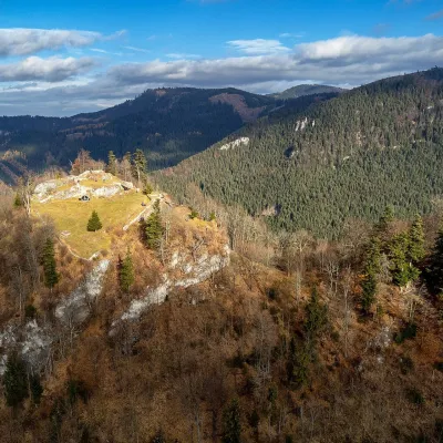 CastleLiptov Castle (ruins)Liptovská Sielnica1.9 km from PravnáčLiptov Castle (Liptovský hrad), also known as Liptov Old Castle or Sielnica Castle, is the ruin of a medieval fortress on the summit of Sestrč (999.9 m) in the Choč...
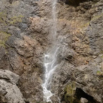 WaterfallČervené piesky waterfall in the Prosiecka valleyProsiek3.5 km from PravnáčČervené piesky is a 15-metre waterfall in a side valley of the Prosiecka dolina in the Chočské vrchy of northern Slovakia, above the village of Prosiek in the Liptov...
Craft nearby
All craft places Water parks & thermal poolsLúčky Spa and AQUA-VITAL ParkLúčky4.7 km from PravnáčLúčky Spa (Kúpele Lúčky) lies in a quiet valley beneath the Choč Mountains, in the village of Lúčky near Ružomberok.
 Water parks & thermal poolsBešeňová Water ParkBešeňová6 km from PravnáčBešeňová — the "thermal heart of Liptov" Bešeňová Water Park (Vodný park Bešeňová) lies on the edge of the village of the same name in the western part of the Liptov...
 Koliby & Hutsul cuisineSalaš Dechtáre above Liptovská MaraGalovany8.2 km from PravnáčSalaš Dechtáre is a wooden koliba above the Liptovská Mara reservoir that is described as one of Slovakia’s first commercial salaš restaurants.
 Water parks & thermal poolsAquapark TatralandiaLiptovský Mikuláš10 km from PravnáčAquapark Tatralandia is a large year-round water leisure complex near Liptovský Mikuláš, on the northern shore of the Liptovská Mara reservoir.
 Craft beer & breweriesLiptovar brewery, Liptovský Mikuláš: craft beer and brewpubLiptovský Mikuláš15 km from PravnáčLiptovský Mikuláš is the main town of the Liptov region, a short drive from the Low and Western Tatras, the Demänovská Valley and the Liptovská Mara reservoir.
 Craft beer & breweriesURSUS craft brewery, Čutkovská valleyRužomberok17 km from PravnáčURSUS craft brewery (Remeselný pivovar URSUS) is the first brewery of the town of Ružomberok, tucked away in the picturesque Čutkovská valley in lower Liptov.
