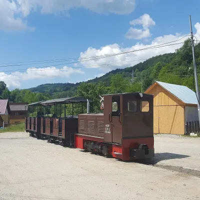
Petreasa Circuit
Trail map
Route, springs and shelters: © OpenStreetMap contributors (ODbL) · elevation: Copernicus DEM © DLR e.V., © Airbus DS · Data & licences
About the trail
Route Petreasa Circuit. Has red marking (local route, Casa de oaspeți Podina). Waymarking data: OpenStreetMap (© OpenStreetMap contributors, ODbL).
Marked local tourist route. Marking is red, sign — a circle on a white background. Marked and maintained by: Casa de oaspeți Podina. Length of the route — 12 km, the route is circular. Location: mountain range — Bihor and Vledyasa, Romania. The route passes through the Apuseni Natural Park. According to the park administration, camping is allowed only in designated areas: in the Sighiștel valley, in Padiș, Ik-Ponor, and Gârda de Sus.
At a glance
A one-day loop route of 12 km with 465 m of ascent. Estimated walking time: about 4 h, not counting stops. Difficulty: moderate. Waymarking: red.
How we estimate walking time
By Naismith's rule, used by mountain clubs and guidebooks: an average hiker walks 4 km an hour on the flat and needs one more hour for every 600 m of ascent. For this trail: 12 km ÷ 4 = 3 h + 465 m ÷ 600 = 0.8 h, about 4 h of walking in total.
- Breaks, snacks and photos: add 20–30 %.
- A heavy pack, children, snow, a wet path or windfall add more; a long steep descent also takes time, especially for the knees.
- The height of the Carpathians (up to 2,655 m) hardly changes the pace — on the ridges wind, fog and weather slow you down.
- Limits: up to 9 h is one day; 9–13 h is a very long day or two; over 13 h means several days with overnight stays.
Route stages
- 0–1 kmGentle ups and downs at 1,080–1,130 m
- 1–4 kmClimb of 360 m (up to 1,486 m)
- 4–6 kmAlong the ridge at 1,480–1,550 m
- 6–12 kmDescent of 460 m (down to 1,088 m)
Steepest kilometre: km 1–2, a climb of 150 m (≈15%).
Water and overnight stays
Springs near the trail: at km 3, 6, 7, 9 and 12.
When to go
Best time: May to October. In winter deep snow is possible, so experience and winter gear are needed.
Getting there
This is a loop: it brings you back to the start.
FAQ
- How long does the route take?
- Estimated walking time: about 4 h, not counting stops.
- Is there water on the route?
- Springs near the trail: at km 3, 6, 7, 9 and 12.
Water and shelter on the route
- Spring below Sturu (south-east slope)km 2.6 from the start · Not verified · 1 302 m
- Vieții Springkm 5.5 from the start · 260 m off the path · Not verified · 1 560 m
- Spring below Pietroasakm 7 from the start · Not verified · 1 479 m
- Spring below Petreasa (east slope), 1 418 mkm 7.9 from the start · Not verified · 1 418 m
- Spring below Petreasa (east slope), 1 371 m (2)km 8.7 from the start · Not verified · 1 371 m
- Spring below Sturu (south-west slope)km 11.8 from the start · Not verified · 1 104 m
Comments and trail condition
Travellers’ experience: reports, tips, questions.
No one has reported on this trail yet. Been here lately? Tell others what it is like now.
Trails nearby
All trails Hard1–2 daysMarkedGârda de Sus Vărășoaia SaddleElevation profile727–1 436 m31.8 kmascent 1 186 m≈ 10 h walking
 EasyOne-dayMarkedGhețar Dealu Frumos LoopElevation profile1 088–1 230 m5.2 kmascent 138 m≈ 1.5 h walking
 ModerateOne-dayMarkedGhețar PadișElevation profile821–1 354 m18.3 kmascent 690 m≈ 5.5 h walking