Mięguszowiecki Szczyt Wielki
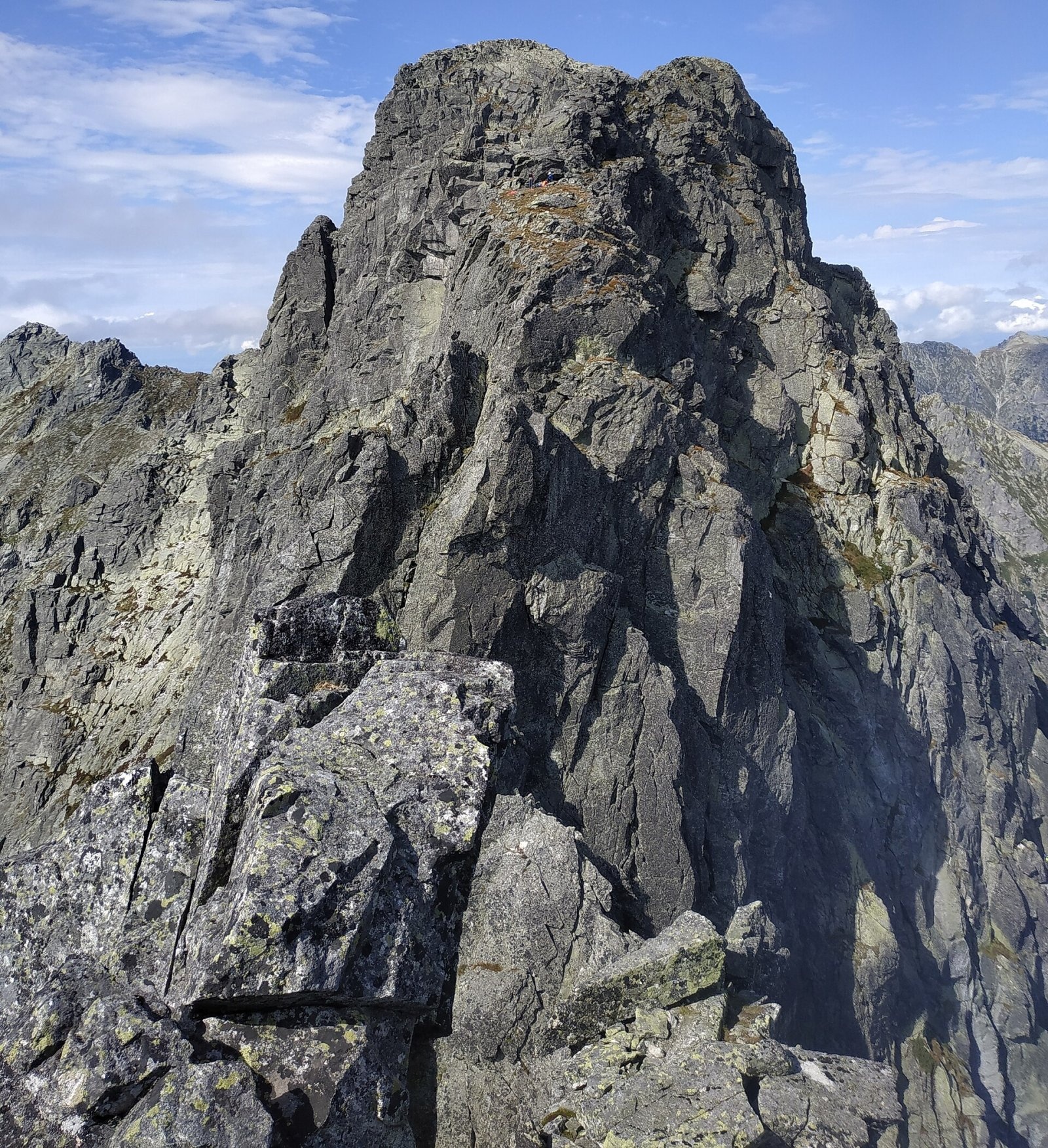
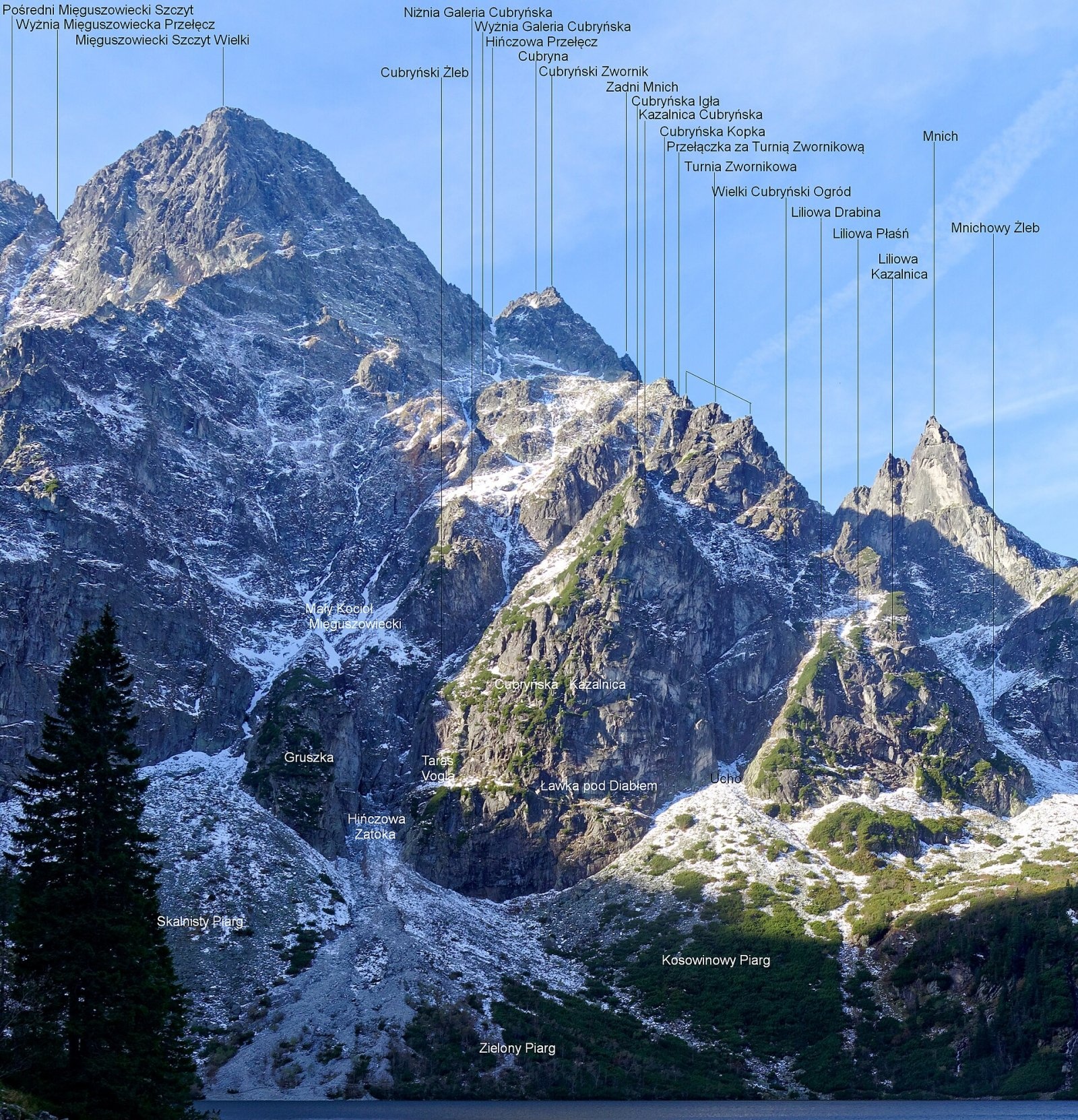
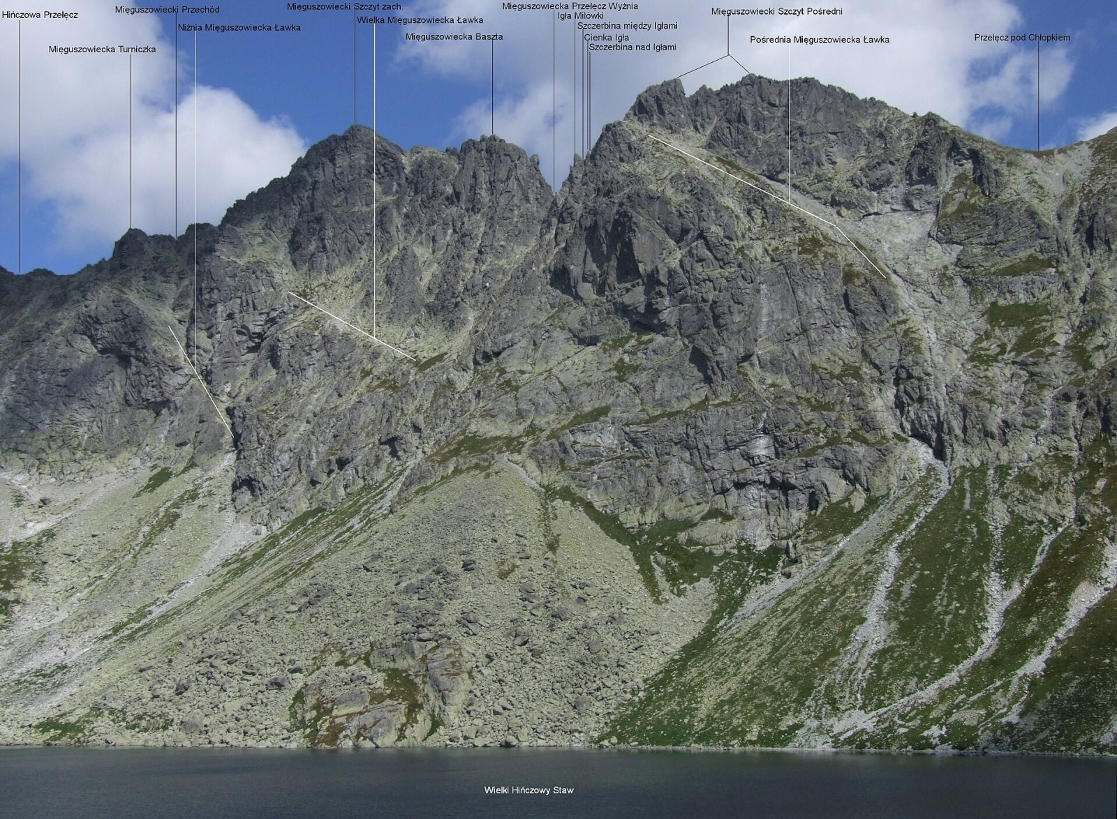
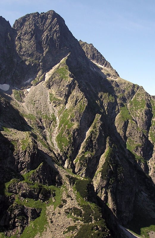
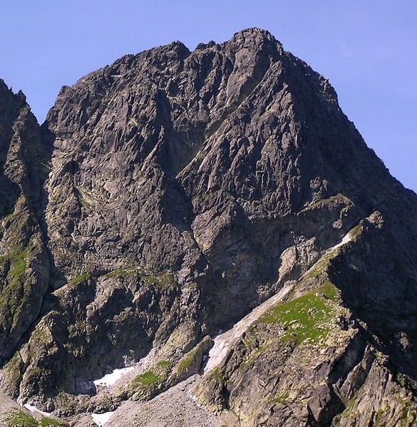
Mięguszowiecki Szczyt Wielki (Slovak Veľký Mengusovský štít) is a 2,438 m summit of the High Tatras on the main Tatra ridge, right on the Polish–Slovak border. It is the highest of the three Mięguszowiecki peaks and, after Rysy, the second-highest mountain in Poland. Its north face rises above Morskie Oko lake in the Rybi Potok valley, its south face above Veľké Hincovo pleso in the Slovak Mengusovská dolina, above Štrbské Pleso. In every language the name comes from the village of Mengusovce, which once owned this land.
The peak has two tops: the western (main) one and a lower eastern one (2,427 m), separated by the Mięguszowiecka Szczerba notch. Hińczowa Pass (2,323 m) separates it from Cubryna in the west, and the upper Mięguszowiecka Pass from Mięguszowiecki Szczyt Pośredni. The almost kilometre-high north-east Mięguszowiecki Pillar drops towards Morskie Oko, and the Great Mięguszowiecki Cirque (Bańdzioch) holds a small glacieret — a snow patch visible from Morskie Oko even in summer.
How to get there / routes
There is no marked hiking trail to the summit. According to Polish Wikipedia, even the easiest routes border on mountaineering: they are unmarked, have no fixed aids, and are confusing and exposed — harder than the Orla Perć. Only experienced climbers and very skilled mountain walkers with good route-finding go up on their own; everyone else should hire a licensed mountain guide.
- From the Polish side a green marked trail runs from Czarny Staw pod Rysami lake to Mięguszowiecka Przełęcz pod Chłopkiem; from there the unmarked "Droga po Głazach" climbs the southern slopes to the top. From Morskie Oko this ascent takes about 5 hours.
- From Morskie Oko via the Cubryna Galleries and Hińczowa Pass — 4–5 hours.
- The easiest, "normal" Slovak route starts in Hincova dolina at Veľké Hincovo pleso — about 2 hours from the lake, 3–4 hours from Popradské pleso.
What you can see from the summit
The rocky summit offers an all-round view. You can see most of the peaks and valleys of the High Tatras, the northern part of the Belianske Tatras, the eastern Low Tatras with Kráľova hoľa, the Orava Beskids and often many mountains of southern Poland. Close by rise Rysy, Cubryna, Mnich, Miedziane, Opalony Wierch and the Żabie peaks.
Nature and history
The first summer ascent was made by Ludwik Chałubiński with guides Wojciech Roj and Maciej Sieczka on 28 June 1877; the first winter ascent by Ernst Dubke, Alfred Martin, Johann Breuer and Johann Franz on 13 February 1906. The first winter ascent of the north face (Zbigniew Korosadowicz and Jan Staszel, 7–9 April 1936) was hailed by the magazine "Wierchy" as the greatest achievement of winter Tatra climbing ever. The walls of the massif are very popular with climbers, the busiest spot being the "Czołówka MSW" at the foot of the pillar. Despite the altitude, alpine flowers and grasses grow near the summit, and chamois and marmots visit it.
The mountain also has a tragic record: at least 15 Polish climbers have died on it, and in September 1992 a sudden change in the weather killed instructor Jerzy Hirszowski and three young climbers on the Świerz route of the east face.
Safety, season and rules
The summit lies in Tatra National Park (TPN) on the Polish side and in TANAP on the Slovak side. On the Polish side, leaving the marked trails is allowed only for climbing under TPN rules. On the Slovak side the peak is in a national nature reserve, accessible only with a mountain guide (horský vodca) or for climbers under TANAP rules; TANAP's high-mountain marked trails are closed from 1 November to 31 May. The green trail to Przełęcz pod Chłopkiem has chains and steep sections, and in winter the slopes are avalanche-prone. On the Polish side rescue is provided by TOPR: 985 or +48 601 100 300; on the Slovak side by the Mountain Rescue Service HZS: 18 300 (+421 18 300). The general emergency number is 112.
Interesting facts
- Newer Polish surveys give 2,439 m and Slovak Wikipedia 2,431.5 m; the traditional height is 2,438 m.
- The famous Świerz route on the east face honours Mieczysław Świerz, who climbed the wall with Jan Humpola on 22 September 1921.
- The north-east pillar is about 880 m high.
Photos: Adam Opioła, CC BY-SA 4.0; Foto:Jakub Hałun, description: Jerzy Opioła, CC BY-SA 4.0; Jerzy Opioła, CC BY-SA 4.0; v, Original uploader was Makarczuk at pl.wikipedia, CC BY-SA 2.5; The original uploader was Makarczuk at Polish Wikipedia., CC BY-SA 2.5; Foto:Adam Opioła, opis:Jerzy Opioła, CC BY-SA 4.0; Foto:Adam Opioła, opis:Jerzy Opioła, CC BY-SA 4.0 — Wikimedia Commons.
Getting there from Ukraine
Border crossings
- Krakovets – Korczowa — road, 24/7
- Shehyni – Medyka — road, 24/7 Pedestrian crossing is not confirmed by the Ukrainian border service — check dpsu.gov.ua before the trip.
- Smilnytsia – Krościenko — road, 24/7
- Hrushiv – Budomierz — road, 24/7
- Mostyska – Przemyśl (rail) — rail, 24/7
By car
Lviv – Zakopane ≈421 km, ≈5 h 10 min without border queues. Route: M-10 Lviv – Krakovets → Krakovets – Korczowa checkpoint → A4 motorway (Rzeszów – Tarnów – Kraków) → Kraków southern bypass → S7/DK7 → DK47 ('Zakopianka') via Nowy Targ → Zakopane. The A4 Katowice – Kraków section (Balice and Mysłowice toll plazas) is tolled, but this route does not use it. In summer and at weekends the DK47 near Zakopane is often congested.
Checked 23.10.2026; border crossing hours and timetables change — check before you travel.
Location on the map
Water and shelter nearby
- Spring below Kazalnica Mięguszowiecka510 m · Not verified · 1 884 m
- Spring below Mengusovský Volovec1.1 km · Not verified · 1 977 m
- Spring below Apostoły1.6 km · Not verified · 1 411 m
- Morskie Oko Hut1.8 km · Standing · 1 410 m
- Hut under Rysy2.4 km · Standing · 2 250 m
- Spring below Mała Kotelnica / Malá Kotolnica (south slope), 1 627 m2.6 km · Not verified · 1 627 m
- Spring below Mała Kotelnica / Malá Kotolnica (south slope), 1 598 m2.7 km · Not verified · 1 598 m
- Wrzące Spring2.8 km · Not verified · 1 371 m
Comments
Trails nearby
All trails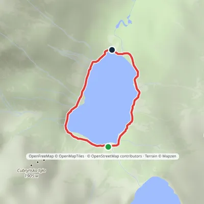 EasyOne-dayMarkedAround Morskie OkoElevation profile1 395–1 423 m2.5 kmascent 23 m≈ 45 min walkingunder 1 km from Mięguszowiecki Szczyt Wielki
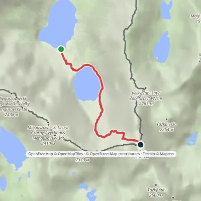 HardOne-dayMarkedMorskie Oko Rysyvia Czarny StawElevation profile1 401–2 501 m3.4 kmascent 1 100 m≈ 3 h walking1 km from Mięguszowiecki Szczyt Wielki
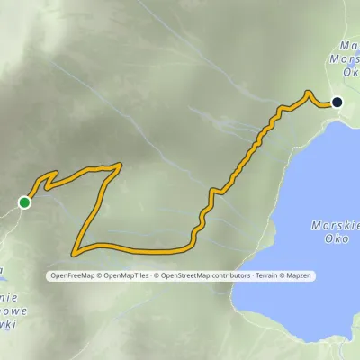 ModerateOne-dayMarkedPod Mnichem Junction to Szpiglasowa PassElevation profile1 409–1 794 m2.3 kmascent 8 m≈ 30 min walking1.1 km from Mięguszowiecki Szczyt Wielki
Nearby attractions
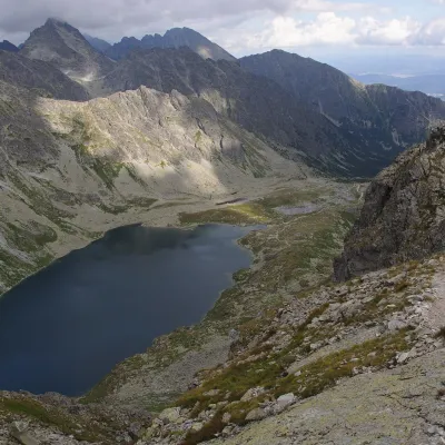 LakeVeľké Hincovo plesoVyšné Hágyunder 1 km from Mięguszowiecki Szczyt WielkiVeľké Hincovo pleso is the largest and deepest glacial lake in the Slovak part of the Tatras and in all of Slovakia.
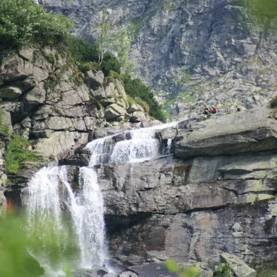 WaterfallCzarnostawiańska Siklawa (Black Lake Falls)1.1 km from Mięguszowiecki Szczyt WielkiCzarnostawiańska Siklawa (Black Lake Falls) is a cascading waterfall in the Polish High Tatras, in the Rybi Potok Valley (Dolina Rybiego Potoku) inside Tatra National...
Craft nearby
All craft places Cheese dairies & pasturesShepherd's Hut on Rusinowa PolanaBrzegi8.7 km from Mięguszowiecki Szczyt WielkiRusinowa Polana is one of the most beautiful mountain glades in the Polish Tatras, and from May to October it is home to the bacówka (shepherd's hut) of baca Stanisław...
 Cheese dairies & pasturesFurtek's Shepherd's Huts, Kuźnice and KalatówkiZakopane11 km from Mięguszowiecki Szczyt WielkiAbove Kuźnice — the southern edge of Zakopane where most hikes into the Western and High Tatras begin — the flocks are tended by baca Andrzej Staszel, nicknamed "Furtek".
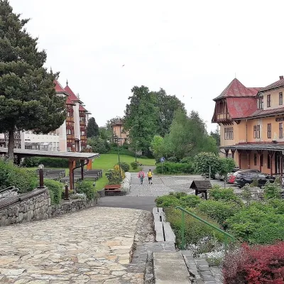 Water parks & thermal poolsClimatic spas of the High Tatras: Nový Smokovec, Polianka, KotlinaVysoké Tatry13 km from Mięguszowiecki Szczyt WielkiNový Smokovec is the best known of the climatic spas of the High Tatras. It grew up in a spruce forest at about 1010 m, south-west of Starý Smokovec, with which it...
 Koliby & Hutsul cuisineBąkowo Zohylina Wyźnio Highland TavernZakopane13 km from Mięguszowiecki Szczyt WielkiBąkowo Zohylina Wyźnio is a regional highland tavern in Zakopane housed in a wooden "szałas" (shepherd-hut-style building) with a view of the Tatras.
 Water parks & thermal poolsTermy Zakopiańskie (Aqua Park Zakopane)Zakopane14 km from Mięguszowiecki Szczyt WielkiTermy Zakopiańskie is a thermal water park right in Zakopane, on Jagiellońska Street, only a kilometre from Krupówki.
 Crafts & workshopsSztukomania Studio, Zakopane: handmade ceramics and pottery workshopsZakopane14 km from Mięguszowiecki Szczyt WielkiSztukomania is a small ceramics and woodwork studio on Staszica street in Zakopane, a few minutes' walk from Krupówki.
