The hole of Rakytov – the grassy Liptov ridge of Veľká Fatra
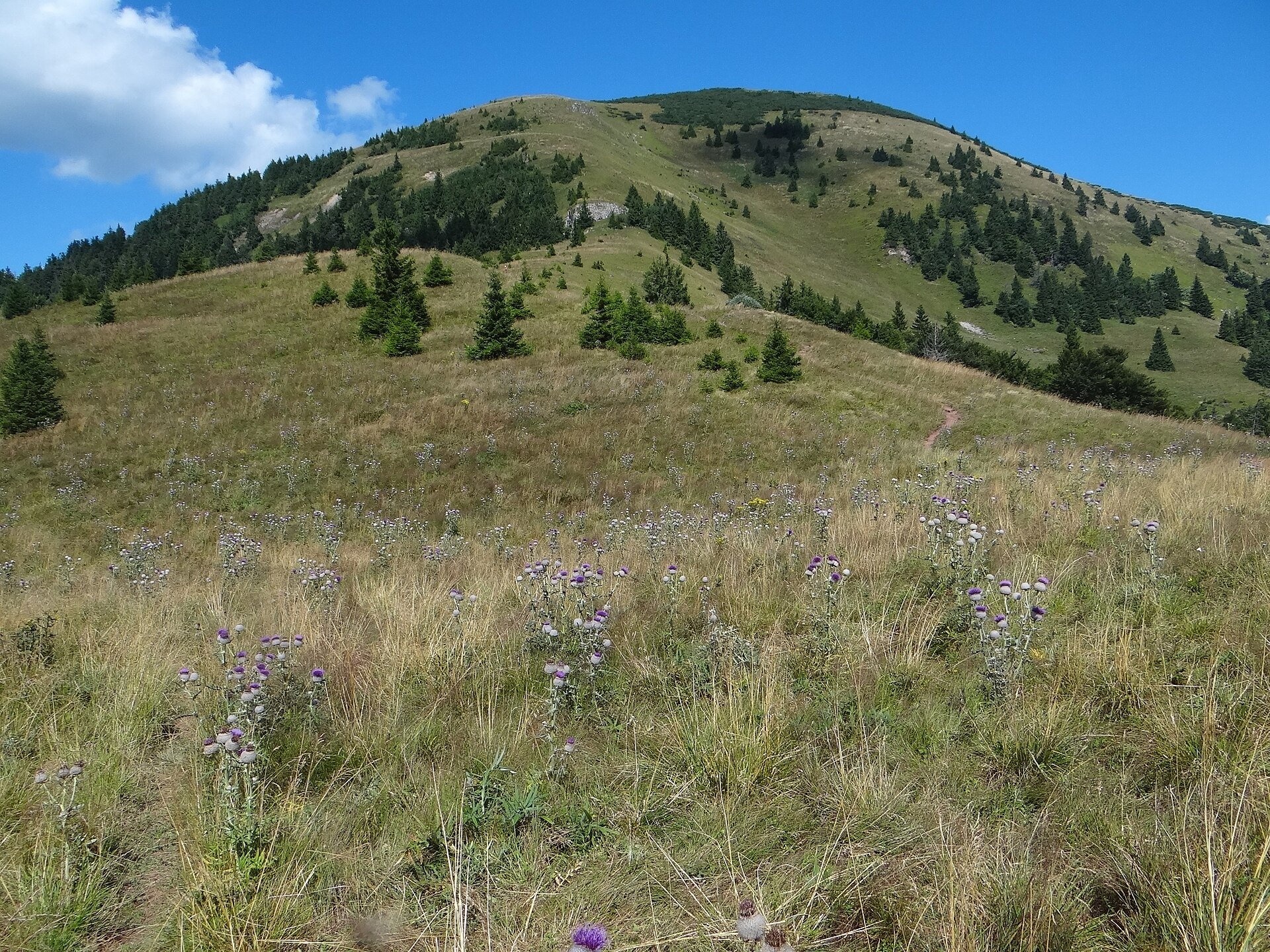
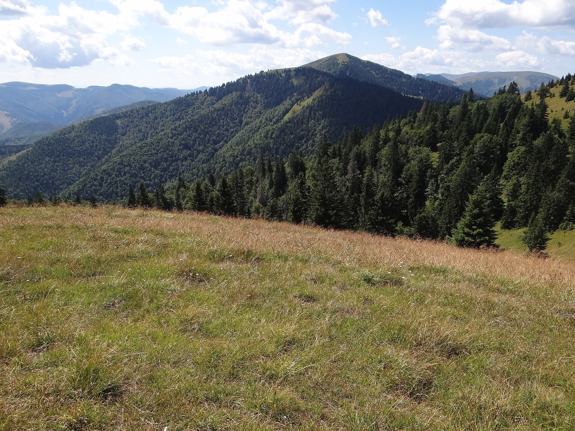
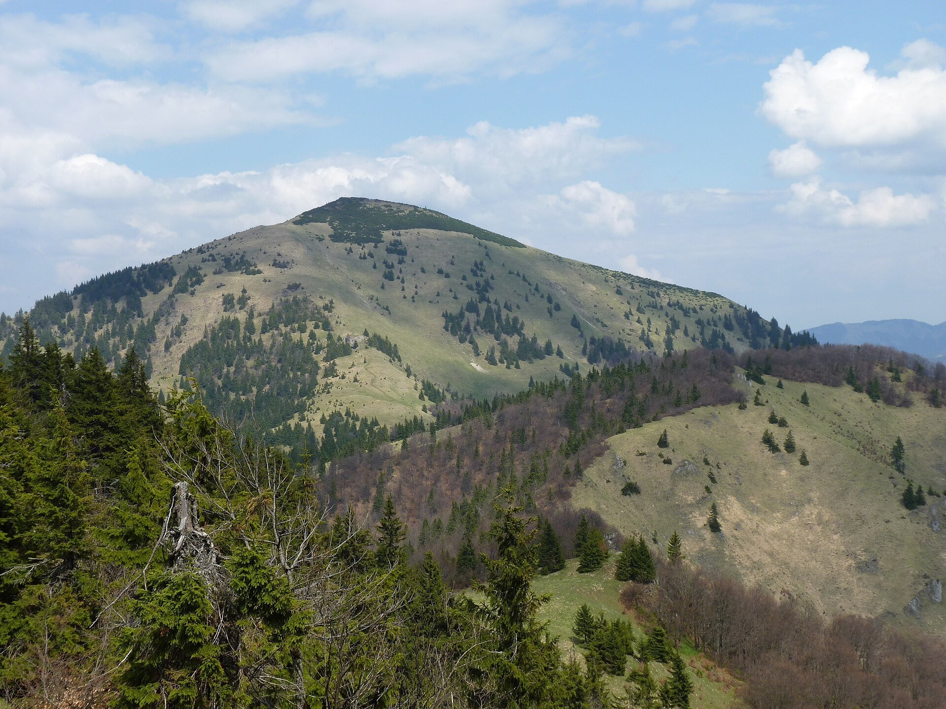
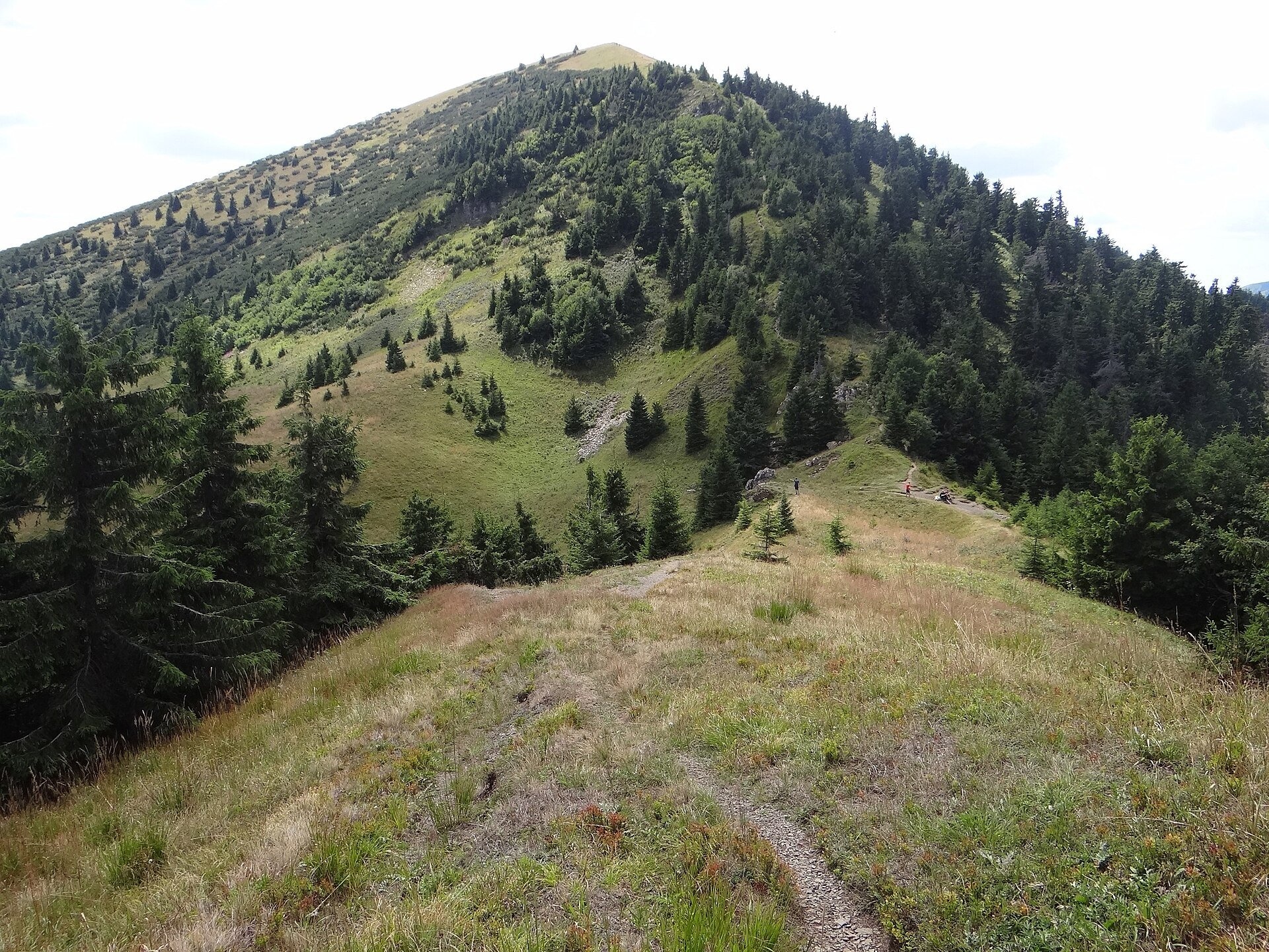
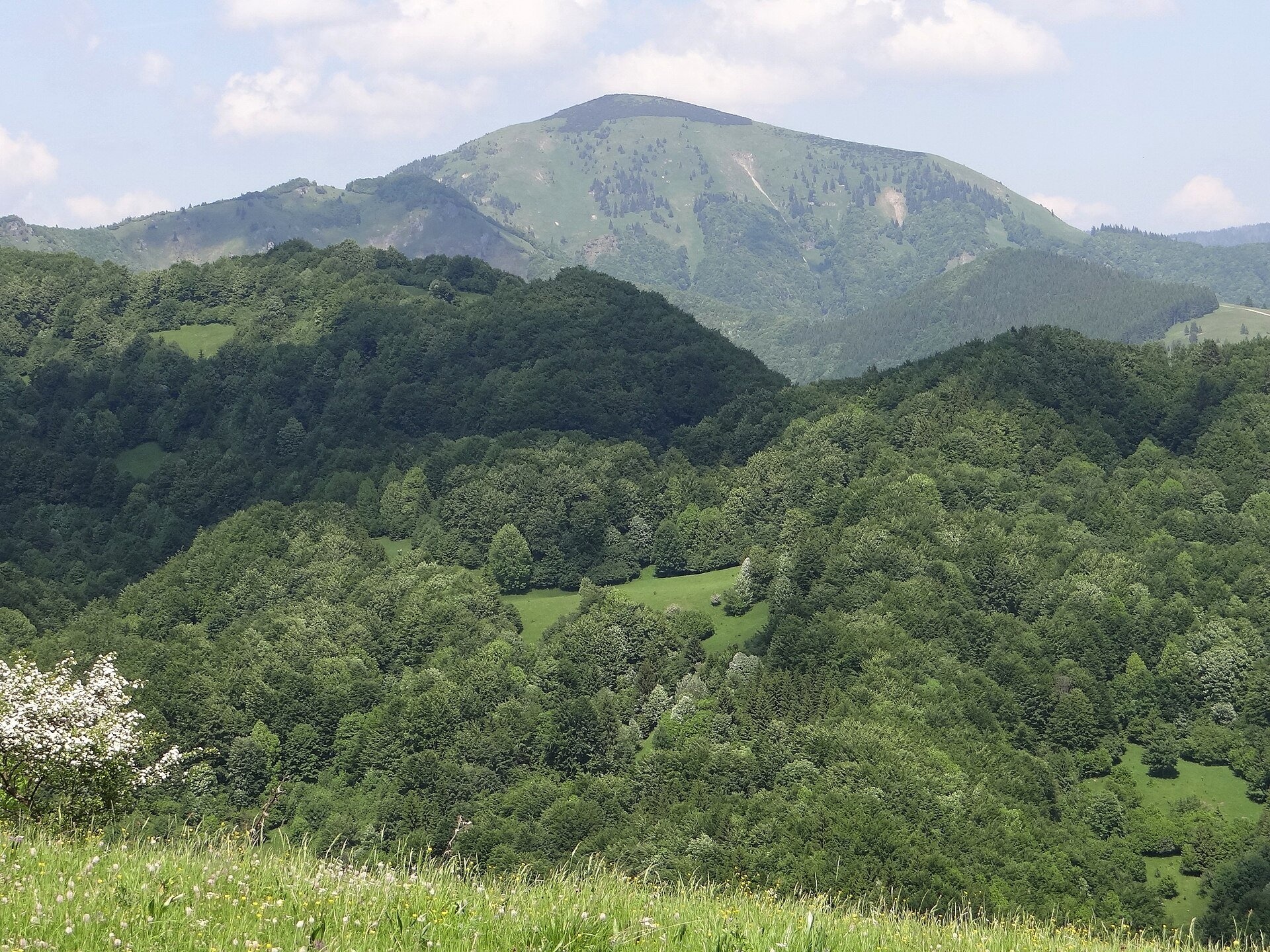
Rakytov (1,567 m) is the highest summit of the Liptov branch of the main ridge of Veľká Fatra in Slovakia, in the Hôľna Fatra subunit, whose name comes from "hole" – treeless ridge pastures. The mountain lies in Veľká Fatra National Park above the Ľubochnianska valley to the west and the side valleys of the Revúca valley to the south-east, within the villages of Ľubochňa and Liptovské Revúce. From here the crest runs north over Tanečnica to Skalná Alpa and south-west over Minčol (Kračkov, 1,398 m) and the saddle below Čierny kameň to Ploská. This ridge, followed by the green Liptov main trail (Liptovská magistrála), is one of the most beautiful grassy crests of Veľká Fatra.
Although the massif is built mostly of limestone, Rakytov has soft, rounded shapes. Above about 1,300 m the beech forest gives way to the hole belt: the summit area is covered by mountain meadows where several orchid species flower in spring and early summer. The top itself is covered by planted dwarf pine, while neighbouring Tanečnica holds one of the larger natural dwarf-pine stands in the area. According to Polish reference works, the grassy ridge between Minčol and Čierny kameň consists of old shepherds' hale; Slovak encyclopaedic sources link the origin of such hole mainly to the Wallachian colonisation, when shepherds cleared the forest ever higher. Čierny kameň (1,479 m) is an outlier of dolomite and limestone on soft marls with two summits of equal height; it is one of the most valuable parts of the park, with subalpine and alpine plant communities, so the summit and its crest are closed to walkers. The northern slopes of Rakytov are protected by the Skalná Alpa reserve (524.5 ha, since 1964).
What to see and do
- Panorama with a "wind rose". On the summit stand a cross and a panorama table. You can see all of Veľká Fatra, Malá Fatra, the Chočské vrchy, the Low and part of the High Tatras, Poľana, the Štiavnica Mountains, Babia hora and, through the Strečno gorge, occasionally the Moravian-Silesian Beskids with Lysá hora.
- Along the hole ridge. From the northern to the southern Rakytov saddle and on to Minčol the path runs through open meadows with islands of spruce; Čierny kameň is visible from afar as a dark rock above the grass.
- Skalná brána. On the southern spur of the mountain there is a striking rock formation – the Rock Gate (Skalná brána).
- The best time is June, when the meadows and orchids flower, and September–October, when the grass turns russet.
How to get there
Rakytov is the goal of a real mountain hike; you cannot drive here. The green Liptovská magistrála (Ružomberok, A Hlinka Square – Hut under Borišov, junction) has crossed the summit itself only since 1977; before that it bypassed it through the forest on the western slopes, where a yellow path now runs – handy for avoiding the exposed summit in bad weather (30 min between the southern and northern Rakytov saddles). According to signpost data (pl.wikipedia): from the hut below Borišov along the ridge – 7.2 km, about 390 m of ascent and 2 h; from the Močidlo junction by the Smrekovica hotel – 6.1 km, 550 m of ascent and 3 h. From the Revúca valley a trail climbs through the Teplá valley from the locality of Teplô between Liptovské Revúce and Liptovská Osada (Hájovňa pred Teplou dolinou – Južné Rakytovské sedlo). These paths are not suitable for prams or small children.
Season and safety
The crest is exposed: in thunderstorms and fog it is unpleasant, so in bad weather use the yellow bypass. In winter large snow cornices form on the crest of Skalná Alpa and the grassy eastern slopes are avalanche-prone; Veľká Fatra as a whole is among the most avalanche-prone mountains in Slovakia, so follow the warnings of the Mountain Rescue Service (HZS, tel. 18 300). Veľká Fatra National Park rules: walk only on marked trails (the summit and crest of Čierny kameň are closed), keep dogs on a lead, and do not pitch tents or sleep in the open. Information as of October 2026.
Nearby
South-west along the ridge are Ploská and Borišov: meadows and mountain hut in the heart of Veľká Fatra, and further on Krížna and the hole meadows of Veľká Fatra. To the east, beyond the Váh valley, in the Low Tatras is the Brankovský waterfall — the highest in the Low Tatras.
Official website: npvelkafatra.sk
Photos: Jerzy Opioła, CC BY-SA 4.0, Wikimedia Commons; Michal Klajban, CC BY-SA 3.0, Wikimedia Commons; Mineralysk, CC BY-SA 4.0, Wikimedia Commons; Derbeth, CC BY 4.0, Wikimedia Commons.
Getting there from Ukraine
Border crossings
- Uzhhorod – Vyšné Nemecké — road, 24/7
- Malyi Bereznyi – Ubľa — road, 24/7 For cars and buses; pedestrians not confirmed by the Ukrainian border service, lorries up to 3.5 t.
- Mali Selmentsi – Veľké Slemence (pedestrian) — pedestrian, 09:00–21:00 Kyiv time Pedestrians and cyclists only; inconvenient for the Tatras without onward transport.
- Chop – Čierna nad Tisou (rail) — rail, 24/7
By car
From Uzhhorod ≈275 km, ≈3 h 35 min without queues: Uzhhorod – Vyšné Nemecké → I/19 to Košice → D1 motorway via Prešov, Poprad and Liptovský Mikuláš to Ružomberok (≈270 km, ≈3 h 25 min from the border). From Lviv it is faster through Poland: M-10 → Krakovets – Korczowa → A4 to Kraków → S7/DK7 to the Chyżne – Trstená border → R3 and I/59 via Dolný Kubín to Ružomberok: ≈482 km, ≈6 h 15 min (via Uzhok and Ubľa ≈500 km, ≈7 h 30 min). The D1 requires an e-vignette (eznamka.sk).
Checked 23.10.2026; border crossing hours and timetables change — check before you travel.
Location on the map
Water and shelter nearby
- Veľká Rakytová Spring580 m · Not verified · 1 265 m
- Spring below Kračkov640 m · Not verified · 1 297 m
- Zadné Jamy Spring780 m · Not verified · 1 181 m
- Ramža Spring840 m · Not verified · 1 181 m
- Markovičova Spring880 m · Not verified · 1 134 m
- Well below Rakytov920 m · Not verified · 1 220 m
- Spring below Tanečnica (south-east slope), 1 190 m930 m · Not verified · 1 190 m
- Mountain Shelter Limba under Rakytov930 m · Standing · 1 218 m
- Spring below Tanečnica (south-east slope), 1 172 m930 m · Not verified · 1 172 m
- Spring below Rakytov (east slope)980 m · Not verified · 1 120 m
- Spring below Tanečnica (south-east slope), 1 173 m990 m · Not verified · 1 173 m
- Nižný Rakytov Spring990 m · Not verified · 1 116 m
- Teplý potok Spring1 km · Not verified · 1 283 m
- Spring below Suchá (south slope), 1 115 m1 km · Not verified · 1 115 m
- Spring below Tanečnica (north-west slope), 1 356 m1.1 km · Not verified · 1 356 m
- Spring below Tanečnica (south-east slope), 1 163 m1.1 km · Not verified · 1 163 m
Comments
Trails nearby
All trails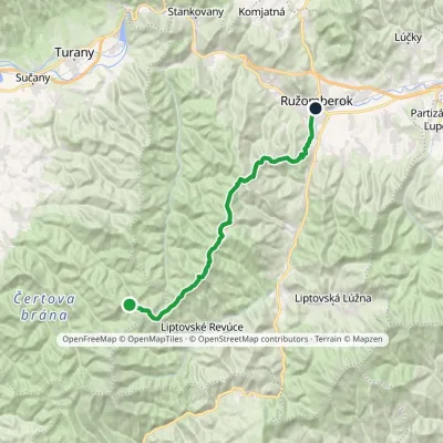 HardTwo-dayMarkedRužomberok, A Hlinka Square Hut under Borišov, junctionElevation profile494–1 567 m30 kmascent 889 m≈ 9.5 h walkingunder 1 km from The hole of Rakytov – the grassy Liptov ridge of Veľká Fatra
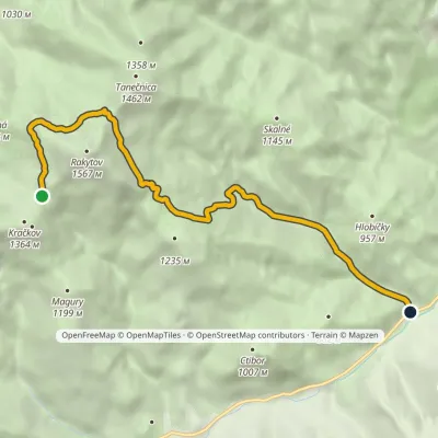 EasyOne-dayMarkedHájovňa pred Teplou dolinou Južné Rakytovské sedloElevation profile637–1 406 m7.9 kmascent 108 m≈ 2 h walkingunder 1 km from The hole of Rakytov – the grassy Liptov ridge of Veľká Fatra
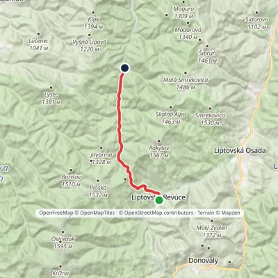 ModerateOne-dayMarkedStredná Revúca Blatná Forester's LodgeElevation profile662–1 269 m13 kmascent 605 m≈ 4.5 h walking2.8 km from The hole of Rakytov – the grassy Liptov ridge of Veľká Fatra
Nearby attractions
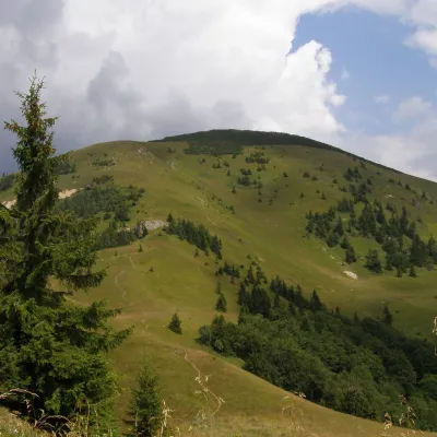 PeakRakytovLiptovské Revúcealtitude 1 567 munder 1 km from The hole of Rakytov – the grassy Liptov ridge of Veľká FatraRakytov is a 1,567 m mountain in the Greater Fatra (Veľká Fatra) in Slovakia and the highest summit of the so-called Liptov branch of the main ridge, part of the Hôľna...
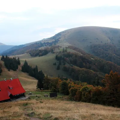 Mountain meadowPloská and Borišov: meadows and mountain hut in the heart of Veľká FatraLiptovské Revúcealtitude 1 300 m6.4 km from The hole of Rakytov – the grassy Liptov ridge of Veľká FatraPloská (1,532 m) and Borišov (1,510 m) are two treeless summits in the very centre of Veľká Fatra, with the old Chata pod Borišovom mountain hut (about 1,300 m)...
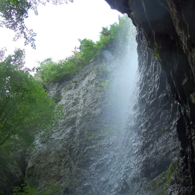 WaterfallBrankovský waterfall — the highest in the Low TatrasLiptovská Osada9.6 km from The hole of Rakytov – the grassy Liptov ridge of Veľká FatraThe Brankovský waterfall (Brankovský vodopád) is the highest waterfall in the Low Tatras: the water drops 55 m.
Craft nearby
All craft places Craft beer & breweriesURSUS craft brewery, Čutkovská valleyRužomberok14 km from The hole of Rakytov – the grassy Liptov ridge of Veľká FatraURSUS craft brewery (Remeselný pivovar URSUS) is the first brewery of the town of Ružomberok, tucked away in the picturesque Čutkovská valley in lower Liptov.
 Cheese dairies & pasturesSalaš Krajinka near RužomberokRužomberok17 km from The hole of Rakytov – the grassy Liptov ridge of Veľká FatraSalaš Krajinka is a genuine sheep farm on the edge of Ružomberok in lower Liptov. It was founded in 1983 to keep a thousand sheep, and the owners have deliberately...
 Water parks & thermal poolsBešeňová Water ParkBešeňová25 km from The hole of Rakytov – the grassy Liptov ridge of Veľká FatraBešeňová — the "thermal heart of Liptov" Bešeňová Water Park (Vodný park Bešeňová) lies on the edge of the village of the same name in the western part of the Liptov...
 Water parks & thermal poolsLúčky Spa and AQUA-VITAL ParkLúčky25 km from The hole of Rakytov – the grassy Liptov ridge of Veľká FatraLúčky Spa (Kúpele Lúčky) lies in a quiet valley beneath the Choč Mountains, in the village of Lúčky near Ružomberok.
 Craft shopsÚĽUV Banská Bystrica: folk-craft shop and craft schoolBanská Bystrica25 km from The hole of Rakytov – the grassy Liptov ridge of Veľká FatraÚĽUV (Ústredie ľudovej umeleckej výroby, the Centre for Folk Art Production) is a state institution that has looked after Slovak folk crafts since 1945: it keeps a...
 Water parks & thermal poolsBrusno Spa: mineral springs, treatments and Caracalla SpaBrusno25 km from The hole of Rakytov – the grassy Liptov ridge of Veľká FatraBrusno Spa (Kúpele Brusno) lies in the Hron valley (Horehronie), about 20 km north-east of Banská Bystrica, on the northern slopes of the Vepor massif in the Slovak...
