Condition
Not verifiedNo recent reports. Carry water and, if you pass by, tell us what you saw.
- 568 m
- Marked as drinkable
About
Skole Beskids range, about 570 m above sea level. The nearest settlement is Kamianka, about 2.3 km in a straight line. 6 of the site’s trails pass nearby, including “Dubyna village, via Kamianka Waterfall, Mount Lopata and Mount Matahiv to Tukhlia village”.
The water is marked as drinkable on the map, but nobody guarantees its quality.
On the map
Coordinates: 49.03322, 23.57012
How to get there
Trails nearby
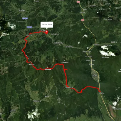 HardMulti-dayUnmarkedDubyna village to Tukhlia villagevia Kamianka Waterfall, Mount Lopata +1Elevation profile390–1 220 m38.8 kmascent 1 698 m≈ 13 h walking
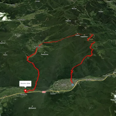 HardMulti-dayUnmarkedSkole to Dubyna villagevia Mount Lopata, Kamianka WaterfallElevation profile420–1 205 m25.7 kmascent 1 072 m≈ 8.5 h walking
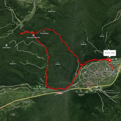 ModerateTwo-dayUnmarkedSkole loopvia Kamianka Waterfall, Lake ZhuravlyneElevation profile394–680 m17.7 kmascent 619 m≈ 5.5 h walking
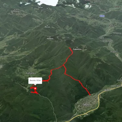 ModerateTwo-dayUnmarkedSkole to Kamianka Waterfallvia Mount LopataElevation profile448–1 211 m18 kmascent 981 m≈ 6.5 h walking
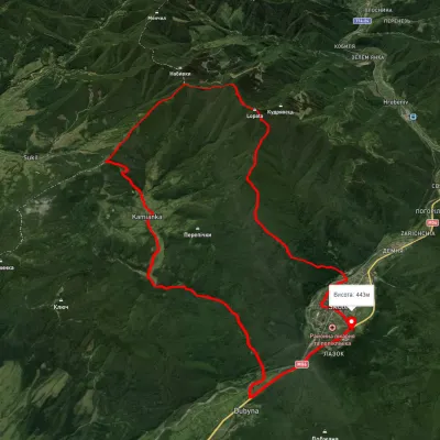 HardMulti-dayUnmarkedSkole loopvia Mount Lopata, Mount Khom +3Elevation profile420–1 248 m31.4 kmascent 1 276 m≈ 10.5 h walking
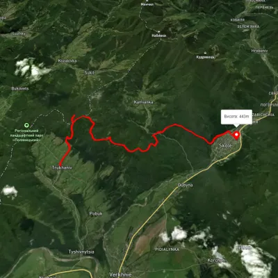 ModerateTwo-dayUnmarkedTrukhaniv village to Skolevia Mount Kliuch, Lake Zhuravlyne +1Elevation profile441–915 m18.8 kmascent 888 m≈ 6.5 h walking
Nearest settlement: Kamianka, about 2.3 km in a straight line.
Report the condition
Been here recently? Tell us what you saw and add photos — your report appears on the page right away with today’s date.
No photos yet — send yours together with a condition report.
