Żar
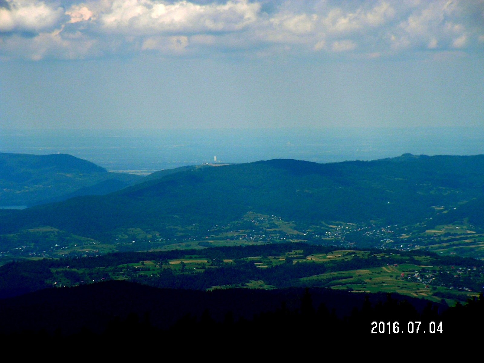
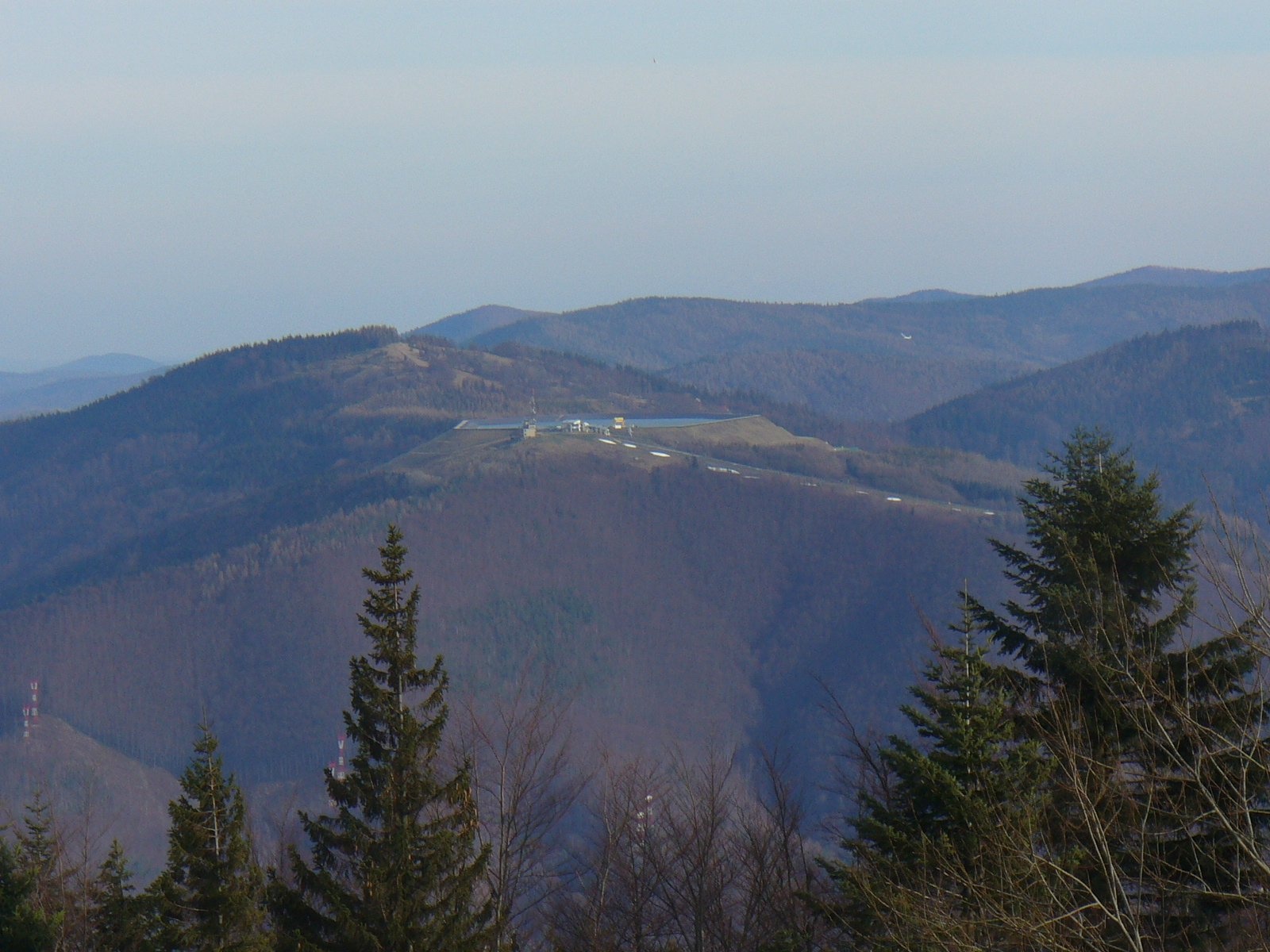
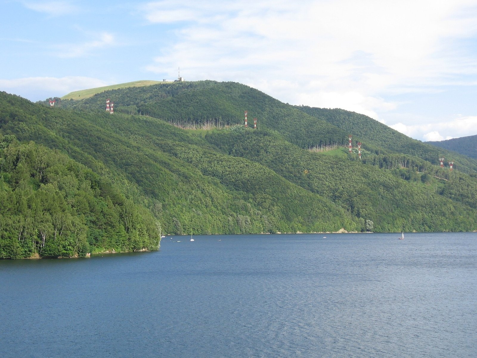
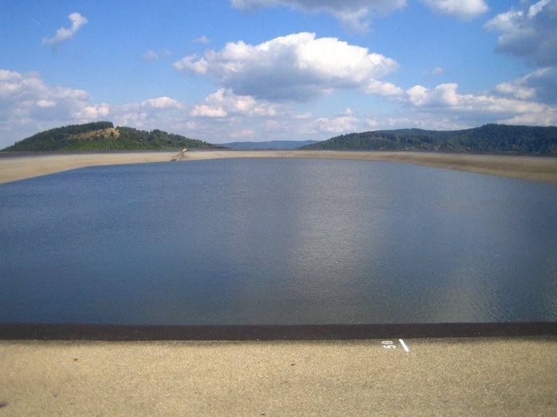
Żar is a 761 m mountain in the Little Beskids in southern Poland, above Lake Międzybrodzie on the Soła river. Its western slopes drop to the reservoir, its south-eastern slopes to the Isepnica stream valley and its northern slopes to the Mała Puszcza valley, while a ridge runs north-east to Kiczora (Kiczera), linking Żar with the rest of the Kocierz group. Administratively the summit belongs to the village of Międzybrodzie Żywieckie in Żywiec County, Silesian Voivodeship. The name probably recalls that pastures on its slopes were once cleared by burning the forest; it is very common across the Beskids.
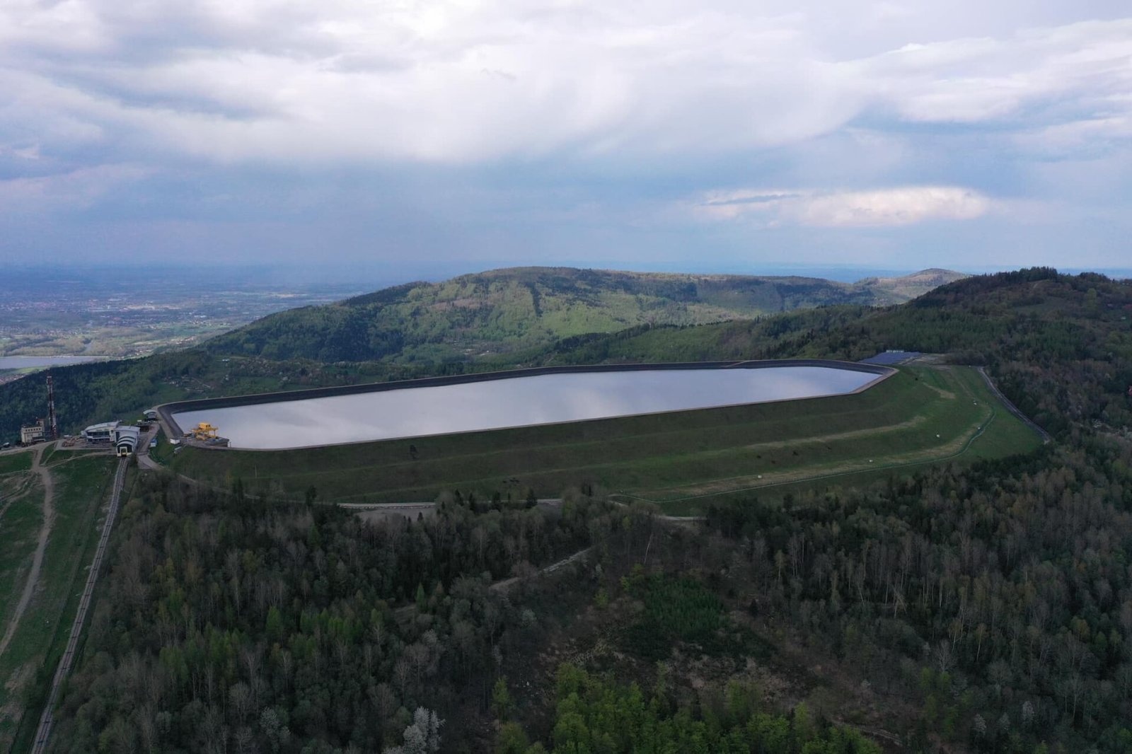
The look of the summit was transformed by the Porąbka-Żar pumped-storage power station, built in 1971–1979: instead of forest the top now holds an artificial upper reservoir shaped like a kite.
How to get there / routes
Since 2004 a funicular about 1,300 m long, owned by Polskie Koleje Linowe, has carried visitors to the summit in 5.5 minutes; it reuses rolling stock taken from the Gubałówka funicular in Zakopane after its modernisation. An asphalt road has led to the top since 1979, but since the funicular opened only authorised vehicles may use it; walkers can still follow it.
- The red Little Beskid Trail crosses the summit: from the Porąbka dam via Żar (reservoir), Kiczora, Isepnicka Pass, Cisowe Grapy and Wielka Góra (Kocierz) to Kocierska Pass — about 4 h 05 min.
- From the Żar car park along the asphalt road via Isepnicka Pass and the slopes of Kiczora — about 2 h.
- Green and black trails also climb from Międzybrodzie Żywieckie.
What you can see from the summit
Żar is an excellent viewpoint. You can see the Żywiec Basin with Lake Żywiec and the peaks of the Żywiec and Silesian Beskids above it, and across the Soła almost the whole Magurka Wilkowicka group, from Łysy Groń via Rogacz, Magurka Wilkowicka and Chrobacza Łąka to Bujakowski Groń. To the north, beyond Lake Czaniec, lie the Silesian Foothills with their towns and factory chimneys, and to the east, above the reservoir embankment, Złota Góra, Kiczera, Cisowe Grapy and Potrójna. Viewing binoculars and a labelled panorama stand by the upper station.
Nature and history
In 1936, on the initiative of the Air and Anti-Gas Defence League, the Żar gliding airfield opened on the summit. In 1947 an airfield for glider-towing aircraft was built at the foot of the mountain (they were not allowed to land on top). Construction of the power station closed the summit airfield; it was moved to the middle slopes and joined with the aircraft airfield. The "Żar" Mountain Gliding School still operates at the foot, and paragliding is popular here.
The power station's upper reservoir, opened in 1979, is about 650 m long and up to 250 m wide and holds 2.31 million m³ of water up to 28 m deep. It is sealed with several layers of asphalt and reinforced concrete, and its embankments are over 30 m high. It is the highest-lying reservoir of its kind in Poland, with the greatest pumping head — 440 m. The station's output is 500 MW; pumping takes about 5.5 hours and generation about 4 hours. There is also a weather station on the summit.
Safety, season and rules
Żar is accessible all year. In winter two lifts and ski runs operate on the slope, so walkers should keep clear of the pistes. The summit reservoir is an industrial facility: do not climb the fences or approach the water. Gliders and paragliders fly over the slopes near the airfield. In an emergency call GOPR mountain rescue on 985 or +48 601 100 300, or 112.
Interesting facts
- Lake Międzybrodzie at the foot lies at 318 m — more than 440 m below the summit.
- The efficiency of the station's pumping-generation cycle is about 75%.
- In German the mountain is sometimes called Feuerberg, "Fire Mountain".
Photos: Pborys, CC BY-SA 4.0; Pudelek at Polish Wikipedia, CC BY-SA 3.0; Michał Płachta (micio), CC BY-SA 2.5; Multi Passionate Guy, CC BY-SA 4.0; pufacz, Public domain; Milosz B., CC BY 3.0; Jerzy Opioła, CC BY-SA 4.0 — Wikimedia Commons.
Getting there from Ukraine
Border crossings
- Krakovets – Korczowa — road, 24/7
- Shehyni – Medyka — road, 24/7 Pedestrian crossing is not confirmed by the Ukrainian border service — check dpsu.gov.ua before the trip.
- Smilnytsia – Krościenko — road, 24/7
- Hrushiv – Budomierz — road, 24/7
- Mostyska – Przemyśl (rail) — rail, 24/7
By car
Lviv – Żywiec ≈412 km, ≈5 h 30 min without queues or tolls: M-10 → Krakovets – Korczowa → A4 to Kraków (≈249 km) → DK52 via Wadowice → DW781 and DW946 to Żywiec. ≈333 km, ≈4 h from the border. Alternative via the tolled A4 Kraków – Katowice and the S1 via Tychy and Bielsko-Biała: ≈457 km, ≈5 h 25 min.
Checked 23.10.2026; border crossing hours and timetables change — check before you travel.
Location on the map
Water and shelter nearby
- Spring below Żar140 m · Not verified · 701 m
- Spring below Maleckie1.7 km · Not verified · 490 m
Comments
Trails nearby
All trails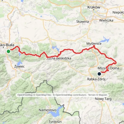 HardMulti-dayMarkedMały Szlak BeskidzkiElevation profile282–1 022 m134.7 kmascent 5 091 munder 1 km from Żar
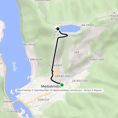 EasyOne-dayMarkedMiędzybrodzie Żywieckie III Żar (black trail)Elevation profile384–761 m2.5 kmascent 377 m≈ 1.5 h walkingunder 1 km from Żar
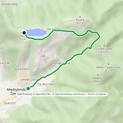 EasyOne-dayMarkedMiędzybrodzie Żywieckie III Żar (green trail)Elevation profile382–761 m5.8 kmascent 404 m≈ 2.5 h walkingunder 1 km from Żar
Nearby attractions
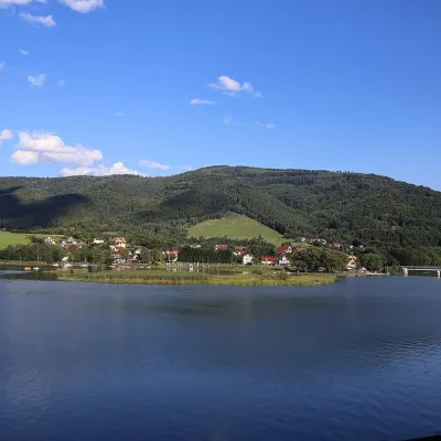 LakeLake Międzybrodzie (Jezioro Międzybrodzkie)Międzybrodzie Bialskie1.7 km from ŻarLake Międzybrodzie (Jezioro Międzybrodzkie), or the Międzybrodzie Reservoir, is an artificial lake on the Soła river in the Beskid Mały (Little Beskids), in the...
 PeakCzupelMiędzybrodzie Bialskiealtitude 930 m5 km from ŻarCzupel is the highest summit of the Little Beskids at 930 m; the latest geodetic and LiDAR measurements give 931 m, and some publications quote 933 m.
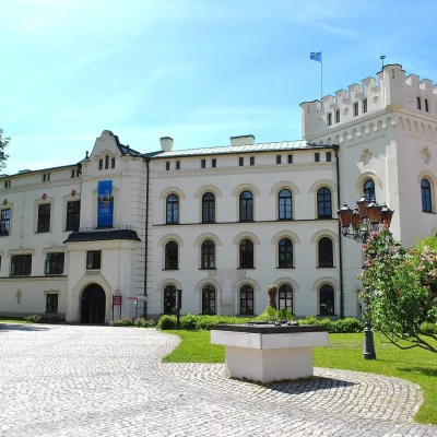 CastleŻywiec castles: Old Castle, Habsburg Palace and parkŻywiec11 km from ŻarIn the very centre of Żywiec, two residences of the former lords of the Żywiec estate stand side by side — the Old Castle and the Habsburg Palace, or New Castle —...
Craft nearby
All craft places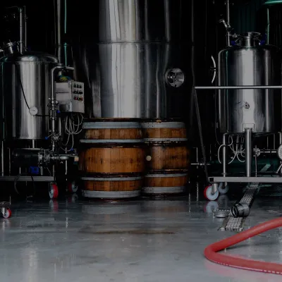 Craft beer & breweriesBrowar Zarzecze in the Żywiec Basin: craft brewery shopZarzecze8.9 km from ŻarBrowar Zarzecze works in the village of Zarzecze near Pietrzykowice in the Żywiec Basin — a region where beer has been brewed since at least the 19th century and home...
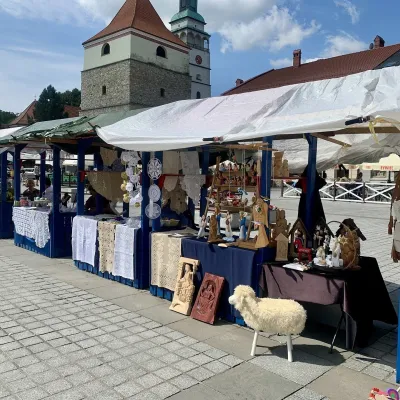 Markets & fairsFolk Art Fair in Żywiec during the Beskidy Week of CultureŻywiec11 km from ŻarThe Beskidy Highlanders' Week of Culture (Tydzień Kultury Beskidzkiej, TKB) is Poland's largest folklore festival: it was first held in Wisła in 1964, and today, at...
 Water parks & thermal poolsAquapark Leśna (Żywiec)Leśna14 km from ŻarAquapark Leśna (also called Aquapark Żywiec) is a swimming-pool complex in the village of Leśna, a few kilometres from Żywiec, in the Żywiec Basin, surrounded by the...
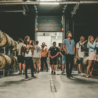 Craft beer & breweriesPINTA Brewery, Wieprz near Żywiec: tours and taproomWieprz16 km from ŻarPINTA is the brewery that Poles associate with the start of the “beer revolution”; it calls itself the country's first craft brewery.
 Cheese dairies & pasturesBacówka na Bukowinie, Żabnica: sheep's cheese and alpacasWęgierska Górka22 km from ŻarBacówka na Bukowinie stands on a slope above the village of Żabnica, next to Węgierska Górka, where the Żywiec Beskids meet the Silesian Beskids.
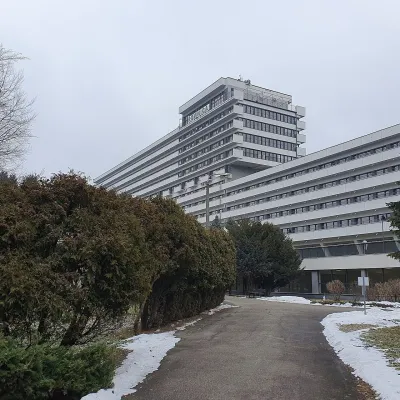 Water parks & thermal poolsUstroń spa: brine, peat and brine poolsUstroń30 km from ŻarUstroń is the only spa of the Silesian Beskids: the town lies where the Vistula valley leaves the mountains, between the ridges of Równica (884 m) and Czantoria Wielka...
