Wierch Lubania Glade
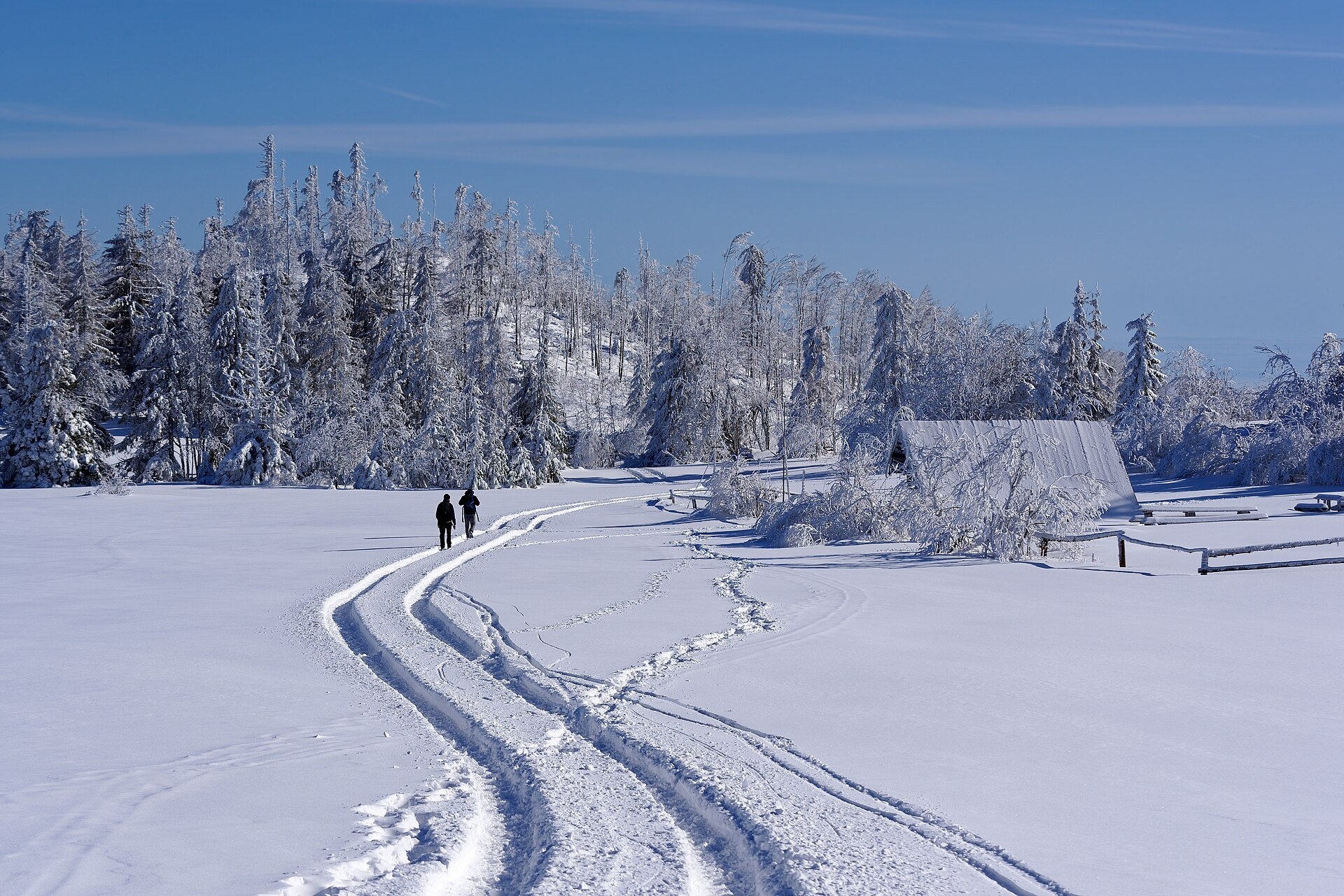
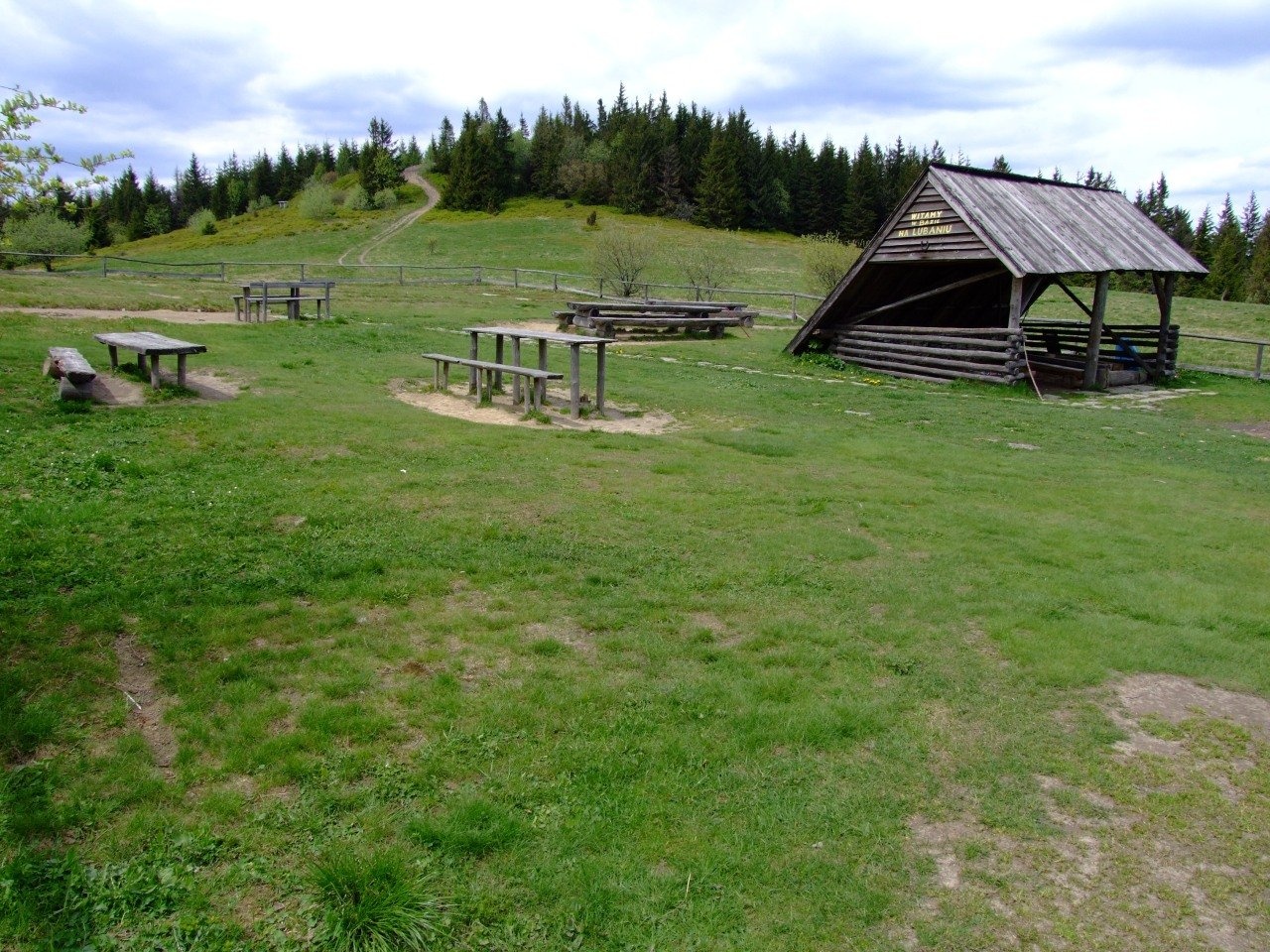
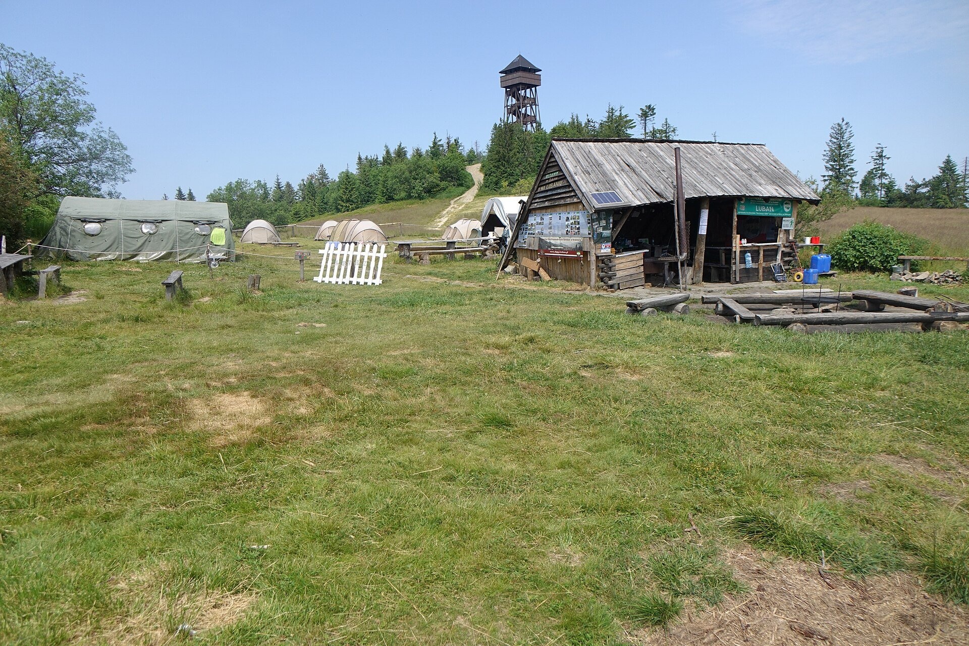
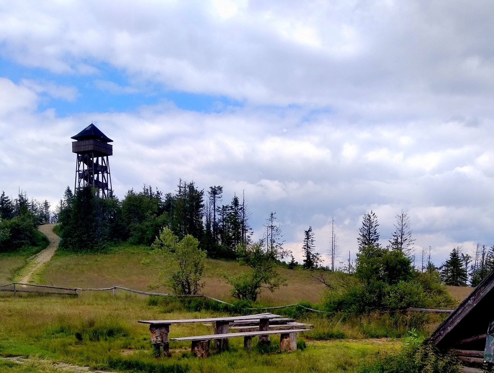
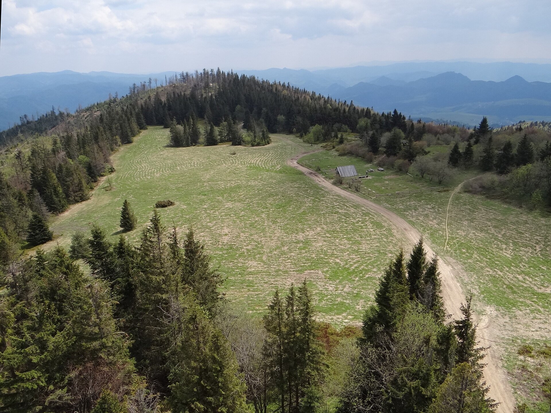
Wierch Lubania is a meadow on the summit of Lubań, the highest mountain of the Lubań range in the south-eastern part of the Gorce. It lies at 1,180–1,200 m on a fairly large flat area between Lubań's two summits – the western one (1,211 m), famous for its panoramas, and the wooded Średni Groń. The meadow belongs to the village of Krośnica in the commune of Krościenko nad Dunajcem; it is not part of Gorce National Park. The Geoportal map gives the name Lubień, but all older sources call the meadow Wierch Lubania.
The meadow used to be grazed. As late as the 1970s a temporary pond formed here after heavy downpours – a trace of a former pool. Lubań's tourist history was started by spa guests from Szczawnica: as early as 1860 they came up here on peasant carts, and in 1912 the first marked trail was laid out from Krościenko. In 1936–1939 the Tatra Ski Society built a hut with about 100 beds by the Samorody rocks on the southern edge of the meadow. During the Second World War it was used by partisans and by local people hiding from the Germans; on 24 September 1944 the Germans burnt the hut and killed two partisans – a memorial cross stands by the ruins. A PTTK bacówka built in 1973–1974 on the neighbouring Wyrobki meadow was destroyed by fire in January 1978; only its stone foundations remain.
Since the 1960s the Lubań student tent base has operated on the meadow in July and August, and its shelter can serve as a refuge from bad weather all year. Below Samorody, by the blue and green trails, there is a spring of drinking water. Among Lubań's rare plants are the woolly thistle (Cirsium eriophorum) and the melancholy thistle (Cirsium heterophyllum).
What to see and do
- The observation tower on the western summit (2015): wooden, 30 m high, with a terrace at 20.7 m reached by 138 steps. Its shape recalls the wooden Gothic churches of the region. From the tower you can see the Gorce, the Pieniny, Lake Czorsztyn, the Spiš Magura, the Spisz-Gubałówka Foothills and the Tatras.
- The meadow itself – a good picnic spot with views of the Tatras, the Pieniny and the Beskids; a large information board about Lubań stands on the terrace on the south side.
- The Samorody rocks of Magura sandstone, the ruins of the pre-war hut, and a field altar on the western summit commemorating Karol Wojtyła's mountain hikes.
How to get there
Three marked trails cross on the meadow. The red Main Trail of Beskidy: from Krościenko via Marszałek 3:10 up (2:10 down), from Przełęcz Knurowska via Runek 3:35. The blue trail Tarnów – Wielki Rogacz: from Ochotnica Dolna 2:15, from Przełęcz Snozka 2:05. The green trail Grywałd – Polana Gabrowska: from Ochotnica Dolna 2:30, from Grywałd 2:10. Another green trail leads from Tylmanowa (2:15). These are ordinary mountain hikes of 2–3.5 hours on forest paths, manageable for children who already hike; not with a pram.
Season and safety
The meadow is open all year, and access to it and to the observation tower is free (the tower has no fee according to OpenStreetMap). It is best here on a clear morning, when the Tatras are most sharply visible, and in autumn. In winter the ridge is covered with snow and people come up on skis or on foot along packed trails. In fog it is easy to lose the trail on the open meadow – stick to the waymarks. Mountain rescue GOPR: 985 or 601 100 300.
Nearby
At the foot of Lubań, above Lake Czorsztyn, stand the Czorsztyn Castle ruins, and on the opposite shore Niedzica Castle (Dunajec Castle). Following the Main Trail of Beskidy west you reach the pastures of Gorce National Park, including Gorc Kamienicki Glade.
Photos: Jakub Hałun, CC BY-SA 4.0, Wikimedia Commons; Jerzy Opioła, CC BY-SA 4.0, Wikimedia Commons; Gorofil, CC BY-SA 4.0, Wikimedia Commons; Krzysztof Dudzik-Górnicki (User:ToSter), CC BY-SA 3.0, Wikimedia Commons.
Getting there from Ukraine
Border crossings
- Krakovets – Korczowa — road, 24/7
- Shehyni – Medyka — road, 24/7 Pedestrian crossing is not confirmed by the Ukrainian border service — check dpsu.gov.ua before the trip.
- Smilnytsia – Krościenko — road, 24/7
- Hrushiv – Budomierz — road, 24/7
- Mostyska – Przemyśl (rail) — rail, 24/7
By car
Lviv – Szczawnica ≈384 km, ≈5 h 25 min without queues: M-10 → Krakovets – Korczowa → A4 to Brzesko (≈198 km) → DK75 to Nowy Sącz → DW969 via Stary Sącz and Łącko to Krościenko nad Dunajcem → Szczawnica. ≈306 km, ≈4 h from the border.
Checked 23.10.2026; border crossing hours and timetables change — check before you travel.
Location on the map
Water and shelter nearby
- Drinking water below Lubań200 m · Not verified · 1 156 m
Comments
Trails nearby
All trails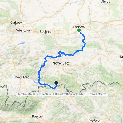 HardMulti-dayMarkedTarnów Wielki RogaczElevation profile206–1 211 m191.5 kmascent 6 941 munder 1 km from Wierch Lubania Glade
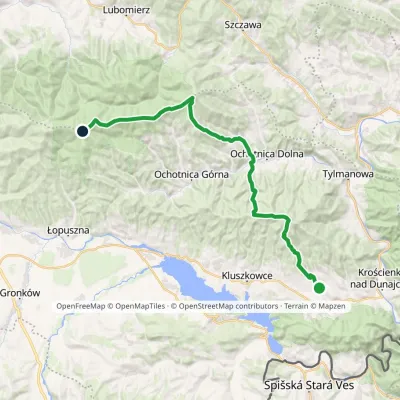 HardMulti-dayMarkedGrywałd Polana GabrowskaElevation profile506–1 288 m29.5 kmascent 1 624 m≈ 10.5 h walkingunder 1 km from Wierch Lubania Glade
 HardMulti-dayMarkedMain Trail of BeskidyElevation profile309–1 723 m499.9 kmascent 19 519 munder 1 km from Wierch Lubania Glade
Nearby attractions
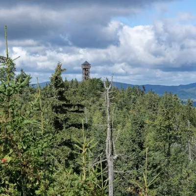 PeakLubańKrośnicaaltitude 1 211 munder 1 km from Wierch Lubania GladeLubań is the highest summit of the Lubań range in the south-eastern Gorce, 1,211 m high. It is a large forested massif cut by the valleys of several streams, north...
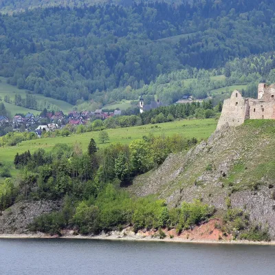 CastleCzorsztyn Castle ruinsCzorsztyn6.3 km from Wierch Lubania GladeThe ruins of Czorsztyn Castle rise on a limestone rock above Lake Czorsztyn, on the border between Podhale and the Pieniny mountains.
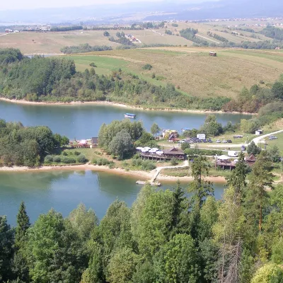 LakeLake CzorsztynFalsztyn7 km from Wierch Lubania GladeLake Czorsztyn (Jezioro Czorsztyńskie) is a reservoir on the Dunajec river in the Nowy Targ Basin, between the Pieniny and the Gorce.
Craft nearby
All craft places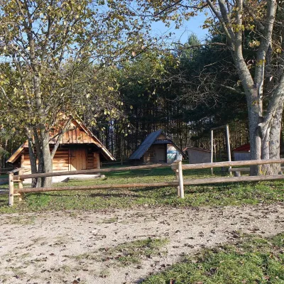 Cheese dairies & pasturesMajerz Meadow Shepherd's Hut, Pieniny National Park: oscypek and żętycaKrośnica5.8 km from Wierch Lubania GladeMajerz meadow (hala) sits on a 689 m hill between Czorsztyn-Nadzamcze and the village of Hałuszowa, above Lake Czorsztyn.
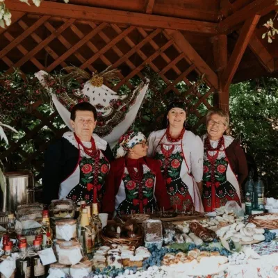 Markets & fairsFruit Harvest Festival in Łącko: village stands, fruit and folkloreŁącko11 km from Wierch Lubania GladeŁącko, in the Dunajec valley between Stary Sącz and the Pieniny, is one of Poland's best-known fruit-growing areas: the slopes around are covered with apple, pear and...
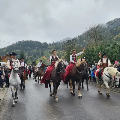 Markets & fairsAutumn Redyk in Szczawnica: sheep drive, oscypek and shepherdsSzczawnica11 km from Wierch Lubania GladeRedyk is an old Carpathian shepherding custom: in spring the flocks are driven up to the mountain pastures (hale), and in autumn, after the cheese-making season, they...
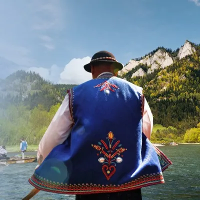 Ethno tours & guidesGoral raftsmen of Červený Kláštor: wooden-raft trip on the DunajecČervený Kláštor12 km from Wierch Lubania GladeBetween Červený Kláštor and Lesnica the Dunajec cuts a deep, winding gorge through the limestone Pieniny, and here the river becomes the border between Slovakia and...
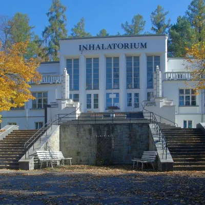 Water parks & thermal poolsSzczawnica spa: pump room, waters and the InhalatoriumSzczawnica13 km from Wierch Lubania GladeThe Szczawnica spa (Uzdrowisko Szczawnica) is all about water and air: in the valley of the Grajcarek stream, between the Pieniny and the Beskid Sądecki at 430–500 m,...
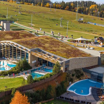 Water parks & thermal poolsTerma BaniaBiałka Tatrzańska21 km from Wierch Lubania GladeTerma Bania is a large thermal water park in the village of Białka Tatrzańska, at the foot of the Kotelnica ski slope.
